Witnessing the Past

We’ve traipsed through these woods before, My Guy and I, but always, there’s the old to see and the new to appreciate. And so today we visited both.

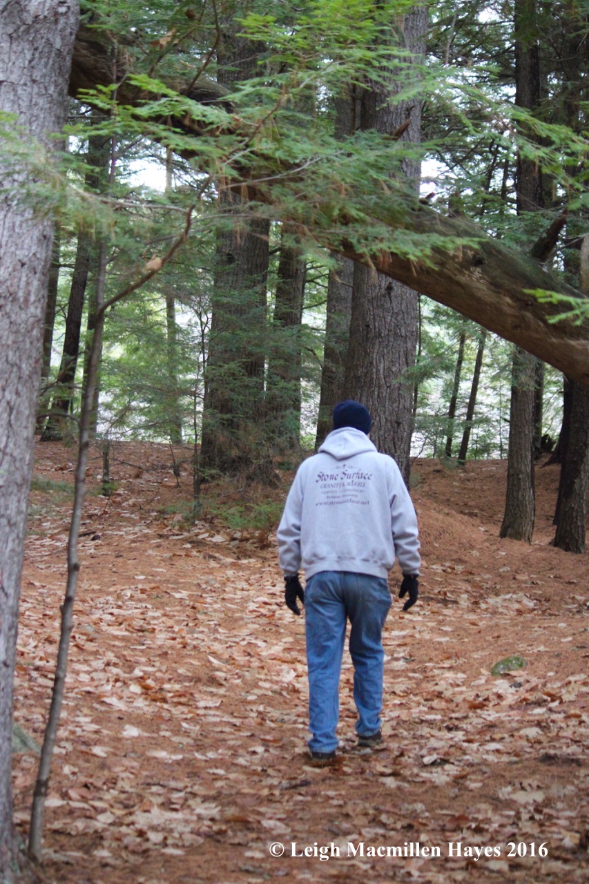
By the shape of the forest road we walked, I could have driven another mile before parking. But . . . I like to walk. And besides, you can’t appreciate all the beauty that surrounds you on a wet autumn day if you fly in at 60 miles per hour. Or even at 20!

And because we walked, we found an off-shoot trail that led us to a sweet spot we’d not visited before along Great Brook, where we stood for a few moments watching and listening and smelling as the water cascaded over the rocks.

Once we got to the trailhead after passing around a gate, we followed another old road for a ways, up and down over a few little hills, and then, because memory was on our side, as the road curved to the right and the stonewall began on the left, we knew it was time to turn and begin a bushwhack up a road that hasn’t seen much use in decades. It was there that we spied the first witness. A tree standing over a marker. By the way the tree is growing around the sign, it’s obvious that it’s been keeping watch for decades.

So if that was the witness post, where was the survey marker? Atop a rock at the base of the witness tree. And 1965 would be the year that the sighting was first made.

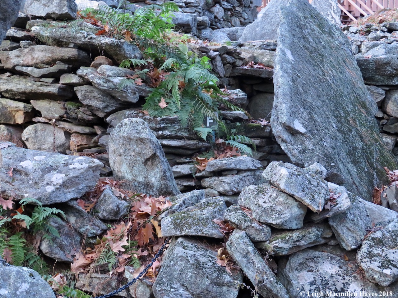
Eventually we reached the first of the foundations because even when we are what seems to be deep in the woods, we’re in the middle of a place that was once somewhere — someone’s neighborhood. In this case, according to the 1858 map, we were visiting the Durgins.

My friend, Jinnie Mae (RIP), was an historian and tech guru and years ago she overlaid part of the bushwhack we did today on an 1858 map. You can see the name E. Durgin on that.

One of my favorite things about the Durgin cellar hole is the cold storage. In the cold to come, it will still serve as storage, so witnessed by the findings within today.

For the back corner has long provided protection from the elements for a porcupine, given the scat pile.

Because we were there, we decided to check on the Durgins who hang out a ways in the woods behind their former home and followed a stonewall to their locale.

Three of them were still there. Sarah, daughter of Anna and Ephraim (E. Durgin on the map), died in 1858 at age 22.

Beside her stood Mary, wife of Sumner Dergin, who died before Sarah in 1856, also at age 22.

Our best guess is that Sarah and Sumner were siblings.

Ephraim, father of Sarah and Sumner, and husband of Anna, died in 1873 at age 81. Did you notice the difference in stone from the 1850s to 1870s? Slate to cement. And the name change–Dergin vs. Durgin. We’ve learned through geneology research that spellings often differ. I found the following a few years back on RootsWeb.

8. ANNA3 FURLONG (PATRICK2, JOHN1) was born 1791 in Limerick, Maine, and died 1873 in Stoneham, Maine. She married EPHRAIM DURGIN June 18, 1817 in Limerick, Maine14. He was born April 13, 1790 in Limerick, Maine, and died in Stoneham.

Children of ANNA FURLONG and EPHRAIM DURGIN are:
i.OLIVE4 DURGIN, b. 1811, Stoneham, Maine; m. DUNCAN M. ROSS, April 11, 1860, Portland, Maine.
ii.SALOMA DURGIN, b. 1813.
iii.ELIZABETH DURGIN, b. 1815.
iv.SALLY DURGIN, b. 1817.
v.SUMNER F. DURGIN, b. 1819, Of Stoneham, Massachusettes; m. MARY ANN DURGAN, July 11, 1853, York County, Maine; b. Of Parsonsfield, Maine.
vi.CASANDIA DURGIN, b. 1821.
vii.EPHRAIM DURGIN, b. 1823.
viii.FANNY DURGIN, b. 1825.

Sarah isn’t listed above. But . . . Sally and Sarah were often interchangeable.

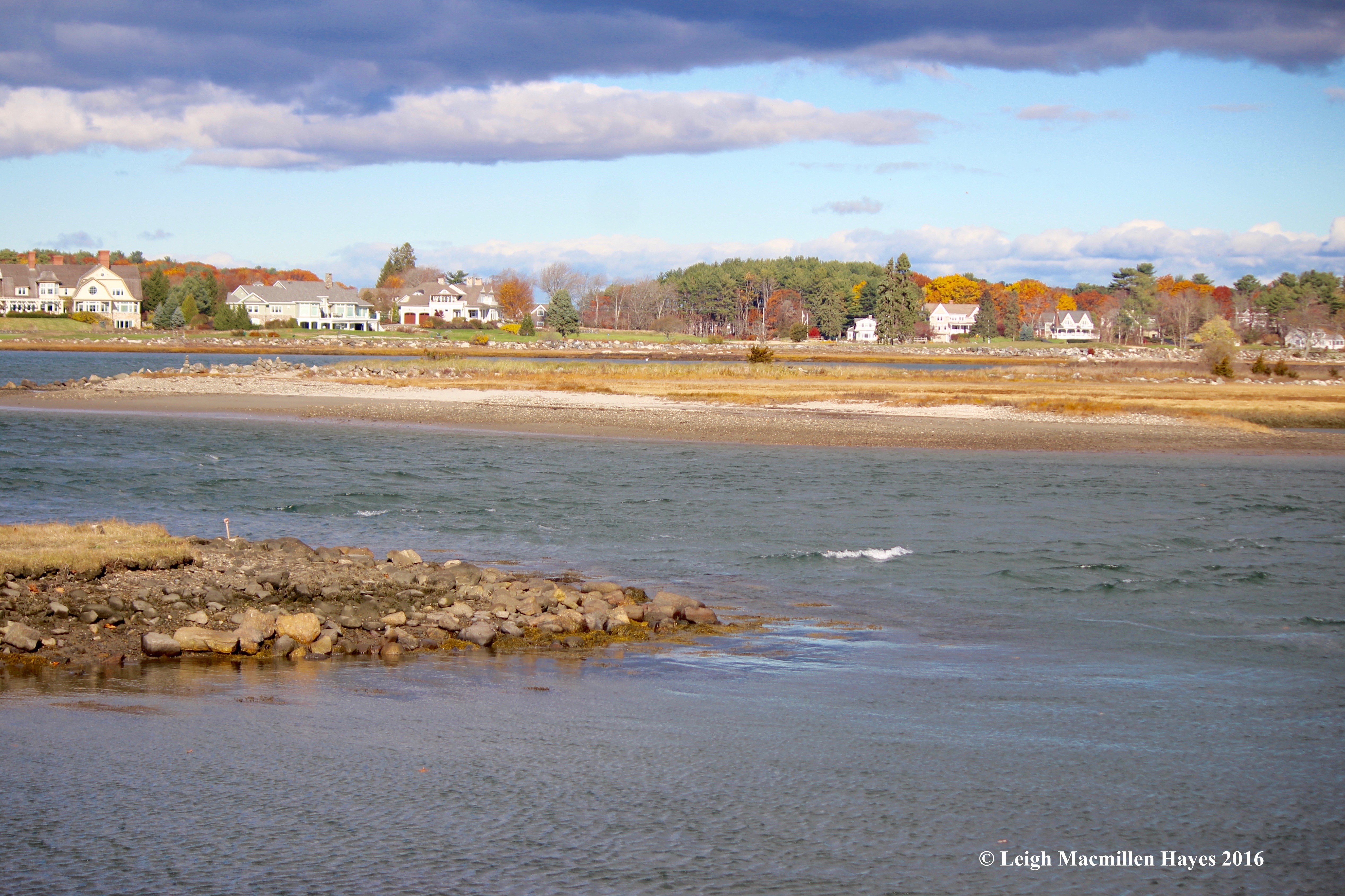
We ate lunch with the family as we looked out at the view they enjoy every day–possibly once called Durgin Hill, and then maybe Sugar Hill.

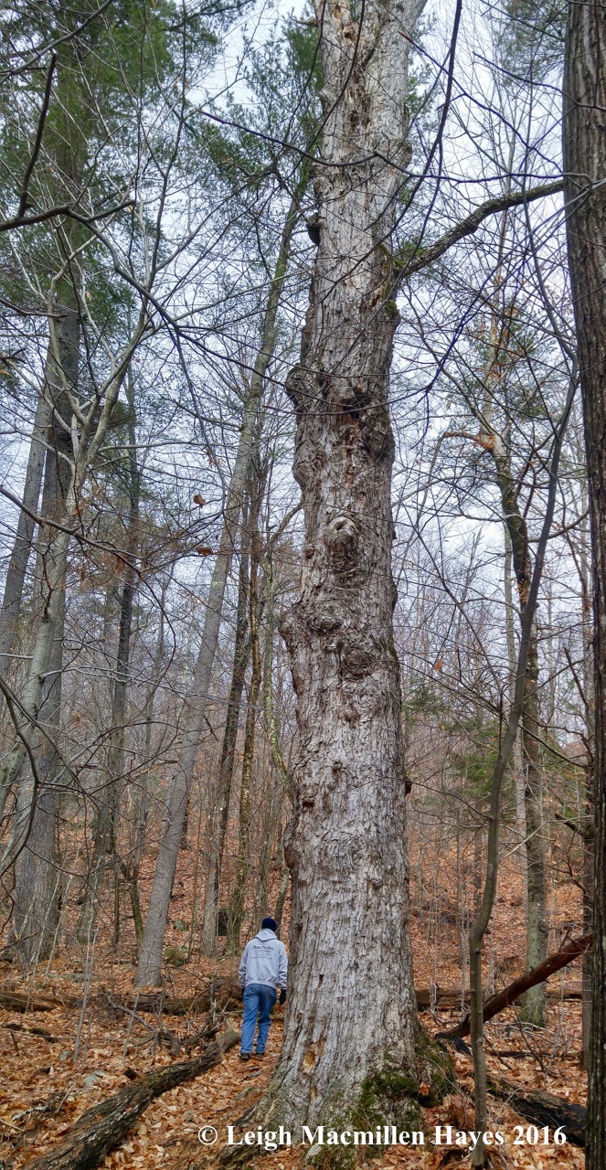
After lunch, our journey continued a wee bit further until another witness stopped me in my hiking boots. It took me three bear hugs with arms fully outstretched to completely circle this ancient Sugar Maple. Can you imagine the tales stored inside this great, great, great grandfather?

And at his feet, a wee one to appreciate –a Many-fruited Pelt Lichen, the many fruits being the brown fruiting bodies or apothecia.

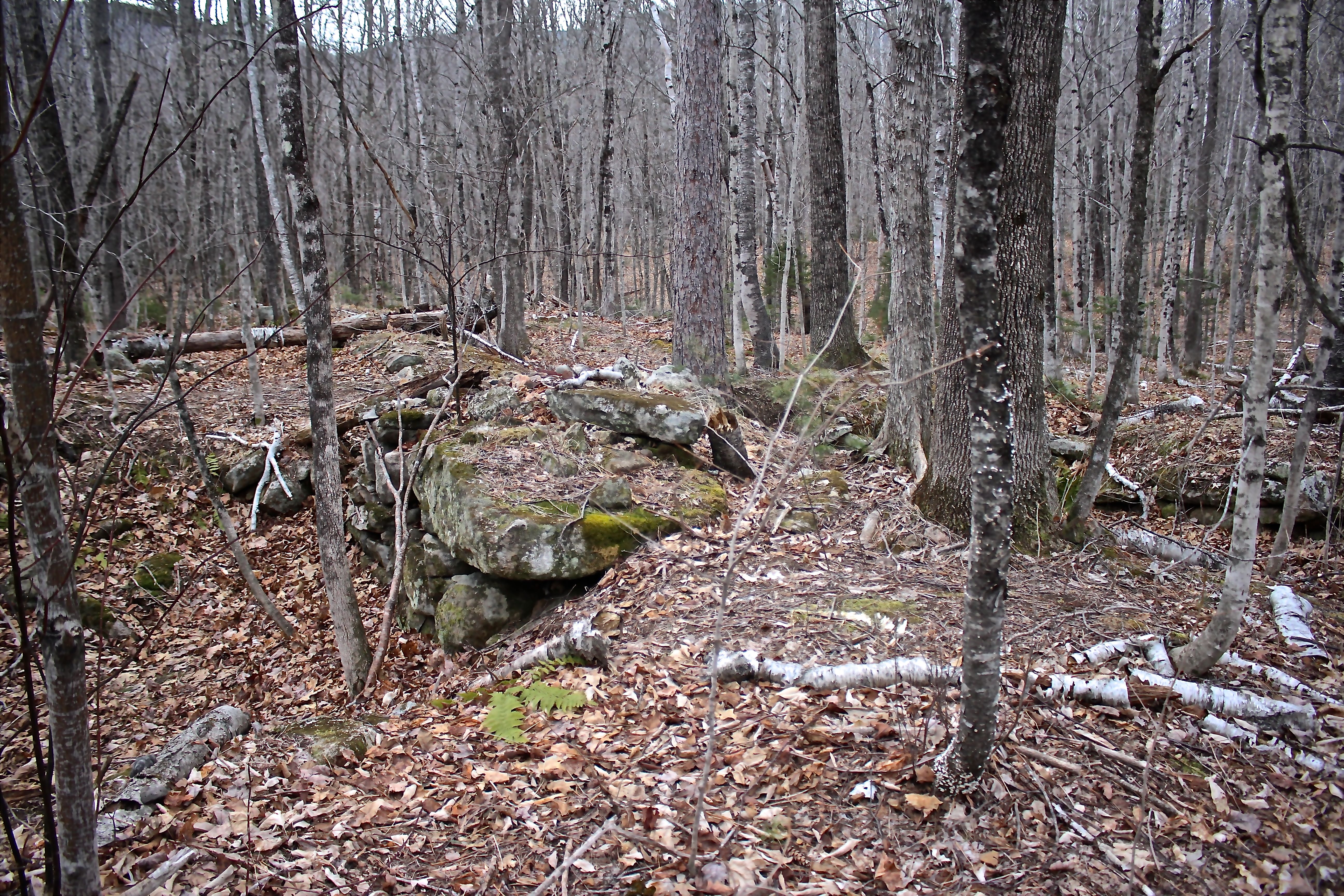
A few steps away, we reached the Willard family foundation. Two large granite slabs are visible in the back and I had to wonder if they originally formed the roof of another cold storage.

Again, I referred to Jinnie Mae’s research. By 1880, the Willards house was occupied by the McKeens. And the Durgins were no longer living there, which makes sense given that Anna and Ephraim both died in 1873. The Rowlands had moved in to their home.

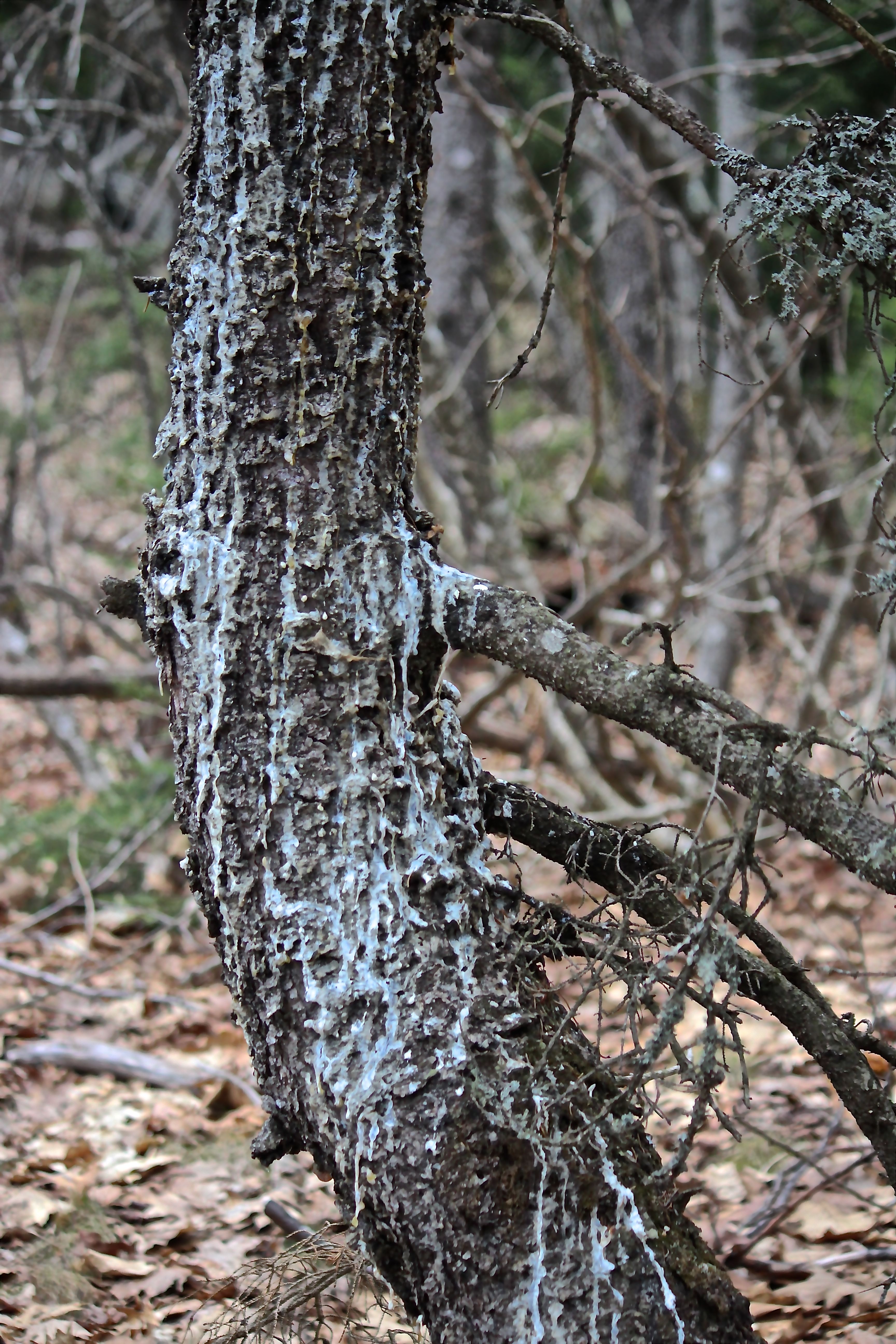
A newer member of the neighborhood, a Striped Maple, may not have known any of these occupants, but despite the full canopy of evergreens and maples and birches, it sure knew how to produce large leaves to increase its chances of survival.

Eventually, we turned west and followed an old road way bordered by stonewalls on either side. I remember when few trees grew there, but now one has to move through like a ball in a pinball machine, ricocheting off this tree and that rock along the way.

It’s well worth the effort because it leads directly to Willard Brook, which flows southward toward Great Brook , where we first began our journey.

Though I know the first part of the trip well, I sometimes get a bit mixed up with the second part and such was the case today. That said, as we scrambled up and down the sometimes steep hillside beside the brook, we came upon these wheels and bingo. We knew them as old friends we’d met on a previous trip.

There is so much history tucked away in these woods, and I gave thanks for two more witnesses, who despite their differences, stood together and supported each other.

We live in unceded Wabanaki land and I’ve come to some understanding of the Native American presence that once existed here in this place between Great Brook and Willard Brook. And I’m sure still does.

After witnessing the past, we walked back down the road as raindrops fell. A perfect hush to end the journey.

Where The Moose Led Us Mondate

It seems there are never enough rainy days to complete home chores so when today dawned as such I thought that all the contents I’d been sorting from a closet would finally make their way to new homes like the dump store or community clothing closet or back into containers to be stored for another rainy day.

Apparently, I thought wrong for the Cardinal beckoned and we answered the call to head out the door.

When I mentioned a location for today’s hike to My Guy, he agreed that it sounded good, though come to find out, in reality he thought we were going someplace else and even when we arrived at Great Brook, he couldn’t recall our last visit, which was in 2016. Fair enough. I’ve been there many more times.

It soon became apparent that we were in Moose territory and our excitement rose. Actually, on another trail in this same neck of the woods we once spotted a Moose, so all we could do was hope that today we’d receive the same honor.

But first, there were other honors to receive, such as this bouquet of flowering Red Maple.

And the first of the season for us, maple leaves bursting forth in all their spring glory of color.

Onward we hiked deeper into the woods where a place one might think of as no place was once some place. This particular foundation has long been a favorite of mine because within is a root cellar.

It’s one I can’t resist stepping into because you never know what tidbit might have been left behind.

Porcupine scat! Rather old, but still.

My friend, Jinny Mae (RIP), was a talented techie and though the red line isn’t the entire route we followed today, it’s one she and I explored back in 2016. The map is from a section of the 1858 map of Stoneham. And we were at E. Durgin’s old homestead.

Knowing that there were some gravestones in the woods behind the house, we once again followed the Moose who led us directly to the family cemetery. Someone has cleared the site a bit, so it was easy to spot, especially since the trees haven’t fully leafed out.

Sarah, daughter of Anna and Ephraim Durgin, is the first tombstone. She died in 1858 at age 22.

Beside her is the stone for Mary, wife of Sumner Dergin, who died before Sarah–in 1856. She, too, was 22 years old. As best I can tell, Sarah and Sumner were siblings.

And Ephraim, Sarah’s father, died in 1873 at age 81. Notice the difference in stone from the two girls to Ephraim? Slate to cement. And the name spelling–Dergin and Durgin. As genealogy hobbiests, we’ve become accustomed to variations in spelling.

I found the following on RootsWeb:

8. ANNA3 FURLONG (PATRICK2, JOHN1) was born 1791 in Limerick, Maine, and died 1873 in Stoneham, Maine. She married EPHRAIM DURGIN June 18, 1817 in Limerick, Maine14. He was born April 13, 1790 in Limerick, Maine, and died in Stoneham.

Children of ANNA FURLONG and EPHRAIM DURGIN are:
i.OLIVE4 DURGIN, b. 1811, Stoneham, Maine; m. DUNCAN M. ROSS, April 11, 1860, Portland, Maine.
ii.SALOMA DURGIN, b. 1813.
iii.ELIZABETH DURGIN, b. 1815.
iv.SALLY DURGIN, b. 1817.
v.SUMNER F. DURGIN, b. 1819, Of Stoneham, Massachusettes; m. MARY ANN DURGAN, July 11, 1853, York County, Maine; b. Of Parsonsfield, Maine.
vi.CASANDIA DURGIN, b. 1821.
vii.EPHRAIM DURGIN, b. 1823.
viii.FANNY DURGIN, b. 1825.

Sarah isn’t listed above. But . . . Sally and Sarah were often interchangeable.

By 1880, there had been a change in ownership of the neighborhood homes and the Rowlands had moved into the Durgin house.

Again, we followed the moose, this time in the form of a Striped Maple browsed upon, curious to see what might be ahead.

A chuckle. Yes, a mailbox in the middle of nowhere, this spot being a place where someone once had a camp. Our Moose tried to send a letter, but missed by a couple of feet.

Willard Brook was our next stop and I was reminded that when I first started wondermyway.com, a post about this brook initiated some discussion about the Indigenous stonework found throughout the area. I’ve explored it looking for such and convinced myself in the past that I saw the turtles in most of the stonewalls. In fact, I see them everywhere, but today I was looking at different subjects.

Beside the brook, lots of Hobblebush looked ready to burst into life and we thought how fortunate that the moose hadn’t decided to dine. Yet.

There were even tiny Hobblebush leaves to celebrate for their accordion style.

And Broad-leaved Dock looking quite happy and healthy.

Back to Great Brook we eventually wandered, still with no actual Moose in sight.

But beside the brook I did spot some Trailing Arbutus buds preparing for their grand opening.

As we walked back on the dirt road we’d walked in on, we paused beside a beaver pond where Spring Peepers sang their high-pitched love songs. I made My Guy scan the area with me because just maybe . . .

or maybe not. We did spot a Mallard couple. Oh well, We still had fun discovering everything else where the Moose led us on this rainy day.

And when we arrived home I had an email from an acquaintance double-checking with me that the print he found on his shore front of Kezar Lake was a moose print. Indeed it was!

(And now it’s time to prepare for Big Night. Finally. The temperature is in the 40˚s; it’s been raining all day and will continue tonight; and though lots of amphibians have moved to their native vernal pools, I think there will be some action tonight and we’ll be able to help them cross the road safely.)

Pondering the Past at Pondicherry Park

Before today’s deluge began, I slipped into Pondicherry Park in Bridgton, Maine, to fill the innermost recesses of my lungs with November air, and at the same time my brain with memories of so many people who have traveled these trails with me from Ned Allen, former executive director of Bridgton Historical Society, to Loon Echo’s Jon Evans, and Lakes Environmental Association’s Alanna Yanelli and Mary Jewett, and friends and friends and friends, including the late JoAnne Diller, Sue Black, and Jinny Mae. But today’s journey also included memories of one I took two years ago with Becky Cook, who shared her remembrances of growing up along South High Street and romping through these trails as they were part of her backyard. If anyone ever had a sense of this place, it is Becky.

My journey began at the Bob Dunning Memorial Bridge, the main entryway into the park if you approach from the town parking lot on Depot Street behind Reny’s Department Store.

Bob Dunning, who died suddenly in November 2007, was a builder, an artist, and among other things, a teacher–sharing his craft with students young and old. To honor Bob, who treasured traditional building techniques, his friends and fellow craftspeople designed and built this bridge in a true barn-raising fashion. To learn more about the bridge, check out this previous wondermyway post: Barking Up A Bridge.

The bridge spans Stevens Brook, the source of power when Bridgton was first founded and for many years thereafter.

But today’s tale is about the the land beyond the bridge.

And the three properties I tried to circle on this 1871 map.

They are the same properties circled above to give a sense of place. Well, I may be off a wee bit in my drawing techniques, but it provides an idea of the land that was first owned by Thomas Cleaves, Dr. Nathaniel Pease, and Osborn Foster.

According to the 1870 census, Mr. Cleaves had 20 acres of improved land. His farm was worth $2,500 and equipment $75. For animals, he had 2 horses, 3 cows, 2 oxen, and 1 swine. His crops included wheat, corn and oats.

Dr. Pease had 20 acres of improved land and 50 acres of unimproved land. The value of his farm was $2,000, while his equipment was worth $75. Likewise he had 2 horses, but only 1 cow, plus 2 oxen, and 1 swine. Corn and oats were his crops.

Mr, Foster owned 40 acres of improved land, and his farm’s value was also $2,000, with the equipment at the going rate of $75. He had 1 horse, 2 oxen, and 1 swine. He also produced corn and oats. (One might note that there was a corn canning shop on the eastern side of Stevens Brook)

As time went on, Henry Moxcey acquired the Cleaves house. His occupation was farming and traveling according to the 1930 census. He lived in the house valued at $10,000 with his wife, Hattie, and daughter Hazel.

Next door, Charles Kneeland had taken ownership of the Pease property in 1881. In 1919, it became the property of his daughter Florence, wife of Alfred Keene. They lived there with their young children, Adria and Maurice. I couldn’t read the value of their home on the census, but Alfred owned a radio set. The 1930 census reflected the emerging values of early twentieth-century America, in particular the growing influence of consumerism and mass culture, thus it included a question about radio sets.

I’m not sure of the exact year, but Osborn Foster’s house was sold to Edward Carman. Charles Hermann Cook then purchased the home valued at $5,000. Herman was overseer in the finishing room at Pondicherry Mill (wondermyway: Milling About Stevens Brook). He lived with his wife Lula, son Enoch, and Edith Foster, who was their housekeeper (she was 43 and widowed).

Looking a the open field in the park, the houses/field to the west are the subject of the journey. While the homes remain private, the land that became the park was purchased in a collaborative fashion by Loon Echo Land Trust and Lakes Environmental Association through the generosity of many donors, as well as grant monies. After placing it under conservation easement with LELT, constructing entry points and trails, it was gifted to the town of Bridgton in 2012. The park consists of 66 acres of quiet woodland and 3,200 feet of stream shore in the heart of downtown Bridgton, making it one special place.

If you’ve stayed with me, this is the point where Becky’s story will enhance the tale. She is the daughter of the late Enoch and Hazel Cook, and granddaughter of C. Hermann Cook. My guy had the privilege, like so many others, of being taught by Mrs. Cook and still loves to talk about her. She passed away a few years ago, or maybe it was a few years before that, but he last visited her on her 102nd birthday and listened as she shared stories of her classroom and students as if she had only stepped out of school yesterday.

One of the first stops Becky and I made two years ago was at Kneeland Spring, pictured above. The water bubbles through the sandy bottom and so the spring never freezes. Even in July, Becky said, she remembered the water being ice cold. Notice the moss-covered split granite–I didn’t take a photo of it today, but just above there are several rock samples that may have been the source as they feature drill holes a farmer would have created to split the stone. Pin and feathering was a technique that required a person to drill holes along the grain of the stone, fill each hole with two semi-cylindrical pieces of iron, and drive a steel wedge between them.

To Becky, standing by the spring and looking west (uphill toward South High Street) brought back memories of running through fields as a kid. Below the spring she recalled there being woods and a boggy area.

She told me that Mr. Kneeland had livery stables beside his house for his horses and cows. The Keenes, who inherited the land, didn’t have any horses or cows. But Bob Dineen, who lived across South High Street, used the pastures for his work horses and cows. “You could ride them,” said Becky. “And I wasn’t particular. I could ride a cow just as easily as a horse.”

For many years I thought it was local lore that Hannaford Brothers purchased water from the spring, but Ned Allen shared this document with me. Apparently, this was coveted water.

Throughout the park one might spot numbered Roosters. By using either the Bridgton Historical Society’s free app, or picking up a brochure at the kiosk, you can key in on descriptions of historic locations in the park. I’d spent a few years feeling that the info for #4 wasn’t accurate, but Becky set me right.

You see, according to the description, #4 states this: Barway, This gap was left in the stonewall to provide an opening to pass through. A log would be placed across the gap so it could be closed up again and continue to keep the livestock contained.

In my brain, the stones had been moved to create the gap so the park trail could pass through it.

According to Becky, this was the wall that formed the boundary between the Keene/Kneeland property and the Cook property. She remembered a much smaller gap, but still there was one.

Off trail there used to be an old rail on the ground that referenced the Narrow Gauge Train that ran beside what is now the park. After the train stopped running in 1941, either Becky’s father or grandfather or both took advantage of the old rails and used them when necessary, such as for the ties of bridges, this one having been located along what was a rough road from the Cooks’ home on South High Street down to their camp on Willet Brook, which meets Stevens Brook in the park.

Before going to the site of the camp, I traveled along a spur trail, which I often do because I love the reflection it offers . . .

in any season.

When I traveled the trails with Becky, I was so grateful because she opened my mind to some of what had come before, including the family camp, this photo from the Bridgton Historical Society’s collection.

In its day, it was a single family camp at 1360 Willet Brook Shore owned by C. Hermann Cook and his family. Becky recalled it having a couple of bedrooms on the western side, which you see here, a kitchen, and a long living room spanning the front. French doors opened from the living room onto the porch. And she remembered evenings when her parents would wind up the Victrola and people danced out one door, across the porch, and back into the living room through another porch.

All that’s left of the camp, sadly, is the chimney and a foundation wall. In 1968, some kids began to make a habit of partying in the camp. According to Becky, they figured if they created a fire in the fireplace someone might spot the smoke rising from the chimney. Instead, they created a campfire in the middle of the living room floor. Several time, apparently, this happened. Their frivolity ended, however, when they accidentally burned the camp to the ground on what became the final party.

Becky was sad to lose this beautiful place. She did recall with humor, however, the adventures she and her brother, Tim, shared as it was their responsibility to clean snow off the roof. With Tim at the helm, and Becky holding on for dear life, they’d zoom through the fields and woods on a snowmobile to reach the camp.

Standing with my back to the chimney, I tried to imagine another scene Becky painted for me: this once was a cove filled with water. Her grandfather Hermann kept a boat here and often fished.

It began to make sense because at that time the mills were in use and they would have dammed the water in various locations in order to have power to run turbines.

Looking west from the chimeny, one gets a sense of the camp road. Though it looks rather level now, roots were often an issue. Becky told me that the vehicles of yore were high-wheeled and high-bottomed so it wasn’t really a bother.

Continuing up the “road,” a visit to the park doesn’t feel complete with stopping by to say hello to the Yellow Birch growing on a pine nurse stump where life is richer than we can imagine. It turned out that Becky was also a frequent stopper at this statue. Some tree species, especially those with small seeds, cannot germinate on leaf litter and need high-porosity seedbeds. Yellow Birch is such a species that requires mineral soil or deadwood to germinate. Hemlock is the same.

A bit farther along, the stonewalls begin to state their presence. They are powerful reminders that land that is now forested was once cleared and cultivated. Somer are single walls, such as this, built with large stones, where the land below is much lower than the land above, suggesting that the “short” side was plowed regularly and much more frequently than the tall side. Plowing tends to push soil against a wall. I don’t know when these walls were constructed, but some intense wall building occurred between 1775 and 1850. The majority of New England walls were dry built, meaning the stones were kept in place by skillful arrangement and balance.

A short distance above is a different type of wall. It’s a double-wide wall with larger stones on the outside and smaller filling in between. These were indicative of a garden wall. They weren’t high so as to keep livestock in or out. Instead, they became the place to toss all the stones that pushed to the field’s surface with the annual freezing and thawing. The smaller stones would likely have been the spring “crop” over the course of many years that were removed from the field by women and children. Remember, these farmers were growing their own grains. From Becky I learned that her grandfather had a commercial strawberry field. Usually such fields were between 2 – 4 acres, thus being the optimal size for moving stones from the center to the edges.

What grows best here now is the invasive Norway Maple. It’s not native to Maine and is aggressive in nature. This type of maple was planted along roadsides as a shade tree after the demise of elm trees. The leaf is similar to a Sugar Maple, but much more rectangular (boxier) in shape. And . . . while the Sugar Maples have lost their leaves by now, the Norway Maples hold on to them for a much longer time period.

Because it had started raining in earnest and I could barely see through my glasses, I knew it was time to draw today’s journey to a close. But, there was one last place to pause–in a pasture with a small opening in the boundary. The Kneeland/Keene homestead can be seen through the opening. If I turned around, which I didn’t, I knew that I could follow another old “road” down to Kneeland Spring. And to my left as I looked up at the house, would have been the Cooks’ property (eventually they moved across the street), and to my right the Cram/Cleaves/Moxcey property now owned by the Russos, which actually serves as a farm today, albeit on a much smaller scale. (All have passed through one or two or more hands of ownership.)

One final note (or maybe two): It has been said that Pondicherry was the name of Bridgton before Moody Bridges surveyed the land for the proprietors. The source of the name has been questioned–was it so called for a union territory in India or for the cherry trees that grew by the ponds?

Perhaps there’s another choice to ponder–was it named by indigenous people before people of European descent thought the land was theirs to occupy and own? That’s another story that needs to be researched.

As for today, I’m so glad the rain didn’t keep me home and I once again made time to ponder the past in Pondicherry Park.

Walking Among Mysteries

We knew not what to expect when we met this morning. My intention was to visit a structure of unknown use, then follow a trail for a bit before going off trail and mapping some stone walls. Curiosity would be the name of the game and friends Pam and Bob were ready for the adventure when I pulled into the trailhead parking lot.

We traveled rather quickly to our first destination, pausing briefly to admire only a few distractions along the way–if you can believe that.

It’s a stone structure on the back side of Amos Mountain. Three years ago we visited this site with Dr. Rob Sanford, a University of Southern Maine professor and author of Reading Rural Landscapes. At that time we came away with so many questions about this structure located on a mountainside so far from any foundations. Today, we still had the same questions and then some.

Who built it? What was it used for? Was there a hearth? Did it have a roof? Was it ever fully enclosed? Was there originally a front wall? Could it be that it extended into the earth behind it? Was it colonial? Pre-colonial?

Why only one piece of split granite when it sits below an old quarry?

And then there’s the left-hand side: Large boulders used in situ and smaller rocks fit together. One part of the “room” curved. For what purpose?

Pam and Bob stood in the center to provide some perspective.

And then I climbed upon fallen rocks to show height.

We walked away still speculating on the possibilities, knowing that we weren’t too far from a stone foundation that belonged to George Washington and Mary Ann McCallister beginning in the mid-1850s and believed the structure to be upon their “Lot.”

As we continued along the trail, we spied several toads and a couple of frogs. Their movement gave them away initially, but then they stayed still, and their camouflage colorations sometimes made us look twice to locate the creator of ferns in motion.

At last we crossed over a stonewall that we assumed was a boundary between the McAllister property and that of Amos Andrews. It was the walls that we wanted to follow as there are many and our hope was to mark them on GPS and gain a better understanding of what seems like a rather random lay out.

The walls stand stalwart, though some sections more ragged than others. Fallen trees, roots, frost, weather, critters and humans have added to their demise, yet they are still beautiful, with mosses and lichens offering striking contrasts to the granite. Specks of shiny mica, feldspar and quartz add to the display.

The fact that they are still here is a sign of their endurance . . . and their perseverance. And the perseverance of those who built them.

But the fashion of these particular walls has stymied us for years. As we stood and looked down the mountain from near the Amos Andrews foundation, we realized that the land was terraced in a rather narrow area. And so we began to follow one wall (perspective isn’t so great in this photo) across, walk down the retaining wall on the right edge and at the next wall follow it across to the left. We did this over and over again and now I wish I’d counted our crossings, but there were at least eight.

Mind you, all were located below the small root cellar that served as Amos Andrews’ home on and off again beginning in 1843.

And below one of the terraced walls just beyond his cellar hole, there was a stoned off rectangle by the edge. Did it once serve as a foundation for a shed?

Had Amos or someone prior to him tried to carve out a slice of land, build a house, and clear the terraced area for a garden?

It seems the land of western Maine had been forested prior to the 1700s and there was plenty of timber to build. A generation or two later, when so much timber had been harvested to create fields for tillage and pasture, the landscape changed drastically, exposing the ground to the freezing forces of nature. Plowing also helped bring stones to the surface. The later generation of farmers soon had their number one crop to deal with–stone potatoes as they called them. These needed to be removed or they’d bend and break the blade of the oxen-drawn plowing rake. Summer meant time to pick the stones and make piles that would be moved by sled to the wall in winter months. Had the land been burned even before those settlers arrived? That would have created the same scenario, with smaller rocks finding their way to the surface during the spring thaw.

As it was, we found one pile after another of baseball and basketball size stones dotting the landscape. Stone removal became a family affair for many. Like a spelling or quilting bee, sometimes stone bees were held to remove the granite from the ground. Working radially, piles were made as an area was cleared. Stone boats pulled by oxen transported the piles of stones to their final resting place where they were woven into a wall.

Occasionally, however, we discovered smaller stones upon boulders. Were they grave markers? Or perhaps spiritual markers?

There were double-wide stone walls with big stones on the outside and little stones between, indicating that the land around had been used for planting. But why hadn’t all the piles been added to the center of these walls? That’s what had us thinking this was perhaps Pre-colonial in nature.

Pasture walls also stood tall, their structure of a single stature. I may be making this up because I’ve had an affinity with turtles since I was a young child and own quite a collection even to this day, but I see a turtle configured in this wall. Planned or coincidence?

My turtle’s head is the large blocky rock in the midst of the other stones, but I may actually be seeing one turtle upon another. Do you see the marginal scutes arching over the head? Am I seeing things that are not there? Overthinking as my guy would suggest?

I didn’t have to overthink when I spotted this woody specimen–last year’s Pine Sap with its many flowered stalk turned to capsules still standing tall.

And a foot or so away, its cousin, Indian Pipe also showing off the woody capsules of last year’s flowers, though singular on each stalk.

As we continued to follow the walls, other things made themselves known. I do have to admit that we paused and pondered several examples of this plant because of its three-leaved presentation. Leaves of three, leave them be–especially if two leaves are opposite each other and have short petioles and the leader is attached between them by a longer petiole. But, when we finally found one in flower we were almost certain we weren’t looking at Poison Ivy. I suggested Tick-Trefoil and low and behold, I was correct. For once.

Our journey wandering the walls soon found us back on what may have been a cow or sheep path and it was there that we noted a cedar tree. Looking at it straight on, one might expect it to be dead. But a gaze skyward indicated otherwise. Still, the question remained–why here?

A Harvestman Spider may have thought the same as it reached out to a Beech Nut. After all, the two were located upon a Striped Maple leaf.

Onward we walked, making a choice of which way to travel each time we encountered an intersection of walls. This one had a zigzag look to it and we thought about the reputation Amos Andrews had with a preference for alcohol. But . . . did Amos build all or any of these walls?

We continued to ponder that question even as we came upon a stump that practically shouted its name all these years after being cut, for the property we were on had eventually been owned by Diamond Match, a timber company. Do you see the mossy star shape atop the stump? And the sapling growing out of it? The star is actually a whorl–of White Pine branches for such is their form of growth. And the sapling–a White Pine.

And then . . . and then . . . something the three of us hadn’t encountered before. A large, rather narrow boulder standing upright.

Behind it, smaller rocks supported its stance.

The stone marked the start of another stone wall. And across from it a second wall, as if a road or path ran between the two and Bob stood in their midst adding coordinates to his GPS.

We chuckled to think that the stone was the beginning of Amos’ driveway and he’d had Andrews written upon it. According to local lore, he had a bit of a curmudgeon reputation, so we couldn’t imagine him wanting people to stop by. The road downhill eventually petered out so we didn’t figure out its purpose. Yet.

In the neighborhood we also found trees that excited us–for until ten months ago we didn’t think that any White Oaks existed in Lovell. But today we found one after another, much like the piles of stones. With the nickname “stave oak,” it made sense that they should be here since its wood was integral in making barrels and we know that such for products like rum were once built upon this property.

Trees of varying ages grow quite close to Amos Andrews’ homestead.

Also growing in the area was Marginal Wood Fern, its stipe or stalk below the blade covered with brown scales and fronds blue-green in color, which is often a give-away clue that it’s a wood fern.

We know how it got its name–for the round sori located on the margins of the underside of the pinnules or leaflets. Based on their grayish-blue color, they hadn’t yet matured. But why are some sori such as these covered with that smooth kidney-shaped indusium? What aren’t all sori on all ferns so covered?

So many questions. So many mysteries.

As curious as we are about the answers, I think we’ll be a wee bit disappointed if we are ever able to tell the complete story of the stone structure and the upright stone and all the walls between.

Walking among mysteries keeps us on our toes–forever asking questions and seeking answers.

Book of the March: Entering the Mind of the Tracker

A few weeks ago I’d contacted my friend Parker Veitch of White Mountain Mushrooms, LLC, to make sure he was willing to co-lead a couple of fungi walks this summer and in his response he included this paragraph: “I have a book for you. Should I leave it at the office? The first 20 or so pages are a little slow, but I think you will really like it.”  

Like it? I LOVE it. And I haven’t even finished reading it. So you must be curious by now. As I was when I saw it sitting on the table at the Greater Lovell Land Trust office. You see, I was sure the book would be about fungi because Parker is always trying to help me learn about the principal decomposers of the world. Ah, but one should never assume.

May I present to you the Book of March: Entering the Mind of the Tracker by Tamarack Song.

This book is like no other tracking book that I’ve read. As I wrote back to Parker, “Thank you so much for sharing the book with me. I’m in the midst of reading Eager by Ben Goldfarb, The Invention of Nature by Andrea Wulf, which is about Alexander von Humboldt, and a book of essays by E.B. White (thanks Judy and Bob for gifting me that gem), but right now I’m most captivated by the teaching of Tamarack Song and I am going to have to ask Bridgton Books to order a copy for me. I want to be him and have the understandings and slow down and ask the questions he asks. And teach others to do the same.

At first I couldn’t put the book down. But now I’ve changed my tune a bit because I want to savor it. Typically, when I read a book such as this I underline key phrases, write notes in the margin and turn page corners up. But, because I’m only borrowing this copy I’m not doing that. (Did I have you nervous for a minute there, Parker?) And that’s making me soak it all in and savor each chapter more fully than I might.

You see, Tamarack, according to the back cover blurb, “has spent his life studying the world’s aboriginal peoples, apprenticing to Elders, and learning traditional hunter-gatherer survival skills. He has spent years alone in the woods as well as living with a pack of Wolves. In 1987, he founded the Teaching Drum Outdoor School in the wilderness of northern Wisconsin, where he runs the yearlong Wilderness Guide Program.”

In each of the sixteen chapters, Tamarack plays the role of guide, but not by telling. Rather, he takes the reader along on an exploration with one of his students, and encourages all of us to question what we see. In other words, to never assume, which is what I did when Parker first mentioned the book and what I often do when I’m tracking.

Instead, he wants us to notice and think about why the animal might be behaving in a particular manner, even if we know what it is by its tracks and its sign. What’s the rest of the story?

In fact, why did Opossum suddenly appear toward the tail end of the snowstorm on Sunday night?

And why is he in western Maine? How has he survived this winter with its frigid temps (mind you, it’s finally starting to warm up a tad). Where has he been since I last saw his prints in the snow a few months ago? What brought him to our yard again? Does he live under the barn with the rest of the neighborhood?

And what about last night’s visitor, Raccoon. Where has he been all winter? What brought him out? I have to say I wasn’t surprised to see him as once the temps do begin to rise the slightest bit, he appears. I also know that the bird seed attracted him, though he surprised me by not stealing the suet.

Tamarack encourages us to become the animal, especially if we don’t see it, but do see the signs it left behind. Had there been snow on the deck, I imagine I would have recognized the raccoons prints, but I would have wondered about other lines that probably would have appeared. Having the chance to watch Raccoon as I did, I now know that those lines would have been his nose and tongue as he tried to vacuum the seeds.

But then there was Raccoon’s coloration. Why the mask? Why the striped tail? I have so much to think about and learn.

And then late today, I headed out the door through which I’d taken those photos the previous two nights, and noted the Hemlock tree that Porcupine had denuded this winter. It used to be one of my favorites in the yard. But today it occurred to me that though we pay taxes on this property and try to “maintain” it, it really isn’t ours. It never has been. It belongs to the animals and the trees, and yes, even the fungi. Maybe especially the fungi.

One thing I have noticed is that all of Porcupine’s activity has aided Deer who also stops by daily.

As I continued over the stone wall, noting the six or seven other Hemlocks Porcupine has visited, a shape high up in one tree caught my attention.

I moved under Hemlock for a better look. Well, not all the way under, for I sometimes know better than to stand below such an exhibit.

As I looked with the aid of a telephoto lens, I noticed that Porcupine had apparently dined briefly and then fell asleep. Hmmm. I know some people who do that.

But the sight of Porcupine got me thinking–was this friend who lived under the barn a he and not a she after all?

And how did he/she sleep as the breeze swayed that not so thick Hemlock bough upon which Porcupine was balanced?

I did gain a better appreciation for the various types of hair that cover Porcupine’s body.

But still, so many questions, some that haven’t even formed in my mind yet.

I give thanks to Tamarack and his stories within Entering the Mind of the Tracker for that. Now I must practice the art of slowing down and paying more attention.

And I give special thanks to Parker for the offering of this book. In many ways, he emulates Tamarack Song, for both are hunter-gatherers and Parker understands the ecological systems in a way I will never know. At less than half my age, he has already slowed down and learned to pay attention.

To be attuned to the hidden nature–that is my wish. To that end, I shall purchase a copy of this book. And hope you will consider it as well.

Book of March: Entering the Mind of the Tracker: Native Practices for Developing Intuitive Consciousness and Discovering Hidden Nature.

Entering the Mind of the Tracker: Native Practices for Developing Intuitive Consciousness and Discovering Hidden Nature, by Tamarack Song, Bear & Company, a division of Inner Traditions International, 2013.

Romancing the Stone Mondate

Visiting a site in winter that is so popular in the summer we actually avoid it unless hiking past offers an entirely different appreciation.

And so between errands in North Conway, New Hampshire, this afternoon, my guy and I donned our micro-spikes to traverse the hard-packed snowy ice trail into Diana’s Bath in neighboring Bartlett.

Upon reaching Lucy Brook, the history of the area was briefly documented on an interpretive panel that provided information about George Lucy who built a sawmill in the 1860s powered by an undershot wheel on the brook and a home not far from its banks.

About 1890, when tourists began making regular visits to the brook, Mr. Lucy added a boarding house and barn, but business never took off the way he’d intended.

By the 1920s the water wheel was replaced by a turbine fed from a penstock pipe, the remnants of which remained for us to gain a better understanding of the passage of power.

Above the turbine we could see another piece of the penstock pipe burrowed within the ledge upstream.

Before climbing up to it, I walked below the turbine site while my guy stood over and thought about the Lucy family’s history, which in a professional way is connected to his own for the sawmill idea was eventually abandoned as the Lucys realized they could use a portable mill to harvest wood and later descendants owned a lumber yard and then one of them opened a hardware store and he and my guy periodically touch base to share ideas or stock and both could be known as Mr. Hardware.

Upon the interpretive panel, we appreciated a photograph of the sawmill for it aided our comprehension of the view before us.

To our best understanding, the cement located above the penstock was part of the mill and dam created by Chester Lucy in the 1930s. Today, water swirled through and flowed over.

Below, the natural formation of rocks obscured was reflected in the shape of icy indentations.

Above, water hugged rocks in mid-cascade and created designs and colors that changed with each moment frozen in time.

We finally moved upward where more baths were plentiful but on this frigid day the thought of a dip was quickly suppressed by reality.

Still, we were intrigued by the power of it all as water gushed between curtains of ice.

As for the name, Diana’s Bath, I’ve heard several renditions including this from Robert and Mary Julyan’s Place Names of the White Mountains (a great bathroom read):

These curious circular stone cavities on Lucy Brook originally were known as the Home of the Water Fairies; tradition says evil water sprites inhabited the ledges, tormenting the Sokokis Indians until a mountain god answered the Indians’ prayers and swept the sprites away in a flood. But sometime before 1859 a Miss Hubbard of Boston, a guest at the old Mount Washington House in North Conway, rechristened them Diana’s Baths, presumably to evoke images of the Roman nature goddess. The pools are also called Lucy’s Baths.”

In the midst of wondering, I noticed a rare sight that added to the mystique of this place. Do you see four circular discs in the water? All spun at the same rate despite their varied sizes.

They were ice discs spinning counterclockwise much to my delight. This rare phenomenon was caused by the cold, dense air formed within the eddy at the base of the fall.

After that sight, we continued to climb until the brook leveled out. And then we pause before the spirit of one made from the same crystals that flowed beyond; one who wore a smile indicating he knew the ways and whys and wonders of the brook even if we didn’t.

As it turned out, he wasn’t the only one.

The woods were full of those who listened like old sages,

and smiled with a secret knowledge tucked within their grins.

Through it all, we felt the love of the universe as we tried to interpret the romance of the stones–icy though they were. And on this first Mondate of 2019, we were grateful for our “dip” into Diana’s Bath. It’s so much better in the winter than summer, especially on a weekday, for there are far fewer people about. But the sprites and fairies. They are there. Some you might even find among the rocks and boulders; I know. I saw a few. And others, might be upon the tree trunks. Or in the midst of the water.

If you decide to Romance the Stones, do know that unless you have a White Mountain National Forest Pass, you will need to pay the $3 fee to park. For some reason, the sprites don’t take care of that. Hmmm . . . one would think.

Amazing Race–Our Style: episode ten

I can’t believe we are still in the race, but we are. And so last night the clue arrived as mysteriously as ever and a wee bit vague: Drive west and then south, following Routes 16, 125, and 111. Find your way to Stonehenge.

While we were certain that Route 111 in New Hampshire was not going to put us on a flight to England’s Stonehenge, we decided to follow the directions and see where we ended up.

We did note that Team Speedy was ahead of us as we drove south on Route 16, but in Ossipee they turned right onto Route 25. Oops, wrong number, but we weren’t going to tell them that.

Two and a half hours later and BINGO! We’d found our destination.

0-America's Stonehenge sign

America’s Stonehenge in Salem, New Hampshire. Who knew? I’d lived in New Hampshire for ten years prior to moving to Maine in 1986 and never heard of this place. But . . . apparently the time had come.

We entered and watched a brief introductory film. First named “Mystery Hill Caves,” the name was changed to America’s Stonehenge in 1982 because researchers believed that better reflected their understanding of the site.

Was it built by a Native American culture or a migrant European population? Who knows? But what we did learn is that carbon dating has helped age some of its features at over 4,000 years old, making it possibly the oldest man-made construction of  chambers, walls and ceremonial meeting places in the United States.

The site has been under continuous research and there are a variety of theories about its origin. Our main challenge was to observe and learn.

1-Sundial

But first, one of us had to determine the time of day. My guy rose to the occasion and placed the pole in the center of the sundial.

2-Sundial 2

“2:11 pm,” he said. Pretty darn close for it was actually 2:09, but we were told to proceed.

3-Wigwam

The first part of the journey included a Three Sisters Garden of corn, pole beans, and pumpkins. There’s a replica of a dugout canoe and a wigwam for such were found on the property, plus some pottery and other artifacts.

4-Well of crystals, Pattee Area

And then we worked our way up the hill and into the maze of chambers. Some referenced astrological events; others were the works of Jonathan Pattee who built a wooden structure upon some of the chambers, but it burned in 1855 and his son later sold off some of the artifacts; and William B. Goodwin, the first researcher to own the property.

Fortunately for us, many items worth noting were labeled. Number 8 was an Upper Well, also known as the Well of Crystals because excavations in 1963 proved that quartz crystals were found in a vertical fault twenty-two feet below. Such crystals may have been worshipped or used for tools by ancient cultures.

5-Pattee Chamber, root cellar

By the well was the Pattee area, and so I ventured down and stood before a chamber that may have served as either his family’s root cellar or at least storage space.

6-Chamber in Ruins

Nearby was a collapsed chamber. The roof slab that now stands upright is estimated to weigh 6.5 tons. And here’s the cool stuff–tree roots near the back wall of the chamber were carbon dated to the late 1690s, indicating the walls were built prior to Mr. Pattee’s residency. Further research indicated the following: “In 1969, charcoal that had sifted into the walls was found below these roots at two to four inches above bedrock and dated to 1400 BC. In 1971, a third and even older date of 2000 BC was obtained.” There’s more, but that’s enough to be mind boggling. BC?

7-True south pointing wall

The astrological importance of the site was noted throughout and we found the True South Pointing Wall.

8-south facing chamber

Directly opposite of it was the entrance to a south facing chamber. For me, the curious thing about this chamber was that it was damaged in a 1982 earthquake–and I quickly recalled that quake as I remembered feeling its tremors.

9-The Pulpit

Then there was The Pulpit. It’s believed that quarrymen used this spot as a staging area to load stones onto wagons in the 1800s, thus giving the property another chunk of historical value. It’s also thought that Mr. Goodwin had the upper part of the structure reconstructed by his crew for he believed that the site was built by Irish Culdee Monks.

I have to say that my guy and I weren’t beyond that interpretation for some of the chambers reminded us of Newgrange, a Neolithic passage tomb alleged to be older than Stonehenge and the Great Pyramids. Constructed during the Stone Age, about 5,200 years ago, Newgrange is a large circular mound in Ireland that covers 300 feet in diameter and stands 36 feet high. A stone passageway leads to three small chambers. Some describe it as an ancient temple, a place of astrological, spiritual and ceremonial importance. Hmmm . . .

10-The V Hut

Another interesting chamber from our point of view was the V Hut, so named for its shape. This one reminded us of the Mystery Structure in Lovell, Maine, for part of it forms a similar sort of V shape.

11-East-West Chamber

Throughout the journey, our focus was brought back to orientation of chamber openings. So the curious thing about this particular one and the one opposite of it–they had an east-west orientation. All other openings faced south.

12-Wqll restoration

The outer wall of the East-West Chamber offered a different look than any we’d previously seen. Using photographs from the Goodwin era, the outer walls were restored in the late 1970s.

14-Wall and pathway to Oracle Chamber

They led to a wonder-filled pathway. Do note the white paint–that was used throughout to feature key points. Though I thought it ghastly, it did serve its purpose and the drawing you see on the bedrock was part of a very important drainage system. Curiously, the area was well drained, but when we later walked surrounding trails we had to work around water obstacles–why can’t we figure out today how to make the water move in an effective fashion?

15-Drill marks and wedge marks

The pathway we were traveling led to the Oracle Chamber. And then there was more white paint. But, take notice. The U-shape above was painted around drill marks probably made by those 1800s quarrymen as they broke off slabs.

But it’s the Vs that were of even more interest.

16-Wedge mark

The V wedges were similar to those found at ancient sites in Europe we were told. Before the invention of the steel drill in the early 1800s, stone masons apparently made these V wedges.

17-Sundeck with orbs

Now all oracles need a sundeck and lo and behold, such existed. As we admired it, a few orbs did the same and we had to wonder about the ghosts living among the rocks. They certainly had stories to tell.

18-Oracle Chamber

The Oracle Chamber was known to be the most important area with a variety of features including an upper drain, secret bed, speaking tube, roof opening (see the sunlight coming through at the end of the chamber?), seat, closet, and deer carving. It was actually rather dark and we could locate some of the features, but never saw the deer carving, which would have been a treat.

20-Sacrificial Table

Before we’d entered the Oracle Chamber, we’d viewed one of several tables within the complex.

21-Sacrificial Table 2

But it wasn’t until we were standing above it that it made more sense. The Sacrificial Table was a 4.5 ton slab with a grooved channel. Its a point of controversy for the site, but some believe that because of its size it was used for sacrifices. The oracle had a speaking tube in his chamber located directly beneath it that adds to the assumption.

16a-if lichens and mosses could talk

If only mosses and lichens could talk, the tales they could tell. But then we wouldn’t have mysteries to consider.

30-Marginal wood fern

Speaking of such, one of our challenges was to identify a fern that grew among the rocks. It had several key features, including the fact that all of its fronds grew from a central point in a circle and it was still quite green–as in evergreen. A quick look at its spore arrangement on the underside and the answer was clear–marginal evergreen wood fern.

28-Black and Red Oak

We also had to name three colors represented by the oak leaves on the grounds: Black, red,  and . . .

29-White Oak

white.

23-Astronomical Calendar with view cuts

And then it was time to climb the Astronomical Viewing Platform. I was initially put off by the sight of the modern structure and thought perhaps it was a children’s playground tossed into the mix. But . . . thankfully I was wrong. Constructed in 1975, from the platform you can view the major astronomical alignment stones, including true north for summer and winter solstice. Trees were cleared in 1967 along the various important date sights and are still maintained. When the structure was first constructed, there were probably no trees atop the bedrock. This afternoon, as we looked out, our view included the November 1st sunset.

24-Nov 1 Sunset

We followed the trail toward the November 1 Sunset Stone.

26-Winter Solstice Sunset Monolith

And were equally excited to note the Winter Solstice Sunset Monolith. This was the first monolith that researchers suspected to be a solar alignment. On December 21, 1970, the shortest day of the year, it was photographed. Because the Earth’s tilt has changed, it’s a bit off these days, but would have marked the southern most set of the sun almost 4,000 years ago. Wow!

33-White Pine map

Before we left, we had another challenge: to find something that reminded us of the maze we’d just journeyed through–and in many ways the pine tree’s route system seemed to provide a map.

31-Alpaca

We also needed to pay homage to the alpacas who now call this place home and in their own way bring us back in time. The earliest evidence of man at America’s Stonehenge was 7,400 years ago as proven by evidence from a fire pit, and alpacas were domesticated about 5,000 years ago–in South America.

32-Modern day message

That being said, our final challenge was to find a more up-to-date representation and a message etched onto a rock seemed to fill the bill.

34-Astronomical Calendar and contour model

Back into the museum we journeyed and imagined ourselves into a contour model of the property with yellow lines representing the various astrologically important dates and sight lines. We’d also learned that a line can be drawn directly from America’s Stonehenge to England’s Stonehenge along the Solstice.

When our time was done, we were more than wowed. And had a lot to absorb about our learnings.

But, we were in a race and as quick as we’d wanted to be, we feared we were too slow.

Team Speedy, however, apparently went way off course when they turned onto Route 25. They were the last to cross the mat and have been eliminated. (Quietly we were heard to  mutter: YES!)

Team Purple won this leg as she has done several times even though she’s solo. And still sporting her sandals despite the colder temps.

We actually placed second today and were thrilled. We’re still in the race!

Only two more episodes to go. It’s down to Team Purple, Team Cape Cod, Team Livermore and us. Who will be the final three? Stay tuned for The Amazing Race–Our Style: episode eleven.

Self-Guided Tour of Sabattus Mountain

As stories go, Sabattus Mountain in Lovell offers plenty of lore. For starters, there’s the name of the mountain. I’ve heard at least two tales and seen three spellings, but basically the legend is the same–about a Pequawket named Sabatos, Sabatis, or Sabattus, who guided hunters and one day killed a lynx, or was it a mountain lion, before it sprang upon him.

In a July 14, 2017 article, Ed Parsons of the Conway Daily Sun wrote: “Sabattus was born in St. Francis, Canada, and with the influence of French missionaries, was named for St. John the Baptist, shortened to Sabattus. When Roger’s Rangers destroyed St. Francis in 1759, Sabattus was about 10 years old. He was kidnapped and went south with the rangers. Later, he went to Fryeburg with one of them, and spent the rest of his life in the area.

Sabattus had two children with the well-known area healer, Molly Ockett. In 1783, an earlier wife of his returned from a long trip to Canada, and claimed to be his spouse. To settle the dispute, Sabattus took them to the house of Mr. Wiley in Fryeburg so there would be a witness, and the two women fought, “hair and cloth flying everywhere.” Mrs. St. Francis, as Molly Ockett called the former wife, was stronger and won out. Molly Ockett left and moved to Andover, Maine.

There’s also the Devil’s Staircase, but that’s for another day.

s1-sign

Two Land for Maine’s Future program grants, along with funding from the Greater Lovell Land Trust, enabled the State of Maine to purchase 177 acres on and around Sabattus Mountain, protecting hiking access to Lovell’s highest peak. The trail is a 1.6-mile loop to and from the 1,253-foot summit. Sabattus Mountain is now owned and managed by the Bureau of Parks and Lands. The land trust, however, has taken a keen interest in upkeep of the trail system recently because there had been much erosion ever since Hurricane Irene and the State seemed to back off maintaining it. Last year, the GLLT’s three interns built numerous water bars, especially on the eastern trail.

s6-Brent's Loop Trail Sign

Last week, Brent Legere of Lovell Box Company and Western Maine Slabworks, installed new signs to guide hikers on the trail system.

s2-self-guided nature walk

Today, a team of docents, associates and this year’s intern, under the well-organized leadership of GLLT Docent and Maine Master Naturalist Joan Lundin, installed informational signage along the loop.

s3-explaining the plan

The morning began as Joan divided the team into two groups. First she instructed Intern Isaiah (in red) and Stewardship Associate Dakota (in plaid), to take one set of signs up the western trail and leave them beside examples of particular species on the way.

s5-all smiles to go

Then she prepped Associate Director Aidan, and GLLT Docents Nancy and Pam in the plan for the eastern trail.

s4-signs

All signs were laid out and ready to be hauled up the trails for installation.

s12-hi ho

And so, in true Seven Dwarf style, it was hi ho, hi ho and off to work we went.

s7-installing the first sign

Because she’d climbed the trail so often in order to prepare for today’s undertaking, Joan knew right where each sign belonged. At the start, she did most of the installing, showing off her muscle power on this steamy day, despite her petite physique.

s8-yellow birch

Each sign included common and scientific names, plus only a few key characteristics so not to overwhelm those who might stop to read them and look around to locate the particular species. It’s a technique decided long ago by the full team of docents who have undertaken this task each summer for years–always along a different GLLT trail.

s9-striped maple

The natural community along both trails on the loop system transitioned about two-thirds of the way up. For the lower portion, the community consisted of a variety of deciduous trees.

s13-hemlock

Suddenly everything changed. Light turned to shade. Dry turned to damp. Leaves turned to needles. And conifers showed off their unique characteristics.

s14-sphagnum moss

Even the forest floor changed from dried leaves and wildflowers to green mosses, including sphagnum, with its pom-pom shaped heads.

s15-loop trail sign at ridge

As we hiked up the eastern trail, Dakota and Isaiah swung along the ridge line and came down to find us for they had only placed their signs along the western trail as instructed by Joan, and hadn’t yet pounded them into the earth. We chatted as we moved upward, talking about the turn ahead to the ridge, and Dakota told us we’d be pleased with how obvious it was since Brent had installed the new signs. Indeed!

s16-glacial erratic

Of course, we were a group that failed at following directions, and so off trail we went to check on the glacial erratic that we knew stood just beyond a downed tree.

s17-porcupine scat

We also checked underneath, for who doesn’t like to look at porcupine scat. New and old, though not especially fresh, it’s been a winter den for at least 30+ years that I’ve been climbing this mountain.

s18-Canada mayflower

And then Joan redirected us, pulling us back into the mission of the morning and finding a place to post the Canada Mayflower sign–between the granite slabs at our feet.

s19-window on the world beyond

Making our way across the ridge, we paused for a second to look out the window upon the world beyond. It’s from heights like this one that we always appreciate how much of Maine is still forested. At a recent gathering with District Forester Shane Duigan, he said that the state is 85% forested–down from 90% not because of urban sprawl, but instead increased farming.

s20-main summit signs

A few minutes later we reached the main summit, where Brent had posted more signs. They’re nailed to a White Pine and mark the intersection of the ridge trail and western loop, with a spur to the western-facing ledges and scenic overlook.

s21-white pine

That very White Pine was also on Joan’s list as an excellent example, and so it will be noticed for a while.

s22-Keyes Pond and Pleasant Mtn

For a few minutes, we took in the wider view to the south–noting Keyes Pond in Sweden and Pleasant Mountain in Bridgton, both part of the great beyond.

s23-scenic view

And then a quick trip out to the scenic overlook, where the sweeping view included the Lower Bay of Kezar Lake and pyramid outline of Mount Kearsarge in North Conway.

s24-scenic view 2

Turning a wee bit to the north, the view also encompassed more of Kezar Lake, and the White Mountains.

s25-chipmunk

On the way down, we continued, or rather, the rest of the team continued to install the signs while I watched, and one quiet chipmunk with a piece of a leaf dangling from its mouth looked on with approval. We assumed it approved, for it didn’t chatter at us.

s26-teamwork

It seemed the signs on the western trail went into place far more quickly than on the climb up, but maybe it was because there weren’t as many. We did pause for a few minutes as Isaiah and Dakota changed out one sign for another because the species Joan wanted to feature wasn’t as prominent as hoped. But, she was prepared with extra laminated cards and quickly produced a description of an alternate species.

s27-plank

We were nearly finished with our morning’s work when we reached the new plank bridge Brent had placed across a small stream.

s28-white admiral

Back at the parking lot, we were wowed by the sight of pollinators upon the Staghorn Sumac, including a White Admiral Butterfly.

With that, our tour was done for the day, but we’d met several people along the way who were thrilled with the work we’d done. We hope you, too, will partake of the pleasant hike up Sabattus Mountain, and stop along the way to enjoy the self-guided tour. It will be in place until Labor Day weekend.

And be sure to stop by the office on Route 5 and make a contribution to the Greater Lovell Land Trust for we are a membership-driven organization and can’t do such work without your continued support.

P.S. Thank you Self-guided Tour Docents and GLLT staff, plus Property Steward Brent.


Back Soon Mondate

We headed south today in search of spring. LOL! Indeed, we found as much snow on Sawyer Mountain in Limington as we have in western Maine.

s1-trailhead

The mountain was a new one for us. It featured two trailheads and we chose the one on Route 117 where only one map was available. We borrowed it and later returned it for others.

Much of the mountain, as in 1,472 acres, was purchased over the course of eleven years by the Francis Small Heritage Trust. According to an article in the Portland Press Herald written by hiking enthusiast Carey Kish in May 2016, “Francis Small, the namesake of the trust, was a fur trader and landowner who lived from 1625 to 1714. Small is said to have owned the largest amount of land of any person who has ever lived in Maine.

In 1668, Small operated a trading post a few miles northwest of Sawyer Mountain, at the confluence of the Ossipee and Saco rivers and the crossroads of three major Native American travel routes, the Sokokis Trail (now Route 5), the Ossipee Trail (now Route 25) and the Pequawket Trail (now Route 113).

Newichewannock Abenaki tribesmen who owed debts to Small plotted to kill him to avoid payment. Their chief, Wesumbe, warned Small in time to foil the plan, but not before Small’s home was burned to the ground.

To compensate for the loss, Chief Wesumbe sold Small 20 square miles of land for two large Indian blankets, two gallons of rum, two pounds of powder, four pounds of musket balls and 20 strings of beads.

Small’s Ossipee Tract was bounded by the Saco, Great and Little Ossipee, and Newichewannock (later Salmon Falls) rivers, and included today’s towns of Limerick, Limington, Cornish, Newfield and Parsonsfield, the area where Francis Small Heritage Trust works to conserve land.”

s1a-trail sign

Wooden blocks with yellow turtles carved into them blazed the trail. According to Kish, “This is the mark of Captain Sandy, also known as Chief Wesumbe, of the Newichewannock Abenaki tribe.” Having been a turtle enthusiast for most of my life, I smiled each time I saw one.

s3-Camp Ticumoff

Not everyone felt the same way. Less than a half mile up, we came upon a cabin beside the trail. It had been named Camp Ticumoff. Say it slowly.

s4a--guided turtle hunts

Zooming in on the side of the cabin, we noted a sign–“Guided Turtle Hunts.” And there was another sign as well about the Francis Small Heritage Trust being an ethically challenged organization. We weren’t sure what it was all about, but obviously not all were thrilled with the trail that we immensely enjoyed.

s5-Estes cemetery

Continuing on, we came across the first of several cemeteries. With the snow so deep, we didn’t climb up to inspect the gravestones more carefully.

s6-Estes grave

But in the center stood a marker recognizing various members of the Estes family. Salome died March 30, 1874, aged 66 years, 11 months and 6 days. We often see that in old cemeteries–the number of days into the person’s final month indicated.

s7-caution sign

As we crossed over a brook, a caution sign gave an indication of its own–did I mention how deep the snow was?

s8-Turtle cemetery

And then we found another turtle reference–on the negative side. Definitely some unhappy neighbors in the old ‘hood.

s8a--large foundation

We were in an old ‘hood, after all, for most of our journey was along Sawyer Mountain Road, which was discontinued over one hundred years ago. Left behind were not only cemeteries, but also foundations, this one quite large and I wasn’t sure if it was a home or a barn.

s9-trail map

Right by the foundation, we stood for a few minutes and examined a trail map.

s10-phoebe nest

Apparently others have examined it as well, and decided it suited them. I wasn’t surprised. Kiosks often serve as nest sites for Eastern Phoebes, which I trust will return soon.

s11-deer feeding site

It was about a mile and a half to the spur trail that led to the summit. All along, we noted the lack of mammal activity. Not total lack, for occasionally we did see squirrel tracks, but that was all. And then on the spur we found lots of deer activity–where they’d pawed through the snow in search of last year’s acorns.

s36

Apparently they don’t have a feeding station like the deer in our neighborhood.

s12-summit

At last, we reached the summit, the site of a whale oil lighthouse used for navigation within Portland Harbor during the eighteenth century. It’s our understanding that the mountain is visible from the ocean so sailors would line up the light with other points to guide their ships into the harbor. We had hoped for a view of the ocean, but as it turned out, the summit was rather anticlimactic. To the northwest, we did catch a glimpse of Sebago Lake, but that was about it as too many trees had taken over the space. It didn’t matter too much as we’d enjoyed the climb and the history, both old and new, encountered along the way.

s13-hiking down in deep snow

After sharing lunch on two tree stumps at the summit, we began our journey down, again traveling through deep snow.

s14-Old David Walker Burying Ground

Because we were on our way down and no one had previously carved a trail to another cemetery, we decided to go for it. We’re not sure what the sign meant–was David Walker old? Or had his burying ground been moved to another site?

s15--John Walker gravestone

Up a hill, we located a small plot with a couple of stones. The first was for John Walker, who died in 1863.

s16-cleaning off a stone

And then another leaning against a granite pillar–so my guy wiped the snow away.

s17--Ebenezer Walker

That one was for Ebenezer Walker. So where was Old David Walker buried?

s19-nature trail sign

Back at the trailhead, I decided to loop around the nature trail while my guy headed to the truck. A sign said a nature trail map would be available at the trailhead, but I found none.

s20-blue turtle

And so I followed the blue turtles and decided to interpret the trail my way.

s21-young pines?

1. White pines: the Maine state tree, took advantage of the clearing and started to fill in the space.

s22-stone wall

2. Stories in granite: A stone wall at least four feet high; a lacy wall perhaps built to keep sheep in or out.

s23-hemlock stand

3. Hemlock grove: The perfect habitat for mammals, including deer. Because of their evergreen leaves (needles) that hold snow, its easier for critters to move below them.

s24-beech trees

4. A Mixed Forest: Beech, maples, oaks, hemlocks, pines–all living together in harmony of sorts.

s25-glacial eratics

5. Glacial erratics: Large boulders dropped by the last glaciers about 12,000 years ago.

s26-ledge and life on a rock

6. Life on a ledge: From lichens and mosses to  hemlock trees, the ledge was a prime example of the abiotic and biotic interactions that create an ecosystem.

s27-downed trees? summer storm?

7. I dunno: A piece of blue flagging and another of orange. Perhaps it was the downed trees to the left–several hemlocks had fallen during a storm with winds out of the southeast–indicating a summer storm probably.

s28-not sure

8. I Dunno Ditto: Perhaps the stream that flowed just below.

s29-pine tree?

9. Big White Pine: But really, was it the tree?

s30-giant boulders

Or the giant boulders beside it?

Perhaps one day, I’ll learn how I did on the quiz–though I do think I got at least two wrong.

s4-no one home

I rejoined my guy and together we reflected upon our journey. One of the things we most enjoyed was the historical features along the way, including the 1940s hunting camp built by the father of Sherwood Libby, one of the Trust’s founders.

s34-Be back soon

And our absolute favorite–a sign on the hunting camp door–“Went out for supplies. Be back soon.”

We will also return–once the snow melts– for there’s so much more to see, as well as other trails to explore. What a fine place for a Mondate on this last day of winter. Be Back Soon. Indeed.

Forever Green

According to a Cherokee legend, one cold season an injured sparrow knew he could not fly south with his family, so he bid them farewell and went in search of a place to survive.

Sparrow asked Oak to shelter him among its leaves so he might heal and greet his family upon their return in the spring.

But being a crusty old tree, Oak didn’t wish to have a winter house guest and so he turned Sparrow away.

Downtrodden, Sparrow approached Maple. Sweet as she might be, Maple also turned Sparrow away.

And so it went. Sparrow was turned down by each tree he visited, until there was only Pine left to ask for help.

Pine listened to Sparrow’s pleas and his heart heard Sparrow’s plight. And though Pine knew his leaves were tiny and more like needles, and his branches not as many as the others, he welcomed Sparrow to join him for the cold season.

As hoped, Sparrow healed and greeted his family the following spring.

Creator heard and saw all that had happened and called a great council of the Trees. In his address, he rebuked them for they’d been given so much and would not share the least of what they had with Sparrow in his time of need. Therefore, from that day forward, when cold came upon the land, their leaves would wither, die and blow away.

Creator then spoke to Pine, praising him for being the least among the trees, and yet giving so much. And so, Pine was honored to remain forever green.

e-eastern white pine magestic.jpg

The Eastern white pine (Pinus strobus), strikes me as the majestic tree of our forest. Of course, it was once even more majestic. In the 1600s, the British Royal Navy blazed all of those two feet or more in diameter and within three miles of water with the broad arrow indicating they were to be cut, harvested and sent to England for ship masts. The blaze became known as the King’s Arrow in honor of King George I. At that time, the trees may have been 300-400 years old and over 200 feet tall. The oldest and tallest white pines in our current landscape are 80-100 years old and maybe about 100 feet tall.

v-white pine

The three to five-inch white pine needles are blueish-green and bound in bundles of five. That’s easy to remember for you can spell both the tree’s name W-H-I-T-E with each needle or M-A-I-N-E for the white pine is our state tree.

e-pine tube insect

Occasionally, I’ve spotted trees with clumps of needles stuck together in such a way that they formed tubes. Actually, they were the tunnels created by the pine tube moth. Larvae hatched from eggs deposited on the needles during the summer. They used silk to bind the needles together, thus forming a hollow tube. Notice the browned tips–that’s due to the larvae feeding on them. Eventually the overwintering larvae pupate within the tube and emerge in April. Two generations occur each year and those that overwinter are the second generation. Fortunately, they don’t seem to harm the trees.

e-pine whorls

In addition, the arrangement of branches is another important feature of this white pines for they are arranged in whorls radiating from the tree’s trunk like spokes on a bicycle wheel, with each whorl representing one year’s growth. Sometimes on older trees that grew beside stone walls in pastures, the older branches remain and when topped with snow look like a spiral stairway to heaven.

e-lines in white pine bark

On younger white pines, the bark has a greenish hue, but as the trees mature the bark turns dark gray to reddish-brown and forms into thick, vertical scales with furrows between. Upon the flattened ridges of the scales, look for a pattern of horizontal lines reminiscent of the lines on notebook paper.

e-red pine bark

Red pine (Pinus resinosa) is a favorite of mine because of its bark, which reminds me of a jigsaw puzzle. Ranging in colors from faded orange to mottled red and grayish brown, its flaky flat scales hug the tree.

e-red pine needles, chimney sweep

In a perfect world, red pine would produce three needles/bundle to spell R-E-D. Alas, the world isn’t perfect, nor is that the case with this tree. Instead, it has two dark green needles that are twice as long as those on a white pine and quite stiff. In fact, while a white pine’s needles are soft and flexible, bend a red pine needle and it will snap in half. Because of the needle arrangement on these two members of the Pinus family, from a distance I can name them. To my eyes, a white pine’s branch tips look like bottle brushes, while a red pine’s remind me of the brush Bert used to sweep chimney’s in Disney’s Mary Poppins.

e-pitch pine needles on trunk

Another common pine in our area of Maine is pitch pine (Pinus rigida). This one is easy to confuse with red pine because the bark looks similar in color, though it strikes me as forming thicker plates. The name, pitch, refers to the high amount of resin within this tree.

It’s the needles of pitch pine that also add to its identification for they grow in bundles of three, like a pitchfork’s tines. The unique thing about this tree is that not only do the stiff, dark yellow-green needles grow on the branches, but they also grow on the trunk. If you spy a tree that you think may be a Red Pine, scan upward and if you see green needles along the trunk, then you’ve discovered a Pitch Pine.

Pitch pine is an important species for it is the only pine that is well adapted to fire and can even resprout.

e-jack pine

Finally, for our native pines, and I can only think of a few local places where I’ve seen these, including along the Foster Pond Outlook Trail at Bald Pate Mountain in South Bridgton, is Jack pine (Pinus banksiana). It seems to prefer the coast and central northern Maine. But . . . walk Loon Echo Land Trust’s trail at Bald Pate, and see if you can spot them.

Jack pine has two yellow-green to dark green needles in each bundle so an easy way to remember its name: Jack and Jill. I don’t know about you, but I love mnemonic devices.

e-white pine cone, red pine cone, hemlock cone

One last way to differentiate the pine trees is by their cones. Cones are the fruits of the trees and they consist of scales that protect seeds. When conditions are right, the scales will open to release the seeds, which have wings much like a maple samara, allowing them to flutter off in the wind and find their own spot upon which to grow. The line-up in this photo from left to right: white pine, red pine, hemlock.

e-white pine with two year old cones

White pine is easy to ID for it produces long, narrow cones, often coated with white sap. It takes two years for a white pine cone to mature.

e-pine cone midden

Red squirrels are known to gather mature cones and store them in a cache for winter consumption. During the winter, the squirrels tunnel under the snow to access the cache, then climb up to a high spot and remove each scale to reach the seeds. Left behind is a midden or garbage pile of scales and center cob of the cone.

e-red pine cone and needles

Red pine cones are about two inches long and egg-shaped on short stalks.

e-pitch pine cone 1

You can barely see the stalk of pitch pine cones that tend to be clustered together, but their key feature is the rigid prickle atop each scale tip. On Jack pines, the cones are about two inches long and slightly curved like a comma.

Before I move on to the other evergreens, I need to make one point. Members of the Pinus family produce pinecones. All other evergreens produce cones, but they aren’t pinecones because they don’t grow on pine trees.

e-mixed forest 2

Eastern hemlock (Tsuga canadensis) grows almost as abundantly as white pine. Often white pine, hemlock, balsam fir and spruce saplings can be observed growing together, and a perfect classroom situation evolves.

e1-drooping hemlock

The hemlock is easy to ID once you realize its characteristics. To begin with, and especially noticeable in younger trees, is the drooping terminal shoot. In fact, all of the branches droop, providing the overall effect of a graceful tree.

e-hemlock gathering snow

Those sturdy, down-sweeping boughs also hold snow, thus creating the perfect spot for deer to hunker down under on a winter night.

e-hemlock porcupine evidence below hemlocks

Another mammal that takes advantage of the hemlock is the porcupine. If you spy nipped twigs on the ground surrounding a hemlock, then it’s best to look up and make sure you won’t become a pin cushion should the animal fall.

e-hemlock porcupine

Typically, the downed hemlock twig features a cut made at a 45˚ angle.

e-hemlock petioles (stems) and stomata lines

The half-inch hemlock needles taper to a dull point. You may only see this with a hand lens, but each needle is attached to the twig by a short stem, aka petiole. And the needles extend outwards from both sides of a twig, thus giving it an overall flat appearance.

e-inner bark of hemlock

The bark on a hemlock, initially grayish and smooth, becomes cinnamon brown and scaly with age. I also enjoy looking at the inner bark that might be exposed by an injury, for its features various shades of reddish purple.

e-hemlock cones

Hemlock cones are petite in comparison to pinecones, at only .75 inch in length. In the spring, their scales are blue-green, maturing to a tan by autumn.

e-balsam fir standing upright

While the hemlock droops, a balsam fir (Albies balsamea) stands straight and tall as it forms a spire with a symmetrical crown.

e-balsam fir needles

Like the hemlock, the needles are flat, but they differ in that they attach directly to the twig, are about an inch in length and some have a notch at the blunt end. The upper side is a shiny dark green, while the underside is silvery-blue.

e1-balsam bark

The pale gray to green-brown bark of balsam fir is also different than the other evergreens. It has raised dashes, aka lenticels. All trees have lenticels that allow for the exchange of gases. On some trees, however, the lenticels are more noticeable. Balsam fir bark also is riddled with bumps or resin-filled blisters. Poke one with a stick and watch the pitch ooze out. Beware, it’s very sticky. And it smells like Christmas.

e-balsam fir cones

One other unique characteristic of a fir tree is that the cones point upward rather than dangling down. That, in itself, offers an easy ID.

e-spruce

The next family, the Picea or spruces, I find more difficult to distinguish in a crowd. Like balsam fir, the leaders or top sections point skyward giving it an overall pyramid shape, but its the idiosyncrasies within the family that sometimes stump me.

e-spiky spruce

The one thing I am certain of is that they are spruces if their needles are sharp and pointed. Shake hands with a branch and if it hurts, it’s a spruce.

e1-spruce bark

Spruce bark is broken into irregularly-shaped scales in general, and white spruce bark is gray to reddish-brown.

Again, I’m brought to things to remember when trying to determine whether I am looking at a fir or spruce—firs are friendly, spruces are spiky. Fir needles are flat, spruce needles are square.

The only cedar tree native to western Maine is the Northern white cedar. Whenever I sniff its fragrant scent, I’m reminded of my mother’s cedar chest and the treasures it stored.

e-Northern white cedar leaves and cones

Northern white cedar (Thuja occidentalis) is also known as Eastern arborvitae. Its scale-like leaves appear opposite each other along the twig and have short, blunt points.

The cones are about a half inch long, oblong in shape and borne upright on the branches. Their scales are leathery, red-brown and notched. They also have a small spine on the tip.

e-Northern white cedar bark 2

Again, the bark is fibrous, red-brown, which weathers to gray and features a diamond-shaped pattern. This small to medium-sized tree looks like a pyramid with a broad base and rounded top. It often features several main trunks.

And then there’s the tamarack.

e-tamarack in fall

A tamarack or Larix laricina is a native deciduous conifer because it sheds its needles each fall, after they’ve turned a golden yellow, therefore it’s not really an evergreen.

e-winter

I know how easy it is to look at the winterscape and think that everything looks the same in the almost monochromatic mosaic we call the woods.

e-spring 1

But even in spring, as buds give way to leaves,

e-summer evergreens

summer when so many greens dominate our world,

e-fall 2

fall, when evergreens provide a contrast for autumn’s foliage,

e-fall 3

and late fall, when the evergreens continue to be green as the broad leaves drop, these trees make a statement in the landscape.

Thanks to Creator, they are forever green.


The Be-Attitudes Sundate

Today marks the beginning of the season of hope and with that in mind, my guy and I climbed Singepole Mountain in Paris. Paris, Maine, that is.

s-halls-pond-start-1

Our hike began beside Hall’s Pond, where the water reflected the steel gray sky of this late November day.

s1-barbed-wire

And stonewalls and barbed wire reflected the previous use of the land.

s1-beaver-6

In a matter of minutes we learned of its present use.

s-beaver-works-3

Everywhere we looked, beaver sculptures decorated the shoreline.

s1-hemlock-grove

We passed from the hardwood community to a hemlock grove . . .

s-hemlock-girdled-2

where more beaver activity was evident. I’ve been reading The Hidden Life of TREES by Peter Wohlleben and have some questions about tree girdling such as this. There is a theory that beavers chew off the bark all the way around (girdle) to eventually kill trees such as hemlock, so preferable species will grow in their place. But, that’s thinking ahead to future generations. Do beavers really do that?

s-hemlocks-3

On page 18, Wohlleben states the following: “As the roots starve, they shut down their pumping mechanisms, and because water no longer flows through the trunk up to the crown, the whole tree dries out. However, many of the trees I girdled continued to grow with more or less vigor. I know now that this was only possible with the help of intact neighboring trees. Thanks to the underground network, neighbors took over the disrupted task of provisioning the roots and thus made it possible for their buddies to survive. Some trees even managed to bridge the gap in their bark with new growth, and I’ll admit it: I am always a bit ashamed when I see what I wrought back then. Nevertheless, I have learned from this just how powerful a community of trees can be.”

Could this theory be true? Are the surrounding hemlocks feeding that tree via their roots? If so, does that throw out the other theory? So many questions worth asking.

s-huge-maple-1

Soon, we left the Pond Loop Trail and started to climb the Singepole Trail, passing by a gentle giant.

s-maple-2

It’s a snag now, but this old maple offered tales of the forest’s past and hope for the future.

s-downy-rattlesnake-plaintain

On a smaller scale, Downy Rattlesnake Plaintain provided a cheery contrast among the leaf and needle carpet.

s-bobcat-ledges-1

The climb was a bit challenging in places, but we held out hope among the ledges that we might see a bobcat.

s-porky-den

No such luck, but we did find this . . .

s-porky-scat

a well used porcupine den.

s1-water-2

Water dripped in constant harmony as we stepped gingerly along the narrow ledges and tucked under overhanging rocks.

s-halfway-up-2-1

About halfway up, we took a break and paused to admire the view.

s-halfway-up-view-1-jpg-communities-defined

The hardwood and softwood communities became more obvious as we looked down.

s-summit-1-1

And suddenly or so it seemed, my guy reached the moment of truth–the summit.

s-halls-pond-to-pleasant-1

From the top, we looked around and embraced our home place, which appeared on the horizon in the form of Pleasant Mountain.

s-pleasant-to-whites-1

A slight turn and the view extended from Pleasant Mountain to the White Mountains.

s-quartz-intrusion

Below our feet, the granite pegmatite shared its showy display.

s-summit-1

We’d read that there was a quarry at the summit, so we headed toward a cairn, in hopes of locating it. Too many jeep trails confused us and we decided to save the quarry for another day. Instead, we turned into the woods to get out of the wind and munch our PB & J sandwiches, the grape jelly courtesy of Marita Wiser and family.

s-wickiup-1

As we poked about, something caught our attention and we moved closer.

s-wickie-3-1

s-wickie-2-1

s-wickie-1-1

A wickiup frame. We admired the efforts of someone to create this traditional structure.

s-pleasant-mtn

Emerging from the woods, we took one last look at Pleasant Mountain, and . . .

s-summit-4

one last view of what seemed to be the summit (though it may have been a false summit).

s-climbing-down

And then we started down, once again hugging the rocks and trying not to slip.

s-flower-mushroom

On the way, I did note a few things, including this fungi that looked more flowerlike than mushroom like.

s-girdled-beech-1

s1-porky-2

And I spotted a phenomenon that occurred repeatedly. Girdled beech trees too far uphill for a beaver. What or who had debarked these trees?

s-porky-works

I may have been seeing things that weren’t real, but the lines on this particular tree made me wonder about the porcupines. Was I looking at the design they leave with teeth marks created in the distant past? Or were they wounds of another kind?

s1-beaver-5

When at last we reached the Pond Trail again, we continued to circle around it, noting more beaver works.

s-beaver-lodge

At last, we found the mud-packed lodge built into the edge of the pond. Here’s hoping for a warm winter within.

s-pond-at-end-of-day-1

Completing the circle, the biting breeze forced us to walk quickly toward our truck and the end of our hike. We have chores to complete tomorrow so our Sundate may have to suffice for a Mondate.

That being said, in this season of hope, we trust we’ll find more opportunities to consider these be-attitudes:

s1-trees-in-harmony

Be supportive of each other.

s1-christmas-fern-1

Be watchful of what’s to come.

s-heart

Be hopeful of love everlasting.

Reconnection Reflections

We didn’t mean to lose touch. And yet it happened. We got caught up in our family routine and put “old” (read established cuze none of us are old, certainly) friendships on hold.

c-hiding-2

But old friends are the best friends. And they are the ones you can suddenly catch up with after several years and talk and giggle and talk some more as if no time had passed. And convince at least one of them that perhaps she should slide into the hollow of a tree for a photo opp just like both of you would have done in high school.

c-saltmarshodiorne

And so the past three days we had the opportunity to play catch up. For me, the journey actually began on Thursday night, when I met my dear old friend Carissa for a girls’ night out. We began by reminiscing about days gone by, from high school antics to family adventures. On Friday morning, we braved the gale force winds and made new memories along the trails at Odiorne Point State Park in Rye, New Hampshire, where autumn colors enhanced the experience.

c-seavey-creek-1

It was at this point where Witch Creek flows into the Atlantic that Pannaway Plantation was established in 1623. The plantation was New Hampshire’s first settlement, colonized by English fishermen. Though I’m thankful they found this place because I love living in New England, I’m at odds with the invasion of white men. Couldn’t they have taken a different approach?

c-norway-maple-leaves

Interestingly, we weren’t the only invasive species. While the color of the Norway maple leaves attracted my eye, I soon realized that they represent one of many intrusive forms of non-natives that flourish here. Attempts are being made to rid the park of such. Hmmm.

c-odoirne-light-houses

We climbed along the rocky coast and embraced the view of the entrance to Little Harbor. Because of the location, the land eventually became a defense fortification.

c-silent-greatness

As we wound our way along the trails, sometimes doubling back, we suddenly came upon Silent Greatness. Indeed. Certainly a bird bath. Certainly a moment of reflection–both in water and mind, an offering.

c-campbell-road-1

Then the footpath led us to Campbell Road, a standing tribute to those first “settlers.”

c-campbell-road-leaves

For us, it framed the day as leaves floated to the ground. Though our time together was a similar fleeting moment, we trusted that our friendship will continue to endure, much as this road has.

c-plank-1

And then I met up with my guy and we continued on down a different road–making our way to Cape Cod for a family wedding. We spent the afternoon and evening catching up with cousins–reveling in the obvious love of the newlyweds and the renewed connections. The next morning we explored our surroundings, including the Sandwich Plank Walk.

c-sandwich-plankwalk-sign

We learned that a hurricane destroyed the boardwalk several times, most recently during the Blizzard of 2013.

c-plank-comments

The townspeople banned together and purchased new boards, many of which represent family names and messages of good tidings.

c-gull-landingsandwich

The Plank Walk’s 1,350-foot span crosses Mill Creek and marsh, leading to the town beach on Cape Cod Bay.

c-no-parking-gull-1

Beside one end of the boardwalk, a herring gull pondered the message below.

c-no-parking-gull

Apparently, the sign’s upside-down meaning:”Pause Here and Stretch a Wing.”

c-plankwalk-guy

Crossing back over, I followed my guy–a familiar look, I know, but he is my favorite guy to follow.

c-crashing-wavessandwich

On the Sandwich Beach, crashing waves and color reflected the day’s wind and sky.

c-canal-1

From there, we drove to the Cape Cod Canal, where we stretched our legs for another hour or so.

c-loon

As we walked along, the boat traffic was non-existent, but we still had plenty of opportunities for reflection–from short . . .

c-duck-reflection

to longer . . .

c-cormorant-1

to longest.

c-cormorant-balance

And most humorous. Think cormorant meets narrow balance beam.

c-sagamore-bridge-1

This is a place where all of life convened–from rails to power to footpath to canal to bridge.

c-canal-outlet

c-canal-barge-1

c-canal-barge-2

At last it was time to catch up with my college friend, Dianne, and her husband, Tom. We dined at Fishermen’s View on the canal–and a barge did me the pleasure of passing by. And again, we talked non-stop for a couple of hours as the years between visits melted away.

c-sunrise-3

On the road again, we spent the late afternoon catching up with my childhood neighbor and school friend, Bill and Eileen. More memories were shared. And then we joined my guy’s uncle and family for dinner. Once more, constant story telling. Uncle Chuck gave us the use of a timeshare condo for the night. It was an unexpected opportunity that we were most thankful to be offered. We slept like babies and awoke to a gorgeous sunrise overlooking the Atlantic.

c-sunrise-4clouds

The sky swirled . . .

c-sunrise

as the sun rose.

c-sanderling-convention

Sanderlings held a convention.

c-sanderling-1

And entertained us as they skittered along beside the waves.

c-sanderling-in-waves

Occasionally, they took a dip, as is their custom.

c-sanderling-looking-1

But always they searched.

c-sanderling-look-ing

And considered.

c-herring-2

A herring gull also paused . . .

c-herring-3

considered . . .

c-herring-gull1

and posed. Such a handsome specimen.

c-matching-footprints

At last, our mini-vaca had come to an end, but we still had one more visit to make–we surprised my guy’s friend Dave and his family on our way home. It was a quick stop, though stories continued to flow along with promises for the future.

We were thankful for a weekend to reconnect with family and friends. For a chance to once again walk side by side as we reflected on the past and made new memories. Here’s hoping we won’t wait so long to meet again.


Mondate on Mount Will

It’s been a while since we’ve actually had a Mondate. After two days of hiking the trails up Pleasant Mountain, today’s journey found us venturing a wee bit out of the neighborhood as we made our way through Bethel to Mount Will.

w-mount will sign

w-tree farm sign

The parking lot is located between these two signs. Part of the Mount Will trail system is within the 115-acre Bethel Town Forest that had served as the Town Farm back in the day.

w-2 trails

The South Cliff trail leaves from the left, while the North Ledges is on the right. This is a loop and we decided on a counterclockwise trek. It had been at least five years since we last hiked here and we’d forgotten about some of the steep sections.

w-n-parklike

Of course, at the start, it seemed almost parklike. Three years ago, several local organizations including Mahoosuc Pathways, the Oxford County Conservation Corps, Outward Bound and the Bethel Conservation Commission rerouted this particular section of the loop.

w-n-switch

Now switchbacks wind their way up toward the North Ledge.

w-bear 8

When I wasn’t looking down, I scanned the woods, ever searching for my favorite species–bear claw trees.

w-bear

And I wasn’t disappointed.

w-bear 7

We saw them over,

w-bear9

and over again. Oh happy day! We found more than these, which leads me to believe that there are even more. Let the search continue!

w-gargoyle 2a

A few trees displayed other surprise packages–burls or warty growths caused by some environmental condition such as injury, virus, fungus, insect infestation or mold. Though this growth can put stress on a tree if it becomes too heavy, generally trees with these features are healthy. And woodworkers covet burls for the unique pattern and beauty found within. That sounds like a comment on the world–we all have hidden treasures, but they aren’t always visible.

w-n-artist conk

Other tree growths include artist’s conk and

w-s-redbelted polypore

red-belted polypores.

w-n-bobcat

The trail passed below rocky outcrops–and my imagination saw bobcats. But, what would they eat? The undergrowth is limited, so I doubted snowshoe hare. That being said, spruce and hemlock cones are many and red squirrels chided us constantly.

w-n-vp

Meanwhile, at a vernal pool just off the trail, all was quiet–and still partially covered in ice.

w-n-lunch rock

Lunch rock was the North Ledge. Below, the Androscoggin River wends its way through the landscape. The Androscoggin has a long history as a life-giving force–beginning with the Abenaki Indians who used it as a water trail and knew the nuances of this 170-mile river.

w-n-carters

The fertile, ancient floodplain has served many a farmer, including the Carters who own the farm across the river below where we sat. While we ate, we shared our memories of cross-country skiing across those fields, beside the river and into the woods.

w-spruce sap

We continued on across the ridge and through the spruce forest where the sap ran blue.

w-s-sunday river

Before turning toward South Cliffs, we caught a glimpse of the trails at Sunday River Ski Area in Newry.

W-gray 1

And then we saw a sign that had us wondering. The Gray Memorial? We had no previous memory of it, so we followed the detour and walked along a snowmobile trail for about a quarter of a mile.

w-s-gray memorial

The story is sad. The airplane remnants powerful in suggestion. Upon arriving home, I found an article in the Sun Journal referencing the event. Leroy was a state trooper and his wife, Brenda, an executive secretary who became head dispatcher for the Bar Harbor Police Department. With their 14-year-old daughter, Karen, they were flying their Cherokee Piper to Bethel to spend time with relatives when the plane “crashed nose first” into Mount Will about 7:30pm. Despite her own injuries, Karen hiked down the steep mountainside to seek help. A somber site indeed.

w-s-cliff view

We backtracked to the trail and continued on to the South Cliffs, where our view again showed the river, with Route 2 following beside and both leading to Bethel village.

w-s-mtn goats

Moving off the cliff, we were sure mountain goats had laid out the trail.

w-s-ledges

Again, we were in bobcat territory, frequented by chatty red squirrels who seemed to feel quite safe as they scrambled from tree to tree.

w-oz

And then we moved into the land where the monkeys in the Wizard of Oz jumped out upon Dorothy and her friends. My guy started humming the music from his favorite movie. The reality is that these trees knew the wrath of previous storms.

w-s-heading down

Once again the trail turned S curves as we continued downward and

w-s-brook

listened to water trickling over the mossy stream bed beside us.

w-s-logging

And then we found ourselves in the midst of a recent logging operation–remember, this is a working forest. Slash galore decorated the landscape, but we suspect that all of this will be chipped eventually. One thing we happily noted–bird song. Lots of bird song at this spot.

w-s-weather1

We were almost to the bottom of the trail when an anomaly grabbed our attention and forced us to investigate.

w-s-weather 1

w-s-weather tape

We’d stumbled upon a winter weather station. We only knew that because “winter weather station” was printed in faded paint across the box. So, we get the tape measure for snow depth, but the box? And the hole covered with mesh? Worth a wonder, so we did.

w-s-weather cocoon

Apparently, a moth appreciated the efforts of the citizen scientists who created this shelter. Our hike was over, but this chrysalis holds the future.

w-covered 2

We decided to complete our Mount Will Mondate with a visit to Artist’s Bridge over Sunday River–the perfect culmination of our love for nature and history.


From Sheep to Dinosaurs, Oh My!

After leaving a truck at the base of the Ledges Trail on Pleasant Mountain, my guy and I drove to Denmark Village to attend an annual celebration of fiber: the Denmark Sheepfest.

s-sheep 1

Like us, local sheep were ready to shed their winter coats.

s-sheepish look

Waiting their turn, they offered sheepish looks.

s-sheep shearing

But we heard no complaints as the shearing began.

s-MacKay 1

From there, we continued on to the Southwest Ridge Trail of Pleasant Mountain. As we climbed, we thought about the former name of the trail: MacKay’s Pasture Trail.

s-Mac 2

Between the rock outcrops and slope we decided that in the 1800s sheep probably roamed this side of the mountain. I found an 1858 map on the Denmark Historical Society’s Web site, but it’s too small to check names.

s-Denmark_1858

(Thanks to Jinny Mae for sending me a better copy of the map–the McKay’s property is located near the base of the trail on the Denmark/Fryeburg line–makes perfect sense that the side of the mountain served as pastureland for their farm.) Sheep and shepherds–We feel a certain affinity to shepherds/shephards because it’s a family name and were saddened to learn yesterday of the death of one relative we met this past fall in New Brunswick, Canada. Our acquaintance was short, but relationship long. As the Irish say, “May the light of heaven shine upon your grave.” Rest in peace, Ellis Shephard.

s-hiking

We love climbing up this trail and pausing . . .

s-mac 3

to take in the views behind us–Brownfield Bog, Lovewell Pond, Eastern Slopes Airport in Fryeburg, Maine, and White Mountains of New Hampshire in the distance.

s-lunch

In no time, or so it seemed, we reached lunch rock by the teepee. The teepee was constructed by the late George Sudduth, director/owner of Wyonegonic Camps , the oldest camp for girls in America. His wife, Carol, whom I’ve had the pleasure of hiking with, and family still run the camp, located below on Moose Pond.

s-lunch view

Our view as we appreciated fine dining–ham and swiss instead of PB&J–Moose Pond’s lower basin to the left, Sand (aka Walden) Pond with Hancock Pond behind it, Granger Pond and Beaver Pond directly below us. Actually, if you look closely, you might see Long Lake between Moose and Hancock. This is the Lakes Region of Maine.

s-fire tower 1

We continued along the ridge and the fire tower came into view. Once the leaves pop, this view will disappear until fall.

s-vp

At the vernal pool between knobs, we only saw one large egg mass–I had to wonder if the number is related to the amount of human and dog traffic.

s-ft2

And then . . . we were there. At the summit of Pleasant Mountain. With a kazillion other people and dogs.

s-summit 3

Again, we could see the bog and Lovewell Pond behind it,

s-summit view

plus Kezar Pond in Fryeburg and Mount Washington beyond.

s-summit 2

No matter how often I gaze upon this view, I’m always awestruck.

s-trail sign

We had two options because we’d left two trucks, and decided to follow the Ledges Trail to Mountain Road.

s-toadskin

Though I was with my guy, Mr. Destinationitis, I did stop long enough to admire the common toadskin lichen with its warty pustules.

s-toadskin and tripe

Had this been a teaching moment, the lesson plan was laid out in front of me–toadskin versus common rock tripe. Warty versus smooth. A difference in color. Both umbilicate lichens–attached to the rock substrate at a single point. OK, so maybe it was a teachable moment.

s-rest

But one of us didn’t give two hoots. He tolerated me . . . while he rested. 😉

s-ledges 1

For the most part, we hiked within feet of each other, but I can never resist stopping at this point as we come upon the beginning of the ledges that gave this trail its name.

s-trees

Continuing down, I frequently grasped trees and thought about how many handprints are imbedded in the history of this land–from Native Americans to surveyors to shepherds to trail blazers and hikers. On this made-in-Maine type of day, we encountered many people of all ages and abilities–and were glad to share the trail with them.

s-dino1

It’s not only people and sheep who have moved across Pleasant Mountain. Even today, dinosaurs made their presence known.


Wondering Beside Willard Brook

I dragged my guy along for a wander in the Hut Road neighborhood today and we made Willard Brook the center of our attention.

That being said, our journey began at Great Brook. I parked by the gate that isn’t open yet due to  road conditions–not realizing that the only other vehicle belonged to a friend, who kindly left us a note we found under the windshield wiper as we drove away hours later.

The wind was wild and we felt it rattle our bones while we walked along Forest Service Road #4. That just meant a fast walk to the start of our adventure.

h-Great falls

The beauty of this spot never ceases to take my breath away.

h-ice

But we didn’t pause long because that wind was cold and icicles helped tell the story.

h-map

Lately, when I’ve tramped about in this area, I’ve been on the Great Brook Trail to start, but I contacted a few folks in the past two days because they’ve made comments on previous posts that indicated they have some understanding of the Native American presence that once existed here. And perhaps still does.

Stoneham_Hut_Road_1858_12-06-2015

My friend, Jinny Mae, had intended to join us today, but that didn’t work as planned. She and I have explored this area a couple of times in the past few months and she’s my GPS techie, as well as a talented historian and naturalist. The above map is from a section of the 1858 map of Stoneham she posted. (Thanks JM for letting me borrow this without asking.)

Stoneham_Hut_Road_1880_12-06-2015

As Jinny Mae indicates on her blog, this is from the 1880 map and there’s been a change in ownership of the neighborhood homes.

h-stone pile beside willard

We chose a different route than the one she has outlined in red. Ours led to Willard Brook. Just before the snowmobile bridge, we turned right and began to follow the brook. I realized immediately that I’d been here before. Part of my quest was to take a look at stone placement and think about it not as Colonial only, but also as Pre-colonial or Native American. And so, I paused at every rock formation I found, including this circular configuration beside the brook. Current day fire pit? My guy didn’t think so. I don’t know.

h-stove 2

As happens in our woods, we suddenly found ourselves visiting an old camp. Debris is scattered about. This particular piece from a stove front caught my guy’s attention. He was born in Taunton, Massachusetts, and immediately recognized this as coming from The Weir, an industrial section of town. If memory serves him right, there were at least three stove companies in that area.

h-mailbox

My favorite will always be the mailbox, truly a tribute to snail mail.

h-yellow birch

Our intention had been to follow the brook north, but we let an already traveled trail lead us instead. Soon we came to another landmark I remembered, the great yellow birch. An old yellow birch. Very old. I led a bark workshop yesterday and this is one of the trees we talked about. Yellow birch can live to be 200 years old, much longer than any of their relatives. I don’t know the age of this monument, but I do wish I could hear the stories it has to tell of this land.

h-colonial road

We turned left and followed the former road to Willard Brook. Colonial road or older?

h-stone wall turtle

I’ve learned from others to look at the shapes incorporated into stone walls and fences. I may be making this up because I’ve had an affinity with turtles since I was a young child and own quite a collection even to this day, but I see a turtle configured in this wall. Planned or coincidence? Worth a wonder.

h-stone wall 2, turtle

Potentially another in this section of the same wall, but at the same time, this part seems more consistent in structure.

h-Willard 1

We ate the quickest lunch in our hiking history because our fingers were so cold. Even winter temps didn’t seem to bother us as much as today’s temp and wind chill. Lunch rock  sat beside Willard Brook with Speckled Mountain above.

h-entering neighborhood

And then we backtracked up the road and I took my guy up to the Hut Road neighborhood. He’d not visited this particular community before, so was happy to make its acquaintance.

h-1st fdn

Our first encounter was with the Willard homestead of 1858; later known as the McKeen homestead of 1880.

h-wall on hill, balancing

As we moved up the hill to another foundation, we passed by this stonewall, where I wondered about the difference in stone size. A balancing act perhaps?

h-fdn 2 and chamber

Homestead #2 belonged to the Durgins in 1858 and Rowlands in 1880. It’s one of my favorites because of the stone chamber within. Which came first–the stone chamber or the rest of the cellar? Was the entire cellar considered a root cellar?

h-chamber interior

Hence, a closer look. Oh yes, and the porcupine scat pile is still there in the back right-hand corner, but none of it is fresh. Darn.

h-chamber stones 1

On the outside of the chamber’s edge that connects with the cellar–again my imagination took over. Perhaps my turtle’s head is the large blocky rock bottom center. Or is it a smaller version in the rocks above. Am I seeing things that are not there? Overthinking as my guy would suggest?

h-chamber back

Perhaps in the back wall?

h-chamber int 2

And in the side? Again, I see a face peering out at me just up from the bottom center/left. Do you see it?

h-rock pile 2

h-stone 5

h-stone pile 4

h-stone pile 3

While I was busy photographing stone piles in the woods and wondering about their significance, my guy followed his nose and made a discovery that has eluded Jinny Mae and me for months.

h-tombstones 1

Just like that he found the cemetery.

h-Sarah Dergin

Sarah, daughter of Anna and Ephraim, is the first tombstone. She died in 1858 at age 22.

h-Mary Dergin

Beside her, Mary, wife of Sumner Dergin, who died before Sarah–in 1856. She, too, was 22 years old. As best I can tell, Sarah and Sumner were siblings.

h-Ephraim Durgin

And Ephraim, Sarah’s father, who died in 1873 at age 81. Notice the difference in stone from the two girls to Ephraim? Slate to cement. And the name spelling–Dergin and Durgin. As genealogy hobbiests, we’ve become accustomed to variations in spelling.

I found the following on RootsWeb:

8. ANNA3 FURLONG (PATRICK2, JOHN1) was born 1791 in Limerick, Maine, and died 1873 in Stoneham, Maine. She married EPHRAIM DURGIN June 18, 1817 in Limerick, Maine14. He was born April 13, 1790 in Limerick, Maine, and died in Stoneham.

Children of ANNA FURLONG and EPHRAIM DURGIN are:
i.OLIVE4 DURGIN, b. 1811, Stoneham, Maine; m. DUNCAN M. ROSS, April 11, 1860, Portland, Maine.
ii.SALOMA DURGIN, b. 1813.
iii.ELIZABETH DURGIN, b. 1815.
iv.SALLY DURGIN, b. 1817.
v.SUMNER F. DURGIN, b. 1819, Of Stoneham, Massachusettes; m. MARY ANN DURGAN, July 11, 1853, York County, Maine; b. Of Parsonsfield, Maine.
vi.CASANDIA DURGIN, b. 1821.
vii.EPHRAIM DURGIN, b. 1823.
viii.FANNY DURGIN, b. 1825.

Sarah isn’t listed above. But . . . Sally and Sarah were often interchangeable.

h-cemetery view-Durgin

Though only these three stones stand upright, leaning against a wall, this potentially was a large cemetery. And the view–Durgin Mountain.

h-down from cem

Rather than backtrack again, we decided to travel cross-country back toward Willard Brook.

h-bog

At the bottom of the hill, the area was filled with sphagnum moss and cinnamon and interrupted fern.

h-bear scat

Though I didn’t find any bear trees today, I did find bear scat 😉

h-moose scat

And plenty of moose sign.

h-red maple

The red maples offered numerous examples of the bull’s-eye fungi that I told yesterday’s workshop participants to notice. I encouraged them to develop bark eyes. Meanwhile, I’m working on my stone eyes. (not stoned!)

h-willard dry bed

As we traipsed across the landscape, my guy recognized the large yellow birch we’d come upon earlier. And then we followed the walls down to Willard Brook where bushwhacking became the name of the game. Sometimes we found ourselves moving cautiously along the rocks in a dry section of riverbed–the overflow.

h-rock slide by Willard

I kept my eyes open for stone treatments and found this twenty-foot rock slide that didn’t look natural. I have no idea what it represents.

h-wheels

One of the things I continue to notice and love about the woods around us–no matter how far from civilization you think you are, you never are. Notice the wooden wheel spokes.

h-trees and rocks beside willard

I also noticed the trees and rocks across Willard, where the water’s rise and fall over the years has carved out a unique landscape and each entity is intertwined with the other.

h-2nd bridge

Eventually we came out at the spot where we’d headed off the snowmobile trail and decided to turn right and follow it toward Evergreen Valley.

h-cairn

Though the walk was nice and the wind not so strong, we got to this modern-day cairn and felt we’d gone far enough. We turned back and bushwhacked down to Willard Brook.

h-scouting willard

Like Lewis, my guy scouted for a crossing. Like Clark, I followed.

h-brook crossing

Our spot to ford the brook looked easier than it was. He crossed first and landed without issue. Me too–um, almost. Only one foot slipped. His comment, “Good thing your hiking boots are waterproof.” My response, “Yeah, but my socks aren’t.” Oh well. I’ve had wet feet before and will again. When I finally took my boot off at home, I was surprised at how drenched the sock was.

h-great brook on way back

We made our way through balsam fir saplings and hobblebush and a variety of other species and turned away from Willard assuming we’d eventually encounter Great Brook again. Success.

h-great structure 2

I’d been told to pay attention to Willard for Native American sites, and found this beside Great Brook. I have no idea what it represents.

h-3rd fdn central chimney

And lo and behold as we headed back to our starting point, we found ourselves at a third foundation–a rather large one with a center chimney between two cellar holes and an addition behind it. It’s where the school probably stood in 1858 and A. Gray’s home in 1880.

h-fnd 3 chimney

Bricks still top the central chimney.

h-final

Just like that, we were back at our starting point–looking at it from the opposite side of the brook.

Thanks to all those I bugged about what to look for as we tramped about today. And thanks again to Jinny Mae for her talent. I can’t wait to share this trail with you again.

We’d wandered for hours and found plenty to wonder about–especially along Willard Brook.