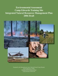
Camp Edwards Training Site Integrated Natural Resources
Camp Edwards Training Site Integrated Natural Resources
Camp Edwards Training Site Integrated Natural Resources

You also want an ePaper? Increase the reach of your titles
YUMPU automatically turns print PDFs into web optimized ePapers that Google loves.
<strong>Camp</strong> <strong>Edwards</strong> <strong>Integrated</strong> <strong>Natural</strong> <strong>Resources</strong> Management Plan<br />
ii
<strong>Camp</strong> <strong>Edwards</strong> <strong>Integrated</strong> <strong>Natural</strong> <strong>Resources</strong> Management Plan<br />
iii
<strong>Camp</strong> <strong>Edwards</strong> <strong>Integrated</strong> <strong>Natural</strong> <strong>Resources</strong> Management Plan<br />
PREPARER-REVIEWER PAGE<br />
This <strong>Integrated</strong> <strong>Natural</strong> <strong>Resources</strong> Management Plan (INRMP) was prepared and<br />
reviewed by the following people and organizations:<br />
Prepared by:<br />
Michael A. Ciaranca John P. Kelly<br />
<strong>Natural</strong> Resource Manager <strong>Natural</strong> Resource Planner<br />
<strong>Camp</strong> <strong>Edwards</strong> <strong>Training</strong> <strong>Site</strong> <strong>Camp</strong> <strong>Edwards</strong> <strong>Training</strong> <strong>Site</strong><br />
Reviewed by:<br />
<strong>Camp</strong> <strong>Edwards</strong> <strong>Training</strong> <strong>Site</strong><br />
Michael A. Ciaranca<br />
<strong>Natural</strong> <strong>Resources</strong> Manager<br />
<strong>Camp</strong> <strong>Edwards</strong> <strong>Training</strong> <strong>Site</strong><br />
LTC Randall J. Cordeiro<br />
Director, Plans, Operations, <strong>Training</strong>, and Military Support<br />
<strong>Camp</strong> <strong>Edwards</strong> <strong>Training</strong> <strong>Site</strong><br />
LTC Mary Mixson<br />
Range Control Officer<br />
<strong>Camp</strong> <strong>Edwards</strong> <strong>Training</strong> <strong>Site</strong><br />
Massachusetts Army National Guard<br />
Shaun C. Cody<br />
Director of Environmental Affairs<br />
MAARNG<br />
COL Richard V. Crivello<br />
Deputy Chief of Staff, Operations<br />
MAARNG<br />
Brian Nickerson<br />
Master Planner<br />
MAARNG<br />
iv
<strong>Camp</strong> <strong>Edwards</strong> <strong>Integrated</strong> <strong>Natural</strong> <strong>Resources</strong> Management Plan<br />
Massachusetts Army National Guard cont.<br />
William Sullivan<br />
Operations Manager<br />
MAARNG<br />
National Guard Bureau<br />
COL Jeffrey G. Phillips<br />
Division Chief<br />
NGB-ARE<br />
Beth Law<br />
Branch Chief<br />
NGB–ARE<br />
CPT. Steve Stadelman<br />
<strong>Natural</strong> <strong>Resources</strong>/Forestry<br />
NGB-ARE<br />
Dr. Lee Barber<br />
ITAM Program Manager<br />
NBG–ART<br />
Kristin Leahy<br />
Cultural <strong>Resources</strong><br />
NGB-ARE<br />
Brett Wood<br />
ITAM Coordinator<br />
NGB–ART<br />
Chris Williams<br />
NEPA Program Manager<br />
NGB–ARE<br />
Helen Yusko<br />
Public Affairs Specialist<br />
NGB–PAI-E<br />
v
<strong>Camp</strong> <strong>Edwards</strong> <strong>Integrated</strong> <strong>Natural</strong> <strong>Resources</strong> Management Plan<br />
Massachusetts Division of Fisheries and Wildlife<br />
Jason Zimmer<br />
MADFW SE District Manager<br />
U.S. Fish and Wildlife Service<br />
Anthony Tur<br />
USFWS<br />
New England Field Office<br />
General Public<br />
vi
<strong>Camp</strong> <strong>Edwards</strong> <strong>Integrated</strong> <strong>Natural</strong> <strong>Resources</strong> Management Plan<br />
Preface<br />
The Massachusetts Army National Guard (MAARNG) is required by the Sikes<br />
Act to develop and implement an <strong>Integrated</strong> <strong>Natural</strong> <strong>Resources</strong> Management Plan<br />
(INRMP) for the <strong>Camp</strong> <strong>Edwards</strong> <strong>Training</strong> <strong>Site</strong>. The INRMP is the installation<br />
commander’s adaptive plan for managing natural communities and natural resources to<br />
support and be consistent with the military mission while protecting and enhancing<br />
those natural communities and resources for multiple use, sustainable yield, and<br />
biological integrity. “The purpose of the INRMP is to ensure that natural resource<br />
conservation measures and Army activities on mission lands are consistent with federal<br />
stewardship requirements” (US Army National Guard Bureau, 2000) and to sustain<br />
native natural resources on an ecosystem scale and to comply with current legal<br />
mandates while resulting in no net loss in capability to fulfill the military training<br />
mission.<br />
The <strong>Camp</strong> <strong>Edwards</strong> INRMP supports and guides the Massachusetts National<br />
Guard’s Final Environmental Impact Report (2001). The Environmental Performance<br />
Standards (EPS) listed in the Massachusetts National Guard’s Area Wide FEIR and as<br />
required by M.G.L. Chapter 47 Acts of 2002 serve as the guide by which MAARNG<br />
training and natural resources management is conducted on <strong>Camp</strong> <strong>Edwards</strong>. These<br />
EPS’s are continuosly incorporated with federal environmental and land management<br />
programs specified by military regulation and federal law. The INRMP, to the extent<br />
appropriate and applicable, integrates and aids in achieving the standards set forth<br />
within the EPS’s. For a complete description of the EPS’s, please refer to the<br />
Massachusetts National Guard’s Area Wide FEIR (2001). Also, the INRMP integrates<br />
current environmental management practices incorporated in the <strong>Camp</strong> <strong>Edwards</strong><br />
Regulations 385-63 (Range Safety) and the MAARNG’s <strong>Natural</strong> <strong>Resources</strong> and<br />
<strong>Integrated</strong> <strong>Training</strong> Area Management (ITAM) Programs. In addition, the<br />
Environmental Readiness Center was formed to help guide and implement the<br />
aforementioned documents, laws, regulations, standards, and programs.<br />
The MAARNG <strong>Natural</strong> Resource Office has and will continue to consult and<br />
cooperate with state and federal environmental agencies throughout the development<br />
and implementation of the INRMP, including U.S. Fish and Wildlife Service, the<br />
Environmental Management Commission (EMC), the Department of Conservation and<br />
Recreation, the Department of Environmental Protection (MASSDEP), the Division of<br />
Fisheries and Wildlife/<strong>Natural</strong> Heritage and Endangered Species Program<br />
(DFW/NHESP) are involved with INRMP creation and implementation.<br />
Since the 1950s, and more frequently in the last 20 years, the MAARNG has<br />
received input and adopted management practices from several federal and state<br />
agencies and non-profit organizations in Massachusetts. The DFW has provided<br />
consultation and support on white tail deer (Odocoileus virginiana) hunting on <strong>Camp</strong><br />
vii
<strong>Camp</strong> <strong>Edwards</strong> <strong>Integrated</strong> <strong>Natural</strong> <strong>Resources</strong> Management Plan<br />
<strong>Edwards</strong> since 1955 and was instrumental in reintroducing wild turkey (Meleagris<br />
gallopavo) in the 1980s which subsequently resulted in the first turkey harvest in the<br />
spring of 2000 and continues today. The NHESP conducted a grassland bird survey<br />
(White and Melvin 1985) of the cantonment area of the MMR. Within the report for the<br />
survey were recommendations for managing the grassland habitats on the MMR for<br />
rare bird species. These recommendations were in part adopted by the MAARNG and<br />
have been followed since the time of the initial survey. The NHESP has also been<br />
instrumental in conducting a comprehensive floristic survey of <strong>Camp</strong> <strong>Edwards</strong> (Jenkins<br />
1994), as well as a moth survey that documented the 16 state-listed species of moths that<br />
inhabit the <strong>Camp</strong> <strong>Edwards</strong> Impact Area for at least part of their life cycle (Mello et al.<br />
1999). The United States Department of Agriculture (USDA) has conducted research on<br />
the MMR since the 1980s. Throughout the course of this research, the USDA has<br />
focused on the gypsy moth (Lymantria dispar) caterpillar and the Asian longhorn beetle<br />
(Anoplophora glabripennis), which has not been recorded in Massachusetts, and has<br />
utilized various areas of <strong>Camp</strong> <strong>Edwards</strong> as study sites. The Environmental<br />
Management Commission created by “Chapter 47 of the Acts of 2002” was established<br />
to verify, through independent oversight, monitoring, and evaluation, the compatibility<br />
of training with environmental protection.<br />
The MAARNG <strong>Natural</strong> Resource Office has also coordinated with multiple<br />
agencies on a single task. For instance, the Cape Cod National Seashore within the<br />
National Park Service (NPS), the MASSDEP, the University of Massachusetts at<br />
Amherst (UMASS), and The Nature Conservancy (TNC) have assisted in planning and<br />
conducting the prescribed burn program on <strong>Camp</strong> <strong>Edwards</strong>. UMASS completed a<br />
prescribed burn management plan in 2000 (revised by MAARNG in 2006) to provide<br />
direction on future prescribed burning on <strong>Camp</strong> <strong>Edwards</strong>.<br />
An objective of the <strong>Camp</strong> <strong>Edwards</strong> INRMP is to compile and consolidate the<br />
management recommendations from the survey and study reports to provide a<br />
comprehensive management plan (i.e., INRMP) for the natural communities and<br />
natural resources on <strong>Camp</strong> <strong>Edwards</strong>. Input and comments from all agencies that have<br />
reviewed the <strong>Camp</strong> <strong>Edwards</strong> INRMP were taken into account and incorporated where<br />
appropriate. Ease of interpretation is the intent of this plan, so that the natural<br />
resources of <strong>Camp</strong> <strong>Edwards</strong> may be properly managed and protected while providing<br />
the most beneficial training experience for the MAARNG.<br />
The <strong>Camp</strong> <strong>Edwards</strong> <strong>Natural</strong> Resource Office currently maintains a web site that<br />
describes in detail the natural resources of <strong>Camp</strong> <strong>Edwards</strong>, including the flora, fauna,<br />
and rare species, the ITAM Program, and other natural resources surveys and research.<br />
The site can be accessed at www.eandrc.org.<br />
viii
<strong>Camp</strong> <strong>Edwards</strong> <strong>Integrated</strong> <strong>Natural</strong> <strong>Resources</strong> Management Plan<br />
TABLE OF CONTENTS<br />
LIST OF TABLES ................................................................................................................... XIV<br />
LIST OF FIGURES.................................................................................................................XVI<br />
LIST OF ACRONYMS .......................................................................................................XVIII<br />
EXECUTIVE SUMMARY..................................................................................................... XXI<br />
SECTION I. TRAINING SITE OVERVIEW............................................................................ 1<br />
CHAPTER 1. LOCATION AND ACREAGE ........................................................................ 1<br />
1.1 LOCATION .................................................................................................................................................1<br />
1.2 ACREAGE AND ACQUISITION ..................................................................................................................2<br />
1.3 INSTALLATION HISTORY..........................................................................................................................4<br />
1.4 NEIGHBORS ...............................................................................................................................................5<br />
1.5 SATELLITE INSTALLATIONS .....................................................................................................................6<br />
CHAPTER 2. MILITARY MISSION ...................................................................................... 6<br />
2.1 OVERVIEW .................................................................................................................................................6<br />
2.1.1 Military Mission........................................................................................................................................6<br />
2.1.2 Types of <strong>Training</strong>.......................................................................................................................................6<br />
2.1.3 Soldier Usage Data ....................................................................................................................................7<br />
2.1.4 Types of Equipment Which Might Impact <strong>Natural</strong> <strong>Resources</strong> ..................................................................8<br />
2.1.5 Range Use Days.........................................................................................................................................8<br />
2.1.6 Ammunition Storage and Production........................................................................................................9<br />
2.2 NATURAL RESOURCES NEEDED TO SUPPORT THE MILITARY MISSION ............................................10<br />
2.3 EFFECTS OF THE MILITARY MISSION ON NATURAL RESOURCES .......................................................10<br />
2.4 IMPACTS OF NATURAL RESOURCES MANAGEMENT ON THE MISSION .............................................12<br />
2.5 FUTURE MILITARY MISSION IMPACTS ON NATURAL RESOURCES ....................................................12<br />
CHAPTER 3. FACILITIES...................................................................................................... 13<br />
3.1 OVERVIEW ...............................................................................................................................................13<br />
3.2 LAND USE ................................................................................................................................................16<br />
3.3 TRANSPORTATION SYSTEM ...................................................................................................................16<br />
3.3.1 Cantonment Area Roads...........................................................................................................................19<br />
3.3.2 Northern <strong>Training</strong> Area Roads..................................................................................................................19<br />
3.3.3 Railroad Access Point................................................................................................................................19<br />
3.3.4 ARNG Aviation Facility ...........................................................................................................................19<br />
3.4 WATER SUPPLY .......................................................................................................................................19<br />
3.5 PROJECTED CHANGES IN FACILITIES ....................................................................................................20<br />
SECTION II. MANAGEMENT RESPONSIBILITIES ......................................................... 22<br />
CHAPTER 4. GOALS AND POLICIES ................................................................................ 22<br />
4.1 GOALS......................................................................................................................................................22<br />
4.2 REQUIRED AND RELEVANT ENVIRONMENTAL REGULATIONS ...........................................................23<br />
4.3 POLICIES ..................................................................................................................................................24<br />
4.4 ENVIRONMENTAL REVIEW (NEPA COMPLIANCE) ..............................................................................24<br />
ix
<strong>Camp</strong> <strong>Edwards</strong> <strong>Integrated</strong> <strong>Natural</strong> <strong>Resources</strong> Management Plan<br />
4.5 MONITORING INRMP IMPLEMENTATION...........................................................................................25<br />
CHAPTER 5. RESPONSIBLE AND INTERESTED PARTIES........................................ 27<br />
5.1 INSTALLATION ORGANIZATIONS..........................................................................................................27<br />
5.2 FEDERAL DEFENSE ORGANIZATIONS....................................................................................................27<br />
5.3 OTHER FEDERAL AGENCIES...................................................................................................................28<br />
5.4 STATE AGENCIES ....................................................................................................................................28<br />
5.5 UNIVERSITIES..........................................................................................................................................30<br />
5.6 CONTRACTORS........................................................................................................................................30<br />
5.7 NATIVE AMERICAN TRIBES ...................................................................................................................30<br />
5.8 OTHER INTERESTED PARTIES ................................................................................................................30<br />
5.9 SIGNATORY AGENCIES...........................................................................................................................31<br />
SECTION III. NATURAL RESOURCES OF CAMP EDWARDS...................................... 32<br />
CHAPTER 6. NATURAL RESOURCES AND CLIMATE ............................................... 32<br />
6.1 SETTING...................................................................................................................................................32<br />
6.2 TOPOGRAPHY..........................................................................................................................................33<br />
6.3 GEOLOGY.................................................................................................................................................35<br />
6.4 CLIMATE ..................................................................................................................................................35<br />
6.5 PETROLEUM AND MINERALS .................................................................................................................36<br />
6.6 SOILS........................................................................................................................................................36<br />
6.6.1 Soils of the Sandwich and Buzzards Bay Terminal Moraines .................................................................36<br />
6.6.2 Soils of the Outwash Plains .....................................................................................................................36<br />
6.7 WATER RESOURCES................................................................................................................................40<br />
6.7.1 Surface Water <strong>Resources</strong>..........................................................................................................................40<br />
6.7.2 Groundwater <strong>Resources</strong>...........................................................................................................................43<br />
6.8 NATURAL COMMUNITIES OF CAMP EDWARDS....................................................................................45<br />
6.8.1 Plantations ...............................................................................................................................................45<br />
6.8.2 Pitch Pine-Oak Forest Woodland ............................................................................................................48<br />
6.8.3 Pitch Pine-Scrub Oak Community ...........................................................................................................51<br />
6.8.4 Black Oak-Scarlet Oak Forest/Woodland.................................................................................................54<br />
6.8.5 Scrub Oak Shrub land ..............................................................................................................................57<br />
6.8.6 Cultural Grasslands.................................................................................................................................60<br />
6.8.7 Wetlands...................................................................................................................................................64<br />
6.8.8 Disturbed <strong>Natural</strong> Communities ..............................................................................................................70<br />
6.9 FAUNA......................................................................................................................................................71<br />
6.9.1 Invertebrates ............................................................................................................................................72<br />
6.9.2 Birds.........................................................................................................................................................73<br />
6.9.3 Mammals .................................................................................................................................................76<br />
6.9.4 Reptiles.....................................................................................................................................................78<br />
6.9.5 Amphibians..............................................................................................................................................79<br />
6.9.6 Fish............................................................................................................................................................79<br />
6.10 ENDANGERED, THREATENED, AND SPECIAL CONCERN SPECIES .......................................................79<br />
6.10.1 Threatened and Endangered Flora .........................................................................................................81<br />
6.10.2 Threatened and Endangered Fauna .......................................................................................................81<br />
SECTION IV. NATURAL RESOURCES MANAGEMENT AT CAMP EDWARDS ....... 84<br />
CHAPTER 7. INTEGRATED TRAINING AREA MANAGEMENT (ITAM)<br />
PROGRAM................................................................................................................................. 84<br />
7.1 OVERVIEW OF ITAM AND RELATIONSHIP TO NATURAL RESOURCE MANAGEMENT .....................84<br />
x
<strong>Camp</strong> <strong>Edwards</strong> <strong>Integrated</strong> <strong>Natural</strong> <strong>Resources</strong> Management Plan<br />
7.1.1 ITAM Coordination.................................................................................................................................86<br />
7.1.2 ITAM Program on <strong>Camp</strong> <strong>Edwards</strong>..........................................................................................................86<br />
7.2 RANGE AND TRAINING LAND ASSESSMENTS (RTLA) .......................................................................86<br />
7.2.1 Introduction .............................................................................................................................................86<br />
7.2.2 History of RTLA at <strong>Camp</strong> <strong>Edwards</strong>.........................................................................................................88<br />
7.2.3 RTLA Goals and Objectives.....................................................................................................................90<br />
7.2.4 Plot Inventory and Monitoring ...............................................................................................................90<br />
7.2.5 Data Management and Analysis .............................................................................................................91<br />
7.2.6 Geographic Information Systems (GIS)...................................................................................................92<br />
7.3 TRAINING REQUIREMENTS INTEGRATION (TRI).................................................................................93<br />
7.3.1 TRI Introduction......................................................................................................................................93<br />
7.3.2 TRI Goals and Objectives ........................................................................................................................94<br />
7.3.3 <strong>Training</strong> Siting ........................................................................................................................................94<br />
7.3.4 Guidelines for Protection of <strong>Natural</strong> <strong>Resources</strong> During <strong>Training</strong> ..........................................................95<br />
7.3.5 Rotational Use of <strong>Training</strong> Areas ............................................................................................................99<br />
7.3.6 Restricted Areas...................................................................................................................................99<br />
7.4 LAND REHABILITATION AND MAINTENANCE (LRAM).......................................................................100<br />
7.4.1 LRAM Introduction...............................................................................................................................100<br />
7.4.2 LRAM Goals and Objectives .................................................................................................................100<br />
7.4.3 LRAM Project Planning........................................................................................................................101<br />
7.4.4 LRAM Projects ......................................................................................................................................102<br />
7.4.5 LRAM Project Monitoring....................................................................................................................102<br />
7.5 SUSTAINABLE RANGE AWARENESS (SRA ..........................................................................................103<br />
7.5.1 SRA Introduction .................................................................................................................................103<br />
7.5.2 SRA Goals and Objectives .....................................................................................................................103<br />
7.5.3 Environmental Stewardship ..................................................................................................................104<br />
7.5.4 Soldier Awareness..................................................................................................................................104<br />
7.5.5 Educational <strong>Training</strong> Tools ...................................................................................................................105<br />
7.5.6 Community Environmental Awareness ................................................................................................106<br />
7.5.7 Professional Education...........................................................................................................................108<br />
7.5.8 Research Opportunities..........................................................................................................................108<br />
CHAPTER 8. NATURAL RESOURCE MANAGEMENT............................................... 109<br />
8.1 INTRODUCTION.....................................................................................................................................109<br />
8.1.1 Philosophy of <strong>Natural</strong> Community Management at <strong>Camp</strong> <strong>Edwards</strong>....................................................109<br />
8.1.2 <strong>Natural</strong> Community Management Goals and Objectives......................................................................109<br />
8.1.3 <strong>Natural</strong> Resource Management Units...................................................................................................111<br />
8.2 PITCH PINE-SCRUB OAK COMMUNITY MANAGEMENT ....................................................................111<br />
8.2.1 Introduction ...........................................................................................................................................111<br />
8.2.2 Goals and Objectives..............................................................................................................................112<br />
8.2.3 Management ..........................................................................................................................................112<br />
8.3 PITCH PINE-OAK FOREST WOODLAND MANAGEMENT...................................................................113<br />
8.3.1 Introduction ...........................................................................................................................................113<br />
8.3.2 Goals and Objectives..............................................................................................................................113<br />
8.3.3 Management ..........................................................................................................................................114<br />
8.4 BLACK OAK SCARLET OAK FOREST MANAGEMENT .........................................................................114<br />
8.4.1 Introduction ...........................................................................................................................................114<br />
8.4.2 Goals and Objectives..............................................................................................................................115<br />
8.4.3 Management ..........................................................................................................................................115<br />
8.5 SCRUB OAK SHRUBLAND MANAGEMENT ..........................................................................................116<br />
8.5.1 Introduction ...........................................................................................................................................116<br />
8.5.2 Goals and Objectives..............................................................................................................................116<br />
8.5.3 Management ..........................................................................................................................................116<br />
xi
<strong>Camp</strong> <strong>Edwards</strong> <strong>Integrated</strong> <strong>Natural</strong> <strong>Resources</strong> Management Plan<br />
8.6 GRASSLANDS MANAGEMENT .............................................................................................................118<br />
8.6.1 Introduction ...........................................................................................................................................118<br />
8.6.2 Goals and Objectives..............................................................................................................................119<br />
8.6.3 Management ..........................................................................................................................................120<br />
8.7 WETLAND RESOURCE MANAGEMENT ..................................................................................................124<br />
8.7.1 Introduction ...........................................................................................................................................124<br />
8.7.2 Goals and Objectives..............................................................................................................................124<br />
8.7.3 Management ..........................................................................................................................................125<br />
8.7.4 Groundwater Management....................................................................................................................126<br />
8.8 RESEARCH AND MONITORING ............................................................................................................127<br />
8.8.2 Goals and Objectives..............................................................................................................................127<br />
8.8.3 Projects, Research, and Surveys.............................................................................................................128<br />
8.9 FIRE MANAGEMENT .............................................................................................................................136<br />
8.9.1 Introduction ...........................................................................................................................................136<br />
8.9.2 Goals and Objectives..............................................................................................................................138<br />
8.9.3 Management .........................................................................................................................................139<br />
8.9.4 Fire Management Blocks........................................................................................................................142<br />
8.9.5 Smoke Management Zones ....................................................................................................................149<br />
8.10 INTEGRATED PEST MANAGEMENT......................................................................................................151<br />
8.10.1 Introduction .........................................................................................................................................151<br />
8.10.2 Goals and Objectives............................................................................................................................151<br />
8.10.3 Invasive Plant Species...........................................................................................................................152<br />
8.10.4 Common Pests of <strong>Camp</strong> <strong>Edwards</strong> ........................................................................................................155<br />
8.10.5 <strong>Integrated</strong> Pest Management Principles..............................................................................................156<br />
8.11 CULTURAL RESOURCES MANAGEMENT .............................................................................................157<br />
8.11.1 Goals and Objectives............................................................................................................................157<br />
8.11.2 Policies .................................................................................................................................................157<br />
8.11.3 Contributions to <strong>Natural</strong> Community Management...........................................................................160<br />
8.11.4 Sacred <strong>Site</strong> Protection ..........................................................................................................................160<br />
8.11.5 Management at <strong>Camp</strong> <strong>Edwards</strong>...........................................................................................................161<br />
8.12 OUTDOOR RECREATION MANAGEMENT............................................................................................162<br />
8.12.1 Introduction .........................................................................................................................................162<br />
8.12.2 Goals and Objectives............................................................................................................................162<br />
8.12.3 Outdoor Recreation Opportunities on <strong>Camp</strong> <strong>Edwards</strong>........................................................................163<br />
8.13 NATURAL RESOURCES LAW ENFORCEMENT ......................................................................................164<br />
8.13.1 Introduction .........................................................................................................................................164<br />
8.13.2 Goals and Objectives............................................................................................................................165<br />
CHAPTER 9. CONSERVATION OF LISTED RARE SPECIES.................................... 166<br />
9.1 INTRODUCTION ......................................................................................................................................166<br />
9.2 PLANTS...................................................................................................................................................166<br />
9.3 ODONATES .............................................................................................................................................167<br />
9.4 MOTHS ...................................................................................................................................................168<br />
9.5 BIRDS ......................................................................................................................................................168<br />
9.6 TURTLES .................................................................................................................................................169<br />
9.7 MAMMALS..............................................................................................................................................170<br />
CHAPTER 10. ADDITIONAL NATURAL RESOURCES ISSUES.............................. 171<br />
SECTION V. IMPLEMENTATION OF THE CAMP EDWARDS INRMP..................... 172<br />
CHAPTER 11. PLAN IMPLEMENTATION ..................................................................... 172<br />
xii
<strong>Camp</strong> <strong>Edwards</strong> <strong>Integrated</strong> <strong>Natural</strong> <strong>Resources</strong> Management Plan<br />
11.1 ORGANIZATION, ROLES, AND RESPONSIBILITIES..............................................................................172<br />
11.2 STAFFING................................................................................................................................................172<br />
11.2.1 MAARNG Personnel...........................................................................................................................172<br />
11.2.2 Soldier Man-Days................................................................................................................................172<br />
11.2.3 Contractors ..........................................................................................................................................172<br />
11.2.4 State Environmental Agencies.............................................................................................................173<br />
11.3 FUNDING SOURCES ................................................................................................................................173<br />
11.4 COMMAND SUPPORT .............................................................................................................................175<br />
11.5 IMPLEMENTATION OF INRMP GOALS AND OBJECTIVES 2001-2006 ...............................................176<br />
11.6 TRACKING AND IMPLEMENTATION MATRIX OF INRMP GOALS AND OBJECTIVES ......................177<br />
GLOSSARY.............................................................................................................................. 192<br />
REFERENCES .......................................................................................................................... 196<br />
APPENDIX A – SOILS OF CAMP EDWARDS, MA ....................................................... 200<br />
APPENDIX B – PLANT SPECIES OF CAMP EDWARDS, MA .................................... 201<br />
APPENDIX C – MACROLEPIDOPTERA (MOTH AND BUTTERFLY) SPECIES OF<br />
CAMP EDWARDS, MA ........................................................................................................ 207<br />
APPENDIX D – ODONATE (DRAGONFLY) SPECIES OF CAMP EDWARDS, MA.<br />
..................................................................................................................................................... 214<br />
APPENDIX E – BIRD SPECIES OF CAMP EDWARDS, MA........................................ 215<br />
APPENDIX F – MAMMAL SPECIES OF CAMP EDWARDS, MA.............................. 217<br />
APPENDIX G –MEMORANDUMS OF AGREEMENT AND MEMORANDUMS OF<br />
UNDERSTANDING . ............................................................................................................ 218<br />
APPENDIX H –COMMENTS AND CORRESPONDENCE .......................................... 243<br />
xiii
<strong>Camp</strong> <strong>Edwards</strong> <strong>Integrated</strong> <strong>Natural</strong> <strong>Resources</strong> Management Plan<br />
LIST OF TABLES<br />
Table 2-1. Range use days for <strong>Camp</strong> <strong>Edwards</strong>, 2002-2005.<br />
Table 3-1. Road system of <strong>Camp</strong> <strong>Edwards</strong>.<br />
Table 6-1. Wetlands and Ponds of <strong>Camp</strong> <strong>Edwards</strong>, MA.<br />
Table 6-2. Species of Pitch Pine-Oak Forest Woodland.<br />
Table 6-3. Species of Pitch Pine-Scrub Oak Community<br />
Table 6-4. Species of Black Oak-Scarlet Oak Forest Woodland<br />
Table 6-5. Species of Scrub Oak Shrubland Community.<br />
Table 6-6. Species of Cultural Grasslands.<br />
Table 6-7. Species of the Wetlands of <strong>Camp</strong> <strong>Edwards</strong><br />
Table 6-8 State-Listed rare moths, their associated habitat, and host plant on <strong>Camp</strong><br />
<strong>Edwards</strong>, MA<br />
Table 6-9. Numbers of state-listed rare bird species observed in <strong>Camp</strong> <strong>Edwards</strong><br />
grasslands.<br />
Table 6-10. Deer harvest data for <strong>Camp</strong> <strong>Edwards</strong>, MA, 1992-2000.<br />
Table 6-11. Reptile species observed on <strong>Camp</strong> <strong>Edwards</strong>, MA.<br />
Table 6-12. State-listed and watch-listed species, <strong>Camp</strong> <strong>Edwards</strong>, MA.<br />
Table 6-13. State-listed and watch-listed plant species, <strong>Camp</strong> <strong>Edwards</strong>.<br />
Table 6-14. State-listed fauna observed on <strong>Camp</strong> <strong>Edwards</strong>.<br />
Table 8-1. Seasonal and permanent road closures on <strong>Camp</strong> <strong>Edwards</strong>.<br />
Table 8-2. Historical Prescribed Fire Activity for <strong>Camp</strong> <strong>Edwards</strong>, MA 1983-2005.<br />
Table 8-3. Common pests and their potential locations on <strong>Camp</strong> <strong>Edwards</strong>, MA.<br />
xiv
<strong>Camp</strong> <strong>Edwards</strong> <strong>Integrated</strong> <strong>Natural</strong> <strong>Resources</strong> Management Plan<br />
LIST OF TABLES cont.<br />
Table 11-1 Implementation of INRMP Goals and Objectives<br />
xv
<strong>Camp</strong> <strong>Edwards</strong> <strong>Integrated</strong> <strong>Natural</strong> <strong>Resources</strong> Management Plan<br />
LIST OF FIGURES<br />
Figure 1-1. Location of the MMR in Massachusetts.<br />
Figure 1-2. Massachusetts Military Reservation (MMR) and <strong>Camp</strong> <strong>Edwards</strong><br />
installation boundaries.<br />
Figure 3-1. Tenants of the Massachusetts Military Reservation.<br />
Figure 3-2. <strong>Training</strong> area delineation on <strong>Camp</strong> <strong>Edwards</strong>, MA.<br />
Figure 3-3. Transportation System on <strong>Camp</strong> <strong>Edwards</strong>, MA.<br />
Figure 6-1. Geology and Topography of <strong>Camp</strong> <strong>Edwards</strong>, MA.<br />
Figure 6-2. Soil classification of <strong>Camp</strong> <strong>Edwards</strong>, MA.<br />
Figure 6-3. Erosion potential of soils on <strong>Camp</strong> <strong>Edwards</strong>, MA.<br />
Figure 6-4. Sagamore Lens of the Cape Cod Aquifer with Groundwater Contours and<br />
Central Monitoring Well.<br />
Figure 6-5. Upper Cape Water Supply Wells on <strong>Camp</strong> <strong>Edwards</strong>, MA.<br />
Figure 6-6. Portion of 1932 Shawme State Forest Map indicating historic burning,<br />
access roads, and exotic pine and spruce plantations<br />
Figure 6-7. <strong>Natural</strong> Communities of <strong>Camp</strong> <strong>Edwards</strong>, MA.<br />
Figure 6-8. Grassland Management Area, <strong>Camp</strong> <strong>Edwards</strong>, MA.<br />
Figure 6-9. Wetlands of <strong>Camp</strong> <strong>Edwards</strong> and the MMR.<br />
Figure 7-1. RTLA (EM) plot locations within natural communities on <strong>Camp</strong> <strong>Edwards</strong>.<br />
Figure 7-2. The Soldier’s/Trainer’s Field Card from <strong>Camp</strong> <strong>Edwards</strong>.<br />
Figure 7-3. LRAM on <strong>Camp</strong> <strong>Edwards</strong><br />
Figure 8-1. Prescribed Fire Management Blocks on <strong>Camp</strong> <strong>Edwards</strong>, MA.<br />
Figure 8-2. Burn Units on <strong>Camp</strong> <strong>Edwards</strong>, MA<br />
xvi
<strong>Camp</strong> <strong>Edwards</strong> <strong>Integrated</strong> <strong>Natural</strong> <strong>Resources</strong> Management Plan<br />
LIST OF FIGURES cont.<br />
Figure 8-3. Smoke Management Zones for <strong>Camp</strong> <strong>Edwards</strong>, MA.<br />
xvii
<strong>Camp</strong> <strong>Edwards</strong> <strong>Integrated</strong> <strong>Natural</strong> <strong>Resources</strong> Management Plan<br />
LIST OF ACRONYMS<br />
AIRFA-American Indian Religious Freedom Act of 1978<br />
ANG-Air National Guard<br />
AO-Administrative Order<br />
APC-Armored Personnel Carrier<br />
AR-Army Regulations<br />
ARE-Army Environmental Division<br />
ARI-Army Installations Division<br />
ARNG-Army National Guard<br />
ARO-Army Operations<br />
ARPA-Archaeological Resource Protection Act of 1979<br />
ART-Army <strong>Training</strong> Division<br />
ASP-Ammunition Supply Point<br />
ATV-All Terrain Vehicle<br />
BMP-Best Management Plan<br />
BOQ-Bachelor Officer’s Quarters<br />
CATS-Combined Arms <strong>Training</strong> Strategy<br />
CCC-Cape Cod Commission<br />
CFM-Custom Fuel Model<br />
CFMO-Construction and Facilities Management Officer<br />
COMSTA-United States Coast Guard Communication Station<br />
CWA-Clean Water Act<br />
CX-categorical exclusion<br />
DA-Department of the Army<br />
DCR-Department of Conservationa dn Recreation<br />
DFP-Division of Forest and Parks<br />
DFW-Division of Fisheries and Wildlife/<br />
NHESP-<strong>Natural</strong> Heritage and Endangered Species Program<br />
DoD-Department of Defense<br />
DPW-Real Property Operation and Maintenance funds<br />
DWM-Division of Watershed Management<br />
EA-Environmental Awareness<br />
E-Endangered<br />
EIR-Environmental Impact Report<br />
EIS-Environmental Impact Statement<br />
EM-Environmental Monitoring<br />
EMC-Environmental Management Commission<br />
EO-Executive Order<br />
EPA-Environmental Protection Agency<br />
EPS-Environmental Performance Standards<br />
FE-Facilities Engineer<br />
FEIR-Final Environmental Impact Report<br />
xviii
<strong>Camp</strong> <strong>Edwards</strong> <strong>Integrated</strong> <strong>Natural</strong> <strong>Resources</strong> Management Plan<br />
LIST OF ACRONYMS cont.<br />
FMB-Fire Management Blocks<br />
FMZ-Fire Management Zone<br />
FT-Foot<br />
FY-Fiscal Year<br />
GIS-Geographical Information System<br />
IAGWS-Impact Area Groundwater Study<br />
ICRMP-<strong>Integrated</strong> Cultural Resource Management Plan<br />
IDT-Inactive Duty <strong>Training</strong><br />
INRMP-<strong>Integrated</strong> <strong>Natural</strong> Resource Management Plan<br />
IPM-<strong>Integrated</strong> Pest Management<br />
IPMP-<strong>Integrated</strong> Pest Management Plan<br />
ITAM-<strong>Integrated</strong> <strong>Training</strong> Area Management<br />
JPO-Joint Programs Office<br />
KM-Kilometer<br />
RTLA-Range and <strong>Training</strong> Land Assessments<br />
LRAM-Land Rehabilitation and Maintenance<br />
LZ-Landing Zone<br />
MAANG-Massachusetts Air National Guard<br />
MAARNG-Massachusetts Army National Guard<br />
MACOM-Major Army Command<br />
MASSDEP -Department of Environmental Protection<br />
MANG-Massachusetts National Guard<br />
MCA-Master Cooperative Agreement<br />
MEPA-Massachusetts Environmental Policy Act<br />
MESA-Massachusetts Endangered Species Act<br />
METL-Mission Essential Task List<br />
MMR-Massachusetts Military Reservation<br />
MOA-Memorandum of Agreement<br />
MOU-Memorandum of Understanding<br />
MS-Microsoft<br />
MWPA-Massachusetts Wetland Protection Act<br />
NAGPRA-Native American Graves Protection and Repatriation Act<br />
NEPA-National Environmental Policy Act<br />
NGB-National Guard Bureau<br />
NHPA-National Historic Preservation Act<br />
NPS-National Park Service<br />
OP-Observation Point<br />
Otis ANGB-Otis Air National Guard Base<br />
PAB4-Palustrine Aquatic Bed<br />
PACERS-Patriots Advocating <strong>Camp</strong> <strong>Edwards</strong> Restoration and Survival<br />
PAVE-PAWS-Precision Acquisition Vehicle Entry – Phased Array Warning System<br />
PEM-Palustrine Emergent<br />
xix
<strong>Camp</strong> <strong>Edwards</strong> <strong>Integrated</strong> <strong>Natural</strong> <strong>Resources</strong> Management Plan<br />
LIST OF ACRONYMS cont.<br />
PFO1-Palustrine Forested<br />
PLS-Planning Level Survey<br />
POTO-Plans, Operations, and <strong>Training</strong> Officer<br />
POW-Palustrine Open Water<br />
PSS-Palustrine Scrub Shrub<br />
REC-Record of Environmental Consideration<br />
RFMSS-Range Facility Management Support System<br />
RTI-Regional <strong>Training</strong> Institute<br />
RTLP-Range and <strong>Training</strong> Land Program<br />
RUSLE-Revised Universal Soil Loss Equation<br />
SC-Special Concern<br />
SDWA-Safe Drinking Water Act<br />
SDZ-Surface Danger Zones<br />
SFM-Standard Fuel Model<br />
SHPO-State Historic Preservation Officer<br />
SMZ-Smoke Management Zone<br />
SOP-Standard Operating Procedures<br />
STEP-Staus Tool for Environmental Programs<br />
STRONG-Save The Reserve and Our National Guard<br />
THPO-Tribal Historic Preservation Officer<br />
TNC-The Nature Conservancy<br />
TRI-<strong>Training</strong> Requirements Integration<br />
T-Threatened<br />
UMASS-University of Massachusetts<br />
USCG-United States Coast Guard<br />
USDA-United States Department of Agriculture<br />
USFWS-United States Fish and Wildlife Service<br />
UTES-Unit <strong>Training</strong> Equipment <strong>Site</strong><br />
UXO-Unexploded Ordinance<br />
VA-Veteran’s Affairs<br />
WL-Unofficial Watch List<br />
WUI-Wildland Urban Interface<br />
xx
<strong>Camp</strong> <strong>Edwards</strong> <strong>Integrated</strong> <strong>Natural</strong> <strong>Resources</strong> Management Plan<br />
EXECUTIVE SUMMARY<br />
<strong>Camp</strong> <strong>Edwards</strong> is a 14,433-acre Massachusetts Army National Guard<br />
(MAARNG) training site located in southeastern Massachusetts approximately 50 miles<br />
southeast of Boston, at the base of Cape Cod (i.e., Barnstable County). The land use of<br />
<strong>Camp</strong> <strong>Edwards</strong> consists of military training activities, including assembly, tactical<br />
maneuvering, tactical bivouacking, small arms range firing, engineering, ammunition<br />
storage, support, maintenance, and aviation facilities, environmental management, as<br />
well as being designated the Upper Cape Water Supply Reserve, a drinking water<br />
recharge area. Consistent with the use of military installations to ensure the<br />
preparedness of the Armed Forces, the land and resources of <strong>Camp</strong> <strong>Edwards</strong> must be<br />
properly managed to minimize negative impacts from use, to preserve sensitive<br />
habitats and rare species, and to promote the sustainment of native natural<br />
communities.<br />
Development and implementation of an <strong>Integrated</strong> <strong>Natural</strong> <strong>Resources</strong><br />
Management Plan (INRMP) for <strong>Camp</strong> <strong>Edwards</strong> are required by the Sikes Act (16 USC §<br />
670a et seq.) and the Sikes Act Improvement Amendments of 1997. The purpose of this<br />
plan is to guide natural resources management at <strong>Camp</strong> <strong>Edwards</strong> from Fiscal Year (FY)<br />
2008 through 2013, and also review the previous five years for proper implementation.<br />
Chapter 11, Plan Implementation, includes a table listing goals and objectives with<br />
space for comments as to current level of implementation. The INRMP is renewed<br />
every five years, but may be amended as needed. This document represents a revision<br />
of the 2001 INRMP. Issues from the revised INRMP that drive NEPA documentation<br />
are as follows:<br />
1. Environmental Oversight by the Environmental Management<br />
Commission as established by the Massachusetts General Law Chapter 47<br />
the Acts of 2002.<br />
2. Reclassification of the <strong>Natural</strong> Communities of <strong>Camp</strong> <strong>Edwards</strong> to be<br />
consistent with sister state agencies.<br />
3. Adjusted goals, objectives, and management actions based upon<br />
reclassification of natural communities.<br />
4. Expanded fire management goals, objectives, and proposed actions as<br />
exerted from the <strong>Camp</strong> <strong>Edwards</strong> <strong>Integrated</strong> Fire Management Plan.<br />
5. The need to recognize a Federal Candidate Species, New England<br />
Cottontail (Sylvilagus transitionalis) and put forth proactive management<br />
actions to address this species.<br />
xxi
<strong>Camp</strong> <strong>Edwards</strong> <strong>Integrated</strong> <strong>Natural</strong> <strong>Resources</strong> Management Plan<br />
In addition, The INRMP serves, in part, as a document by which the<br />
Environmental Performance Standards, as codified in Massachusetts General Law.<br />
Chapter 47, Acts of 2002, are achieved and implemented on <strong>Camp</strong> <strong>Edwards</strong>.<br />
The goal of the <strong>Camp</strong> <strong>Edwards</strong> <strong>Integrated</strong> <strong>Natural</strong> <strong>Resources</strong> Management Plan<br />
(INRMP) is to support the training mission of the MAARNG through conservation and<br />
maintenance of the natural resources of <strong>Camp</strong> <strong>Edwards</strong>. Guidance from the INRMP<br />
aids in improving the training lands while benefiting the natural resources through<br />
reduced soil erosion, improvement to the flora, fauna, and their habitats, protection of<br />
wetlands, and conservation of rare species. Further objectives of the <strong>Camp</strong> <strong>Edwards</strong><br />
INRMP are:<br />
1. To outline the military mission and its effects on the natural resources of <strong>Camp</strong><br />
<strong>Edwards</strong>.<br />
2. To establish specific goals, objectives, and time frames for the management<br />
and protection of natural and cultural resources on <strong>Camp</strong> <strong>Edwards</strong> to<br />
maintain biological diversity and sustainability of the training site for mission<br />
use.<br />
3. To suggest methods for increasing awareness of the Massachusetts Army<br />
National Guard and the general public on matters of natural resources<br />
protection and conservation and its integration with military training.<br />
4. To provide specific management instructions so that the Environmental<br />
Performance Standards from the Massachusetts National Guard’s Master<br />
Plan/Area-Wide Environmental Impact Report may be achieved on <strong>Camp</strong><br />
<strong>Edwards</strong> with no net loss to the training mission.<br />
5. To describe the physical characteristics of the <strong>Camp</strong> <strong>Edwards</strong> <strong>Training</strong> <strong>Site</strong>.<br />
6. To describe the results and findings of the Range and <strong>Training</strong> Land<br />
Assessment Program and other natural resources inventories and studies on<br />
<strong>Camp</strong> <strong>Edwards</strong>. These results will serve as a baseline of information upon<br />
which management recommendations will be based.<br />
7. To describe in detail the organization, personnel, funding, and support<br />
required for the implementation of the INRMP on the <strong>Camp</strong> <strong>Edwards</strong><br />
<strong>Training</strong> <strong>Site</strong>.<br />
8. To provide an avenue for public involvement in the implementation process of<br />
the INRMP as well as in the recommendations for use of the training site for<br />
recreational purposes.<br />
xxii
<strong>Camp</strong> <strong>Edwards</strong> <strong>Integrated</strong> <strong>Natural</strong> <strong>Resources</strong> Management Plan<br />
9. Use experiences as lessons learned, positive and negative, for other military<br />
installations.<br />
Benefits of the INRMP to the military mission include improved lands allowing<br />
for more realistic training, better distribution of military activities, and reduced conflicts<br />
between training requirements and environmental management resulting in minimized<br />
disruption to training exercises on <strong>Camp</strong> <strong>Edwards</strong>. The <strong>Camp</strong> <strong>Edwards</strong> INRMP<br />
supports the mission of the MAARNG by ensuring that the environmental conditions of<br />
the training lands continue to provide a variety of terrain that is necessary for realistic<br />
military training (missionscape) as well as providing natural resources data and<br />
information to benefit mission planning.<br />
The <strong>Camp</strong> <strong>Edwards</strong> INRMP benefits the Massachusetts National Guard’s Final<br />
Environmental Impact Report (2001). The INRMP integrates current environmental<br />
management practices incorporated in the <strong>Camp</strong> <strong>Edwards</strong> Regulations 385-63 (Range<br />
Safety) and the MAARNG’s <strong>Natural</strong> <strong>Resources</strong> and <strong>Integrated</strong> <strong>Training</strong> Area<br />
Management (ITAM) Programs.<br />
Benefits of the <strong>Camp</strong> <strong>Edwards</strong> INRMP to the environment include reduced soil<br />
erosion and vegetation loss, improvement to sensitive species habitats and subsequent<br />
enhancement of their populations, improvement of water-quality, and an increase in<br />
overall knowledge of the operation of the ecosystem of <strong>Camp</strong> <strong>Edwards</strong> through<br />
surveys, research, and monitoring. In addition, the natural resources management<br />
program described in this plan will protect natural communities and their components<br />
from unnecessary damage or degradation, and provide for restoration if needed,<br />
thereby protecting the <strong>Camp</strong> <strong>Edwards</strong> training mission.<br />
xxiii
<strong>Camp</strong> <strong>Edwards</strong> <strong>Integrated</strong> <strong>Natural</strong> <strong>Resources</strong> Management Plan<br />
1.1 Location<br />
SECTION I. TRAINING SITE OVERVIEW<br />
CHAPTER 1. LOCATION AND ACREAGE<br />
The <strong>Camp</strong> <strong>Edwards</strong> <strong>Training</strong> <strong>Site</strong> (41° 42’ 30” N, 70° 32’ 30”W) is located in<br />
southeastern Massachusetts approximately 50 miles southeast of Boston, at the base of<br />
Cape Cod (i.e., Barnstable County) (Figure 1-1). <strong>Camp</strong> <strong>Edwards</strong> lies within the towns of<br />
Sandwich and Bourne. U.S. Route 6 and State Routes 28 and 130 border <strong>Camp</strong> <strong>Edwards</strong><br />
to the north, west, and east, respectively. <strong>Camp</strong> <strong>Edwards</strong> comprises approximately 70%<br />
of the Massachusetts Military Reservation (MMR) of which the southern portion is<br />
occupied by the Veteran’s Administration Cemetery, and land leased to the United<br />
States Coast Guard and to the United States Air Force.<br />
Figure 1-1. Location of the MMR in Massachusetts<br />
March 2006, MAARNG GIS, MassGIS, Michael Ciaranca, <strong>Natural</strong> Resource Manager<br />
1
<strong>Camp</strong> <strong>Edwards</strong> <strong>Integrated</strong> <strong>Natural</strong> <strong>Resources</strong> Management Plan<br />
1.2 Acreage and Acquisition<br />
The <strong>Camp</strong> <strong>Edwards</strong> <strong>Training</strong> <strong>Site</strong> is 14,433 acres in size (Mass. Army National<br />
Guard 1999). This excludes areas within the northern portion of the Massachusetts<br />
Military Reservation (MMR) that are leased to either the U.S. Air Force or the U.S. Coast<br />
Guard, including but not limited to the Cape Cod Air Force Station early warning radar<br />
site (PAVE PAWS) and the U.S. Coast Guard Communication Station (COMSTA)<br />
Boston (Figure 1-2).<br />
While training and live firing by the Massachusetts Army National Guard<br />
occurred on <strong>Camp</strong> Sandwich, a site thought to have been somewhere in the northern<br />
portion of the MMR, as early as 1908, <strong>Camp</strong> <strong>Edwards</strong> was not established until 1933.<br />
The MMR was created in 1935 primarily from 12,600 acres of land acquired from the<br />
purchase of the Coonamesset Sheep Ranch. At the onset of World War II in 1941, 6,457<br />
acres of Shawme-Crowell State Forest was added to the MMR. Eight years later, an<br />
additional 1,090 acres was added for military use. After World War II, the entirety of<br />
the MMR, then known as Otis Air Force Base, was transferred to the Massachusetts Air<br />
National Guard (MAANG) in the early 1970’s. In 1976, The U.S. Air Force granted a<br />
permit to the U.S. Army for training Army Reserves on the northern portion of Otis<br />
AFB, which was the area presently known as <strong>Camp</strong> <strong>Edwards</strong> (Massachusetts National<br />
Guard 2001).<br />
The land that currently comprises <strong>Camp</strong> <strong>Edwards</strong> is owned by the<br />
Commonwealth of Massachusetts and is custody of Massachusetts Division of Fisheries<br />
and Wildlife, which has leased the property to the Department of the Army. In turn,<br />
the U.S. Army licensed the land to the Massachusetts Army National Guard for<br />
training. The current lease held by the U.S. Army expires in the year 2051.<br />
2
<strong>Camp</strong> <strong>Edwards</strong> <strong>Integrated</strong> <strong>Natural</strong> <strong>Resources</strong> Management Plan<br />
Figure 1-2. Massachusetts Military Reservation (MMR) and <strong>Camp</strong> <strong>Edwards</strong>.<br />
March 2006, MAARNG GIS, MassGIS, Michael Ciaranca, <strong>Natural</strong> Resource Manager<br />
3
<strong>Camp</strong> <strong>Edwards</strong> <strong>Integrated</strong> <strong>Natural</strong> <strong>Resources</strong> Management Plan<br />
1.3 Installation History<br />
The historic use of <strong>Camp</strong> Sandwich in 1908 and in 1913 arose from the need for<br />
an area at which the MAARNG could conduct live fire artillery training. Prior to this<br />
time period, the MAARNG was concentrated primarily in New Bedford and Fall River.<br />
Between 1920 and 1923, Fort Devens was used for much of the infantry training for the<br />
MAARNG. In 1933 the MAARNG sought another area of the state in which to conduct<br />
its training. The present site of <strong>Camp</strong> <strong>Edwards</strong> was chosen as the most suitable location<br />
for the new training site (Massachusetts National Guard 2001).<br />
After its establishment in 1935, <strong>Camp</strong> <strong>Edwards</strong> was used intensively for training<br />
throughout World War II. Initial construction on <strong>Camp</strong> <strong>Edwards</strong> occurred between the<br />
years of 1935 and 1940 and consisted of 63 buildings and two runways. However, by<br />
1941, the threat of war stimulated the construction of facilities to house 30,000 troops as<br />
well as a 1,722-bed hospital. Throughout the course of World War II, numerous Army<br />
Infantry Divisions and other major units trained on <strong>Camp</strong> <strong>Edwards</strong> prior to fighting in<br />
Europe and the Pacific (Massachusetts National Guard 2001).<br />
After World War II, the U.S. Army deactivated <strong>Camp</strong> <strong>Edwards</strong>, which was then<br />
used for training the Army National Guard. However, at the start of the Korean War in<br />
1950, <strong>Camp</strong> <strong>Edwards</strong> was reactivated to train U.S. Army troops. Otis Air Force Base,<br />
comprising Otis Field (the existing runways) and <strong>Camp</strong> <strong>Edwards</strong>, was established in<br />
1958 through a transfer of land from the U.S. Army to the U.S. Air Force. In 1976 the<br />
U.S. Air Force granted a permit to the U.S. Army to use 14,433 acres, which was then<br />
licensed to the Massachusetts Army National Guard in 1979 for year-round training.<br />
Throughout the course of training on <strong>Camp</strong> <strong>Edwards</strong> by the U.S. Army and the<br />
Massachusetts Army National Guard, ranges have been used for firing various<br />
weapons including pistols, rifles, machine guns, rocket launchers, long-range artillery,<br />
mortars, and anti-aircraft weapons. However, in May of 1997, the Environmental<br />
Protection Agency (EPA), citing potential groundwater contamination from actual or<br />
potential releases emanating from the <strong>Training</strong> Ranges and Impact Area, delivered<br />
Administrative Order 1 to the MAARNG. As a result, range firing on <strong>Camp</strong> <strong>Edwards</strong><br />
has been limited to small arms firing of tungsten nylon “green” ammunition and plastic<br />
ammunition. However, tungsten nylon too has been abandoned due to leaching<br />
concerns. As a result, only plastic bullets are fired at the ranges. The cessation of actual<br />
artillery firing out of concerns for soil and groundwater contamination on <strong>Camp</strong><br />
<strong>Edwards</strong> resulted in a loss of training. Soldiers currently travel to Fort Drum, New<br />
York, or Fort Dix, New Jersey, to conduct live artillery fire.<br />
Historically, few people populated the area around the perimeter of <strong>Camp</strong><br />
<strong>Edwards</strong>. However, between 1920 and 1990 the population of Cape Cod (i.e.,<br />
Barnstable County) had the fastest growth rate of any county in Massachusetts,<br />
4
<strong>Camp</strong> <strong>Edwards</strong> <strong>Integrated</strong> <strong>Natural</strong> <strong>Resources</strong> Management Plan<br />
resulting in a high demand for an adequate water supply (Massachusetts National<br />
Guard 2001). As a result of depletion and pollution of groundwater within residential<br />
areas, the surrounding Upper Cape towns of Falmouth, Sandwich, Bourne, and<br />
Mashpee required water supplies from <strong>Camp</strong> <strong>Edwards</strong> to meet their current and future<br />
demands.<br />
In October of 1999, the Governor of Massachusetts, Argeo Paul Cellucci, drafted<br />
an executive order to establish an Upper Cape Water Supply Reserve and Commission<br />
to oversee the management of <strong>Camp</strong> <strong>Edwards</strong> <strong>Training</strong> Area as a water supply and for<br />
wildlife habitat. On October 2001, a Memorandum of Agreement (MOA) was signed<br />
establishing a management and oversight structure for the Reserve. In March of 2002,<br />
Chapter 47 of the Acts of 2002 codified into law the MOA and a set of Environmental<br />
Performance Standards ensuring the permanent protection of the drinking water<br />
supply and wildlife habitats in the Reserve, while allowing compatible military<br />
training. This legislation also created the Environmental Management Commission<br />
(EMC) to independently verify the compatibility of training with environmental<br />
protection.<br />
1.4 Neighbors<br />
Although the upper portion of Cape Cod was sparsely populated in the 1930’s<br />
when <strong>Camp</strong> <strong>Edwards</strong> was first established, the residential population has exhibited one<br />
of the fastest rates of growth in the United States. Approximately 70% of the perimeter<br />
of <strong>Camp</strong> <strong>Edwards</strong> is surrounded by residential development. In these areas, residential<br />
development is within one half mile of the boundary of <strong>Camp</strong> <strong>Edwards</strong> and often<br />
directly adjacent to the fences.<br />
The cantonment area in the southern portion of <strong>Camp</strong> <strong>Edwards</strong> adjoins the<br />
remainder of the MMR, which includes Otis Air National Guard Base, the Veteran’s<br />
Administration Cemetery, Coast Guard Housing, and the Coast Guard Golf Course.<br />
The Coast Guard transmitter station is adjacent to <strong>Camp</strong> <strong>Edwards</strong> at its eastern border.<br />
The U.S. Air Force PAVE PAWS Radar station is located within the northern portion of<br />
<strong>Camp</strong> <strong>Edwards</strong>.<br />
The only parts of <strong>Camp</strong> <strong>Edwards</strong> that are not directly bordered by development<br />
are at the northern and southern ends of the perimeter. The far northern end of <strong>Camp</strong><br />
<strong>Edwards</strong> is adjacent to the Cape Cod Canal. Although no development currently exists<br />
in this area, the land is highly sought after for residential homes. The northeastern<br />
corner of <strong>Camp</strong> <strong>Edwards</strong> abuts Shawmee-Crowell State Forest. Although the state<br />
forest is only 742 acres in size, it is the most highly used state forest in southeastern<br />
Massachusetts (Massachusetts National Guard 2001). Furthermore, Shawmee-Crowell<br />
State Forest is so fragmented that within the forest, residential development is always<br />
less than one half mile from and often in contact with the boundary of <strong>Camp</strong> <strong>Edwards</strong>.<br />
5
<strong>Camp</strong> <strong>Edwards</strong> <strong>Integrated</strong> <strong>Natural</strong> <strong>Resources</strong> Management Plan<br />
Crane Wildlife Management Area, which is managed by the Massachusetts DFW, is the<br />
only other relatively large public land in close proximity to <strong>Camp</strong> <strong>Edwards</strong>. It is<br />
located south of Otis Air National Guard Base and the Coast Guard Golf Course.<br />
Partnerships have been developed between <strong>Camp</strong> <strong>Edwards</strong> <strong>Natural</strong> Resource Office<br />
and the DFW on Crane WMA and the DCR on Shawme-Crowell State Forest.<br />
1.5 Satellite Installations<br />
The <strong>Camp</strong> <strong>Edwards</strong> <strong>Integrated</strong> <strong>Natural</strong> <strong>Resources</strong> Management Plan will<br />
directly affect no other installations occupied by the Massachusetts Army National<br />
Guard.<br />
2.1 Overview<br />
2.1.1 Military Mission<br />
CHAPTER 2. MILITARY MISSION<br />
The MAARNG on <strong>Camp</strong> <strong>Edwards</strong> serves the public interest in two primary<br />
areas. The federal mission of the MAARNG is to support the national military strategy<br />
of U.S. Army. As a result, the MAARNG must maintain a capable force of soldiers that<br />
have received high-quality realistic training. Achieving training objectives and overall<br />
force readiness depends, in part, upon the availability of adequate training lands.<br />
The state mission of the MAARNG is to provide assistance to the<br />
Commonwealth of Massachusetts, under the direction of the Governor, during natural<br />
disasters or other emergencies under the ARNG’s Innovative Readiness <strong>Training</strong><br />
program. Furthermore, the MAARNG assists local communities with improvements to<br />
public properties such as athletic fields, landscaping, and playgrounds (Massachusetts<br />
National Guard 2001).<br />
Headquarters at <strong>Camp</strong> <strong>Edwards</strong> “is committed to excellence in all aspects of<br />
environmental protection and management of the training site.” The vision of<br />
Headquarters is “to constantly improve upon training practices that protect the future<br />
of our ecosystem” (Massachusetts Army National Guard 1999).<br />
2.1.2 Types of <strong>Training</strong><br />
Army National Guard troops are trained on <strong>Camp</strong> <strong>Edwards</strong> in three basic<br />
categories: weapons systems, maneuvering, and support. As a result of Administrative<br />
Order 2 (AO 2) issued in May of 1997, weapons systems training is currently limited to<br />
small arms training and to simulators. The small arms training consists of firing pistols,<br />
rifles, and machine guns on 15 designated ranges throughout <strong>Camp</strong> <strong>Edwards</strong>.<br />
6
<strong>Camp</strong> <strong>Edwards</strong> <strong>Integrated</strong> <strong>Natural</strong> <strong>Resources</strong> Management Plan<br />
Furthermore, the EPA mandated that any lead-based ammunition may not be fired on<br />
<strong>Camp</strong> <strong>Edwards</strong>. More recently, the firing of tungsten-nylon “green” ammunition was<br />
instituted on <strong>Camp</strong> <strong>Edwards</strong> at the early stages of its use by the Department of Defense.<br />
This ammunition too has been abandoned due to leaching concerns. As a result, only<br />
plastic bullets are fired at the ranges. <strong>Training</strong> simulators on <strong>Camp</strong> <strong>Edwards</strong> consist of<br />
the Fire Support Combined Arms Tactical Trainer, the Engagement Skills Trainer, and<br />
the Fire Arms <strong>Training</strong> System (Massachusetts National Guard 2001).<br />
Maneuvering consists primarily of troop movement on foot through training<br />
areas. Vehicle maneuvering is limited to all existing roads, road shoulders, and power<br />
line right of ways on <strong>Camp</strong> <strong>Edwards</strong>. <strong>Training</strong> typically consists of either light or<br />
mechanized infantry training. Light Infantry Maneuver involves troops practicing<br />
patrolling, reacting to ambush, defense, movement to contact, and actions at the<br />
objective on foot throughout the training areas (Massachusetts National Guard 2001).<br />
Mechanized Infantry Maneuver may include troops mounted on armored personnel<br />
carriers (APCs) traveling along roads, road shoulders, and power line right of ways, or<br />
dismounted from the APCs to conduct light infantry maneuvers. Other maneuver and<br />
support unit training activities on <strong>Camp</strong> <strong>Edwards</strong> may include bivouac operations<br />
training, infantry battle course, land navigation training, individual chemical<br />
confidence training, engineering training, military police training, helicopter landing<br />
zones, and water storage and distribution training. For a more comprehensive list of<br />
training exercises and explanations, see Massachusetts Army National Guard (1999).<br />
A notice of project change, in regards to Final Environmental Impact Report<br />
(FEIR) (2001), has been filed with Massachusetts Executive Office of Environmental<br />
Affairs MEPA office to resume the firing of lead ammunition on <strong>Camp</strong> <strong>Edwards</strong>. With<br />
this, the EMC will have to concur with changes to the Environmental Performance<br />
Standards and the EPA will be petionted to “lift” AO 2.<br />
2.1.3 Soldier Usage Data<br />
The Massachusetts Army National Guard is currently authorized by the National<br />
Guard Bureau (NGB) and the Department of the Army to maintain an end strength of<br />
9,000 soldiers. The actual number of soldiers fluctuates, but is at present approximately<br />
5,552 troops.<br />
Soldier training on <strong>Camp</strong> <strong>Edwards</strong> takes place during two-week increments<br />
concentrated between May and August and weekend inactive duty training (IDT)<br />
occurring throughout the year. Throughout summer months, approximately 2,500 to<br />
3,000 soldiers train on <strong>Camp</strong> <strong>Edwards</strong>. At most 3,000 troops will train on <strong>Camp</strong><br />
<strong>Edwards</strong> at one time (Massachusetts National Guard 2001). In the summer of 1999,<br />
3,011 National Guard soldiers trained on <strong>Camp</strong> <strong>Edwards</strong>, of which 2,111 were from<br />
Massachusetts. A total of 3,153 soldiers trained on <strong>Camp</strong> <strong>Edwards</strong> between May and<br />
7
<strong>Camp</strong> <strong>Edwards</strong> <strong>Integrated</strong> <strong>Natural</strong> <strong>Resources</strong> Management Plan<br />
August of 2000. The total number of personnel that used <strong>Camp</strong> <strong>Edwards</strong> throughout<br />
the year averaged 44,588 from 1994-1999, 29,946 of whom were MAARNG troops.<br />
Other military and law enforcement personnel and general civilians that used <strong>Camp</strong><br />
<strong>Edwards</strong> during the same time period averaged 5,258, 1,620, and 7,763, respectively.<br />
After 11 September 2001, general civilian use including Boy Scouts, BMX racing,<br />
athletics, motorcycle training, and commercial drivers license training, are limited.<br />
2.1.4 Types of Equipment Which Might Impact <strong>Natural</strong> <strong>Resources</strong><br />
Heavy mechanized equipment, such as tracked or wheeled vehicles, that is used<br />
and stored by the MAARNG on <strong>Camp</strong> <strong>Edwards</strong> has the potential to impact the natural<br />
resources in a negative manner. Wheeled vehicles, such as pickup trucks, Humvees,<br />
dump trucks, tractors, and dozers, are usually used on <strong>Camp</strong> <strong>Edwards</strong> on a daily basis.<br />
Tracked vehicles, which include armored personnel carriers, recovery vehicles, and selfpropelled<br />
Howitzers, are utilized during weekend training and two-week annual<br />
training in the summer. However, all vehicle traffic is currently restricted to the<br />
established roads, road shoulders, and power line right of ways and does not present an<br />
evident threat to the natural resources on <strong>Camp</strong> <strong>Edwards</strong>. The only instance in which<br />
vehicles are used in areas other than established roads might include land rehabilitation<br />
projects.<br />
Equipment used on <strong>Camp</strong> <strong>Edwards</strong> that has a noticeable negative impact on the<br />
natural resources are associated with well drilling, required by EPA under<br />
Administrative Order 1, and power line maintenance. The well-drilling rigs used in the<br />
Impact Area Ground Water Study typically require an area of area of 4000 ft 2 (.09 ac)<br />
clear of vegetation for drilling each well. Although preparation of monitoring well<br />
pads and access roads once involved removal of all vegetation and topsoil, and a<br />
concomitant decrease in soil stability and increase in soil erosion, negotiations between<br />
the IAGSWP and <strong>Natural</strong>/Cultural Resource Program Managers in 2002 led to the<br />
adoption of new policies. Current methods for preparation of well pads and access<br />
roads include flush-cutting of vegetation within the well pad and access road areas and<br />
limbing of overhanging branches. A layer of native woodchips is placed over the<br />
ground surface to provide a level surface for vehicle traffic; this layer protects the<br />
ground surface from disturbance during well construction activity and, unlike<br />
geotextile fabric, allows for gradual re-establishment of vegetation. In instances where<br />
wet conditions and/or steep slopes require the emplacement of fill or dense grade,<br />
geotextile fabric is placed over the layer of woodchips, and the fill or dense grade is<br />
placed on the fabric. Once the well has been constructed, the fabric and fill are removed.<br />
The woodchips remain in place to provide a surface for well monitoring.<br />
2.1.5 Range Use Days<br />
8
<strong>Camp</strong> <strong>Edwards</strong> <strong>Integrated</strong> <strong>Natural</strong> <strong>Resources</strong> Management Plan<br />
Table 2-1 provides a summary of the range use days for <strong>Camp</strong> <strong>Edwards</strong> 2002<br />
2005. Ranges in which remediation is taking place (e.g., J-3, L, M Ranges) were not used<br />
for range firing. The ranges are divided into groups that exist on the north, south, east,<br />
and west of the Impact Area.<br />
Range <strong>Training</strong><br />
Days<br />
Table 2-1. Range use days for <strong>Camp</strong> <strong>Edwards</strong>, 2002-2005.<br />
Personnel Ammunition Type<br />
Military Civilian 5.56 TN 5.56<br />
Plastic<br />
9<br />
.50 cal<br />
Plastic<br />
.45 cal<br />
F<br />
.40 cal<br />
F<br />
9mm<br />
F<br />
12<br />
Gauge<br />
B 18 375 0 42,496 0 0 0 0 2,290 0 0<br />
C 11 438 14 28,599 0 0 0 0 1,310 0 0<br />
D 1 12 0 11,80 0 0 0 0 0 0 0<br />
E 3 12 0 0 0 0 0 0 720 0 0<br />
J 4 143 142 11,672 0 0 0 0 1,232 0 0<br />
K 6 220 200 22,204 0 0 0 0 0 0 0<br />
KD 4 296 0 8,280 0 0 0 0 0 0 475<br />
SW 3 49 0 9,280 0 0 0 0 0 0 0<br />
OFG 2 0 16 0 0 0 0 0 0 750 0<br />
TY<br />
2005<br />
52 1,545 372 124,331 0 0 0 0 5,552 750 475<br />
TY<br />
2004<br />
TY<br />
2003<br />
TY<br />
2002<br />
98 3,068 840 204,293 11,242 8,400 2,700 6,900 22,320 6,875 240<br />
93 3,575 640 286,920 100 1,200 3,900 2,900 10,750 1,250 0<br />
80 3,111 1,232 223,241 30,662 11,097 3,880 3,000 6,000 5,275 0<br />
KD: Known Distance, OFG: Otis Fish and Game Club, SE: Sierra East, SW: Sierra West, TN: Tungsten Nylon, TP:<br />
Target Practice, F: Frangible<br />
2.1.6 Ammunition Storage and Production<br />
All ammunition that is fired on <strong>Camp</strong> <strong>Edwards</strong> by National Guard soldiers is<br />
stored and issued at the Ammunition Supply Point in the southwestern area of <strong>Camp</strong><br />
<strong>Edwards</strong>. All ammunition that is not fired during training as well as the spent cartridge<br />
shells are returned to the Ammunition Supply Point at the end of the training period.<br />
Ammunition is not currently produced on <strong>Camp</strong> <strong>Edwards</strong>.<br />
40<br />
mm<br />
TP
<strong>Camp</strong> <strong>Edwards</strong> <strong>Integrated</strong> <strong>Natural</strong> <strong>Resources</strong> Management Plan<br />
2.2 <strong>Natural</strong> <strong>Resources</strong> Needed to Support the Military Mission<br />
<strong>Natural</strong> resources required to fulfill the training needs of the MAARNG and to<br />
support the military mission is referred to as the missionscape and includes all existing<br />
habitats on <strong>Camp</strong> <strong>Edwards</strong>. The diversity of habitats on <strong>Camp</strong> <strong>Edwards</strong> offer the<br />
vegetation types, density, and structure required for light infantry maneuvers and<br />
common task training, including map reading, terrain orientation, camouflage training,<br />
and ambush and defense training. Bivouac operations training requires bivouac sites<br />
with closed canopy and a relatively sparse under story for aerial and horizontal<br />
concealment. These areas are used for establishing command and control areas during<br />
training maneuvers as well as for tactical assembly areas. Open areas with little<br />
vegetation are used for engineering training, administrative assembly areas (3500 and<br />
3600 areas in B10), and for establishing and maintaining helicopter landing zones. See<br />
the <strong>Camp</strong> <strong>Edwards</strong> Trainer’s Guide for more information regarding training specific<br />
natural resource conditions.<br />
2.3 Effects of the Military Mission on <strong>Natural</strong> <strong>Resources</strong><br />
All activities that are part of the military mission have the potential for impacting<br />
the natural resources of the <strong>Camp</strong> <strong>Edwards</strong> <strong>Training</strong> <strong>Site</strong>. However, all training<br />
practices are restricted to areas and schedules established in the Environmental<br />
Performance Standards and approved by the <strong>Natural</strong> Resource Office at <strong>Camp</strong><br />
<strong>Edwards</strong>. Any training activities that are potentially destructive to natural resources<br />
are currently prohibited on <strong>Camp</strong> <strong>Edwards</strong>. These activities include firing lead<br />
ammunition, anti-tank missile fire, artillery or mortar fire, deforestation, burning gun<br />
powder, demolition, creation and use of open latrines, vehicle refueling in the field, as<br />
well as any training activity, with the exception of foot travel, within the following<br />
areas (Massachusetts National Guard 2001):<br />
• 400 feet from a water supply well<br />
• 100 foot wetland buffer<br />
• grassland habitat<br />
• cultural resource locations with high sensitivity<br />
• the Impact Area<br />
• any IRP remediation site<br />
• any area not approved by Range Control and the <strong>Natural</strong> Resource Office<br />
These restrictions effectively exclude approximately 2704 acres of land from most<br />
training activities. Most of this land, 2161 acres, consists of the Impact Area, which is<br />
currently restricted to all training activities due to the presence of unexploded<br />
ordinance. The impact area does have the potential to be used as training land (convoy<br />
training, vehicle maneuvers, etc.) if it is deemed appropriate by training and<br />
environmental staff. With no live fire training within the impact area there is the<br />
10
<strong>Camp</strong> <strong>Edwards</strong> <strong>Integrated</strong> <strong>Natural</strong> <strong>Resources</strong> Management Plan<br />
absecnece of wildland fire form this fire adapted natural community (Scrub Oak<br />
Shrubland Community). Efforts are being made to introduce prescribed fire into the<br />
impact area to avoid the loss of this fire adapted natural community type. To achieve<br />
this end coordination among environmental agencies and the MAARNG in reference to<br />
range investigations and cleanup will have to be held to provide for safety and not to<br />
interfere with these efforts. Funding and other appropriate resources will have to be<br />
secured to provide for resources needed to under take prescribed fire activities within<br />
the <strong>Camp</strong> <strong>Edwards</strong> impact area. The remaining 543 acres consists of wetland buffers<br />
(395 acres), cantonment area grasslands (113 acres), and water supply well buffers (135<br />
acres), in which only foot travel is allowed for at least part of the year.<br />
Bivouacking by soldiers during their annual training also has potential to<br />
negatively affect the natural resources of <strong>Camp</strong> <strong>Edwards</strong>. Bivouacking and heavy<br />
activity in disturbed areas often impact the natural resources in a negative manner,<br />
resulting in soil compaction, lower plant and mammal diversity. Results from<br />
analyzing the long-term environmental monitoring (i.e. Range and <strong>Training</strong> Lands<br />
Assessment- RTLA) data collected from 1994 through 1999 indicates that, in general,<br />
bivouacs and disturbed areas have the lowest plant diversity and animal diversity and<br />
abundance when compared to other habitats on <strong>Camp</strong> <strong>Edwards</strong>. However, a rotational<br />
schedule for bivouac site use to minimize the impacts of training and to restore bivouac<br />
sites to suitable environmental conditions is being developed. The objective of this is to<br />
prevent any net loss of capability to fulfill the training mission, namely bivouac areas,<br />
as a result of overuse.<br />
Vehicle traffic within the bivouac areas and throughout the training area has the<br />
potential to cause mortality of flora and fauna. Animals such as deer, raccoons,<br />
squirrels, and toads have been documented as cases of vehicle mortality. Only two<br />
eastern box turtle road kills were documented between 1994 and 2006. The relatively<br />
frequent sightings and few road kills of eastern box turtles on the roads of <strong>Camp</strong><br />
<strong>Edwards</strong> suggests that soldiers and other personnel are aware of eastern box turtles,<br />
and their status as a state-listed rare species, and avoid them.<br />
Within the <strong>Camp</strong> <strong>Edwards</strong> <strong>Training</strong> <strong>Site</strong>, roads, road shoulders, and power line<br />
right of ways (areas between the wood lines of utility easements) are considered<br />
maneuver corridors by military training staff. Use of manuever corridors is not<br />
permitted without an approved nonstandard training request, filed through Range<br />
Control, the <strong>Natural</strong> Resource Office, and notification to the Environmental and<br />
Readiness Center on <strong>Camp</strong> <strong>Edwards</strong>. All manuever corridors used will be monitored<br />
for restoration (i.e. erosion, invasive plant species) if so needed.<br />
See the <strong>Camp</strong> <strong>Edwards</strong> Trainer’s Guide for additional information regarding the<br />
effects of the military mission on the natural resources.<br />
11
<strong>Camp</strong> <strong>Edwards</strong> <strong>Integrated</strong> <strong>Natural</strong> <strong>Resources</strong> Management Plan<br />
2.4 Impacts of <strong>Natural</strong> <strong>Resources</strong> Management on the Mission<br />
As a result of four Administrative Orders (AO) set in place by the United States<br />
Environmental Protection Agency under the Safe Drinking Water Act, all actual<br />
artillery and mortar fire have been banned on <strong>Camp</strong> <strong>Edwards</strong>. This was done to protect<br />
groundwater resources. However, it is not foreseen that the natural resources of <strong>Camp</strong><br />
<strong>Edwards</strong> or their management should have any future impact on the military mission.<br />
An important part of the military’s vision on <strong>Camp</strong> <strong>Edwards</strong> is to be committed to<br />
excellence in all aspects of environmental protection and management of the <strong>Camp</strong><br />
<strong>Edwards</strong> <strong>Training</strong> <strong>Site</strong>. Furthermore, the MAARNG seeks to constantly improve upon<br />
training practices that protect the future of the ecosystem and training lands of <strong>Camp</strong><br />
<strong>Edwards</strong>.<br />
However, certain areas of the training site, such as bivouacs, may be closed for<br />
rehabilitation and maintenance. Such closures would temporarily restrict training from<br />
these areas, but would ultimately serve to improve the training lands as a whole.<br />
2.5 Future Military Mission Impacts on <strong>Natural</strong> <strong>Resources</strong><br />
In the past, artillery fire often caused brush fires in the Impact Area of <strong>Camp</strong><br />
<strong>Edwards</strong>. This disturbance maintained the rare scrub oak shrubland community of the<br />
Impact Area. Since artillery fire no longer occurs, the prescribed burn program on<br />
<strong>Camp</strong> <strong>Edwards</strong> will manage this sensitive natural community. Each section of the<br />
Impact Area is burned on a rotational basis to maintain the Impact Area as scrub oak<br />
shrubland and pitch pine scrub oak community. Burn prescriptions have also been<br />
developed for training areas outside of the Impact Area on <strong>Camp</strong> <strong>Edwards</strong>. These areas<br />
will be burned in the future pending permitting and funding approval.<br />
12
<strong>Camp</strong> <strong>Edwards</strong> <strong>Integrated</strong> <strong>Natural</strong> <strong>Resources</strong> Management Plan<br />
3.1 Overview<br />
CHAPTER 3. FACILITIES<br />
The MMR is usually divided along Connery Avenue into two distinct areas: the<br />
training area to the north and the cantonment area to the south. <strong>Camp</strong> <strong>Edwards</strong><br />
occupies approximately 90% of the northern training area, which translates to 14,433 of<br />
the 14,575 acres. Approximately one-half (55%) of the northern training area of <strong>Camp</strong><br />
<strong>Edwards</strong> consists of 22 maneuver training areas, with another 40% of the area occupied<br />
by small arms ranges, the impact area and its buffers (Figure 3-2). The remainder of the<br />
northern training area includes two former demolition areas, the Otis Fish and Game<br />
Club, the Upper Cape Regional Water Cooperative, and an infiltration bed for<br />
wastewater each of which comprise 1% or less of <strong>Camp</strong> <strong>Edwards</strong>, as well as two utilty<br />
easements: an electrical powerline (NStar), and a natural gas pipeline (Keyspan and<br />
Algonquin). The remaining 10% of the land in the northern training area of the MMR is<br />
occupied by US Coast Guard Transmitter <strong>Site</strong> and surrounding areas, US Air Force<br />
PAVE-PAWS Radar <strong>Site</strong>, US Air Force Right-of-Way (Connery Avenue) and the former<br />
landfill, which has been closed and capped, as well as other Off-limit Areas (Figure 3-1)<br />
(Massachusetts National Guard 2001).<br />
In contrast to the northern training area, <strong>Camp</strong> <strong>Edwards</strong> occupies only 12%, or<br />
697 of the 5,905 acres, of the cantonment area within the MMR. The <strong>Camp</strong> <strong>Edwards</strong><br />
facilities within the cantonment area include the ARNG Maintenance Facility/UTES,<br />
ARNG <strong>Training</strong> Support Facilities, ARNG Aviation (helicopter) Facilities, Regional<br />
<strong>Training</strong> Institute (RTI), Bachelor Officer’s Quarters (BOQ), Billeting (i.e., housing<br />
assignment office), and grassland management areas. The other 88% of the cantonment<br />
area is occupied by the ANG Airfield and its clear zones and associated facilities, ANG<br />
Combat Communications Squadron and Support Facilities, ANG Infrastructure Area,<br />
US Coast Guard Housing and Recreation Areas, Veteran’s Affairs National Cemetery,<br />
Bourne School System, a portion of the Crane Wildlife Management Area, and the<br />
remainder of the grassland management area (Massachusetts National Guard 2001).<br />
13
<strong>Camp</strong> <strong>Edwards</strong> <strong>Integrated</strong> <strong>Natural</strong> <strong>Resources</strong> Management Plan<br />
Figure 3-1. Tenants of the Massachusetts Military Reservation.<br />
March 2006, MAARNG GIS, MassGIS, Michael Ciaranca, <strong>Natural</strong> Resource Manager<br />
14
<strong>Camp</strong> <strong>Edwards</strong> <strong>Integrated</strong> <strong>Natural</strong> <strong>Resources</strong> Management Plan<br />
Figure 3-2. <strong>Training</strong> area delineation on <strong>Camp</strong> <strong>Edwards</strong>, MA.<br />
March 2006, MAARNG GIS, MassGIS, Michael Ciaranca, <strong>Natural</strong> Resource Manager<br />
15
<strong>Camp</strong> <strong>Edwards</strong> <strong>Integrated</strong> <strong>Natural</strong> <strong>Resources</strong> Management Plan<br />
3.2 Land Use<br />
The land use of <strong>Camp</strong> <strong>Edwards</strong> consists of certain training activities, including<br />
assembly, tactical maneuvering, tactical bivouacking, small arms range firing,<br />
engineering, ammunition storage, support, maintenance, and aviation facilities, and<br />
environmental management (Figure 3-2). Troop assembly occurs primarily in the 3600<br />
Area or at the UTES Facility, but may occur in other areas. Tactical maneuvering, either<br />
on foot throughout the training area or in vehicles along roads, occurs as soldiers travel<br />
from the assembly area to their area of operation, which is one or more training areas.<br />
From the area of operation, soldiers engage in training missions specific to their mission<br />
requirements (e.g., engineering, infantry, medevac) throughout the training area. Small<br />
arms range firing and ammunition storage at the Ammunition Supply Point (ASP) also<br />
occur on the northern training area. The support, maintenance, and aviation facilities<br />
exist in a centralized region within the cantonment area.<br />
Environmental management is not limited to a specific area, but rather occurs<br />
throughout <strong>Camp</strong> <strong>Edwards</strong>. For instance, maintenance of the scrub oak shrubland<br />
occurs in the northern training area, whereas grassland management takes place<br />
primarily within the cantonment area. See Chapter 8 for details on environmental<br />
management on <strong>Camp</strong> <strong>Edwards</strong>.<br />
<strong>Natural</strong> Resource management activities should be reviewed to determine if they<br />
comply with Cultural <strong>Resources</strong> requirements. The compliance requirements of NEPA,<br />
NHPA (National Historic Preservation Act), ARPA (Archaeological Resource Protection<br />
Act of 1979), NAGPRA (Native American Graves Protection and Repatriation Act),<br />
AIRFA (American Indian Religious Freedom Act of 1978), EO (Executive Order) 13007<br />
and 13175, and DoDI 4710.02 should be considered when undertaking any<br />
environmental management activity. For example, the following may trigger Section<br />
106 consultation under the NHPA: (i) all ground disturbing activities associated with<br />
forest management (harvesting, plowing and planting for regeneration); (ii) habitat<br />
management (physical soil preparation for food plots, over plantings, pond and<br />
wetland construction, cantonment area management (historically appropriate<br />
landscaping may be an issue if the cantonment area is a historic district), soil surveys<br />
and land rehabilitation); (iii) maintenance (terrain modification for erosion control and<br />
restoration); and (iv) agricultural out leasing (plowing). See Chapter 8.11 for details on<br />
Cultural <strong>Resources</strong> Management.<br />
3.3 Transportation System<br />
<strong>Camp</strong> <strong>Edwards</strong> has an extensive transportation system including 120 miles of<br />
roads (Table 3-1), a railroad access point, and an ARNG Aviation facility with<br />
associated access points throughout the training area (Figure 3-3). Figure 3-3 also<br />
displays the conditions of the roads on <strong>Camp</strong> <strong>Edwards</strong> and accompanying Table 3-1<br />
16
<strong>Camp</strong> <strong>Edwards</strong> <strong>Integrated</strong> <strong>Natural</strong> <strong>Resources</strong> Management Plan<br />
lists the total mileage and percent of the total roads for each road type. Paved roads are<br />
asphalt roads. Improved roads are those with an enhanced surface such as blue-stone,<br />
crushed concrete, gravel etc. All unimproved roads are single vehicle-width primitive<br />
dirt roads.<br />
Table 3-1. Road system of <strong>Camp</strong> <strong>Edwards</strong>.<br />
Road Condition Miles % Total<br />
Paved 26.3 21.7<br />
Improved 23.1 2.5<br />
Unimproved 70.4 54.6<br />
Total 119.8<br />
17
<strong>Camp</strong> <strong>Edwards</strong> <strong>Integrated</strong> <strong>Natural</strong> <strong>Resources</strong> Management Plan<br />
Figure 3-3. Transportation System on <strong>Camp</strong> <strong>Edwards</strong>, MA.<br />
March 2006, MAARNG GIS, MassGIS, Michael Ciaranca, <strong>Natural</strong> Resource Manager<br />
18
<strong>Camp</strong> <strong>Edwards</strong> <strong>Integrated</strong> <strong>Natural</strong> <strong>Resources</strong> Management Plan<br />
3.3.1 Cantonment Area Roads<br />
Nearly all of the roads in the cantonment area of <strong>Camp</strong> <strong>Edwards</strong> are paved, with<br />
the exception of some older segments that have deteriorated. The paved roads are twolane<br />
roads, with the exception of Connery Avenue, which is a four-lane road,<br />
constructed of bituminous concrete and lacking curbs. A storm water drainage system<br />
is lacking on most of the roads in the cantonment area, resulting in runoff draining into<br />
the shoulders of the roads.<br />
3.3.2 Northern <strong>Training</strong> Area Roads<br />
In contrast to the roads in the cantonment area, a relatively small percentage of<br />
roads in the northern training area of <strong>Camp</strong> <strong>Edwards</strong> are paved. The majority of the<br />
roads in the northern training area are unimproved single-vehicle trails that are utilized<br />
by wheeled vehicles for training and remediation purposes. A track vehicle trail exists<br />
on the western and northern portions of the training area and is used primarily by<br />
APCs, which may also utilize other unimproved (i.e., dirt) roads in the northern<br />
training area.<br />
3.3.3 Railroad Access Point<br />
A rail spur diverges from the Bourne-Falmouth railroad line and ends in the<br />
cantonment area of <strong>Camp</strong> <strong>Edwards</strong>. This rail line has historically served to transport<br />
large tracked vehicles (e.g., tanks and APCs) and other equipment that is typically too<br />
large for transporting on existing public roads.<br />
3.3.4 ARNG Aviation Facility<br />
The ARNG Aviation Facility exists adjacent to and utilizes the airfield on Otis<br />
ANGB that is also used by the USCG Air Station Cape Cod. The ARNG Aviation<br />
Facility primarily supports UH60 (Blackhawk) helicopters and a C26 fixed-wing<br />
airplane. Approximately 29 helicopter landing zones (LZs) are located throughout<br />
<strong>Camp</strong> <strong>Edwards</strong> to serve as locations to which soldiers may be transported by<br />
helicopter. These LZs are typically a 120’x111’ area of cleared and smoothed land, with<br />
the actual landing pad measuring 23’x40’. However, many of the LZs are not used on a<br />
regular basis and are in need of maintenance. The restoration of LZs on <strong>Camp</strong> <strong>Edwards</strong><br />
will be implemented as a Land Rehabilitation and Maintenance (LRAM) project (see<br />
Chapter 7.4).<br />
3.4 Water Supply<br />
There are two public water systems on the MMR located on land within the<br />
property licenses of the Massachusetts National Guard. The Upper Cape Regional<br />
19
<strong>Camp</strong> <strong>Edwards</strong> <strong>Integrated</strong> <strong>Natural</strong> <strong>Resources</strong> Management Plan<br />
Water Supply Cooperative provides drinking water to the four surrounding<br />
communities, the Barnstable County Correctional Facility, and the MMR. The 102 nd<br />
Fighter Wing water supply system provides water to base residents and to employees<br />
working in the general Cantonment Area.<br />
The Cooperative has three wells in the northern area of the <strong>Camp</strong> <strong>Edwards</strong> <strong>Training</strong><br />
Area. The locations of these wells are provided in Figure 6-5. The Cooperative serves as<br />
a water wholesaler, providing water to existing public water supply systems. It does<br />
not provide water directly to individual (service connection) customers. The Water<br />
Management Act Permit for the system was issued on December 26, 2002 and runs<br />
through November 30, 2010. The Cooperative’s system is authorized to withdraw a<br />
daily average of 3.0 million gallons per day, for a total annual withdrawal of 1,095<br />
million gallons per year.<br />
The 102 nd Fighter Wing draws water from J-Well, which is located in the<br />
Cantonment Area along Herbert Road on the north side of the Otis airfield. The Water<br />
Management Act Registration for this system was reissued by MassDEP in May 1999<br />
and runs through May 2009. The system is authorized to withdraw an average volume<br />
of 540,000 gallons per day and a total annual volume of 197,100,000 gallons.<br />
There are two additional water wells under Massachusetts National Guard controll.<br />
These are located at Range Control in <strong>Training</strong> Area B-7 and at the ASP in <strong>Training</strong><br />
Area A-4. The location of these facilities is provided in Figure 6-5. These wells, which<br />
are not metered and serve less than five full-time personnel each, do not serve enough<br />
people to be classified as public water supply system wells under the provisions of<br />
Massachusetts state regulation 310 CMR 22.00.<br />
The Otis Fish and Game Club, located just north of Connery Avenue near the Otis<br />
Rotary, receive its water from the Bourne Water District.<br />
3.5 Projected Changes in Facilities<br />
Proposed changes in facilities on <strong>Camp</strong> <strong>Edwards</strong> within the cantonment area<br />
include a new Unit <strong>Training</strong> Equipment <strong>Site</strong> (UTES) and an upgraded Regional<br />
<strong>Training</strong> Institute by 2011. Within the training area of <strong>Camp</strong> <strong>Edwards</strong> a live fire<br />
convoy course, a forward operating base, and an upgrade to the Infantry Battle Course,<br />
upgrades to A, E, SE, SW, and T Ranges are proposed. As a result of the upgrade to the<br />
RTI, a 40 acre engineering dig site is planned.<br />
A new Barnstable County Jail was constructed in 2004 in training area A-1. The<br />
construction and operation of the facility is not the responsibility of the MAARNG. The<br />
construction of the jail results in increased traffic on Connery Avenue which will not<br />
likely affect training, since convoys are required to <strong>Camp</strong> <strong>Edwards</strong> via the convoy gate<br />
20
<strong>Camp</strong> <strong>Edwards</strong> <strong>Integrated</strong> <strong>Natural</strong> <strong>Resources</strong> Management Plan<br />
on the northeastern corner of the installation. Other environmental impacts include<br />
habitat destruction, increased noise, light pollution, runoff, and facilities construction<br />
(e.g., power lines, sewers, water supply).<br />
21
<strong>Camp</strong> <strong>Edwards</strong> <strong>Integrated</strong> <strong>Natural</strong> <strong>Resources</strong> Management Plan<br />
4.1 Goals<br />
SECTION II. MANAGEMENT RESPONSIBILITIES<br />
CHAPTER 4. GOALS AND POLICIES<br />
The goals of the <strong>Camp</strong> <strong>Edwards</strong> <strong>Integrated</strong> <strong>Natural</strong> <strong>Resources</strong> Management Plan<br />
(INRMP) are to maintain the natural resources of <strong>Camp</strong> <strong>Edwards</strong> consistent with the<br />
use of <strong>Camp</strong> <strong>Edwards</strong> to ensure the preparedness of the MAARNG. Guidance from the<br />
INRMP will aid in improving the training lands while benefiting natural resources<br />
through reduced soil erosion, improvement to the flora, fauna, and their habitats,<br />
protection of wetlands, and conservation of rare species. Further objectives of the<br />
<strong>Camp</strong> <strong>Edwards</strong> INRMP are:<br />
1. To outline the military mission and its effects on the natural resources of<br />
<strong>Camp</strong> <strong>Edwards</strong>.<br />
2. To recommend guidelines for the management and protection of natural and<br />
cultural resources on <strong>Camp</strong> <strong>Edwards</strong> to maintain biological diversity and<br />
sustainability of the training site for mission use.<br />
3. To suggest methods for increasing awareness of the Massachusetts Army<br />
National Guard and the general public on matters of natural resources<br />
protection and conservation and its integration with military training.<br />
4. To provide specific natural resources management guidelines and<br />
recommendations so that the Environmental Performance Standards from the<br />
Massachusetts National Guard’s Master Plan/Area-Wide Environmental<br />
Impact Report, may be achieved on <strong>Camp</strong> <strong>Edwards</strong> with no net loss to the<br />
training mission.<br />
5. To describe the physical characteristics of the <strong>Camp</strong> <strong>Edwards</strong> <strong>Training</strong> <strong>Site</strong>.<br />
6. To describe the results and findings of the Range and <strong>Training</strong> Land<br />
Assessment Program and other natural resources inventories and studies on<br />
<strong>Camp</strong> <strong>Edwards</strong>. These results will serve as a baseline of information upon<br />
which management recommendations will be based.<br />
7. To describe in detail the organization, personnel, funding, and support<br />
required for the implementation of the INRMP on the <strong>Camp</strong> <strong>Edwards</strong><br />
<strong>Training</strong> <strong>Site</strong>.<br />
22
<strong>Camp</strong> <strong>Edwards</strong> <strong>Integrated</strong> <strong>Natural</strong> <strong>Resources</strong> Management Plan<br />
8. To provide an avenue for public involvement in the implementation process of<br />
the INRMP as well as in the recommendations for use of the training site for<br />
recreational purposes.<br />
9. The experiences are to be used as lessons learned, positive and negative, for<br />
other military installations.<br />
4.2 Required and Relevant Environmental Regulations<br />
Various policies, laws, regulations (both federal and state), and procedures apply<br />
to natural resources management at <strong>Camp</strong> <strong>Edwards</strong>. Of particular importance are the<br />
following regulations:<br />
• Sikes Act (16 U.S.C. 670a et seq.); the Sikes Act Improvement<br />
Amendments of 1997 (SAIA) requires every Army installation to develop<br />
an INRMP by November 2001<br />
• National Environmental Policy Act (NEPA) requires review of<br />
environmental consequences of federal actions<br />
• Clean Water Act (CWA)<br />
• Safe Drinking Water Act (SDWA) protects drinking water supplies<br />
• Department of Defense (DoD) Instruction 4715.3 (Environmental<br />
Conservation Program) provides guidelines on developing environmental<br />
programs on military installations<br />
• National Guard Bureau All States Memo (Log Number P00-0039)(NGB,<br />
2000) provides instructions on developing and implementing the INRMP<br />
• Army Assistant Chief of Staff for Installation Management Memo, dated<br />
21 March 1997 (Army Goals and Implementing Guidance for <strong>Natural</strong><br />
<strong>Resources</strong> Planning Level Surveys (PLS) and <strong>Integrated</strong> <strong>Natural</strong><br />
<strong>Resources</strong> Management Plan (INRMP)) lists planning level surveys on<br />
installations<br />
• Army Regulations (AR) 200-1 provides guidelines on protection and<br />
enhancement of the environment<br />
• AR 200-2 discusses the review environmental effects of Army actions<br />
• AR 200-4 addresses the protection of cultural resources on Army lands<br />
• AR 200-5 discusses pest management principles and policies<br />
• Chapter 47 of the Acts of 2002 as they pertain to the Massachusetts<br />
Military Reservation<br />
• Massachusetts Endangered Species Act (MESA) prevents a loss or take of<br />
state-listed rare species<br />
• Massachusetts Wetland Protection Act (MWPA) protects against loss or<br />
destruction of wetlands<br />
23
<strong>Camp</strong> <strong>Edwards</strong> <strong>Integrated</strong> <strong>Natural</strong> <strong>Resources</strong> Management Plan<br />
• The Environmental Performance Standards (EPS) listed in the<br />
Massachusetts National Guard’s Area Wide FEIR and as required by<br />
M.G.L. Chapter 47 Acts of 2002 serve as the guide by which MAARNG<br />
training and natural resources management will be conducted on <strong>Camp</strong><br />
<strong>Edwards</strong>. These EPS’s is incorporated with federal environmental and<br />
land management programs specified by military regulation and federal<br />
law. The INRMP, to the extent appropriate and applicable, will integrate<br />
and aid in achieving the standards set forth within the EPS’s. For a<br />
complete description of the EPS’s, please refer to the Massachusetts<br />
National Guard’s Area Wide FEIR (2001).<br />
The MAARNG will maintain copies of available laws and regulations for<br />
review.<br />
4.3 Policies<br />
Various policies established on the <strong>Camp</strong> <strong>Edwards</strong> <strong>Training</strong> <strong>Site</strong> will be used to<br />
attain each of the goals of the INRMP. The physical characteristics and some natural<br />
resources of <strong>Camp</strong> <strong>Edwards</strong> were described by planning level surveys (e.g., soils, water<br />
resources, forest resources) and using geographic information systems (e.g.,<br />
topography, land uses, habitat types). Most of the natural resources of the training site<br />
(i.e., flora and fauna) were described during initial inventories and later through the<br />
<strong>Integrated</strong> <strong>Training</strong> Area Management (ITAM) Program, which was first established on<br />
<strong>Camp</strong> <strong>Edwards</strong> in 1994 (see Chapter 7).<br />
<strong>Camp</strong> <strong>Edwards</strong> <strong>Training</strong> <strong>Site</strong> Regulation 385-63 (Range Safety) was written to<br />
provide guidance and direction relative to the safe and efficient use of <strong>Camp</strong> <strong>Edwards</strong>’<br />
training facilities for all users. A primary goal of the regulation was to ensure proper<br />
protection and management of hazardous wastes, wetlands and water resources,<br />
vegetation, cultural resources, wildlife and their habitat, and fire.<br />
4.4 Environmental Review (NEPA Compliance)<br />
The National Environmental Policy Act (NEPA) was created to identify<br />
environmental concerns with human activities and resolve them to the best degree<br />
possible at early stages of project development. The MAARNG uses NEPA analysis to<br />
ensure its activities are properly planned, coordinated, and documented. The<br />
MAARNG provides NEPA documentation for proposed projects (actions) at <strong>Camp</strong><br />
<strong>Edwards</strong> that are beyond the existing required documentation developed by the<br />
MAARNG for the training site. This additional NEPA documentation can then be used<br />
for identification of potential problems or impacts on the natural resources of <strong>Camp</strong><br />
<strong>Edwards</strong>.<br />
24
<strong>Camp</strong> <strong>Edwards</strong> <strong>Integrated</strong> <strong>Natural</strong> <strong>Resources</strong> Management Plan<br />
NEPA is a three-stage process.<br />
1. If the proposed action meets a categorical exclusion (CX) in Army Regulation 200-2,<br />
a Record of Environmental Consideration (REC) is prepared for the project, and the<br />
project may proceed as planned. These are the most commonly prepared<br />
documents.<br />
2. An Environmental Assessment (EA) or Environmental Impact Statement (EIS) is<br />
required when an action does not qualify for Categorical Exclusion. EAs and EISs<br />
are comprehensive documents that describe a proposed action and the alternatives<br />
to the action. An EA is used for actions that will not have a significant<br />
environmental effect or where an action’s environmental effects can be mitigated<br />
below a level of significance. An EA is often used when extensive new military<br />
exercises, major construction, or land acquisition is planned; when the planned<br />
action involves a large area, or when wetlands or endangered species may be<br />
involved. A Finding of No Significant Impact is required for the action to proceed as<br />
planned. A 30-day review period is provided for public comment.<br />
3. An EIS is reserved for those actions with significant environmental effects that<br />
cannot be mitigated below a level of significance. If more study is needed or a<br />
Finding of No Significant Impact cannot be prepared, an Environmental Impact<br />
Statement (EIS) must be written. These can be lengthy documents that require<br />
significant time to prepare.<br />
Implementation of this INRMP is the proposed action that must be reviewed in<br />
accordance with NEPA and AR 200-2 Environmental Effects of Army Actions before<br />
implementation of the projects, objectives and goals found within. An EA will be<br />
written to address the implementation of this plan. Topics to be addressed are related<br />
to the effects of implementing the proposed plan on natural resources. The details are<br />
discussed in the following chapters and include but are not limited to: ITAM,<br />
endangered species, wildlife, prescribed burning, routine maintenance activities,<br />
riparian zones, floodplains, wetlands, off-road vehicle use, sedimentation, erosion, and<br />
non-point source pollution.<br />
4.5 Monitoring INRMP Implementation<br />
Monitoring is a critical component of the INRMP implementation. Personnel<br />
from the <strong>Natural</strong> Resource Office on <strong>Camp</strong> <strong>Edwards</strong> will meet semi-annually with<br />
trainers and commanders from the <strong>Camp</strong> <strong>Edwards</strong> <strong>Training</strong> <strong>Site</strong>, the Environmental<br />
Management Commission (EMC), as well as with representatives from the<br />
Massachusetts <strong>Natural</strong> Heritage and Endangered Species Program (NHESP), to discuss<br />
the effectiveness of INRMP implementation. Meetings are held at least once annually to<br />
discuss management projects that will be or were carried out, respectively.<br />
25
<strong>Camp</strong> <strong>Edwards</strong> <strong>Integrated</strong> <strong>Natural</strong> <strong>Resources</strong> Management Plan<br />
The INRMP will be renewed every five years (i.e., 2007, 2012, etc.), unless<br />
circumstances arise that would require the plan to be revised more frequently, to<br />
update the document with any changes in the military mission or the natural resources<br />
of the <strong>Camp</strong> <strong>Edwards</strong> <strong>Training</strong> <strong>Site</strong>.<br />
26
<strong>Camp</strong> <strong>Edwards</strong> <strong>Integrated</strong> <strong>Natural</strong> <strong>Resources</strong> Management Plan<br />
CHAPTER 5. RESPONSIBLE AND INTERESTED PARTIES<br />
5.1 Installation Organizations<br />
The Commonwealth of Massachusetts, Military Division, as mandated in the<br />
license with the Department of Army, is responsible for the land that is <strong>Camp</strong> <strong>Edwards</strong>.<br />
Therefore, the Military Division is responsible for planning and managing activities to<br />
ensure compliance with an approved <strong>Integrated</strong> <strong>Natural</strong> <strong>Resources</strong> Management Plan<br />
(INRMP). The ultimate responsibility for operating and maintaining the installation<br />
and implementing the INRMP resides with the Adjutant General. However, the<br />
development and submission of the INRMP is the responsibility of the MAARNG<br />
<strong>Natural</strong> <strong>Resources</strong> Planner.<br />
The development and implementation of the INRMP requires the cooperation<br />
and participation of the MAARNG <strong>Training</strong> <strong>Site</strong> Commander, the Construction and<br />
Facilities Management Officer (CFMO), the Plans, Operations, and <strong>Training</strong> Officer<br />
(POTO), and <strong>Camp</strong> <strong>Edwards</strong> Range Control. The CFMO provides a full range of<br />
financial, engineering and environmental services for all facilities including <strong>Camp</strong><br />
<strong>Edwards</strong>, under the jurisdiction of the state Military Division. Specific responsibilities<br />
include: 1) procurement and contracting, 2) warehousing, 3) master planning, 4)<br />
construction, and 5) environmental funding. In addition, all Commanders, trainers, and<br />
soldiers must abide by the management guidelines detailed in this document for<br />
successful implementation of the INRMP.<br />
The <strong>Camp</strong> <strong>Edwards</strong> Operations and <strong>Training</strong> Office is primarily responsible for<br />
the scheduling of military training and for the safety of all personnel while training<br />
exercises are conducted. In addition, personnel are in charge of maintaining an<br />
adequate training environment, which is accomplished through monitoring usage and<br />
enforcement of natural resource and land management regulations.<br />
The <strong>Camp</strong> <strong>Edwards</strong> <strong>Natural</strong> Resource Office is responsible for coordinating<br />
activities that affect the installation’s natural resources. This involves, but is not limited<br />
to, preparing plans, developing projects, conducting field studies, securing permits, GIS<br />
support and analysis, preparing reports, and facilitating cooperation between military<br />
operations and other natural resource agencies at the local, state and federal levels.<br />
The responsibility of the Facility Engineers Office on <strong>Camp</strong> <strong>Edwards</strong> is to<br />
develop and maintain training site land and facilities. This office supports the <strong>Camp</strong><br />
<strong>Edwards</strong> <strong>Natural</strong> Resource Office by providing equipment and personnel to aid in<br />
conducting natural resource and remediation projects.<br />
5.2 Federal Defense Organizations<br />
27
<strong>Camp</strong> <strong>Edwards</strong> <strong>Integrated</strong> <strong>Natural</strong> <strong>Resources</strong> Management Plan<br />
Implementing the <strong>Camp</strong> <strong>Edwards</strong> INRMP is ultimately the responsibility of the<br />
Adjutant General of the MA ARNG, and the day-to-day coordination and<br />
implementation of the management proposed in the INRMP will be the responsibility of<br />
the <strong>Camp</strong> <strong>Edwards</strong> <strong>Natural</strong> Resource Office. The NGB is responsible for providing<br />
Army funds for natural resources management as programmed and budgeted by MA<br />
ARNG, and submitted to NGB for funding by the MA ARNG.<br />
5.3 Other Federal Agencies<br />
Coordination with the U.S. Fish and Wildlife Service (USFWS) on the<br />
development and implementation of the <strong>Camp</strong> <strong>Edwards</strong> INRMP is required under the<br />
Sikes Act. Therefore, upon the approval of the INRMP by the agency, the USFWS will<br />
serve as a signatory partner on the INRMP. Although no federally threatened or<br />
endangered species have been found on <strong>Camp</strong> <strong>Edwards</strong>, the USFWS is greatly<br />
interested in the management of wildlife and habitats of the training site and will<br />
provide input throughout the implementation process. Other federal agencies that<br />
might have an interest in the management of natural resources on <strong>Camp</strong> <strong>Edwards</strong> may<br />
include the U.S. Army Corps of Engineers, the <strong>Natural</strong> <strong>Resources</strong> Conservation Service,<br />
the Environmental Protection Agency, the National Park Service, and the U.S. Coast<br />
Guard.<br />
5.4 State Agencies<br />
Under the direction of the Executive Office of Environmental Affairs of the<br />
Commonwealth of Massachusetts, several environmental agencies have been asked to<br />
provide assistance in developing and implementing the INRMP. These agencies<br />
include the Environmental Management Commission, as required by Chapter 47 the<br />
acts of 2002, the Division of Fisheries and Wildlife, as required by the Sikes Act, and<br />
subsequently the <strong>Natural</strong> Heritage and Endangered Species Program, the Department<br />
of Conservation and Recreation and the Department of Environmental Protection<br />
through the Environmental Management Commision.<br />
The purpose of the EMC is to ensure the permanent protection of the drinking<br />
water supply and wildlife habitat of the northern 15,000 acres of the MMR. The EMC<br />
ensures, by independent oversight, monitoring, and evaluation, that all military and<br />
other activities on the northern 15,000 acres are consistent with this purpose. The EMC<br />
oversees compliance with, and enforcement of, the Environmental Performance<br />
Standards (EPS); coordinate the actions of state environmental agencies in the<br />
enforcement of laws and regulations, as appropriate; and facilitate open and public<br />
review of all activities on the northern 15,000 acres of the MMR.<br />
28
<strong>Camp</strong> <strong>Edwards</strong> <strong>Integrated</strong> <strong>Natural</strong> <strong>Resources</strong> Management Plan<br />
5.4.1 Memorandum of Agreement 2001 and Chapter 47 of the Acts of 2002 (see<br />
Appendix G)<br />
On October 4, 2001, a Memorandum of Agreement (MOA) was signed<br />
establishing a management structure for the <strong>Camp</strong> <strong>Edwards</strong> <strong>Training</strong> Area and the<br />
Upper Cape Water Supply Reserve. It also created the oversight structure for the area as<br />
outlined in the CWG Master Plan Final Report. The MOA was signed by the Governor<br />
of Massachusetts for the Commonwealth of Massachusetts and by the Deputy Assistant<br />
Secretary of the Army (Environment, Safety & Occupational Health) for the Department<br />
of the Army. Other signatories were the Secretary of EOEA, NGB, the Adjutant General<br />
of the Massachusetts National Guard, the Commissioner of the Massachusetts<br />
Department of Fisheries, Department of Fish and Game, the Commissioner of the<br />
Massachusetts Department of Conservation and Recreation (DCR), and the<br />
Commissioner of the Massachusetts Department of Environmental Protection (DEP).<br />
On March 5, 2002, acting Governor Jane Swift signed legislation (Chapter 47 of<br />
the Acts of 2002) codifying into law the MOA (Appendix G) ensuring the permanent<br />
protection of the drinking water supply and wildlife habitats in the <strong>Camp</strong> <strong>Edwards</strong><br />
<strong>Training</strong> Area and the Upper Cape Water Supply Reserve, while allowing compatible<br />
military training. Under the law, the compatibility of training with environmental<br />
protection would be verified through independent oversight, monitoring, and<br />
evaluation. For this purpose, the legislation created the Environmental Management<br />
Commission (EMC), consisting of the Commissioner of MDFWELE, the Commissioner<br />
of MassDEP, and the Commissioner of DCR. The EMC oversees compliance with and<br />
enforcement of the Environmental Performance Standards and coordinates the actions<br />
of environmental agencies of the Commonwealth in the enforcement of environmental<br />
laws and regulations within the Reserve.<br />
The legislation further directed that the EMC be assisted by two advisory<br />
councils. The Community Advisory Council (CAC), consisting of 15 members and The<br />
Science Advisory Council (SAC), consisting of 5 to 9 members, both of which assists the<br />
EMC by providing advice on issues related to the protection of the water supply and<br />
wildlife habitat within the <strong>Camp</strong> <strong>Edwards</strong> <strong>Training</strong> Area and the Upper Cape Water<br />
Supply Reserve<br />
Finally, the legislation established a full-time Environmental Officer (EO) for the<br />
MMR. This position acts as a liaison between the EMC, SAC, CAC, military, general<br />
public, and various state agencies, identifies and monitors ongoing issues regarding<br />
training procedures and the environment and keeps the EMC, SAC and CAC apprised<br />
of the progress of these issues, in addition to bringing issues to the Environmental and<br />
Readiness Center (E&RC) for resolution and participates in community outreach<br />
activities with the E&RC and facilitates the EMC, SAC and CAC public meetings under<br />
the legislation<br />
29
<strong>Camp</strong> <strong>Edwards</strong> <strong>Integrated</strong> <strong>Natural</strong> <strong>Resources</strong> Management Plan<br />
5.5 Universities<br />
The University of Massachusetts at Amherst has provided input and advice to<br />
the MAARNG regarding natural resources management since the early 1980s. Recent<br />
cooperation with the MAARNG includes assistance in implementing the prescribed<br />
burn program and planning, conducting various GIS work, and graduate student<br />
research projects on <strong>Camp</strong> <strong>Edwards</strong>.<br />
5.6 Contractors<br />
Contractors have been and will continue to be employed for large-scale<br />
environmental rehabilitation and remediation projects that exceed in-house asset<br />
capability. The <strong>Camp</strong> <strong>Edwards</strong> Facilities Engineers Roads and Grounds Crew is<br />
comprised of three individuals whom are responsible for maintaining all of the roads<br />
and grounds of <strong>Camp</strong> <strong>Edwards</strong>. Therefore, the apparent shortage of personnel results<br />
in the need for hiring contractors to complete larger projects.<br />
5.7 Native American Tribes<br />
The Wampanoag Tribe of Gay Head (Aquinnah) is one of two federally<br />
recognized tribes of Native Americans that consider <strong>Camp</strong> <strong>Edwards</strong> to be within their<br />
ancestral lands. All actions, including those associated with the implementation of the<br />
INRMP, that have the potential for impacting tribal cultural resources must be reviewed<br />
by the tribe under the Section 106 process of the National Historic Preservation Act.<br />
Failure to consult with the Wampanoag Tribe prior to a federal undertaking could<br />
result in a foreclosure of the activity to prevent any potential impacts to cultural<br />
resources (SEE Appendix G for MOU). The other federally recognized tribe is the The<br />
Wampanoag Tribe of Mashpee that was federally recognized May 2007. Consultation<br />
with this tribe will occur according two all guidances, policies, regulations, and laws;<br />
the consultation process will be initiated fall 2007.<br />
5.8 Other Interested Parties<br />
Assistance in developing and implementing the INRMP may also be received<br />
from local agencies of the surrounding towns of Bourne, Falmouth, Mashpee, and<br />
Sandwich. These could include town selectmen, conservation agents, conservation<br />
commissions, and natural resources departments.<br />
Non-profit organizations that contribute technical advice have included The<br />
Nature Conservancy (see Appendix G for Cooperative Agreement), the Massachusetts<br />
Audubon Society, and the Lloyd Center for Environmental Studies. Other<br />
30
<strong>Camp</strong> <strong>Edwards</strong> <strong>Integrated</strong> <strong>Natural</strong> <strong>Resources</strong> Management Plan<br />
organizations that would likely be interested in reviewing the INRMP include, but are<br />
certainly not limited to, the following:<br />
• Environmental Protection Agency<br />
• National Park Service – Cape Cod National Seashore<br />
• Cape Cod Commission<br />
• Friends of the MMR (FMMR)<br />
• Massachusetts Audobon Society<br />
• Association for the Preservation of Cape Cod<br />
• Trustees of Reservations<br />
• Senior Environmental Corps. (RSVP) Of Cape Cod<br />
• Patriots Advocating <strong>Camp</strong> <strong>Edwards</strong> Restoration and Survival (PACERS)<br />
• Save The Reserve and Our National Guard (STRONG)<br />
5.9 Signatory Agencies<br />
The signatory partners of the INRMP include members of the National Guard as<br />
well as a representative from the U.S. Fish and Wildlife Service and the Massachusetts<br />
Division of Fisheries and Wildlife. National Guard signatories are the Chief of<br />
Environmental Programs at the National Guard Bureau, The Adjutant General, the<br />
Construction and Facilities Management Officer, the Director, Plans, Operations,<br />
<strong>Training</strong>, and Military Support, and the <strong>Training</strong> <strong>Site</strong> Commander of the Massachusetts<br />
Army National Guard. Signatory partners from federal and state agencies include an<br />
appointee of the Director of the New England Field Office of the US Fish and Wildlife<br />
Service and the Director of the Massachusetts Division of Fisheries and Wildlife.<br />
31
<strong>Camp</strong> <strong>Edwards</strong> <strong>Integrated</strong> <strong>Natural</strong> <strong>Resources</strong> Management Plan<br />
6.1 Setting<br />
SECTION III. NATURAL RESOURCES OF CAMP EDWARDS<br />
CHAPTER 6. NATURAL RESOURCES AND CLIMATE<br />
The <strong>Camp</strong> <strong>Edwards</strong> <strong>Training</strong> <strong>Site</strong> is located on the western end of Cape Cod,<br />
within the Cape Cod and Islands Ecoregion of the Northeastern Coastal Zone (Barbour<br />
et al. 1999). The predominant geologic characteristics of the Cape Cod Ecoregion<br />
include glacial moraines with associated outwash plains and kettle holes, all of which<br />
are present on <strong>Camp</strong> <strong>Edwards</strong>.<br />
<strong>Camp</strong> <strong>Edwards</strong> contains a unique diversity of natural communities that support<br />
36 state-listed rare species. The predominant natural community of <strong>Camp</strong> <strong>Edwards</strong> is<br />
pitch pine-oak forest woodland. Pine and oak dominate this natural community, with<br />
pitch pine scrub oak community and black oak scarlet oak forests comprising less of the<br />
total acreage. Native grassland communities comprise a relatively small portion of<br />
<strong>Camp</strong> <strong>Edwards</strong>, but are one of the primary habitats for state-listed rare species. The<br />
wetland communities that exist on <strong>Camp</strong> <strong>Edwards</strong> are all classified as palustrine in that<br />
they are well-vegetated and most often lacking open water.<br />
<strong>Camp</strong> <strong>Edwards</strong> represents an island of natural resources surrounded by a sea of<br />
development. It is one of the largest undeveloped tracts of land over 10,000acres, along<br />
the coast, from Maine to New Jersey. The MMR as a whole is a “massive wooded area<br />
on the Upper Cape that is largely undeveloped, but fringed with highways, homes, and<br />
other development” (Cape Cod Commission 1998). The predominant land use<br />
surrounding <strong>Camp</strong> <strong>Edwards</strong> is residential or commercial development. The<br />
cantonment area of <strong>Camp</strong> <strong>Edwards</strong> borders Otis Air National Guard Base (Otis ANGB),<br />
United States Coast Guard (USCG) Air Station Cape Cod, USCG Housing, and the<br />
Veteran’s Affairs (VA) Cemetery. Although the MMR is situated within four towns,<br />
Bourne, Sandwich, Falmouth, and Mashpee, <strong>Camp</strong> <strong>Edwards</strong> lies only within the<br />
boundaries of Bourne and Sandwich. Within the town of Sandwich is the most densely<br />
populated area surrounding <strong>Camp</strong> <strong>Edwards</strong>. Shawmee-Crowell State Forest, an<br />
undeveloped yet fragmented area of land, that borders <strong>Camp</strong> <strong>Edwards</strong> to the north and<br />
is used for recreational purposes. The land uses in the Town of Bourne that border<br />
<strong>Camp</strong> <strong>Edwards</strong> are primarily residential, but also includes the Bourne <strong>Integrated</strong> Solid<br />
Waste Management Facility.<br />
32
<strong>Camp</strong> <strong>Edwards</strong> <strong>Integrated</strong> <strong>Natural</strong> <strong>Resources</strong> Management Plan<br />
6.2 Topography<br />
The surface topography of <strong>Camp</strong> <strong>Edwards</strong> varies greatly between northern and<br />
western portion and the southern portion of the training area (Figure 6-1). The northern<br />
and western portion of <strong>Camp</strong> <strong>Edwards</strong> is part of the Sandwich and Buzzards Bay<br />
glacial moraines, respectively. Large glacial deposits dominate this area with high<br />
topographic relief of rolling hills and deep kettle holes (Figure 6-1). Slopes range from<br />
0-15%, with a mean slope of 3.4%. The greatest change in topographic relief in this area<br />
of <strong>Camp</strong> <strong>Edwards</strong> is approximately 90 feet. The highest point on Cape Cod, Pine Hill<br />
(318 feet above sea level), is situated in this western portion of <strong>Camp</strong> <strong>Edwards</strong>, atop the<br />
Buzzards Bay Moraine.<br />
In contrast, the southern portion of <strong>Camp</strong> <strong>Edwards</strong>, which resides entirely<br />
within the Mashpee pitted outwash plain, has relatively low elevation (approximately<br />
100 feet above sea level) and little topographic relief. Although slopes range from 0-<br />
15% in the outwash plain, the mean slope of 1.5% is considerably less in the moraine.<br />
The majority of the outwash plain has a slope of 0-2%, with the exception of the<br />
approximately 20 kettle-holes within the area.<br />
33
<strong>Camp</strong> <strong>Edwards</strong> <strong>Integrated</strong> <strong>Natural</strong> <strong>Resources</strong> Management Plan<br />
Figure 6-1. Geology and Topography of <strong>Camp</strong> <strong>Edwards</strong><br />
March 2006, MAARNG GIS, MassGIS, Michael Ciaranca, <strong>Natural</strong> Resource Manager<br />
34
<strong>Camp</strong> <strong>Edwards</strong> <strong>Integrated</strong> <strong>Natural</strong> <strong>Resources</strong> Management Plan<br />
6.3 Geology<br />
The geologic origin of Cape Cod dates back to approximately 12,000 years ago at<br />
the end of the Wisconsin Period of glaciation. During the retreat of the Laurentide ice<br />
sheet, moraines of glacial till were deposited by the Cape Cod Bay Lobe to form the<br />
Sandwich moraine, the main peninsula of the Cape, and by the Buzzards Bay Lobe,<br />
which formed the Buzzards Bay Moraine, the western edge of the Cape and the<br />
Elizabeth Islands (Strahler 1966). <strong>Camp</strong> <strong>Edwards</strong> is situated on the northwest corner of<br />
Cape Cod where these two moraines converge. Approximately 40% of <strong>Camp</strong> <strong>Edwards</strong><br />
resides on the glacial moraines. As a result, much of the geologic material with which<br />
much of <strong>Camp</strong> <strong>Edwards</strong> and Cape Cod was formed is an amalgam of well-scoured rock<br />
fragments that originated in northern New England.<br />
As the Laurentide Ice Sheet melted and retreated over the course of hundreds or<br />
thousands of years, rivers and streams of melt water deposited material from the<br />
moraines southward to the ocean. Much of the loam and clay washed into the Atlantic<br />
Ocean while the sand, gravel, and cobble was deposited closer to the moraines, forming<br />
the Mashpee pitted outwash plain (Strahler 1966) (Figure 6-2). This outwash plain is<br />
broad sloping land that forms the southern side of Cape Cod, extending from the<br />
terminal moraines to the Atlantic Ocean. The southeastern portion of <strong>Camp</strong> <strong>Edwards</strong>,<br />
approximately 60% of the land, is situated on the Mashpee pitted outwash plain. As a<br />
result, much of the soil in the area is a loose sand material.<br />
Prior to the development of the Sandwich and Buzzards Bay moraines, the<br />
Laurentide ice sheet had advanced further south, creating the islands of Martha’s<br />
Vineyard and Nantucket (Strahler 1966). During the period when the glacier retreated<br />
northward across what is now Cape Cod, large blocks of ice were left scattered<br />
throughout what would become the Mashpee pitted outwash plain. As the outwash<br />
plain was formed, soil was deposited around the blocks of glacial ice. The glacial ice<br />
eventually melted leaving deep, steep-sided cavities that are referred to as kettle-holes.<br />
Some of these kettle-holes filled with water, creating kettle-hole ponds or lakes, which<br />
are present throughout <strong>Camp</strong> <strong>Edwards</strong>.<br />
6.4 Climate<br />
The climate of the region in which <strong>Camp</strong> <strong>Edwards</strong> is situated is rather temperate<br />
due to the influence of the Atlantic Ocean. Winters are generally cold, with an average<br />
daily temperature of 31°F, and summers are generally warm, averaging 68°F. Average<br />
annual precipitation is 45 inches, 21 inches of which fall between April and September.<br />
The average annual snowfall is about 24 inches. Mean relative humidity is 70% in midafternoon<br />
and 80% at dawn (Soil Conservation Service 1993).<br />
35
<strong>Camp</strong> <strong>Edwards</strong> <strong>Integrated</strong> <strong>Natural</strong> <strong>Resources</strong> Management Plan<br />
6.5 Petroleum and Minerals<br />
There are no known mineral or petroleum resources of commercial value on<br />
<strong>Camp</strong> <strong>Edwards</strong>.<br />
6.6 Soils<br />
In general, the soil of <strong>Camp</strong> <strong>Edwards</strong> is well-drained sand or sandy loam often<br />
containing stones or boulders (Figure 6-2) (Appendix A). As a result, most of the soils<br />
have a high susceptibility to erosion, especially at steeper slopes (US Department of<br />
Agriculture Soil Conservation Service 1993) and along roads (Figure 6-3). The soil<br />
erosion potential data represented in Figure 6-3 were generated using the Revised<br />
Universal Soil Loss Equation (RUSLE) (Renard et al., 1996) which is an empirical model<br />
that predicts the amount of annual soil loss for a specified set of conditions.<br />
For the sake of description, the soils of <strong>Camp</strong> <strong>Edwards</strong> can be classified in two<br />
categories- soils of the Sandwich and Buzzards Bay terminal moraines and soils of the<br />
outwash plain.<br />
6.6.1 Soils of the Sandwich and Buzzards Bay Terminal Moraines<br />
The soils of the Sandwich and Buzzards Bay terminal moraines are classified as<br />
rolling or hilly, and containing many boulders. These excessively drained or welldrained<br />
soils are typically found on slopes ranging from 3-15% and on hills of glacial<br />
moraine areas. Plymouth-Barnstable complex soils and Plymouth loamy coarse sand<br />
(7,066 Ac), and Barnstable-Plymouth complex soils (791 Ac) comprise the entirety of the<br />
terminal moraine soils on <strong>Camp</strong> <strong>Edwards</strong>. The Plymouth-Barnstable and Barnstable-<br />
Plymouth complex soils are mixtures of Plymouth, Barnstable, and other soils in<br />
varying proportions. These soils are typically covered with an inch of organic matter<br />
above the highly permeable soil. The relatively high susceptibility of these soils to<br />
erosion is a management concern (US Department of Agriculture Soil Conservation<br />
Service 1993).<br />
6.6.2 Soils of the Outwash Plains<br />
The soils of the outwash plains on <strong>Camp</strong> <strong>Edwards</strong> are primarily Enfield silt<br />
loams and Merrimac sandy loams. Both of the Enfield and Merrimac loams have been<br />
classified as very deep well-drained soil commonly found in broad areas on outwash<br />
plains. These soils have been described at a range of slopes between 0 and 15%<br />
throughout outwash plains. Erosion is a management concern where these soils exist<br />
on moderate to steep slopes (Soil Conservation Service 1993).<br />
36
<strong>Camp</strong> <strong>Edwards</strong> <strong>Integrated</strong> <strong>Natural</strong> <strong>Resources</strong> Management Plan<br />
Other soil types that have been described on the outwash plain of <strong>Camp</strong><br />
<strong>Edwards</strong> include Plymouth loamy coarse sand, Carver coarse sand, Hinckley gravelly<br />
sandy loam and gravelly sandy loam. These soils are often found on moderate or steep<br />
slopes of swales on outwash plains. Like the Enfield and Merrimac loams, these soils<br />
are described as excessively drained, often resulting in high erodability, especially at<br />
steeper slopes (Soil Conservation Service 1993).<br />
Soil types associated with development on the outwash plain include sand and<br />
gravel pits from which sand or gravel have been removed, Udipsamments, smoothed,<br />
which are areas that have been leveled or smoothed during construction, and urban<br />
land that includes buildings and pavement (Soil Conservation Service 1993).<br />
37
<strong>Camp</strong> <strong>Edwards</strong> <strong>Integrated</strong> <strong>Natural</strong> <strong>Resources</strong> Management Plan<br />
Figure 6-2. Soil classification of <strong>Camp</strong> <strong>Edwards</strong>, MA.<br />
March 2006, MAARNG GIS, MassGIS, Michael Ciaranca, <strong>Natural</strong> Resource Manager<br />
38
<strong>Camp</strong> <strong>Edwards</strong> <strong>Integrated</strong> <strong>Natural</strong> <strong>Resources</strong> Management Plan<br />
Figure 6-3. Erosion potential of soils on <strong>Camp</strong> <strong>Edwards</strong>, MA.<br />
March 2006, MAARNG GIS, MassGIS, Michael Ciaranca, <strong>Natural</strong> Resource Manager<br />
39
<strong>Camp</strong> <strong>Edwards</strong> <strong>Integrated</strong> <strong>Natural</strong> <strong>Resources</strong> Management Plan<br />
6.7 Water <strong>Resources</strong><br />
The water resources of <strong>Camp</strong> <strong>Edwards</strong> are scarce on the surface of the land, but<br />
plentiful beneath. The excessively drained sandy soils of <strong>Camp</strong> <strong>Edwards</strong> are not<br />
conducive to surface water retention. As a result, 45% of the annual rainfall on <strong>Camp</strong><br />
<strong>Edwards</strong> infiltrates the soil and contributes to the groundwater supply.<br />
6.7.1 Surface Water <strong>Resources</strong><br />
Surface water resources are sparse on <strong>Camp</strong> <strong>Edwards</strong>. Although there are 31<br />
wetlands on the training site, they comprise only 55 of the 14,433 Acres, or .39%, of land<br />
(Table 6-1). No large lakes, rivers, or streams exist on the property, only small<br />
palustrine (i.e., marshy) wetlands and ponds (Gravatt et al. 1999). As determined using<br />
the National Wetlands Inventory classification system, there are 17 palustrine emergent,<br />
8 palustrine open water, 6 palustrine scrub-shrub, 5 palustrine forested, 2 Palustrine<br />
emergent/scrub shrub, 1 palustrine forested/scrub shrub, 1 palustrine emergent/open<br />
water, and 1 palustrine aquatic bed wetlands on <strong>Camp</strong> <strong>Edwards</strong>. By definition, these<br />
palustrine wetlands are well-vegetated nontidal wetlands that are dominated by trees,<br />
shrubs, or emergent plants and have salinity below 0.5 ppt. If vegetation is not present,<br />
then the wetlands must be less than 8 hectares, lacking in wave-formed or bedrock<br />
shores, and have a maximum water depth less than 2 meters at low water (Cowardin et<br />
al. 1979). Most of the wetlands and surface waters in the Sandwich and Buzzards Bay<br />
Moraines on <strong>Camp</strong> <strong>Edwards</strong> are considered to be perched (US Army Corps of<br />
Engineers 2000). The wetlands presented in Table 6-1 are also classified by community<br />
type per MA NHESP community classification scheme. It also states whether a given<br />
wetland is certified as a vernal pool.<br />
40
<strong>Camp</strong> <strong>Edwards</strong> <strong>Integrated</strong> <strong>Natural</strong> <strong>Resources</strong> Management Plan<br />
Table 6-1. Wetlands and Ponds of <strong>Camp</strong> <strong>Edwards</strong>, MA.<br />
Name Acres NWI MA NHESP<br />
Certified<br />
Vernl Pool<br />
A-2 Pond 0.2 Palustrine Emergent Shrub Swamp<br />
/ Scrub Shrub<br />
Yes<br />
Bailey's Pond 0.9 Palustrine Emergent Coastal Plain<br />
Pondshore<br />
No<br />
Beaman Street Wetland 0.0 Palustrine Emergent Shrub Swamp<br />
/ Open Water<br />
No<br />
Bypass Bog 0.9 Palustrine Emergent<br />
/ Scrub Shrub<br />
41<br />
Coastal Plain<br />
Pondshore<br />
Cranberry Bog 2.3 Palustrine Emergent Kettlehole Level Bog Yes<br />
Deep Bottom Pond 1.3 Palustrine Open Coastal Plain<br />
Yes<br />
Water<br />
Pondshore<br />
Donnely Pond 2.1 Palustrine Open Coastal Plain<br />
No<br />
Water<br />
Pondshore<br />
Gibbs Pond 0.6 Palustrine Emergent Basin Depression Yes<br />
GP-3 Pond 0.5 Palustrine Emergent Kettlehole Wet<br />
Meadow<br />
No<br />
Grassy Pond 0.5 Palustrine Emergent Shrub Swamp Yes<br />
Little Halfway Pond 0.7 Palustrine Scrub Coastal Plain<br />
Yes<br />
Shrub<br />
Pondshore<br />
Monument Swamp 2.3 Palustrine Emergent Kettlehole Level Bog Yes<br />
Monument Swamp Cistern 0.1 Palustrine Open Woodland Vernal No<br />
Water<br />
Pool<br />
Monument Swamp Red 0.8 Palustrine Forested Forest Seep<br />
No<br />
Maple<br />
Community<br />
Opening Pond 1.0 Palustrine Open Coastal Plain<br />
Yes<br />
Water<br />
Pondshore<br />
Ox Pond 1.0 Palustrine Forested High Bush Blueberry No<br />
/ Scrub Shrub Thicket / Red Maple<br />
Swamp<br />
Raccoon Swamp A 0.1 Palustrine Open Woodland Vernal Yes<br />
Water<br />
Pool<br />
Raccoon Swamp B 0.0 Palustrine Emergent Shrub Swamp Yes<br />
Raccoon Swamp C 0.0 Palustrine Emergent Shrub Swamp No<br />
Raccoon Swamp D 0.4 Palustrine Emergent Woodland Vernal<br />
Pool<br />
No<br />
Raccoon Swamp E 0.5 Palustrine Emergent Kettlehole Level Bog No<br />
No
<strong>Camp</strong> <strong>Edwards</strong> <strong>Integrated</strong> <strong>Natural</strong> <strong>Resources</strong> Management Plan<br />
Table 6-1. continued.<br />
Name Acres NWI MA NHESP<br />
Certified<br />
Vernl Pool<br />
Red Maple Swamp 0.6 Palustrine Forested Red Maple Swamp No<br />
Rod & Gun Club Red Maple<br />
Swamp<br />
0.6 Palustrine Forested Red Maple Swamp No<br />
Rod & Gun Club Red Maple<br />
Swamp<br />
0.8 Palustrine Forested Red Maple Swamp No<br />
Rod & Gun Club S Shrub 1.7 Palustrine Scrub Shrub Swamp No<br />
Swamp<br />
Shrub<br />
Rod & Gun Club S Shrub 1.5 Palustrine Scrub Shrub Swamp No<br />
Swamp<br />
Shrub<br />
Rod and Gun Club 3 0.2 Palustrine Emergent Coastal Plain<br />
Pondshore<br />
No<br />
Rod and Gun Club North 6.7 Palustrine Open Coastal Plain<br />
No<br />
Water<br />
Pondshore<br />
Rod and Gun Club Shrub 2.1 Palustrine Scrub Shrub Swamp No<br />
Swamp<br />
Shrub<br />
Rod and Gun Club Shrub 2.7 Palustrine Scrub Shrub Swamp No<br />
Swamp<br />
Shrub<br />
Rod and Gun Club South 8.3 Palustrine Open Coastal Plain<br />
No<br />
Water<br />
Pondshore<br />
Rod and Gun Club West 0.9 Palustrine Open Coastal Plain<br />
No<br />
Water<br />
Pondshore<br />
Round Swamp 0.5 Palustrine Scrub High Bush Blueberry No<br />
Shrub<br />
Thicket / Red Maple<br />
Swamp<br />
Spruce Swamp 0.0 Palustrine Emergent Shrub Swamp /<br />
Coastal Atlantic<br />
White Cedar Swamp<br />
No<br />
Succonsett Pond 1.3 Palustrine Aquatic Coastal Plain<br />
Yes<br />
Bed<br />
Pondshore<br />
Tank Trail Wetland 0.0 Palustrine Emergent Woodland Vernal<br />
Pool<br />
No<br />
USDA East 0.2 Palustrine Forested Shrub Swamp No<br />
USDA West 0.2 Palustrine Emergent Shrub Swamp No<br />
UTES Pond 0.2 Palustrine Emergent Shrub Swamp No<br />
Washrack Wetland 0.2 Palustrine Emergent Shrub Swamp No<br />
Wood Road Wetland 0.1 Palustrine Emergent Shrub Swamp No<br />
42
<strong>Camp</strong> <strong>Edwards</strong> <strong>Integrated</strong> <strong>Natural</strong> <strong>Resources</strong> Management Plan<br />
6.7.2 Groundwater <strong>Resources</strong><br />
<strong>Camp</strong> <strong>Edwards</strong> sits atop the Sagamore Lens of the Cape Cod Aquifer (Figure 6-<br />
4). This aquifer has been designated as a “sole-source” aquifer by the Environmental<br />
Protection Agency, since it meets the definition of supplying greater than 50 percent of<br />
the drinking water. With the exception of bottled water, it supplies 100% of the<br />
drinking water to the residents of Upper Cape Cod.<br />
The <strong>Camp</strong> <strong>Edwards</strong> <strong>Training</strong> <strong>Site</strong> is also known as the Upper Cape Water Supply<br />
Reserve and is providing up to 3 million gallons of clean drinking water per day to the<br />
MMR and the four Upper Cape Cod towns of Sandwich, Bourne, Falmouth, and<br />
Mashpee (Figure 6-4, see also section 3.4 Water Supply).<br />
Figure 6-4. Sagamore Lens of the Cape Cod Aquifer with Groundwater Contours and<br />
Central Monitoring Well.<br />
25 December 2005, USGS, AEC, MassGIS, AMEC<br />
43
<strong>Camp</strong> <strong>Edwards</strong> <strong>Integrated</strong> <strong>Natural</strong> <strong>Resources</strong> Management Plan<br />
Figure 6-5. Upper Cape Water Supply Wells on <strong>Camp</strong> <strong>Edwards</strong>, MA.<br />
March 2006, MAARNG GIS, MassGIS, Michael Ciaranca, <strong>Natural</strong> Resource Manager<br />
44
<strong>Camp</strong> <strong>Edwards</strong> <strong>Integrated</strong> <strong>Natural</strong> <strong>Resources</strong> Management Plan<br />
6.8 <strong>Natural</strong> Communities of <strong>Camp</strong> <strong>Edwards</strong><br />
An initial floristic survey of the MMR identified 433 species of vascular plants<br />
(Jenkins 1994). The annual RTLA and rare plant surveys have identified an additional<br />
124 specimens since 1994, increasing the total number of known plant species on <strong>Camp</strong><br />
<strong>Edwards</strong> to 557 (Appendix B). Data from the RTLA plant surveys originally indicated<br />
seven major plant communities on <strong>Camp</strong> <strong>Edwards</strong>. These communities were classified<br />
according to The Nature Conservancy’s Albany Pine Bush Reserve Classification<br />
System: mixed woods forest, pitch pine-scrub oak forest, hardwood forest, scrub oak<br />
barrens, grasslands, wetlands, and disturbed communities. The natural communities of<br />
<strong>Camp</strong> <strong>Edwards</strong> and the MMR in 2004 were reclassified using the Massachusetts<br />
<strong>Natural</strong> Heritage and Endangered Species Program’s <strong>Natural</strong> Communities<br />
Classification (Swain and Keasley 2001). Some smaller undescribed plant communities,<br />
such as aspen (Populus spp.) depressions also exist within the predominant natural<br />
communities.<br />
The plant communities of <strong>Camp</strong> <strong>Edwards</strong> are generally classified as mid to late<br />
successional forest with intermittent early successional disturbed areas and kettle-hole<br />
ponds and wetlands. The climax plant community on <strong>Camp</strong> <strong>Edwards</strong> is likely an oakpine<br />
forest with gray birch (Betula populifolia), American beech (Fagus grandifolia), and<br />
bitternut hickory (Carya cordiformis) (Foster and Motzkin 1999). Many of the plant<br />
communities at <strong>Camp</strong> <strong>Edwards</strong> have been influenced by several different factors<br />
including fire, ice storms, frost, drought, insect outbreaks, hurricanes, tropical storms,<br />
and historic logging and grazing. <strong>Natural</strong> or human induced fires have played an<br />
important role in creating and maintaining the plant communities on <strong>Camp</strong> <strong>Edwards</strong>.<br />
The species diversity of the forests of <strong>Camp</strong> <strong>Edwards</strong> is generally quite low. On<br />
average, 53 species of plants were documented in each plant community of <strong>Camp</strong><br />
<strong>Edwards</strong>, which when compared to most fertile woods of western New England that<br />
typically have up to 200 plant species, is relatively low (Jenkins 1994).<br />
The following are brief descriptions of the <strong>Natural</strong> Communities of <strong>Camp</strong><br />
<strong>Edwards</strong> as per the Classification of <strong>Natural</strong> Communities (Swain and Kearsely 2001)<br />
(see Figure 6.7):<br />
6.8.1 Plantations<br />
Prior to the creation of the MMR in the 1935, the area north of Wood Road was<br />
managed as pine, spruce, and fir plantations as part of Shawme State Forest. Areas<br />
were frequently burned over and planted with Austrian pine (Pinus sylverstris), white<br />
pine (Pinus strobus), red pine (Pinus resinosa), Spanish pine (Pinus sp.?), Douglas fir<br />
(Pseudotsuga menziesii), balsam fir (Abies balsamea), Norway spruce (Picea abies), and<br />
45
<strong>Camp</strong> <strong>Edwards</strong> <strong>Integrated</strong> <strong>Natural</strong> <strong>Resources</strong> Management Plan<br />
larch (Larix sp.) between 1925 and 1934 (Figure 6-6) (US Department of Agriculture<br />
1932).<br />
Figure 6-6. Portion of 1932 Shawme State Forest Map indicating historic burning,<br />
access roads, and exotic pine and spruce plantations.<br />
March 2006, MAARNG GIS, Michael Ciaranca, <strong>Natural</strong> Resource Manager<br />
46
<strong>Camp</strong> <strong>Edwards</strong> <strong>Integrated</strong> <strong>Natural</strong> <strong>Resources</strong> Management Plan<br />
Figure 6-7. <strong>Natural</strong> Communities of <strong>Camp</strong> <strong>Edwards</strong>, MA.<br />
March 2006, MAARNG GIS, MassGIS, Michael Ciaranca, <strong>Natural</strong> Resource Manager<br />
47
<strong>Camp</strong> <strong>Edwards</strong> <strong>Integrated</strong> <strong>Natural</strong> <strong>Resources</strong> Management Plan<br />
6.8.2 Pitch Pine-Oak Forest Woodland<br />
The Pitch pine-oak forest woodland of <strong>Camp</strong> <strong>Edwards</strong> varies with degree of<br />
maturity. The structure of the forest ranges from a low canopy with a dense shrub layer<br />
to a taller canopy with a sparser shrub layer. In general, the plant community is in a<br />
mid-successional state where trees and shrubs are increasing in number, while forbs<br />
and grasses are becoming less abundant. The woodlands in the northern area of <strong>Camp</strong><br />
<strong>Edwards</strong> tend to have a higher and denser canopy than the other forest communities.<br />
This may be due to less historic disturbance, resulting in a more mature forest.<br />
The Pitch pine-oak forest woodland of <strong>Camp</strong> <strong>Edwards</strong> has a low canopy of pitch<br />
pine (Pinus rigida) and tree oaks (black oak (Quercus velutina), scarlet oak (Q. coccinea),<br />
and white oak (Q. alba) and a moderately continuous shrub layer of blueberry<br />
(Vaccinium spp.), black huckleberry (Gaylussacia baccata), sheep laurel (Kalmia<br />
angustifolia), and scrub oak (Q. ilicifolia). The sparse forbe layer consists of braken fern<br />
(Pteridium aquilinum), wintergreen (Gaultheria procumbens), and Pennsylvania sedge<br />
(Carex pensylvanica), The low forest canopy, about 10-15 m tall, indicates a relatively<br />
young forest of no more than 100 years old.<br />
The following table (6-2) contains species of Pitch Pine-Oak Forest Woodland<br />
with the plants and birds in order of abundance.<br />
Table 6-2: Species of the Pitch Pine-Oak Forest Woodland<br />
Common Name Scientific Name Status in MA<br />
PLANTS<br />
Trees<br />
Black oak Quercus velutina -<br />
Pitch pine Pinus rigida -<br />
White oak Quercus alba -<br />
Scrub-oak Quercus ilicifolia -<br />
Scarlet oak Quercus coccinea -<br />
Red maple Acer rubrum -<br />
Shrubs<br />
Black huckleberry Gaylussacia baccata -<br />
Late lowbush blueberry Vaccinium pallidum -<br />
Early lowbush blueberry Vaccinium angustifolium -<br />
Sheep-laurel Kalmia angustifolia -<br />
Beaked hazel-nut Corylus cornuta -<br />
Sweet pepper-bush Clethra alnifolia -<br />
Forbes<br />
Wintergreen; Teaberry Gaultheria procumbens -<br />
Bracken fern Pteridium aquilinum -<br />
48
<strong>Camp</strong> <strong>Edwards</strong> <strong>Integrated</strong> <strong>Natural</strong> <strong>Resources</strong> Management Plan<br />
Prairie three-awn Aristata oligantha -<br />
Pennsylvania sedge Carex pensylvanica -<br />
Poverty grass Danthonia spicata -<br />
Withe-rod Viburnum cassinoides -<br />
Hispid swamp dewberry Rubus hispidus -<br />
Ground pine Lycopodium obscurum -<br />
Common greenbrier Smilax rotundifolia -<br />
Oblong-leaf Juneberry Amelanchier canadensis -<br />
INVERTEBRATES<br />
Barrens Daggermoth Acronictan albarufa T<br />
Spiny Oakwoarm Anisota stigma -<br />
Blueberry Sallow Apharetra dentata SC<br />
Straight Lined Mallow Moth Bagisara rectifascia SC<br />
Gerhard’s Underwing Catocala herodius gerhardi T<br />
Melsheimer’s Sack Bearer Cicinnus melsheimeri T<br />
Coastal Barrens Buck Moth Hemileuca maia maia T<br />
Pine Barrens Itame Itame sp. SC<br />
Coastal Swamp Metarranthis Metarranthis pilosaria SC<br />
Water-willow Stem Borer Papaipema sulphurata T<br />
Pine Barrens Zale Zale sp. SC<br />
AMPHIBIANS<br />
Spotted salamander Ambystoma maculatum -<br />
American toad Bufo americanus -<br />
Fowler’s toad Bufo woodhousei fowleri -<br />
Red-backed salamander Plethodon cinereus -<br />
Spring peeper Pseudacris crucifer -<br />
Wood frog Rana sylvatica -<br />
REPTILES<br />
Eastern box turtle Terrapene c. carolina SC<br />
Black racer Coluber constrictor -<br />
Ringneck snake Diadophis punctatus -<br />
Garter snake Thamnophis sirtalis -<br />
BIRDS<br />
Rufous-sided towhee Pipilo erythrophthalmus -<br />
Pine warbler Dendroica pinus -<br />
Common yellowthroat Geothlypis trichas -<br />
49
<strong>Camp</strong> <strong>Edwards</strong> <strong>Integrated</strong> <strong>Natural</strong> <strong>Resources</strong> Management Plan<br />
Black-capped chickadee Parus atricapillus -<br />
Hermit thrush Catharus guttatus -<br />
Ovenbird Seiurus aurocapillus -<br />
Northern oriole Icterus galbula -<br />
Blue jay Cyanocitta cristata -<br />
American goldfinch Carduelis tristis -<br />
American robin Turdus migratorius -<br />
Eastern wood-pewee Contopus virens -<br />
Mourning dove Zenaida macroura -<br />
Chipping sparrow Spizella macroura -<br />
Brown-headed cowbird Molothrus ater -<br />
Gray catbird Dumetella carolinensis -<br />
Tufted titmouse Parus bicolor -<br />
American crow Corvus brachyrhynchos -<br />
Prairie warbler Dendroica discolor -<br />
Northern flicker Colaptes auratus -<br />
Scarlet tanager Piranga olivacea -<br />
MAMMALS<br />
Coyote Canis latrans -<br />
Red Fox Vulpes vulpes -<br />
Southern Flying Squirrel Glaucomys volans -<br />
Ground Hog Marmota monax -<br />
Meadow Vole Microtus pennsylvanicus -<br />
White Tailed Deer Odocoileus virginianus -<br />
Shorttailed Shrew Blarina brevicauda -<br />
White Footed Mouse Peromyscus leucopus -<br />
Southern Red-backed Vole Clethrionomys gapperi -<br />
Raccoon Procyon lotor -<br />
Eastern Cottontail Sylvilagus floridanus -<br />
Eastern Chipmunk Tamias striatus -<br />
50
<strong>Camp</strong> <strong>Edwards</strong> <strong>Integrated</strong> <strong>Natural</strong> <strong>Resources</strong> Management Plan<br />
6.8.3 Pitch Pine-Scrub Oak Community<br />
In areas of forest from which hardwood trees were historically cleared, the plant<br />
community is almost entirely pitch pine (Pinus rigida) with an understory of sometimes<br />
very dense scrub oak (Quercus ilicifolia) (Jenkins 1994). Other tree species that are<br />
present but not common to the community are scotch pine (Pinus sylvestris), white oak,<br />
and scarlet oak. Scotch pine was likely introduced to <strong>Camp</strong> <strong>Edwards</strong> in the late 1920’s<br />
and the early 1930’s as plantations in Shawme State Forest (US Department of<br />
Agriculture 1932). The prevalent shrub species of <strong>Camp</strong> <strong>Edwards</strong>, black huckleberry<br />
(Gaylussacia baccata), blueberry (Vaccinium spp.) are commonly interspersed among<br />
scrub oak.<br />
The structure of the pitch pine-scrub oak communities varies greatly with age.<br />
Younger stands are short, dense thickets of immature pitch pine. Immature pitch pine<br />
is relatively low in plant diversity and often occurs along roads, old firebreaks, or other<br />
previously disturbed areas, and comprises a total of 1% of <strong>Camp</strong> <strong>Edwards</strong>. The<br />
primary value of the immature pitch pine is habitat for prairie warblers. As the pitch<br />
pine matures, the forest has a more closed canopy, which ultimately out competes scrub<br />
oak for sunlight. However, in areas where pitch pine has been cleared, scrub oak often<br />
grows in extremely dense patches. In the pitch pine-scrub oak community, trees and<br />
shrubs in general are growing at a rate greater than in any other plant community,<br />
indicating a somewhat young, but rapidly maturing forest.<br />
The diversity of the pitch pine-scrub oak community, 51 plant species, is about<br />
average for the plant communities of <strong>Camp</strong> <strong>Edwards</strong>. However, pitch pine and scrub<br />
oak are the dominant and most productive species in the community.<br />
The following table (6-3) contains the species of Pitch Pine-Scrub Oak Community with<br />
the plants and birds in order of abundance.<br />
Table 6-3: Species of the Pitch Pine Scrub Oak Community<br />
Common Name Scientific Name Status in MA<br />
PLANTS<br />
Trees<br />
Pitch pine Pinus rigida -<br />
Scrub-oak Quercus ilicifolia -<br />
Black oak Quercus velutina -<br />
White oak Quercus alba -<br />
Black cherry; Wild cherry Prunus serotina -<br />
Dwarf Chinkapin oak Quercus prinoides -<br />
51
<strong>Camp</strong> <strong>Edwards</strong> <strong>Integrated</strong> <strong>Natural</strong> <strong>Resources</strong> Management Plan<br />
Shrubs<br />
Black huckleberry Gaylussacia baccata -<br />
Late lowbush blueberry Vaccinium pallidum -<br />
Early lowbush blueberry Vaccinium angustifolium -<br />
Beaked hazel-nut Corylus cornuta -<br />
Sheep-laurel Kalmia angustifolia -<br />
Arrow-wood Viburnum recognitum -<br />
Forbes<br />
Wintergreen; Teaberry Gaultheria procumbens -<br />
Cat brier Smilax glauca -<br />
Pennsylvania sedge Carex pensylvanica -<br />
Ticklegrass Agrostis hyemalis -<br />
Poverty grass Danthonia spicata -<br />
Bracken fern Pteridium aquilinum -<br />
Hispid swamp dewberry Rubus hispidus -<br />
Redtop; black bentgrass Agrostis gigantea -<br />
Northern dewberry Rubus flagellaris -<br />
Common greenbrier Smilax rotundifolia -<br />
INVERTEBRATES<br />
Barrens Daggermoth Acronictus albarufa T<br />
Spiny Oakwoarm Anisota stigma -<br />
Blueberry Sallow Apharetra dentata SC<br />
Straight Lined Mallow Moth Bagiscara rectifascia SC<br />
Gerhard’s Underwing Catocala herodius gerhardi T<br />
Melsheimer’s Sack Bearer Cicinnus melsheimeri T<br />
Coastal Barrens Buck Moth Hemileuca maia maia T<br />
Pine Barrens Itame Itame sp. SC<br />
Coastal Swamp Metarranthis Metarranthis pilosaria SC<br />
Pine Barrens Zale Zale sp. SC<br />
AMPHIBIANS<br />
Spotted salamander Ambystoma maculatum -<br />
American toad Bufo americanus -<br />
Fowler’s toad Bufo woodhousei fowleri -<br />
Red-backed salamander Plethodon cinereus -<br />
Spring Peeper Pseudacris crucifer -<br />
Green frog Rana clamitans -<br />
Wood frog Rana sylvatica -<br />
52
<strong>Camp</strong> <strong>Edwards</strong> <strong>Integrated</strong> <strong>Natural</strong> <strong>Resources</strong> Management Plan<br />
REPTILES<br />
Spotted turtle Clemmys guttata -<br />
Black racer Coluber constrictor -<br />
Ringneck snake Diadophis punctatus -<br />
Eastern box turtle Terrapene c. carolina SC<br />
Garter snake Thamnophis sirtalis -<br />
BIRDS<br />
Rufous-sided towhee Pipilo erythrophthalmus<br />
-<br />
-<br />
Pine warbler Dendroica pinus -<br />
Common yellowthroat Geothlypis trichas -<br />
Chipping sparrow Spizella passerina -<br />
American robin Turdus migratorius -<br />
Black-capped chickadee Parus atricapillus -<br />
American goldfinch Carduelis tristis -<br />
Blue jay Cyanocitta cristata -<br />
Mourning dove Zenaida macroura -<br />
Gray catbird Dumetella carolinensis -<br />
Brown-headed cowbird Molothrus ater -<br />
Prairie warbler Dendroica discolor -<br />
Northern oriole Icterus galbula -<br />
House finch Carpodacus mexicanus -<br />
Northern mockingbird Mimus polyglottos -<br />
Song sparrow Melospiza melodia -<br />
Northern cardinal Cardinalis cardinalis -<br />
Hermit thrush Catharus guttatus -<br />
House wren Troglodytes aedon -<br />
American crow Corvus brachyrhynchos -<br />
MAMMALS<br />
Coyote Canis latrans -<br />
White Tailed Deer Odocoileus virginianus -<br />
Red Fox Vulpes vulpes -<br />
Ground Hog Marmota monax -<br />
Raccoon Procyon lotor -<br />
Eastern Cottontail Sylvilagus floridanus -<br />
Southern Flying Squirrel Glaucomys volans -<br />
Meadow Vole Microtus pennsylvanicus -<br />
White Footed Mouse Peromyscus leucopus -<br />
Southern Red-backed Vole Clethrionomys gapperi -<br />
53
<strong>Camp</strong> <strong>Edwards</strong> <strong>Integrated</strong> <strong>Natural</strong> <strong>Resources</strong> Management Plan<br />
Shorttailed Shrew Blarina brevicauda -<br />
Eastern Chipmunk Tamias striatus -<br />
6.8.4 Black Oak-Scarlet Oak Forest/Woodland<br />
Although pitch pine is the dominant tree species on <strong>Camp</strong> <strong>Edwards</strong>, some small<br />
stands of hardwood trees exist in the northeastern corner of the training area. Although<br />
the community comprises approximately 2% of <strong>Camp</strong> <strong>Edwards</strong>, it represents the most<br />
advanced state of succession of all of the plant communities. Oaks dominate the tree<br />
canopy of these stands and the shrub layer is similar to the pitch pine-mixed oak forest.<br />
The structure of the community varies with age from stands of immature hardwoods to<br />
more mature forest with a closed canopy and sparse understory.<br />
The following table (6-4) contains the species of Black Oak-Scarlet Oak Forest Woodland<br />
with the plants and birds in order of abundance.<br />
Table 6-4: Species of the Black Oak Scarlet Oak Forest<br />
Common Name Scientific Name Status in MA<br />
PLANTS<br />
Trees -<br />
Black oak Quercus velutina -<br />
White oak Quercus alba -<br />
Pitch pine Pinus rigida -<br />
White pine Pinus strobus -<br />
Scarlet oak Quercus coccinea -<br />
Norway spruce Picea abies -<br />
Shrubs -<br />
Black huckleberry Gaylussacia baccata -<br />
Late lowbush blueberry Vaccinium pallidum -<br />
Sweet pepper-bush Clethra alnifolia -<br />
Early lowbush blueberry Vaccinium angustifolium -<br />
Sheep-laurel Kalmia angustifolia -<br />
Black cherry; Wild cherry Prunus serotina -<br />
Forbes -<br />
Wintergreen; Teaberry Gaultheria procumbens -<br />
Pennsylvania sedge Carex pensylvanica -<br />
Little bluestem Schizachyrium scoparium -<br />
Northern dewberry Rubus flagellaris -<br />
Bracken fern Pteridium aquilinum -<br />
Common greenbrier Smilax rotundifolia -<br />
Sweet fern Myrica asplenifolia -<br />
54
<strong>Camp</strong> <strong>Edwards</strong> <strong>Integrated</strong> <strong>Natural</strong> <strong>Resources</strong> Management Plan<br />
Meadow beauty Rhexia virginica -<br />
Hispid swamp dewberry Rubus hispidus -<br />
Oblong-leaf Juneberry Amelanchier canadensis -<br />
INVERTEBRATES<br />
Barrens Daggermoth Acronictan albarufa T<br />
Spiny Oakwoarm Anisota stigma -<br />
Blueberry Sallow Apharetra dentata SC<br />
Gerhard’s Underwing Catocala herodius gerhardi T<br />
Coastal Barrens Buck Moth Hemileuca maia maia T<br />
Pine Barrens Itame Itame sp. SC<br />
Pine Barrens Zale Zale sp. SC<br />
AMPHIBIANS<br />
American toad Bufo americanus -<br />
Fowler’s toad Bufo woodhousei fowleri -<br />
Spring Peeper Pseudacris crucifer -<br />
Wood frog Rana sylvatica -<br />
Spotted salamander Ambystoma maculatum -<br />
Red-backed salamander Plethodon cinereus -<br />
REPTILES<br />
Eastern Box Turtle Terrapene c. carolina SC<br />
BIRDS<br />
Rufous-sided towhee Pipilo erythrophthalmus -<br />
Ovenbird Seiurus aurocapillus -<br />
Pine warbler Dendroica pinus -<br />
Northern oriole Icterus galbula -<br />
Black-capped chickadee Parus atricapillus -<br />
Common yellowthroat Geothlypis trichas -<br />
Hermit thrush Catharus guttatus -<br />
American goldfinch Carduelis tristis -<br />
Blue jay Cyanocitta cristata -<br />
American robin Turdus migratorius -<br />
Chipping sparrow Spizella passerina -<br />
Scarlet tanager Piranga olivacea -<br />
Eastern wood-pewee Contopus virens -<br />
Gray catbird Dumetella carolinensis -<br />
Brown-headed cowbird Molothrus ater -<br />
55
<strong>Camp</strong> <strong>Edwards</strong> <strong>Integrated</strong> <strong>Natural</strong> <strong>Resources</strong> Management Plan<br />
Mourning dove Zenaida macroura -<br />
Tufted titmouse Parus bicolor -<br />
Black-and-white warbler Mniotilta varia -<br />
Cedar waxwing Bombycilla cedrorum -<br />
American crow Corvus brachyrhynchos -<br />
MAMMALS<br />
Coyote Canis latrans -<br />
White Tailed Deer Odocoileus virginianus -<br />
Red Fox Vulpes vulpes -<br />
Raccoon Procyon lotor -<br />
Southern Flying Squirrel Glaucomys volans -<br />
Ground Hog Marmota monax -<br />
Eastern Cottontail Sylvilagus floridanus -<br />
Meadow Vole Microtus pennsylvanicus -<br />
White Footed Mouse Peromyscus leucopus -<br />
Shorttailed Shrew Blarina brevicauda -<br />
Southern Red-backed Vole Clethrionomys gapperi -<br />
Eastern Chipmunk Tamias striatus -<br />
56
<strong>Camp</strong> <strong>Edwards</strong> <strong>Integrated</strong> <strong>Natural</strong> <strong>Resources</strong> Management Plan<br />
6.8.5 Scrub Oak Shrubland<br />
Much of Upper Cape Cod has been dominated by pitch pine and scrub oak<br />
barrens since the period of colonial settlement (Ruffner and Patterson 2000a). Thomas<br />
Bourne stated in 1769 that “a large barren wilderness of small pitch pines and scrub<br />
oaks make up the space between the settlements [of Sandwich] and indeed the center<br />
and for the greater part of the township” (Lovell 1984). The area was maintained in an<br />
early successional state as a result of timber harvesting and a catastrophic fire that<br />
occurred in 1772 (Sawyer 1988). Fire and frost effects typically suppress the growth of<br />
pitch pine and other tree species while promoting the growth of scrub oak. Fire<br />
scarring causes scrub oak acorns to germinate more readily and terminal buds to die,<br />
resulting in the growth of lateral branches. While frequent late spring frosts result in<br />
chronic dieback of developing leaves, slow growth rates, and reduced stem height<br />
which promotes shrub growth. Eventually, large herds of sheep were grazed<br />
throughout the Upper Cape, which limited tree growth and promoted the<br />
establishment of the scrub oak barren habitats.<br />
The scrub oak shrubland covers 2,107 acres, or 15% of <strong>Camp</strong> <strong>Edwards</strong>, mostly<br />
within the Impact Area, but also in training areas C-13 and C-14, the firing ranges on<br />
the northern edge of the Impact Area, as well as surrounding Demo Area 1. This plant<br />
community represents one of the earliest states of vegetative succession on <strong>Camp</strong><br />
<strong>Edwards</strong> and consists primarily of scrub oak (Quercus ilicifolia) with essentially no pitch<br />
pine (Pinus rigida). Other common plants in the scrub oak barrens include black<br />
huckleberry (Gaylussacia baccata), blueberry (Vaccinium spp.), cat brier (Smilax glauca),<br />
and wintergreen (Gaultheria procumbens).<br />
The following table (6-5) contains the species of Scrub Oak Shrubland with the plants<br />
and birds in order of abundance.<br />
Table 6-5: Species of the Scrub Oak Shrubland<br />
Common Name Scientific Name Status in MA<br />
PLANTS<br />
Trees<br />
Scrub-oak Quercus ilicifolia -<br />
White oak Quercus alba -<br />
Pitch pine Pinus rigida -<br />
Dwarf Chinkapin oak Quercus prinoides -<br />
Black cherry; Wild cherry Prunus serotina -<br />
Gray birch Betula populifolia -<br />
Shrubs -<br />
Black huckleberry Gaylussacia baccata -<br />
Late lowbush blueberry Vaccinium pallidum -<br />
57
<strong>Camp</strong> <strong>Edwards</strong> <strong>Integrated</strong> <strong>Natural</strong> <strong>Resources</strong> Management Plan<br />
Beaked hazel-nut Corylus cornuta -<br />
Early lowbush blueberry Vaccinium angustifolium -<br />
Sheep-laurel Kalmia angustifolia -<br />
Highbush blueberry Vaccinium corymbosum -<br />
Forbes -<br />
Kentucky bluegrass Poa pratensis -<br />
Wintergreen; Teaberry Gaultheria procumbens -<br />
Bracken fern Pteridium aquilinum -<br />
Sweet fern Myrica asplenifolia -<br />
Hispid swamp dewberry Rubus hispidus -<br />
Cat brier Smilax glauca -<br />
Red chokeberry Aronia arbutifolia -<br />
Northern dewberry Rubus flagellaris -<br />
Rough-stemmed goldenrod Solidago rugosa -<br />
Wild indigo Baptisia tinctoria -<br />
INVERTEBRATES<br />
Barrens Daggermoth Acronicta albarufa T<br />
Spiny Oakwoarm Anisota stigma -<br />
Blueberry Sallow Aphraretra dentata -<br />
Straight Lined Mallow Moth Bagisara rectifascia SC<br />
Gerhard’s Underwing Catocala herodius gerhardi T<br />
Melsheimer’s Sack Bearer Cicinnus melsheimeri T<br />
Coastal Barrens Buck Moth Hemileuca maia maia T<br />
Pine Barrens Itame Itame sp. SC<br />
Coastal Swamp Metarranthis Metarranthis pilosaria SC<br />
Pine Barrens Zale Zale sp. SC<br />
AMPHIBIANS<br />
Spotted salamander Ambystoma maculatum -<br />
American toad Bufo americanus -<br />
Fowler’s toad Bufo woodhousei fowleri -<br />
Red-backed salamander Plethodon cinereus -<br />
Spring peeper Pseudacris crucifer -<br />
Green frog Rana clamitans -<br />
Pickerel frog Rana palustris -<br />
Wood frog Rana sylvatica -<br />
REPTILES<br />
Spotted turtle Clemmys guttata -<br />
58
<strong>Camp</strong> <strong>Edwards</strong> <strong>Integrated</strong> <strong>Natural</strong> <strong>Resources</strong> Management Plan<br />
Black racer Coluber constrictor -<br />
Ringneck snake Diadophis punctatus -<br />
Easten box turtle Terrapene c. carolina SC<br />
Garter snake Thamnophis sirtalis -<br />
BIRDS<br />
Rufous-sided towhee Pipilo erythrophthalmus -<br />
Common yellowthroat Geothlypis trichas -<br />
Black-capped chickadee Parus atricapillus -<br />
Prairie warbler Dendroica discolor -<br />
Gray catbird Dumetella carolinensis -<br />
Pine warbler Dendroica pinus -<br />
Northern oriole Icterus galbula -<br />
American goldfinch Carduelis tristis -<br />
House wren Troglodytes aedon -<br />
Chipping sparrow Spizella passerina -<br />
Blue jay Cyanocitta cristata -<br />
Mourning dove Zenaida macroura -<br />
American robin Turdus migratorius -<br />
Black-and-white warbler Mniotilta varia -<br />
Hermit thrush Catharus guttatus -<br />
Field sparrow Spizella pusilla -<br />
Brown-headed cowbird Molothrus ater -<br />
Northern flicker Colaptes auratus -<br />
American crow Corvus brachyrhynchos -<br />
Tree swallow Tachycineta bicolor -<br />
MAMMALS<br />
Shorttailed Shrew Blarina brevicauda -<br />
Southern Red-backed Vole Clethrionomys gapperi -<br />
Eastern Chipmunk Tamias striatus -<br />
Meadow Vole Microtus pennsylvanicus -<br />
White Tailed Deer Odocoileus virginianus -<br />
White Footed Mouse Peromyscus leucopus -<br />
Ground Hog Marmota monax -<br />
Raccoon Procyon lotor -<br />
Eastern Cottontail Sylvilagus floridanus -<br />
New England Cottontail Sylvilagus transitionalis -<br />
Red Fox Vulpes vulpes -<br />
Coyote Canis latrans -<br />
59
<strong>Camp</strong> <strong>Edwards</strong> <strong>Integrated</strong> <strong>Natural</strong> <strong>Resources</strong> Management Plan<br />
6.8.6 Cultural Grasslands<br />
These are human created and maintained open communities dominated by<br />
grasses. Mowing is the typical maintenance, however on <strong>Camp</strong> <strong>Edwards</strong>; fire has<br />
played and is playing a more important role.<br />
There is a total of 1658 acres of cultural grasslands on the MMR, only 175 acres of<br />
which are located on <strong>Camp</strong> <strong>Edwards</strong> (Figure 6-8). The remainder of the grasslands of<br />
the MMR is located in the former parade grounds and the airfield on Otis ANG Base.<br />
Most of the grasslands of <strong>Camp</strong> <strong>Edwards</strong> are located in the cantonment area and were<br />
historically cleared for use as parade grounds during World War II. Other smaller<br />
patches of cultural grasslands exist in the 3600 Assembly Area north of Connery<br />
Avenue, adjacent to the wastewater treatment facility in the northwestern corner of the<br />
MMR and the small arms firing ranges, although the afore mentioned areas are not<br />
managed grasslands.<br />
The cultural grasslands are one of the least diverse plant communities on <strong>Camp</strong><br />
<strong>Edwards</strong>, with only 37 identified species. The community is dominated by grass<br />
species including filiform fescue (Festuca tenuifolia), little bluestem (Schizachyrium<br />
scoparium), switchgrass (Panicum virgatum), hairgrass (Deschampsia flexuosa), redtop<br />
(Agrostis gigantea), poverty grass (Danthonia spiccata), and Pennsylvania sedge (Carex<br />
pensylvanica). The only common tree species is immature pitch pine and red cedar.<br />
Sweetfern (Comptonia peregrina) was found in dense thickets less than a meter in height,<br />
whereas bayberry (Myrica pensylavanica), blueberry, and scrub oak were present, but<br />
less common. Many non native species such as honeysuckle (Lonicera spp.), Asiatic<br />
bittersweet (Celastrus orbiculata), autumn olive (Elaeagnus umbellata), and spotted<br />
knapweed (Centaurea maculosa) occur in the cultural grasslands of <strong>Camp</strong> <strong>Edwards</strong> and<br />
the MMR. There are ongoing management efforts to to remove these exotic, invasive<br />
plant species.<br />
The following table (6-6) contains the species of Cultural Grasslands with the plant and<br />
bird species in order of abundance.<br />
Table 6-6: Species of the Cultural Grassland<br />
Common Name Scientific Name Status in MA<br />
PLANTS<br />
Trees<br />
Red cedar<br />
Shrubs<br />
Juniperus virginiana -<br />
Early lowbush blueberry Vaccinium angustifolium -<br />
Morrow's honeysuckle Lonicera morrowii -<br />
60
<strong>Camp</strong> <strong>Edwards</strong> <strong>Integrated</strong> <strong>Natural</strong> <strong>Resources</strong> Management Plan<br />
Forbes<br />
Filiform fescue Festuca tenuifolia -<br />
Poverty grass Danthonia spicata -<br />
Purple Lovegrass Eragrostis spectabilis -<br />
Little bluestem Schizachyrium scoparium -<br />
Bead-grass Paspalum setaceum -<br />
Swith-grass Panicum virgatum -<br />
Star-thistle; Knapweed Centaurea maculosa -<br />
Ticklegrass Agrostis hyemalis -<br />
Northern dewberry Rubus flagellaris -<br />
Hispid swamp dewberry Rubus hispidus -<br />
INVERTEBRATES<br />
Pink Streak Faronta rubripennis T<br />
AMPHIBIANS<br />
American toad Bufo americanus -<br />
Fowler’s toad Bufo woodhousei fowleri -<br />
Green frog Rana clamitans -<br />
Pickerel frog Rana palustris -<br />
REPTILES<br />
Black racer Coluber constrictor -<br />
Easten box turtle Terrapene c. carolina -<br />
Smooth green snake Opheodrys vernalis -<br />
Garter snake Thamnophis sirtalis -<br />
BIRDS<br />
Chipping Sparrow Spizella passerina -<br />
Savannah Sparrow Passerculus sandwichensis -<br />
American Goldfinch Carduelis tristis -<br />
American Robin Turdus migratorius -<br />
Northern Mockingbird Mimus polyglottos -<br />
Song Sparrow Melospiza melodia -<br />
Tree Swallow Tachycineta bicolor -<br />
Grasshopper Sparrow Ammodramus savannarum T<br />
Mourning Dove Zenaida macroura -<br />
Cedar Waxwing Bombycilla cedrorum -<br />
House Finch Carpodacus mexicanus -<br />
European Starling Sturnus vulgaris -<br />
61
<strong>Camp</strong> <strong>Edwards</strong> <strong>Integrated</strong> <strong>Natural</strong> <strong>Resources</strong> Management Plan<br />
Gray Catbird Dumetella carolinensis -<br />
Black-capped Chickadee Parus atricapillus -<br />
Field Sparrow Spizella pusilla -<br />
Pine Warbler Dendroica pinus -<br />
Prairie Warbler Dendroica discolor -<br />
American Crow Corvus brachyrhynchos -<br />
Horned Lark Eremophila alpestris -<br />
Brown-headed Cowbird Molothrus ater -<br />
MAMMALS<br />
Short-tailed Shrew Blarina brevicauda -<br />
Coyote Canis latrans -<br />
Southern Red-backed Vole Clethrionomys gapperi -<br />
Ground Hog Marmota monax -<br />
Meadow Vole Microtus pennsylvanicus -<br />
White Tailed Deer Odocoileus virginianus -<br />
White Footed Mouse Peromyscus leucopus -<br />
Raccoon Procyon lotor -<br />
Eastern Cottontail Sylvilagus floridanus -<br />
Eastern Chipmunk Tamias striatus -<br />
Red Fox Vulpes vulpes -<br />
Meadow Jumping Mouse Zapus hudsonicus -<br />
62
<strong>Camp</strong> <strong>Edwards</strong> <strong>Integrated</strong> <strong>Natural</strong> <strong>Resources</strong> Management Plan<br />
Figure 6-8. Grasslands Management Area of <strong>Camp</strong> <strong>Edwards</strong>, MA<br />
March 2006, MAARNG GIS, MassGIS, Michael Ciaranca, <strong>Natural</strong> Resource Manager<br />
63
<strong>Camp</strong> <strong>Edwards</strong> <strong>Integrated</strong> <strong>Natural</strong> <strong>Resources</strong> Management Plan<br />
6.8.7 Wetlands<br />
The ponds and wetlands, which comprise only 55 acres, or .39%, of <strong>Camp</strong><br />
<strong>Edwards</strong>, are the most diverse plant community (Figure 6-9). A total of 67 plant species<br />
were documented in the wetlands. There are six different types of wetlands based on<br />
the “Classification of <strong>Natural</strong> Communities in Massachusetts” (MA NHESP, 2001).<br />
They are Ponds, Coastal Plain Pond Shore, Kettlehole Level Bogs, Red Maple Swamps,<br />
Highbush Blueberry Thickets, and Woodland Vernal Pools. The following is a<br />
description of each.<br />
6.8.7a Ponds<br />
The Coastal Plain Ponds of <strong>Camp</strong> <strong>Edwards</strong> are referred to as kettle ponds. Kettle<br />
ponds are typically deep ponds formed during the last Ice Age by large chunks of ice<br />
breaking off retreating glaciers resulting in depressions in the ground called "kettle<br />
holes." When the hole is deep enough to reach groundwater, it is then filled with water<br />
and is called a kettle pond. Seasonal changes in groundwater level are mirrored by<br />
changes in the level of these ponds. The fluctuating water levels alternately flood and<br />
expose the shore like a slow moving tide. This rates and depth of fluctuation is a main<br />
determinant of the plant types that can live in Coastal plain pond shore.<br />
6.8.7b Coastal Plain Pond Shore<br />
These are herbaceous communities of exposed pond shore. The ponds consist of<br />
shallow, acidic, exposed groundwater in the glacial outwash plain, with no inlet or<br />
outlet. Water levels rise and fall with changes in the water table. These changes can be<br />
quite dramatic and result in distinct Coastal Plain Pond flora.<br />
In general, the Coastal Plain Pond Shore communities of <strong>Camp</strong> <strong>Edwards</strong> can be<br />
classified as having four concentric circular zones of vegetation. The first zone is the<br />
deepest area of the wetland where open water is present. This zone is often vegetated<br />
by floating plants including spotted bladderwort (Utricularia purperea), water shield<br />
(Brasenia schreberi), and water-lily (Nymphaea odorata). The presence of this vegetation<br />
depends entirely upon the water levels in these wetland communities.<br />
The zone of emergent vegetation surrounds the open water zone and is located<br />
in the more shallow water of the wetlands. Common emergent plant species are<br />
usually grasses, including bur-reed (Sparganium americanum), wool grass (Scirpus<br />
cyperinus), and three-way sedge (Dulichium arundinaceum).<br />
Beyond the shoreline of the wetlands lies a transitional zone that is occupied by<br />
many emergent species but is dominated by forbs. Lance-leaf violet (Viola lanceolata),<br />
northern bugleweed (Lycopus uniflorus), swamp candles (Lysimachia terrestris), beggar<br />
64
<strong>Camp</strong> <strong>Edwards</strong> <strong>Integrated</strong> <strong>Natural</strong> <strong>Resources</strong> Management Plan<br />
ticks (Bidens frondosa), hyssop-hedge-nettle (Stachys hyssopifolia), rush (Juncus spp.), and<br />
sedges (Carex spp.) are common throughout the forb zone.<br />
As the wetland transitions into the surrounding forest community, a distinct<br />
shrub zone including highbush blueberry (Vaccinium spp.), swamp azalea<br />
(Rhododendron viscosum), hardhack (Spirea tomentosa), inkberry (Ilex verticillata),<br />
leatherleaf (Chamaedaphne calyculata), swamp dewberry (Rubus hispidus), and goldenrod<br />
(Solidago spp.) is present. Common tree species in this zone include red maple (Acer<br />
rubrum), pitch pine, and various oaks.<br />
Although the four zones of vegetation can describe most wetlands of <strong>Camp</strong><br />
<strong>Edwards</strong>, there are some exceptions. Monument Swamp, a Kettlehole Level Bog, is<br />
primarily a bog of sphagnum moss (Sphagnum spp.) and cranberry (Vaccinium<br />
macrocarpon). In addition, many of the Woodland Vernal Pools, and Highbush<br />
Blueberry Thickets that lack standing water for much of the year do not have the<br />
distinct vegetation zones described above.<br />
6.8.7c Kettle Hole Level Bogs<br />
These bogs occur in kettle depressions, and have zoned vegetation. They are<br />
typically small, round, and lack inlets and outlets. Often the outermost ring is a wet<br />
moat that acts as a vernal pool when water remains for 2-3 months. They are<br />
surrounded by highbush blueberry (Vaccinium corymbosum) and swamp azalea<br />
(Rhododendron viscosum). The central mat has a mixture of members of the heath family.<br />
6.8.7d Red Maple Swamps<br />
Red Maple Swamps consist of 5% of the total wetlands on <strong>Camp</strong> <strong>Edwards</strong>.<br />
The hydrogeologic setting is the primary determinant of water regime and plant<br />
community in Red Maple Swamps. On <strong>Camp</strong> <strong>Edwards</strong>, they are seasonally flooded, fed<br />
by groundwater seepage, and overland flow. The Red Maple itself typically provides<br />
90% of the canopy cover. The shrub layer is often dense and well developed and<br />
consist of Sweet pepperbush (Clethra alnifolia), swamp azalea (Rhododendron viscosum),<br />
and highbush blueberry (Vaccinium corymbosum). The herbaceous layer is highly<br />
variable with abundant ferns.<br />
6.8.7e Highbush Blueberry Thicket<br />
This natural community is characterized by acidic peat lands dominated by<br />
dense highbush blueberry (Vaccinium corymbosum) bushes and sphagnum hummocks.<br />
These tall thickets are generally flooded in the spring and early summer with water<br />
levels dropping below surface levels by late summer. Many examples are located in<br />
kettle holes.<br />
65
<strong>Camp</strong> <strong>Edwards</strong> <strong>Integrated</strong> <strong>Natural</strong> <strong>Resources</strong> Management Plan<br />
6.8.7f Woodland Vernal Pools<br />
Woodland vernal pools are small, shallow depressions with little or no<br />
vegetation within upland forests. They are temporally flooded, provide important<br />
breeding habitat for amphibians, and are typically isolated from other surface waters<br />
and are typically dry in the summer. They do not support fish populations. Vernal<br />
pools support diverse invertebrate and amphibian fauna that is not adapted to fish<br />
predation. Most wetlands on <strong>Camp</strong> <strong>Edwards</strong> are either vernal pools or function as one.<br />
The following table (6-7) contains the species of the Wetlands of <strong>Camp</strong> <strong>Edwards</strong> with<br />
the plant and bird species in order of abundance.<br />
Table 6-7: Species of the Wetlands<br />
Common Name Scientific Name Status in MA<br />
PLANTS<br />
Trees -<br />
Red maple Acer rubrum -<br />
Pitch pine Pinus rigida -<br />
Scarlet oak Quercus coccinea -<br />
Shrubs -<br />
Bayberry Myrica pensylvanica -<br />
Highbush blueberry Vaccinium corymbosum -<br />
Forbes -<br />
Wool grass Scirpus cyperinus -<br />
Large cranberry Vaccinium macrocarpon -<br />
Common rush Juncus effusus -<br />
Three-way sedge Dulichium arundinaceum -<br />
Ticklegrass Agrostis hyemalis -<br />
Little bluestem Schizachyrium scoparium -<br />
Panic grass Dichanthelium acuminatum -<br />
Lance-leaved violet Viola lanceolata -<br />
Northern bugleweed Lycopus uniflorus -<br />
Hardhack Spiraea tomentosa -<br />
INVERTEBRATES<br />
Moths<br />
Water-willow Stem Borer Papaipema sulphurata T<br />
Odonates<br />
Amberwings Perithemis tenera -<br />
Blue Pirate Pachydiplax longipennis -<br />
Calico Pennant Celithemis elisa -<br />
66
<strong>Camp</strong> <strong>Edwards</strong> <strong>Integrated</strong> <strong>Natural</strong> <strong>Resources</strong> Management Plan<br />
Comet Darner Anax longipes SC<br />
Common Forktail Ischnura verticalis -<br />
Common Green Darner Anax junius -<br />
Tule Bluet Enallagma carunculatum SC<br />
Fragile Forktail Ischnura posita -<br />
Goldenwings Libellula auripennis -<br />
Green Jacket Erythemis simplicicollis -<br />
Halloween Pennant Celithemis eponina -<br />
New England Bluet Enallagma laterale SC<br />
Pine Barrens Bluet Enallagma recurvatum T<br />
Slaty Skimmer Libellula incesta -<br />
Spatterdock Darner Aeshna mutata SC<br />
Swamp Spreadwing Lestes vigilax -<br />
Crustacea<br />
Clam Shrimp Eulimnadia agassizi E<br />
VERTEBRATES<br />
Amphibians<br />
American toad Bufo americanus -<br />
Fowler’s toad Bufo woodhousei fowleri -<br />
Gray treefrog Hyla versicolor -<br />
Spring peeper Pseudacris crucifer -<br />
Wood frog Rana sylvatica -<br />
Bullfrog Rana catesbeiana -<br />
Green frog Rana clamitans -<br />
Pickerel frog Rana palustris -<br />
Spotted salamander Ambystoma maculatum -<br />
Red spotted newt Notopthalmus viridescens -<br />
Reptiles<br />
Eastern box turtle Terrapene c. carolina SC<br />
Spotted turtle Clemmys guttata -<br />
Snapping turtle Chelydra serpentina -<br />
Musk turtle Sternotherus odoratus -<br />
Eastern painted turtle Chrysemys picta picta -<br />
Eastern ribbon snake Thamnophis sauritus sauritus -<br />
Birds<br />
Rufous-sided towhee Pipilo erythrophthalmus -<br />
Pine warbler Dendroica pinus -<br />
67
<strong>Camp</strong> <strong>Edwards</strong> <strong>Integrated</strong> <strong>Natural</strong> <strong>Resources</strong> Management Plan<br />
American robin Turdus migratorius -<br />
Common grackle Quiscalus quiscula -<br />
Common yellowthroat Geothlypis trichas -<br />
Black-capped chickadee Parus atricapillus -<br />
Hermit thrush Catharus guttatus -<br />
Northern oriole Icterus galbula -<br />
American goldfinch Carduelis tristis -<br />
Chipping sparrow Spizella passerina -<br />
Red-winged blackbird Agelaius phoeniceus -<br />
Gray catbird Dumetella carolinensis -<br />
Eastern wood-pewee Contopus virens -<br />
Blue jay Cyanocitta cristata -<br />
Mourning dove Zenaida macroura -<br />
Brown-headed cowbird Molothrus ater -<br />
Ovenbird Seiurus aurocapillus -<br />
Eastern kingbird Tyrannus tyrannus -<br />
Northern flicker Colaptes auratus -<br />
Prairie warbler Dendroica discolor -<br />
Mammals<br />
Short-tailed shrew Blarina brevicauda -<br />
Masked shrew Sorex cinereus -<br />
Muskrat Ondatra zibethicus -<br />
Meadow vole Microtus pennsylvanicus -<br />
Raccoon Procyon lotor -<br />
68
<strong>Camp</strong> <strong>Edwards</strong> <strong>Integrated</strong> <strong>Natural</strong> <strong>Resources</strong> Management Plan<br />
Figure 6-9. Wetlands of <strong>Camp</strong> <strong>Edwards</strong> and the MMR.<br />
March 2006, MAARNG GIS, MassGIS, Michael Ciaranca, <strong>Natural</strong> Resource Manager<br />
69
<strong>Camp</strong> <strong>Edwards</strong> <strong>Integrated</strong> <strong>Natural</strong> <strong>Resources</strong> Management Plan<br />
6.8.8 Disturbed <strong>Natural</strong> Communities<br />
A major objective of the ITAM Program is to monitor and assess the effects of<br />
ARNG training on the natural resources of <strong>Camp</strong> <strong>Edwards</strong>. In order to achieve this<br />
objective, disturbed plant communities were surveyed to compare results to the native<br />
communities to determine the effect of land use on the flora of <strong>Camp</strong> <strong>Edwards</strong>. The<br />
disturbed plant communities of <strong>Camp</strong> <strong>Edwards</strong> were further divided into three subsets:<br />
bivouacs, burns, and other disturbed (e.g., areas mowed or subject to vehicle traffic).<br />
The flora of bivouac sites, which total 395 acres or 2.7% of <strong>Camp</strong> <strong>Edwards</strong>,<br />
appear less diverse and more sparsely vegetated than the plant communities that<br />
surround them. In fact, bivouac sites have been found to have significantly fewer trees<br />
(P
<strong>Camp</strong> <strong>Edwards</strong> <strong>Integrated</strong> <strong>Natural</strong> <strong>Resources</strong> Management Plan<br />
competing other species, thereby promoting competition between species and<br />
increasing overall plant diversity. Grasses, including poverty grass, Pennsylvania<br />
sedge, little bluestem, cypress witchgrass (Dichanthelium dichotomum), hairgrass, panic<br />
grass (Dichanthelium acuminatum), and starved panic grass (Dichanthelium depauperatum),<br />
were the most prevalent plant form in the disturbed sites. However, pitch pine was<br />
abundant, with scarlet oak, black oak, white oak, and chinquapin oak (Quercus prinoides)<br />
being less common. The shrub layer, which included huckleberry, scrub oak, blueberry,<br />
and sweetfern, was typical of other plant communities on <strong>Camp</strong> <strong>Edwards</strong>. All plant<br />
forms, grasses, forbs, shrubs, and trees, have increased in abundance within the<br />
disturbed sites, indicating a gradual recolonization or succession of vegetation in these<br />
areas.<br />
The plant communities that have been disturbed on <strong>Camp</strong> <strong>Edwards</strong>, either from<br />
training (e.g., bivouacs, vehicle traffic) or through land management (e.g., prescribed<br />
burning), often have characteristics that differ from the surrounding communities.<br />
Bivouacs are typically less diverse due to regular use, whereas the other disturbed areas<br />
were impacted over a shorter period of time, resulting in an increase in plant diversity.<br />
Bivouac restoration will serve to increase plant diversity and abundance within the<br />
bivouac sites on <strong>Camp</strong> <strong>Edwards</strong>. The burned areas are typically one of the least diverse<br />
plant communities, since prescribed fires promote growth of the shrubs and trees, but<br />
not the grass and forb layers. Therefore, disturbance may serve to maintain a particular<br />
natural community (i.e., prescribed burning in scrub oak shrublands) or increase plant<br />
diversity. However, where plant diversity is decreased as a direct result of training<br />
activities, such as in the bivouacs, land management activities (e.g., Bivouac<br />
Restoration) will be employed to restore plant diversity and abundance while<br />
maintaining the land for military training.<br />
Some exotic and invasive plant species benefit from disturbance. They typically<br />
outcompete native species and proliferate in disturbed systems. One example of such a<br />
proliferation is that of Knapweed (Centaurea maculosa) in the Cantonment area. This<br />
species takes over areas where pipelines are put into the ground. The disturbance<br />
leaves the ground bare. The Knapweed quickly establishes and outcompetes native<br />
species. It should be noted however, that the Knapweed is slowly displaced by native<br />
bluestem grasses over a period of several years. Exotic invasives will be discussed<br />
further in Chapter 8 (8.10.3).<br />
6.9 Fauna<br />
Extensive surveys have been conducted to inventory the fauna of <strong>Camp</strong><br />
<strong>Edwards</strong>. Annual RTLA surveys have monitored the long-term trends in bird and<br />
small mammal populations since 1993 while other projects have surveyed faunal<br />
populations for 1 to 8 years. These surveys and inventories have provided an<br />
enormous database of the fauna of <strong>Camp</strong> <strong>Edwards</strong> and their associated habitats.<br />
71
<strong>Camp</strong> <strong>Edwards</strong> <strong>Integrated</strong> <strong>Natural</strong> <strong>Resources</strong> Management Plan<br />
6.9.1 Invertebrates<br />
Due to their high diversity compared to other groups of fauna, invertebrates are<br />
one of the least studied groups of animals on <strong>Camp</strong> <strong>Edwards</strong>. Past surveys and<br />
inventories have concentrated on three groups of invertebrates: moths, dragonflies, and<br />
aquatic invertebrates.<br />
Historically, 10 state-listed rare moth species dependent upon the pitch<br />
pine/scrub oak plant communities and 5 other state-listed rare moth species had been<br />
documented at locations near <strong>Camp</strong> <strong>Edwards</strong>. As a result of these reports as well as the<br />
relative abundance of pitch pine scrub oak communities on <strong>Camp</strong> <strong>Edwards</strong>, the training<br />
site was surveyed for state-listed rare moths from 1996-1998 (Mello et al. 1999). A range<br />
of plant communities on <strong>Camp</strong> <strong>Edwards</strong> were surveyed, primarily within the scrub oak<br />
shrublands, but also within pitch pine scrub oak community, pitch pine-oak forest<br />
woodland, and grasslands. Portions of the cantonment area and the PAVE PAWS radar<br />
station were also included in the survey. A total of 528 species of macrolepidoptera<br />
(i.e., moths and butterflies) were identified during the study (Appendix C), including 17<br />
state-listed rare species (Table 6-8). The open scrub oak shrublands and partially closed<br />
pitch pine scrub oak communities provide significant habitat for 7 of the 17 species,<br />
which feed upon the scrub oak. The host plants for most of the other state-listed rare<br />
moths were members of the plant family Ericaceae, which includes blueberries,<br />
huckleberry, and cranberry- shrub species common to <strong>Camp</strong> <strong>Edwards</strong>.<br />
Table 6-8. State-Listed rare moths, their associated habitat, and host plant on<br />
<strong>Camp</strong> <strong>Edwards</strong>, MA.<br />
Common Name* Associated Habitat on <strong>Camp</strong> <strong>Edwards</strong> Host Plant<br />
Barrens Daggermoth Scrub Oak Shrubland Scrub Oak<br />
Coastal Barren’s Buckmoth Scrub Oak Shrubland Scrub Oak<br />
Gerhard’s Underwing Scrub Oak Shrubland Scrub Oak<br />
Melsheimer’s Sack Bearer Scrub Oak Shrubland Scrub Oak<br />
Pink Streak Grassland/Wet Meadow Panic Grass<br />
Water-Willow Stem Borer Wetlands Water Willow<br />
Chain-dotted Geometer Scrub Oak Shrubland Ericaceae & bayberry<br />
Coastal Heathland Cutworm ??? Ericaeae/Grasses?<br />
Coastal Swamp Metarranthis Pine/Oak Barrens Swamps Cranberry<br />
Ostrich Fern Borer ??? Ostrich Fern<br />
Pine Barrens Itame Scrub Oak Shrubland Ericaceae?<br />
Pine Barrens Zale Scrub Oak Shrubland Scrub Oak<br />
Pink Swallow Moth Pine/Oak Barrens Ericaceae<br />
Straight Lined Mallow Moth ??? Hazelnut?<br />
Sandplain Euchlaena Scrub Oak Shrubland ???<br />
*for scientific names and status in MA, see Table 6-14.<br />
72
<strong>Camp</strong> <strong>Edwards</strong> <strong>Integrated</strong> <strong>Natural</strong> <strong>Resources</strong> Management Plan<br />
The most significant plant communities for state-listed rare moth species on<br />
<strong>Camp</strong> <strong>Edwards</strong> are the scrub oak shrubland and the cultural grasslands. Since both of<br />
these habitats are early successional fire-adapted habitats, active management will be<br />
required to ensure their existence on <strong>Camp</strong> <strong>Edwards</strong>.<br />
Although not systematically, dragonflies and damselflies (i.e., odonates) have<br />
been surveyed during the past 11 years on <strong>Camp</strong> <strong>Edwards</strong>. Mello et al. (1999) noted 20<br />
species of odonates throughout the course of the moth surveys. In addition, some of the<br />
ponds and wetlands of <strong>Camp</strong> <strong>Edwards</strong> were surveyed for dragonflies during the<br />
summers of 1995-2005. A list of documented odonates was compiled, but should by no<br />
means be considered a complete inventory of <strong>Camp</strong> <strong>Edwards</strong> (Appendix D). Five statelisted<br />
rare species of dragonflies were documented during the surveys: the comet<br />
darner (Anax longipes), the spatterdock darner (Aeshna mutata), the Tule Bluet (Enallagma<br />
carunculatum), the New England bluet (Enallagma laterale), and the pine barrens bluet<br />
(Enallagma recurvatum).<br />
An aquatic invertebrate survey was conducted in the ponds and wetlands of<br />
<strong>Camp</strong> <strong>Edwards</strong> during the summer of 1997, during which 153 distinct taxa were<br />
identified (Wojtowicz 2000). The majority of the taxa were in the orders Diptera (flies),<br />
Odonata (dragonflies and damselflies), Coleoptera (beetles), and Hemiptera (true bugs).<br />
Other less common insect orders included Megaloptera (dobsonflies, fishflies, and<br />
alderflies), Trichoptera (caddisflies), and Ephemeroptera (mayflies). Two species from<br />
the study are state-listed rare species: the clam shrimp Eulimnadia agassizi (endangered)<br />
and the damselfly Enallagma carunculatum (special concern). Non-insect invertebrates<br />
were rather diverse and included Collembola (springtails), Nematoda (roundworms),<br />
Hydracarina (water mites), Hydra, Oligochaeta (aquatic earthworms), Isopoda (aquatic<br />
sow bugs), Hirudinea (Leeches), Conchostraca (clam shrimp), Gastropoda (snails),<br />
Amphipoda (scuds and sideswimmers), Copepoda , and Cladocera (water fleas).<br />
6.9.2 Birds<br />
A total of 105 bird species have been documented on <strong>Camp</strong> <strong>Edwards</strong> since 1994<br />
during annual RTLA bird surveys as well as during surveys of grasslands, the Impact<br />
Area, and other areas of <strong>Camp</strong> <strong>Edwards</strong> (Appendix E). The RTLA bird surveys are<br />
conducted along the same transects as the RTLA plant surveys. The data from the bird<br />
surveys are used to determine abundance and species richness of birds throughout the<br />
natural communities of <strong>Camp</strong> <strong>Edwards</strong>. <strong>Camp</strong> <strong>Edwards</strong> supports a relatively large<br />
amount of habitat for bird species that are characteristic of oak and pitch-pine scrub oak<br />
habitats. Many of these species, including the eastern towhee, field sparrow, song<br />
sparrow, prairie warbler, whip-poor-will, and gray catbird that have exhibited<br />
significant regional declines (Scott Melvin, personal communication), are relatively<br />
abundant on <strong>Camp</strong> <strong>Edwards</strong>.<br />
73
<strong>Camp</strong> <strong>Edwards</strong> <strong>Integrated</strong> <strong>Natural</strong> <strong>Resources</strong> Management Plan<br />
There were distinct differences between the avifauna of bivouac sites and their<br />
surrounding habitats. The most noticeable difference was that ovenbirds (Seiurus<br />
aurocapillus) and common yellowthroats (Geothlypis trichas), two scrubland nesting bird<br />
species that typically require deep leaf litter and dense, low vegetation, respectively,<br />
were significantly less abundant in bivouac sites on <strong>Camp</strong> <strong>Edwards</strong> (P=0.024, 0.019,<br />
respectively) (Stokes and Griffin 1997). A P-value is a “probability value” relating to<br />
the probability that the groups being measured are statistically different from one<br />
another. In this case, a P-value of less than 0.05 indicates that there is less than a 5 %<br />
chance that the differences in abundance observed at bivouac sites were false. In<br />
contrast, the American robin (Turdus migratorius), chipping sparrow (Spizella passerina),<br />
and Baltimore oriole (Icterus galbula), three species that are often associated with<br />
suburban park-like habitats or open woodlands, were significantly more abundant in<br />
the bivouac sites (P=0.001, 0.001, 0.033, respectively).<br />
The grasslands of <strong>Camp</strong> <strong>Edwards</strong> and Otis ANG Base cantonment area are<br />
critical habitat for four state-listed rare bird species. These species include the upland<br />
sandpiper (Bartramia longicauda - endangered), the grasshopper sparrow (Ammodramus<br />
savannarum – threatened), the vesper sparrow (Pooecetes graminus - threatened), and the<br />
northern harrier (Circus cyaneus - threatened). The largest population of upland<br />
sandpipers, 14 pairs, observed by White and Melvin (1985) in Massachusetts occurred<br />
in the cantonment area grasslands. The sandpipers used mowed and unmowed areas<br />
of the grasslands for feeding, loafing, courtship, nesting, and brood-rearing. However,<br />
the numbers of upland sandpipers have declined since the initial survey (White and<br />
Melvin 1985), perhaps due to the gradual succession of the grasslands, including<br />
recolonization of pitch pine (Table 6-9).<br />
The second largest population of grasshopper sparrows in Massachusetts, 22<br />
pairs, was observed in the unmowed portions of the cantonment area grasslands. The<br />
population of grasshopper sparrows has also declined from 22 pairs in 1985 to 10<br />
individuals in 1998. Numbers currently are on the increase, 54 individuals were<br />
reported in 2004, and 60 in 2005. This increase reflects the mowing schedule of the<br />
runway. The later in spring that it is mowed, the larger the number of grasshopper<br />
sparrows.<br />
Northern harriers have been observed in the grasslands and scrub oak<br />
shrublands of <strong>Camp</strong> <strong>Edwards</strong>. One pair of northern harriers is observed hunting in the<br />
grasslands most years; however a nest has not been located. A female northern harrier<br />
was observed with three recently fledged young in the Impact Area during a 1998<br />
survey. Although a nest was not located, the presence of the young suggests that the<br />
female may have nested nearby.<br />
74
<strong>Camp</strong> <strong>Edwards</strong> <strong>Integrated</strong> <strong>Natural</strong> <strong>Resources</strong> Management Plan<br />
Although the vesper sparrow was not observed during the White and Melvin<br />
(1985) survey, it has been documented within the cantonment area grasslands several<br />
times since in 1995, 2004, and 2005.<br />
A new arrival to the grasslands was discovered during the RTLA surveys in<br />
2004, 2005, and 2006. The Clay-colored Sparrow (Spizella pallida) has been observed<br />
several times utilizing previously burned areas of the cantonment area grasslands.<br />
Table 6-9. Numbers of state-listed rare bird species observed in<br />
<strong>Camp</strong> <strong>Edwards</strong> grasslands.<br />
Species 1985 1995 2001 2005<br />
Upland sandpiper 14* 16 2 23<br />
Grasshopper sparrow 22* 11 7 60<br />
Vesper sparrow 0* 1 0 3<br />
Northern harrier 1* 1 1 3*<br />
*recorded as number of pairs<br />
The wetlands of <strong>Camp</strong> <strong>Edwards</strong> were surveyed in 1995 for secretive waterbirds,<br />
some species of which are declining in or have disappeared from the Commonwealth of<br />
Massachusetts (Veit and Petersen 1993). Only one species of secretive waterbird, the<br />
green heron (Butorides striatus), was observed during the study (Wilson and Cavanaugh<br />
1996). Other documented wetland bird species were the great blue heron (Ardea<br />
herodius), the Canada goose (Branta canadensis), the wood duck (Aix sponsa), the mallard<br />
(Anas platyrhynchos), and the mute swan (Cygnus olor). None of the bird species<br />
observed were state-listed rare species in Massachusetts.<br />
The Massachusetts Division of Fisheries and Wildlife (DFW) developed and<br />
implemented a wild turkey (Meleagris gallopavo) reintroduction program beginning in<br />
1972. Between 1979 and 1996, 561 turkeys were released throughout the<br />
Commonwealth. The DFW successfully reintroduced wild turkey to the forests of<br />
<strong>Camp</strong> <strong>Edwards</strong>, one of the two locations on Cape Cod where turkeys were released.<br />
Eighteen turkeys, 6 males and 12 females, were released during the winter months of<br />
1989. Since this time, wild turkeys have been a common sight on <strong>Camp</strong> <strong>Edwards</strong>. The<br />
first organized wild turkey harvest was held in the spring 2000, during which a total of<br />
121 hunters shot 11 turkeys. The harvest has since been conducted in spring 2004 (105<br />
hunters, 4 turkeys), spring 2005 (44 hunters, 1 turkey), and spring 2006 (90 hunters, 4<br />
turkeys). Techniques used when hunting wild turkey in the spring favors the harvest of<br />
males over females, thereby minimizing the long-term impact to the overall population<br />
(J. Cardoza pers. comm.).<br />
75
<strong>Camp</strong> <strong>Edwards</strong> <strong>Integrated</strong> <strong>Natural</strong> <strong>Resources</strong> Management Plan<br />
6.9.3 Mammals<br />
<strong>Camp</strong> <strong>Edwards</strong> is inhabited by at least 30 species of mammals (Appendix F).<br />
The most common of these mammals is likely the white-footed mouse (Peromyscus<br />
leucopus). Nine other small mammals have been captured on <strong>Camp</strong> <strong>Edwards</strong>. Ten<br />
species of medium-sized small mammals have been documented from visual<br />
observations. The only mammals that have been observed on <strong>Camp</strong> <strong>Edwards</strong> that<br />
could be classified as large mammals are the coyote and the white-tailed deer. Four<br />
species of bats have been captured throughout the training area during chiropteran<br />
surveys.<br />
Populations of small mammals on <strong>Camp</strong> <strong>Edwards</strong> have been monitored since<br />
1994 during annual RTLA surveys. The most abundant small mammal species<br />
encountered during the surveys were the white-footed mouse and the southern redbacked<br />
vole (Clethrionomys gapperi) (P=.0001). The white-footed mouse was captured in<br />
every plant community on <strong>Camp</strong> <strong>Edwards</strong>, whereas the southern red-backed vole was<br />
found mostly within communities dominated by pitch pine. In the relatively small<br />
grasslands that were surveyed, the meadow vole (Microtus pennsylvanicus) was<br />
common. Other species that were uncommon or rarely captured included, in order of<br />
relative abundance, short-tailed shrew (Blarina brevicauda), southern flying squirrel<br />
(Glaucomys volans), masked shrew (Sorex cinereus), long-tailed weasel (Mustela frenata),<br />
eastern chipmunk (Tamias striatus), and red squirrel (Tamiasciurus hudsonicus). The only<br />
other species of small mammals observed on <strong>Camp</strong> <strong>Edwards</strong> not documented during<br />
the RTLA surveys were the eastern mole (Scalopus aquaticus), grey squirrel (Sciurus<br />
carolinensis) and meadow jumping mouse (Zapus hudsonius).<br />
Among the plant communities, or habitats, of <strong>Camp</strong> <strong>Edwards</strong>, the number of<br />
small mammal species (i.e., richness) did not vary significantly (P = .6062). However, a<br />
significantly greater number of small mammals was captured in the mixed woods north<br />
plant community than in any other (P = .0001). The burn, pitch pine scrub oak, and<br />
grassland communities produced a relatively moderate number of individuals. The<br />
fewest number of small mammals was captured within the disturbed, wetland, and<br />
bivouac communities.<br />
Most of the medium-sized small mammals on <strong>Camp</strong> <strong>Edwards</strong> are species that<br />
are common to Southeastern Massachusetts, with the exception of the fisher (Martes<br />
pennanti) and the New England cottontail (Sylvilagus transitionalis). The geographic<br />
range of the fisher usually does not extend as far south as Cape Cod (Burt and<br />
Grossenheider 1980), the southernmost observation of the species was Middleborough,<br />
Massachusetts. Sightings of fisher by field crews, soldiers etc. was confirmed in 2005<br />
with a road kill discovery on SR 130, by the convoy gate. Also discovered by the<br />
convoy gate in 2005 was the first recorded specimen of a Porcupine (Erethizon dorsatum)<br />
on Cape Cod. The New England Cottontail is recognized by the USFWS as a candidate<br />
76
<strong>Camp</strong> <strong>Edwards</strong> <strong>Integrated</strong> <strong>Natural</strong> <strong>Resources</strong> Management Plan<br />
species for listing. Thus, it is not yet listed as endangedered and no regulations to their<br />
protection are imposed. However, <strong>Camp</strong> <strong>Edwards</strong> hosts a population of this species<br />
and it will be protected through the early successional putch pine scrub oak community<br />
and scrub oak shrublands management.<br />
Beginning in the 1950s, an annual white tail deer hunt has taken place on <strong>Camp</strong><br />
<strong>Edwards</strong>. However, records from only 1992-2005 were available (Table 6-10). On<br />
average, 102 deer were shot each year during this time period. Although the harvest<br />
data do not provide an accurate estimation of the abundance of the deer on <strong>Camp</strong><br />
<strong>Edwards</strong>, the consistent success rate of 4-6% suggests that the population size has not<br />
fluctuated greatly. However, this is assuming that the effort and skill of the hunters<br />
does not vary much between years. Personal accounts from hunters indicate that they<br />
often return to the same location each year, which contributed to a consistent hunting<br />
effort. No hunt occurred in 2001 due to the terrorist attacks of 11 September. This<br />
caused a spike in the take, and thus hunter success due to the increase in deer<br />
population. Two years later, the numbers returned to pre 11 September 2001 levels.<br />
This emphasizes the importance of holding the annual hunt to maintain a healthy deer<br />
herd on <strong>Camp</strong> <strong>Edwards</strong>.<br />
Table 6-10. Deer harvest data for <strong>Camp</strong> <strong>Edwards</strong>, MA, 1992-2005.<br />
Year Hunters Bucks Does Sex Ratio Total Deer/Hunter<br />
1992 2516 68 32 2.1 100 0.04<br />
1993 2364 41 51 0.8 92 0.04<br />
1994 2177 61 34 1.8 95 0.04<br />
1995 2290 53 39 1.4 92 0.04<br />
1996 1919 58 49 1.2 107 0.06<br />
1997 1352 50 32 1.6 82 0.06<br />
1998 2139 62 33 1.9 95 0.04<br />
1999 1778 50 39 1.3 89 0.05<br />
2000 1624 48 43 1.12 91 0.06<br />
2002 1272 105 64 1.64 169 0.13<br />
2003 1291 79 50 1.58 129 0.10<br />
2004 1658 49 56 0.88 105 0.06<br />
2005 1573 38 37 1.03 75 0.05<br />
A survey of the bat species on <strong>Camp</strong> <strong>Edwards</strong> was conducted during 1999 and<br />
2000. Four species were documented during the preliminary survey: the big brown bat<br />
(Eptesicus fuscus), the red bat (Lasiurus borealis), the northern myotis (Myotis<br />
septentrionalis), and the eastern pipistrelle (Pipistrellus subflavus). In 2002 Bat/Duck<br />
boxes have been placed in the wetlands of <strong>Camp</strong> <strong>Edwards</strong>. Bats (northern myotis?)<br />
have been recorded in two houses located in Donnelly Pond and the Rod and Gun Club<br />
South Pond.<br />
77
<strong>Camp</strong> <strong>Edwards</strong> <strong>Integrated</strong> <strong>Natural</strong> <strong>Resources</strong> Management Plan<br />
Domesticated cats are not common to <strong>Camp</strong> <strong>Edwards</strong>, but have been observed in<br />
the housing and cantonment areas of the MMR. Domestic cats may pose a threat to<br />
ground nesting grassland birds. In the event that feral cats are observed in the<br />
grasslands, consultation with MA DFW will occur to determine the appropriate method<br />
of removal.<br />
6.9.4 Reptiles<br />
The reptile species that are found on <strong>Camp</strong> <strong>Edwards</strong> have been documented as a<br />
result of surveys for the Massachusetts Herpetological Atlas Project or from incidental<br />
sightings. Twelve species of reptiles, 5 turtles and 7 snakes, have been observed on<br />
<strong>Camp</strong> <strong>Edwards</strong>, including one species of special concern, the eastern box turtle (Table<br />
6-11).<br />
Table 6-11. Reptile species observed on <strong>Camp</strong> <strong>Edwards</strong>*.<br />
Common Name Scientific Name Status in MA<br />
Eastern box turtle Terrapene c. carolina SC<br />
Spotted turtle Clemmys guttata -<br />
Snapping turtle Chelydra serpentina -<br />
Musk turtle Sternotherus odoratus -<br />
Eastern painted turtle Chrysemys p. picta -<br />
Black racer Coluber constrictor -<br />
Smooth green snake Opheodrys vernalis -<br />
Garter snake Thamnophis sirtalis sirtalis -<br />
Eastern ribbon snake Thamnophis sauritus sauritus -<br />
Northern ring-necked snake Diadophis punctatus edwardsii -<br />
Milk snake Lampropeltis triangulum -<br />
Eastern hog-nosed snake<br />
*SC = Special Concern<br />
Heterodon platirhinos -<br />
The sightings of eastern box turtles have been of particular interest to the <strong>Camp</strong><br />
<strong>Edwards</strong> <strong>Natural</strong> Resource Office and the Massachusetts NHESP. Personnel from the<br />
<strong>Camp</strong> <strong>Edwards</strong> <strong>Natural</strong> Resource Office and Range Control as well as MAARNG<br />
soldiers have recorded eastern box turtle sightings during the past eight years on <strong>Camp</strong><br />
<strong>Edwards</strong>. Approximately 170 individuals have been recorded, 46 of which were<br />
marked. Each individual that was marked was also measured (i.e., carapace length and<br />
width), weighed, sexed, and aged.<br />
As a result of the relatively high incidence of eastern box turtle sightings, the<br />
<strong>Camp</strong> <strong>Edwards</strong> <strong>Natural</strong> Resource Office attached transmitters to 10 individuals to<br />
monitor their movements and habitat use each year for five years. Preliminary analysis<br />
of the data indicates that, in general, eastern box turtles are ubiquitous within the<br />
ecosystem of <strong>Camp</strong> <strong>Edwards</strong>. Home ranges of eastern box turtles vary in size from 3.2-<br />
84.4 acres (mean=20.4 acres) and do not vary much between years. One individual was<br />
78
<strong>Camp</strong> <strong>Edwards</strong> <strong>Integrated</strong> <strong>Natural</strong> <strong>Resources</strong> Management Plan<br />
observed moving over one kilometer within one week. Further analysis of these data<br />
will be summarized in a following report.<br />
6.9.5 Amphibians<br />
A survey of the reptiles and amphibians of <strong>Camp</strong> <strong>Edwards</strong> was conducted in<br />
1995 as part of the Massachusetts Herpetological Atlas Project. Every wetland, drainage<br />
ditch, or area of standing water on <strong>Camp</strong> <strong>Edwards</strong> was visually inspected and sampled<br />
for eggs, larvae, and adults using a dipnet. In addition, most wetlands were surveyed<br />
for calling amphibians in the evening. Although the survey was qualitative in nature, it<br />
resulted in approximately 200 reptile and amphibian records for <strong>Camp</strong> <strong>Edwards</strong>.<br />
A total of 11 species of amphibians have been observed on <strong>Camp</strong> <strong>Edwards</strong>. The<br />
ponds and wetlands of <strong>Camp</strong> <strong>Edwards</strong> were surveyed for amphibians as part of the<br />
Massachusetts Herpetological Atlas Project as well as periodically during the breeding<br />
season since 1994. Observations of breeding amphibians have included 7 species. The<br />
most commonly observed amphibians include bullfrogs (Rana catesbeiana), green frogs<br />
(Rana clamitans), grey treefrogs (Hyla versicolor), wood frog (Rana sylvatica), and spring<br />
peepers (Pseudacris crucifer), however, American toads (Bufo americanus) spotted<br />
salamanders (Ambystoma maculatum) and eastern newts (Notophthalmus viridescens) were<br />
also frequently observed. The redback salamander (Plethodon cinereus), pickerel frog<br />
(Rana palustris), and American toad (Bufo americanus) have been observed at areas of<br />
<strong>Camp</strong> <strong>Edwards</strong> not necessarily associated with delineated wetlands.<br />
6.9.6 Fish<br />
The following fish have been documented within wetlands of <strong>Camp</strong> <strong>Edwards</strong>:<br />
Golden shiner (Notemigonus crysoleucas), Bluegill (Lepomis macrochirus), Pumpkinseed<br />
(Lepomis gibbosus), Brown bullhead (Ameiurus nebulosus), and Largemouth bass<br />
(Micropterus salmoides). Additional surveys are planned to complete the inventory of<br />
fish species on <strong>Camp</strong> <strong>Edwards</strong>.<br />
6.10 Endangered, Threatened, and Special Concern Species<br />
The Cape Cod Ecoregion has the highest number and one of the highest densities<br />
of state-listed rare plant and animal species within the 13 ecoregions in Massachusetts<br />
(Barbour et al. 1999). Within the Cape Cod Ecoregion, the greatest number of statelisted<br />
rare species can be found at the MMR. 41 state-listed (i.e., endangered (E),<br />
threatened (T), and special concern (SC)) and 6 species on the unofficial watch-list (WL)<br />
have been observed on <strong>Camp</strong> <strong>Edwards</strong> (Table 6-12).<br />
Along with the 41 state listed species there is one candidate for federal listing-the<br />
New England cottontail (Sylvilagus transitionalis) that occurs on <strong>Camp</strong> <strong>Edwards</strong>. As it is<br />
79
<strong>Camp</strong> <strong>Edwards</strong> <strong>Integrated</strong> <strong>Natural</strong> <strong>Resources</strong> Management Plan<br />
not yet federally listed, no regulatory actions are required. However, this management<br />
plan outlines further studies of this species (see 8.8.3) and habitat management of it<br />
required habitat of early successional scrub oak shrublands and pitch pine scrub oak<br />
community (see .8.2 and 8.5).<br />
80
<strong>Camp</strong> <strong>Edwards</strong> <strong>Integrated</strong> <strong>Natural</strong> <strong>Resources</strong> Management Plan<br />
Table 6-12. State-listed and watch-listed species observed on <strong>Camp</strong> <strong>Edwards</strong>, MA.<br />
group Endangered Threatened Special concern State-Listed Total Watch-Listed<br />
plants 4 1 0 5 6<br />
odonates 1 1 3 5 0<br />
butterflies 0 0 1 1 0<br />
moths 0 4 12 16 0<br />
reptiles 0 0 1 1 0<br />
amphibians 0 1 0 1 0<br />
birds 1 4 1 6 0<br />
total 6 11 18 35 6<br />
6.10.1 Threatened and Endangered Flora<br />
Only one species of state-listed plants, broad tinker’s-weed (Triosteum<br />
perfoliatum), was documented during the initial floristic survey of <strong>Camp</strong> <strong>Edwards</strong><br />
(Jenkins 1994). As a result of annual surveys to update the list of flora on <strong>Camp</strong><br />
<strong>Edwards</strong>, 4 more state-listed and 6 watch-listed plant species have been identified on<br />
<strong>Camp</strong> <strong>Edwards</strong> (Table 6-13). Conservation of the state-listed rare plant species is<br />
discussed in Chapter 9.2.<br />
Table 6-13 State Listed Plant Species of <strong>Camp</strong> <strong>Edwards</strong><br />
Scientific Name Common Name Status in MA National Status<br />
Rhynchospora torreyana Torrey's Beak Rush *E G5<br />
Thuja occidentalis Northern White Cedar E G5<br />
Triosteum perfoliatum Broad Tinker's Weed E G5<br />
Ophioglossum pusillum Adder's Tongue Fern T G5<br />
Asclepias tuberosa Butterflyweed WL G5<br />
Fuirena pumila Umbrella Grass WL G5<br />
Lechea minor Least Pinweed WL G5<br />
Lupinis perennis Lupine WL G5<br />
Polygala nuttallii Nutall's Milkwort WL G5<br />
Stachys hyssopifolia Hyssop Hedge Nettle WL G5<br />
Eleocharis ovata Ovate Spike-sedge E G5<br />
6.10.2 Threatened and Endangered Fauna<br />
A total of 30 state-listed animals have been observed on <strong>Camp</strong> <strong>Edwards</strong> (Table 6-<br />
14). These species include 17 species of lepidoptera, 5 species of odonates, 6 species of<br />
birds, 1 species of turtle, and 1 amphibian.<br />
81
<strong>Camp</strong> <strong>Edwards</strong> <strong>Integrated</strong> <strong>Natural</strong> <strong>Resources</strong> Management Plan<br />
Table 6-14 State Listed Fauna of <strong>Camp</strong> <strong>Edwards</strong><br />
Scientific Name Common Name Status in MA Heritage Status<br />
BIRDS (6)<br />
Bartramia longicauda Upland Sandpiper E G5<br />
Ammodramus savannarum Grasshopper Sparrow T G5<br />
Circus cyaneus Northern Harrier T G5<br />
Parula americana Northern Parula T G5<br />
Pooecetes gramineus Vesper Sparrow T G5<br />
Accipiter striatus Sharp-shinned Hawk SC G5<br />
REPTILES and AMPHIBIANS (2)<br />
Scaphiopus holbrooki Eastern Spadefoot T G5T5<br />
Terrapene carolina carolina Eastern Box Turtle SC G5T5<br />
ODONATES (5)<br />
Anax longipes Comet Darner SC G5<br />
Aeshna mutata Spatterdock Darner E G3G4<br />
Enallagma carunculatum Tule Bluet SC G5<br />
Enallagma recurvatum Pine Barrens Bluet T G3<br />
Enallagma laterale New England Bluet SC G3<br />
MOTHS (16)<br />
Acronicta albarufa Barrens Daggermoth T G3G4<br />
Hemileuca maia Coastal Barren’s Buckmoth SC G5T3T4<br />
Catocala herodias gerhardi Gerhard’s Underwing SC G3T3<br />
Cicinnius melsheimeri Melsheimer’s Sack Bearer T G4<br />
Faronta rubripennis Pink Streak T G3G4<br />
Papaipema sulphurata Water-Willow Stem Borer T G2<br />
Cingilia catenaria Chain-dotted Geometer SC G4<br />
Abagrotis nefascia benjamini Coastal Heathland Cutworm SC G4T3<br />
Metarrhanthis pilosaria Coastal Swamp Metarranthis SC G3G4<br />
Papaipema sp. Ostrich Fern Borer SC G3G4<br />
Itame sp. Pine Barrens Itame SC G3<br />
Zale sp. Pine Barrens Zale SC G3Q<br />
Psectraglaea carnosa Pink Swalow Moth SC G3<br />
Oncocnemis riparia noctuid moth SC G4<br />
Bagisara rectifascia Straight Lined Mallow Moth SC G4<br />
Euchlaena madusaria Sandplain Euchlaena SC G5S1<br />
BUTTERFLYS (1)<br />
Callophrys irus Frosted elfin SC G3<br />
The Massachusetts NHESP lists sixteen species of moths and one butterfly that<br />
inhabit <strong>Camp</strong> <strong>Edwards</strong> as either threatened or special concern. At least ten of these<br />
species depend upon the scrub oak barrens of <strong>Camp</strong> <strong>Edwards</strong> for at least part of their<br />
life cycle (see Chapter 6.9.1). Mello et al. (1999) identified the habitats on <strong>Camp</strong><br />
<strong>Edwards</strong> that contain scrub oak and an open forest canopy as critical habitat for statelisted<br />
rare moths. The Massachusetts NHESP has requested that the MAARNG<br />
maintain approximately 4000 acres of scrub oak barrens as rare wildlife habitat. The<br />
other species of state-listed rare moths have been documented in either grasslands,<br />
wetlands, or forested habitats on <strong>Camp</strong> <strong>Edwards</strong>. The conservation of state-listed rare<br />
moth species is discussed in Chapter 9.4 of this document.<br />
82
<strong>Camp</strong> <strong>Edwards</strong> <strong>Integrated</strong> <strong>Natural</strong> <strong>Resources</strong> Management Plan<br />
Five state-listed rare species of odonates (i.e., dragonflies and damselflies) have<br />
been documented in or near the ponds on the western edge of <strong>Camp</strong> <strong>Edwards</strong> (Table 6-<br />
14). The Rod and Gun Club Ponds, Donnely Pond, and Deep Bottom Pond are critical<br />
habitat for these species. The occurrence of the state-listed rare odonates in these ponds<br />
suggests that the land along the western edge of <strong>Camp</strong> <strong>Edwards</strong>, which includes an<br />
open path along the powerline easements, serves as a migration corridor between the<br />
ponds. The emphasis in protecting these species should be placed not only on the<br />
aquatic habitats used for feeding and larval development, but also the upland habitats<br />
that are used by the adults. The conservation of state-listed rare odonate species is<br />
discussed in Chapter 9.3 of this document.<br />
Six species of state-listed rare birds have been documented on <strong>Camp</strong> <strong>Edwards</strong>.<br />
Four of these species, the upland sandpiper, grasshopper sparrow, vesper sparrow, and<br />
northern harrier, inhabit the grasslands of the <strong>Camp</strong> <strong>Edwards</strong> cantonment area. Their<br />
habitat requirements and management are discussed in Chapters 8.6 and 9.5 of this<br />
document. Migratory records exist for the sharp-shinned hawk and northern parula in<br />
the forests of <strong>Camp</strong> <strong>Edwards</strong>. The common tern has been observed flying over <strong>Camp</strong><br />
<strong>Edwards</strong>. The conservation of state-listed rare birds will be described in Chapter 9.5 of<br />
this document.<br />
One species of state-listed rare turtle, the eastern box turtle, has been<br />
documented on <strong>Camp</strong> <strong>Edwards</strong>. The eastern box turtle has been observed in nearly<br />
every natural community on <strong>Camp</strong> <strong>Edwards</strong>, including grasslands, forests, and<br />
disturbed areas (e.g., bivouacs and powerline easements). The conservation of statelisted<br />
rare turtle species will be discussed in Chapter 9.6 of this document.<br />
Along with the 41 state listed species there is one candidate for federal listing-the<br />
New England cottontail (Sylvilagus transitionalis) that occurs on <strong>Camp</strong> <strong>Edwards</strong>. As it is<br />
not yet federally listed, no regulatory actions are required. However, this management<br />
plan outlines further studies of this species (see 8.8.3) and habitat management of it<br />
required habitat of early successional scrub oak shrublands and pitch pine scrub oak<br />
community (see .8.2 and 8.5).<br />
83
<strong>Camp</strong> <strong>Edwards</strong> <strong>Integrated</strong> <strong>Natural</strong> <strong>Resources</strong> Management Plan<br />
SECTION IV. NATURAL RESOURCES MANAGEMENT AT CAMP EDWARDS<br />
CHAPTER 7. INTEGRATED TRAINING AREA MANAGEMENT (ITAM) PROGRAM<br />
7.1 Overview of ITAM and Relationship to <strong>Natural</strong> Resource Management<br />
The <strong>Integrated</strong> <strong>Training</strong> Area Management (ITAM) program is responsible for<br />
maintaining the land to help the Army to meet its training requirements. This requires<br />
understanding and balancing Army <strong>Training</strong> requirements and land management<br />
practices. The <strong>Integrated</strong> <strong>Training</strong> Area Management Program (ITAM) is the U.S. Army<br />
standard for sustaining the capability of installation land units to support their military<br />
training missions by achieving the following goals:<br />
• to integrate environmental planning procedures into all operations<br />
• to protect natural and cultural resources<br />
• to ensure compliance with existing statutory regulations (See Chapter 4)<br />
• to prevent future pollution and reduce hazardous waste and toxic releases<br />
(This final goal is coordinated thru the <strong>Camp</strong> <strong>Edwards</strong> Environmental<br />
Manger and Hazardous Waste Coordinator. References: MMR<br />
Groundwater Protection Policy, October 1, 2003, <strong>Camp</strong> <strong>Edwards</strong><br />
<strong>Integrated</strong> Contigency Plan and the Hazardous Materials and Waste<br />
Management Plans)<br />
The ITAM Program relies on its four components and an integrated management<br />
from HQDA, MACOM, and installations to accomplish its mission. The four<br />
components are <strong>Training</strong> Requirements Integration (TRI); Range and <strong>Training</strong> Land<br />
Assessment (RTLA); Land Rehabilitation and Maintenance (LRAM); and Sustainable<br />
Range Awareness (SRA). These components combine to provide the means to<br />
understand how the Army's training requirements impact land management practices,<br />
what the impact of training is on the land, how to mitigate and repair the impact, and<br />
communicate the ITAM message to soldiers and the public. Geographic Information<br />
Systems (GIS) is a foundational support element that provides locational information<br />
that assists land managers in making their decisions.<br />
1) Range and <strong>Training</strong> Land Assessments (RTLA): The RTLA<br />
program inventories and monitors natural resource conditions and<br />
manages and analyzes natural resource information. Results are<br />
pertinent to management of training and testing lands from<br />
training area to installation scales and provides input to decisions<br />
that promote sustained and multiple uses on military lands. The<br />
RTLA program evaluates relationships between land use and<br />
condition through the collection of physical and biological resource<br />
84
<strong>Camp</strong> <strong>Edwards</strong> <strong>Integrated</strong> <strong>Natural</strong> <strong>Resources</strong> Management Plan<br />
data. Some RTLA projects are long term, while others are relatively<br />
short. Key to RTLA success is the evaluation and analysis of<br />
collected data.<br />
2) <strong>Training</strong> Requirements Integration (TRI): TRI is the component of<br />
the ITAM Program that provides a decision support procedure that<br />
integrates training requirements with land management, training<br />
management, and natural and cultural resources management<br />
processes and data derived from RTLA and Army Conservation<br />
Program components.<br />
3) Land Rehabilitation and Maintenance (LRAM): LRAM is the<br />
component of the ITAM Program that provides a preventive and<br />
corrective land rehabilitation and maintenance procedure to reduce<br />
the long-term impacts of training and testing on an installation. It<br />
includes training area redesign and/or reconfiguration to meet<br />
training requirements.<br />
4) Sustainable Range Awareness (SRA): Sustainable Range<br />
Awareness is the component of the ITAM Program that provides a<br />
proactive means to develop and distribute educational materials to<br />
users of range and training land assets. Materials relate procedures<br />
that reduce the potential for inflicting avoidable impacts on range<br />
and training land assets, including the local natural and cultural<br />
resources. ITAM SRA addresses specific environmental sensitivities<br />
at the installation level, to inform land users of restrictions and<br />
activities to avoid so as to prevent damage to natural and cultural<br />
resources.<br />
In 1994, the Office of the Under Secretary of Defense for Environmental Security<br />
issued a memorandum to all forces in the Department of Defense (DoD) to implement<br />
Ecosystem Management on DoD lands. In addition to being a smart way of doing<br />
business, ecosystem management blends multiple-use needs, provides a consistent<br />
framework to manage installations, and ensures that the integrity of the system of DoD<br />
lands remains intact.<br />
DoD Instruction 4715.3 “Environmental Conservation Programs”, implements policy,<br />
assigns responsibilities, and prescribes procedures for the integrated management of natural and<br />
cultural resources on property under DoD control. The guidelines issued by the Department of<br />
Defense in both documents were incorporated into the goals and objectives of this plan (see<br />
Chapter 8 for detailed information about Ecosystem Management at <strong>Camp</strong> <strong>Edwards</strong>).<br />
85
<strong>Camp</strong> <strong>Edwards</strong> <strong>Integrated</strong> <strong>Natural</strong> <strong>Resources</strong> Management Plan<br />
Together, the ITAM Program and <strong>Natural</strong> Resource Management ensure<br />
sustainable use of training lands as well as taking into consideration the surrounding<br />
environment and public concern.<br />
7.1.1 ITAM Coordination<br />
National Guard Bureau ITAM program proponency resides in the Army<br />
<strong>Training</strong> Division (NGB-ART), while the Army Environmental Programs Division<br />
(NGB-ARE) and Army Installations Division (NGB-ARI) provide technical expertise to<br />
support ITAM (see Chapter 4 for responsibilities). In Massachusetts, the Office of The<br />
Adjutant General has proponency of the ITAM program for the MAARNG.<br />
7.1.2 ITAM Program on <strong>Camp</strong> <strong>Edwards</strong><br />
The National Guard Bureau (NGB) and Commonwealth of Massachusetts, State<br />
Military Department (MAARNG) have made a commitment to implement the ITAM<br />
program at <strong>Camp</strong> <strong>Edwards</strong>. ITAM at <strong>Camp</strong> <strong>Edwards</strong> was formally initiated with the<br />
start of the Land Condition Trend Analysis (LCTA) Program in 1993. The LCTA<br />
program is now called the RTLA program.<br />
The ITAM Program at <strong>Camp</strong> <strong>Edwards</strong> is administered by the <strong>Camp</strong> <strong>Edwards</strong><br />
<strong>Natural</strong> Resource Office with cooperation and support from Operations and Range<br />
Control at <strong>Camp</strong> <strong>Edwards</strong>. The RTLA portion of the ITAM Program is carried out by<br />
the seasonal and permanent staff of the <strong>Camp</strong> <strong>Edwards</strong> <strong>Natural</strong> Resource Office.<br />
LRAM Projects are initiated by the <strong>Camp</strong> <strong>Edwards</strong> <strong>Natural</strong> Resource Office, with most<br />
of the work conducted by the Roads and Grounds crew within the <strong>Camp</strong> <strong>Edwards</strong><br />
Division of Facilities Engineering. TRI initiatives are coordinated between the <strong>Camp</strong><br />
<strong>Edwards</strong> <strong>Natural</strong> Resource Office, The Environmental and Readiness Center, Range<br />
Control, and trainers. The EA portion of the ITAM Program is conducted by the <strong>Camp</strong><br />
<strong>Edwards</strong> <strong>Natural</strong> Resource Office with an emphasis not only on the soldiers that train at<br />
<strong>Camp</strong> <strong>Edwards</strong>, but also people and organizations outside the MAARNG (e.g., the<br />
public, local school groups).<br />
7.2 Range and <strong>Training</strong> Land Assessments (RTLA)<br />
7.2.1 Introduction<br />
RTLA is the natural resources data collection and analysis component of the<br />
ITAM Program and is used as a standard base for inventory and monitoring on<br />
Department of Defense owned or managed properties (US Army Construction<br />
Engineering Research Laboratories 1995). The intent of RTLA is to acquire essential<br />
natural resource baseline information that is needed to effectively manage training<br />
lands.<br />
86
<strong>Camp</strong> <strong>Edwards</strong> <strong>Integrated</strong> <strong>Natural</strong> <strong>Resources</strong> Management Plan<br />
RTLA surveys inventory plants, animals, and describe the condition of the land.<br />
The information obtained from RTLA surveys may be integrated with standard data<br />
elements from ancillary components of ITAM (for example, cultural resources surveys,<br />
wetlands surveys, endangered species surveys, water quality monitoring), as well as<br />
satellite imagery and aerial photography to portray a total picture of the natural and<br />
cultural resources of the training site. A Geographic Information System (GIS) is used<br />
to integrate all natural and cultural resources data and graphically display the<br />
relationships between individual resource components.<br />
LCTA was initiated in the mid-1980’s by the Department of Army as a top-down<br />
program emphasizing uniform data collection methodologies to provide regional,<br />
MACOM, or national-level assessments of land condition. With the adoption of ITAM<br />
by the <strong>Training</strong> & Operations community, the LCTA program has evolved to RTLA, a<br />
decentralized, installation-level management of objectives to document the status and<br />
trends in natural resources, examine the relationships between disturbance and<br />
condition, and support training and testing area land use decisions. Current policies<br />
allow installation-level managers (land managers and range operations staff) to<br />
determine how they can best collect and use resource data to support short and longterm<br />
land management decisions such as training area allocation, training area use, and<br />
land rehabilitation.<br />
A successful RTLA program provides scientifically valid baseline and long-term<br />
monitoring data. Monitoring is a critical component of the adaptive management cycle,<br />
especially in the context of ecosystem management, but can only be successful if it is<br />
objective-based. Limited resources dictate that qualitative methods sometimes be<br />
coupled with quantitative methods to address short- and long-term objectives.<br />
Long-term monitoring plots, in addition to non-permanent plots and other<br />
sampling sites, reduce the “noise” caused by annual variability and facilitates detection<br />
of condition trends over time. This information supports stationing decisions, mission<br />
change analysis, and natural resource management activities. It is important to note<br />
that RTLA encompasses the collection and analysis of both field-scale<br />
(plot/transect/area) and spatial (i.e., GIS) data.<br />
RTLA has changed in recent years in response to needs and constraints coming<br />
from installations and Major Army Command (MACOMs- i.e., NGB) as well as changes<br />
in organizational responsibilities and funding. There is a need for core elements that<br />
will remain important over time and flexible regardless of most policy changes.<br />
Decision-making at the installation level is also essential to ensure site-specific issues<br />
can be addressed effectively (Center for Ecological Management of Military Lands,<br />
1999).<br />
87
<strong>Camp</strong> <strong>Edwards</strong> <strong>Integrated</strong> <strong>Natural</strong> <strong>Resources</strong> Management Plan<br />
7.2.2 History of RTLA at <strong>Camp</strong> <strong>Edwards</strong><br />
The RTLA component of the ITAM program at <strong>Camp</strong> <strong>Edwards</strong> was launched<br />
during the spring of 1993, when 30 core plots were installed and monitored (then called<br />
the LCTA program). The number of plots increased with the addition of 30 special use<br />
plots to a total of 60 plots by 1994 (Figure 7-1). Some smaller plant communities (e.g.,<br />
wetlands) were underrepresented within the 30 core plots but were sampled using<br />
special use plots. The special use plots were also established in sites that were visibly<br />
impacted or disturbed by military activities. The purpose of establishing these plots<br />
was to examine the direct impacts of certain activities associated with military training<br />
(e.g., bivouacking, establishing a helicopter landing zone, driving in assembly areas) on<br />
the natural resources of <strong>Camp</strong> <strong>Edwards</strong>. This was accomplished by comparing the data<br />
from the disturbed areas to those from the core plots. The core plots are distributed on<br />
<strong>Camp</strong> <strong>Edwards</strong> in a stratified random fashion. Within the stratified random sampling,<br />
the number of plots in each of the plant communities on <strong>Camp</strong> <strong>Edwards</strong> was directly<br />
proportionate to the percentage of the area of <strong>Camp</strong> <strong>Edwards</strong> that is occupied by that<br />
natural community. Within each natural community, the plots were distributed in a<br />
random fashion. In 2003, a Forest Resource Inventory was conducted. At that time it<br />
was decided to add all of the Forest Inventory plots to the RTLA database, for better<br />
plot coverage, and call them Environmental Monitoring (EM) Plots. There are currently<br />
224 EM plots located on <strong>Camp</strong> <strong>Edwards</strong>. All EM plots are included in the <strong>Camp</strong><br />
<strong>Edwards</strong> GIS database.<br />
Bird surveys began at <strong>Camp</strong> <strong>Edwards</strong> in 1993. Surveys for birds have occurred<br />
yearly since 1993 on <strong>Camp</strong> <strong>Edwards</strong>. Incidental sightings of the less commonly<br />
observed faunal species have been recorded, and the presence of rare or protected<br />
species has also been documented.<br />
The data entered into the training site’s database has many different uses. Of<br />
primary interest to the training staff is the application of data to produce overlays of<br />
particular areas of the training site to get a snap-shot of what is happening within that<br />
portion of the site. Satellite imagery and aerial photography can be viewed within<br />
Arcview along with a map of the site’s training areas and training facilities. Trainers<br />
can use GIS generated maps to plan maneuvers, since terrain, topography, and<br />
vegetation can be portrayed on each map at or above the original scale of the input data.<br />
88
<strong>Camp</strong> <strong>Edwards</strong> <strong>Integrated</strong> <strong>Natural</strong> <strong>Resources</strong> Management Plan<br />
Figure 7-1. RTLA (EM) plot locations within natural communities on <strong>Camp</strong> <strong>Edwards</strong>.<br />
March 2006, MAARNG GIS, MassGIS, Michael Ciaranca, <strong>Natural</strong> Resource Manager<br />
89
<strong>Camp</strong> <strong>Edwards</strong> <strong>Integrated</strong> <strong>Natural</strong> <strong>Resources</strong> Management Plan<br />
7.2.3 RTLA Goals and Objectives<br />
GOAL 1. Maintain the RTLA monitoring system on <strong>Camp</strong> <strong>Edwards</strong> that will serve as a<br />
measure of the integrity of the training site’s ecosystem and defend mission<br />
activities. This system also provides for the early detection of any adverse<br />
environmental impacts by the yearly monitoring of RTLA study plots.<br />
Objectives:<br />
a. Document existing conditions through standardized inventories to evaluate<br />
the capability of the land to meet multiple-use objectives on a sustained basis<br />
and to match land capabilities with land use.<br />
b. Conduct inventories of vegetation, wildlife, and effects of training on the<br />
landscape by monitoring EM plots.<br />
c. Establish additional plots as necessary on <strong>Camp</strong> <strong>Edwards</strong>.<br />
d. Monitor change and detect trends, thereby providing a basis for altering land<br />
use and amending land management plans to ensure long-term resource<br />
availability.<br />
GOAL 2. Maintain a comprehensive RTLA database with sufficient completeness,<br />
consistency, and accuracy, so that reliable and useful analysis can be<br />
achieved.<br />
Objectives:<br />
a. Establish consistent data entry protocols for use by all RTLA database users<br />
and field crews.<br />
b. Train <strong>Camp</strong> <strong>Edwards</strong> <strong>Natural</strong> Resource Office staff in RTLA database<br />
development and maintenance.<br />
GOAL 3. Maintain a Geographic Information System (GIS) that will provide efficient<br />
data storage, retrieval, and presentation to facilitate fully informed and<br />
integrated management decisions on <strong>Camp</strong> <strong>Edwards</strong>.<br />
Objectives:<br />
a. Support environmental, facilities, and training GIS needs.<br />
b. Develop and implement written standards and procedures for GIS<br />
administration.<br />
c. Define how GIS should be used within <strong>Camp</strong> <strong>Edwards</strong> <strong>Natural</strong> Resource<br />
Office, Facilities, and <strong>Training</strong> staffs.<br />
d. Use the Federal Geographic Data Committee Metadata Standard to document<br />
geo-spatial data sets as required by Executive Order 12906.<br />
7.2.4 Plot Inventory and Monitoring<br />
90
<strong>Camp</strong> <strong>Edwards</strong> <strong>Integrated</strong> <strong>Natural</strong> <strong>Resources</strong> Management Plan<br />
RTLA data collection can be divided into three phases: initial plot inventory,<br />
long-term monitoring, and data interpretation. Establishing and inventorying<br />
permanent core field plots are the first and second phases in measuring changes to soil,<br />
vegetation, and wildlife on the entire training site. The initial inventory and monitoring<br />
consist of three major elements: land use assessment, line intercept sampling, and belt<br />
transect sampling. All the data are entered on handheld computers while in the field<br />
doing the actual inventory.<br />
The RTLA plot surveys are conducted each year during the peak of the growing<br />
season for plants, which at <strong>Camp</strong> <strong>Edwards</strong> is from June to August. However, the peak<br />
in bird and small mammal breeding typically occurred in the spring, just prior to or at<br />
the beginning of the surveys. Long-term monitoring techniques are used to monitor all<br />
plots. Details of RTLA monitoring can be found in US Army Construction Engineering<br />
Research Laboratories (1992) and U.S. Army Environmental Center (1997a). Results of<br />
10 years of RTLA data gathering at <strong>Camp</strong> <strong>Edwards</strong> are represented in Section III -<br />
<strong>Natural</strong> <strong>Resources</strong> of <strong>Camp</strong> <strong>Edwards</strong> and in the State of the Reservation Report<br />
produced yearly for the Upper Cape Water Supply Reserve, Massachusetts Army<br />
National Guard, <strong>Camp</strong> <strong>Edwards</strong>, MA.<br />
The second type of plot is the special use plot. As the name implies, special use<br />
plots are for use in special situations. They are not necessarily permanent and may only<br />
be as long lived as required to collect enough data to monitor and assess potential<br />
impacts. Special use plots are used to address issues that cannot be addressed by core<br />
plots. Data collected from special use plots can be used to evaluate land rehabilitation<br />
efforts (i.e., LRAM projects), document the effects of prescribed or accidental fires,<br />
assess natural recovery of degraded lands, or to characterize and monitor relatively<br />
small habitats, including those of sensitive species or wetlands. Special use plots at<br />
<strong>Camp</strong> <strong>Edwards</strong> have been established to monitor the effects of training activities.<br />
7.2.5 Data Management and Analysis<br />
The RTLA plant data are summarized using Microsoft Excel and Access and<br />
analyzed using a variety of statistical software. The RTLA plots serve as replicates for<br />
each of the habitat types in which they are located. Hence, data is analyzed by<br />
comparing habitats, rather than plots.<br />
The RTLA data from 1994-1999 indicated that the plots were sampled in a<br />
somewhat haphazard fashion. Therefore, a permanent plot rotation was established<br />
starting in 2000 in order to facilitate data analysis in the future. Plots were sampled for<br />
birds and small mammals every other year, and sampled for plants every three years.<br />
As a result, one-half of the plots from each habitat and one-half of the core plots were<br />
surveyed for birds and small mammals each year whereas one-third of the plots were<br />
surveyed for plants. These plot rotations were repeated every two (birds and small<br />
91
<strong>Camp</strong> <strong>Edwards</strong> <strong>Integrated</strong> <strong>Natural</strong> <strong>Resources</strong> Management Plan<br />
mammals) or three (plant) years. The objective in establishing this plot rotation was to<br />
create a sampling regime in which habitats could better be compared. Since 2004, when<br />
we created the EM plots, a 1-7 year rotation is in effect. This is due not only to the<br />
increased number of plots, but for reasons of flexibility. For example, core habitat plots<br />
need only be visited every 5-7 years. This is the amount of time most habitats on <strong>Camp</strong><br />
<strong>Edwards</strong> need to exhibit change of any kind. However, if there is a disturbance present<br />
on any one plot such as fire or training damage, a 1-2 year rotation may be necessary to<br />
monitor its recovery, and avoid establishment of invasives on the disturbed soil.<br />
The RTLA plant data are analyzed for species frequency, diversity, stem density,<br />
canopy structure, and rates of succession. The RTLA mammal data are analyzed for<br />
species richness, diversity, abundance, sex ratio, population size, trap success, and<br />
capture success. The RTLA bird data are analyzed for species abundance and diversity.<br />
7.2.6 Geographic Information Systems (GIS)<br />
A GIS is an organized collection of computer hardware, software, geographic<br />
data, and personnel designed to efficiently capture, store, update, manipulate, analyze,<br />
and display all forms of geographically referenced information. A simpler definition of<br />
a GIS is a computer system capable of holding and using data describing places on the<br />
Earth’s surface. The power of a GIS is its ability to identify spatial relationships between<br />
geographic features. A GIS is an analytical tool used not only for making maps but also<br />
for performing complex spatial analysis and modeling.<br />
Over the past several years, the Massachusetts Army National Guard (MA-<br />
ARNG) has developed and maintained a GIS database for <strong>Camp</strong> <strong>Edwards</strong>, the<br />
Massachusetts Military Reservation (MMR), and other MA-ARNG facilities. Until<br />
recently, only a few individuals had direct contact with this database, but with more<br />
workstations (faster PCs) and better-trained personnel, GIS is becoming available to<br />
other individuals and groups. Standards have been implemented to educate users,<br />
improve communication, maintain consistency, assure data compatibility, reduce<br />
duplication of efforts, and provide a medium to transfer the most current information.<br />
In addition to applying standards, a plan to create an Enterprise GIS is being<br />
developed. An Enterprise GIS uses a Relational Database Management System<br />
(RDBMS) and ArcSDE to distribute a GIS to multiple clients over a network. ArcSDE is<br />
an application server and acts as a GIS gateway that facilitates managing and storing<br />
spatial data in a RDBMS like Microsoft SQL Server. An Enterprise GIS is the key<br />
component in managing a multi-user GIS and creates the possibility of integrating GIS<br />
data with other relational databases. A central repository for spatial and non-spatial<br />
data optimizes information accessibility, eliminates the duplication of data, and<br />
increases an organization's efficiency.<br />
92
<strong>Camp</strong> <strong>Edwards</strong> <strong>Integrated</strong> <strong>Natural</strong> <strong>Resources</strong> Management Plan<br />
The GIS database is dynamic. The MAARNG is always obtaining and creating<br />
new layers, updating existing layers, accumulating additional data, and performing<br />
new and more complex analysis in GIS. This GIS is moving towards compliance with<br />
Federal and National Guard Bureau standards. GIS is now a significant part of<br />
facilitating the National Guard mission in environmental stewardship, facility<br />
management, and training.<br />
7.3 <strong>Training</strong> Requirements Integration (TRI)<br />
7.3.1 TRI Introduction<br />
<strong>Training</strong> Requirements Integration (TRI) supports the integration of land use<br />
requirements with natural and cultural resources management processes. Siting<br />
military missions (and other land uses) in areas best capable of supporting the activities<br />
is the main goal of TRI. TRI relies heavily on GIS and RTLA to determine land<br />
capabilities and includes rotation of training lands as well as scheduling lands<br />
according to their “carrying capacity” to support specific missions. TRI also includes<br />
those restrictions required to maintain high-quality training lands, provide a safe<br />
training environment, and protect significant natural resources. When areas cannot be<br />
placed “off-limits” or signage cannot be used, the Sustainable Range Awareness<br />
program will serve to educate the training site users about site limitations. Sustainable<br />
Range Awareness also instructs units about the best means to accomplish the missions<br />
with minimal damage.<br />
<strong>Training</strong> land and range requirements are derived from the Range and <strong>Training</strong><br />
Land Program (RTLP), using the installation’s assigned units’ Mission Essential Task<br />
List (METL) and Combined Arms <strong>Training</strong> Strategy (CATS). Procedures for the day-today<br />
management of range and training lands are also outlined by the RTLP. Using<br />
RTLP information, TRI integrates the training requirements with the capabilities of the<br />
natural resources to support those requirements.<br />
Range Control at <strong>Camp</strong> <strong>Edwards</strong> has fielded the Range Facility Management<br />
Support System (RFMSS) since 1998. RFMSS, which was developed by the USACE, is a<br />
collection of microcomputer-based software programs designed to automate the<br />
training facility management functions at an installation. RFMSS consists of<br />
components that can be customized to a particular installation, scheduling of ranges<br />
and training areas, collection and analysis of range and training area usage data, and<br />
generation of various administrative reports.<br />
RFMSS is used extensively by Range Control and using units in scheduling<br />
training areas, ensuring that planned training activities do not overlap with other units<br />
scheduled to train or affect sensitive areas within the training site. Range control<br />
personnel enter the training site utilization data into dBase compatible tables in the<br />
93
<strong>Camp</strong> <strong>Edwards</strong> <strong>Integrated</strong> <strong>Natural</strong> <strong>Resources</strong> Management Plan<br />
RFMSS program. These tables, in particular, the UPROCESS.DBF table can be added to<br />
ARCVIEW and queried by programs that summarize the data. In so doing, training site<br />
utilization data can be correlated with any information loaded into the GIS system, for<br />
example, ground cover types, wildlife abundance, tree mortality, and bivouac site usage<br />
tracking.<br />
7.3.2 TRI Goals and Objectives<br />
GOAL 1. Ensure that there is no net loss in the capability of training site lands to<br />
support existing and projected military missions on <strong>Camp</strong> <strong>Edwards</strong>.<br />
Objectives:<br />
a. Maximize training opportunities while minimizing impacts to training<br />
lands.<br />
b. Distribute activities and minimize conflicts.<br />
GOAL 2. Maintain quality training lands by minimizing, rehabilitating, and mitigating<br />
damage.<br />
Objectives:<br />
a. <strong>Site</strong> military missions (and other land uses) in the areas best capable of<br />
supporting them.<br />
c. Provide command elements with the information needed to make<br />
decisions that include natural resource-related values.<br />
d. Aid in coordinating development of the five-year Range <strong>Training</strong> Land<br />
Program (RTLP) Development Plan<br />
GOAL 3. Provide guidance to users of <strong>Camp</strong> <strong>Edwards</strong> regarding their conduct while<br />
on the installation.<br />
Objectives:<br />
a. Update the <strong>Camp</strong> <strong>Edwards</strong> Regulation 385-63 as needed.<br />
b. Provide adequate boundary signage and boundary fencing to deter<br />
trespassing<br />
GOAL 4. Aid in establishing consistent RFMSS data entry protocols for use by Range<br />
Control.<br />
Objectives:<br />
a. Continue RFMSS coordination between Range Control and <strong>Natural</strong><br />
Resource Office.<br />
7.3.3 <strong>Training</strong> Siting<br />
Engineer and special types of engineer training projects that involve grading,<br />
filling, or excavation activities must be coordinated with and approved by <strong>Camp</strong><br />
<strong>Edwards</strong> Operations and <strong>Natural</strong> Resource Office. Prior to the start of any such action,<br />
94
<strong>Camp</strong> <strong>Edwards</strong> <strong>Integrated</strong> <strong>Natural</strong> <strong>Resources</strong> Management Plan<br />
the commander of the using unit must coordinate with Range Control and the <strong>Natural</strong><br />
Resource Office to find a location for the action that would limit or prevent the impact<br />
to the natural resources.<br />
Timing and scheduling of activities is important as well; for example, an activity<br />
that might impact the habitat of a breeding bird or flowering plant during a particular<br />
season might not do so in a different season. As a consequence, site-specific<br />
determinations must be made when assessing the possible consequence(s) of an<br />
activity.<br />
The <strong>Camp</strong> <strong>Edwards</strong> trainer’s manual that is being developed by the <strong>Natural</strong><br />
Resource Office will describe the characteristics and restrictions associated with each of<br />
the training areas on <strong>Camp</strong> <strong>Edwards</strong>. This will assist trainers in selecting training areas<br />
that best suit their mission requirements while protecting sensitive areas from<br />
disturbance. See Chapter 7.5.5 for a more detailed description of the trainer’s manual.<br />
7.3.4 Guidelines for Protection of <strong>Natural</strong> <strong>Resources</strong> During <strong>Training</strong><br />
<strong>Training</strong> restrictions are a form of ecosystem protection, since not all locations<br />
within the training area boundaries are always compatible with military training.<br />
<strong>Training</strong> <strong>Site</strong> operations will be conducted in accordance with <strong>Camp</strong> <strong>Edwards</strong> <strong>Training</strong><br />
<strong>Site</strong> Regulation 385-63 and the Environmental Performance Standards as outlined in<br />
MA General Law Chapter 47 the Acts of 2002 and in the Massachusetts National<br />
Guard’s Master Plan/Area-Wide Environmental Impact Report.<br />
Examples of natural communities that are protected by training restrictions<br />
include wetlands and grasslands. Placing troop-oriented signs or marking trees in a<br />
buffer zone around them can prevent training use in these areas. By delineating<br />
wetland buffer zones and grasslands as “off-limits” not only improves the quality of<br />
training, but also improves the quality of the natural communities on <strong>Camp</strong> <strong>Edwards</strong>.<br />
Other off-limits areas, such as cultural resources sites or sensitive species<br />
locations are marked or fenced in addition to placing them on Range Control maps. It is<br />
important that commanders planning training activities incorporate environmental<br />
concerns and hazardous areas during initial planning. Restrictions associated with<br />
these areas are passed on to the soldiers taking part in the training exercise. Each<br />
soldier that trains on <strong>Camp</strong> <strong>Edwards</strong> is issued a Soldier’s/Leader’s Field Card (Figure<br />
7-2), which outlines the environmental restrictions on activities associated with training.<br />
95
<strong>Camp</strong> <strong>Edwards</strong> <strong>Integrated</strong> <strong>Natural</strong> <strong>Resources</strong> Management Plan<br />
Figure 7-2. The Soldier’s/Leader’s Field Card from <strong>Camp</strong> <strong>Edwards</strong>.<br />
<strong>Camp</strong> <strong>Edwards</strong> is an important training center for National Guard and Reserve Units throughout<br />
Northeastern United States. Located on Cape Cod, an environmentally sensitive region, <strong>Camp</strong> <strong>Edwards</strong><br />
contains a number of threatened and endangered wildlife species, culturally sensitive sites, and wetland<br />
areas. Moreover <strong>Camp</strong> <strong>Edwards</strong> sits on top of a sole source aquifer for Cape Cod that is recharged by<br />
rainfall alone and the Northern 15,000 acres of <strong>Camp</strong> <strong>Edwards</strong> have been designated as the Upper Cape<br />
Water Supply Reserve. Materials left on the ground can eventually reach and contaminate this vital<br />
water source.<br />
All users of <strong>Camp</strong> <strong>Edwards</strong> are strictly responsible for ensuring that Army, National Guard, and<br />
<strong>Camp</strong> <strong>Edwards</strong> Range Regulations are followed along with the environmental laws of the Federal, State,<br />
and Local governments. Users are to minimize environmental disturbance to protect the eco-system thus<br />
preserving the long-term training value of the <strong>Camp</strong>.<br />
VISION<br />
The Adjutant General for the MANG and Headquarters, <strong>Camp</strong> <strong>Edwards</strong> are committed to excellence in<br />
all aspects of management and environmental protection of the training site. We will seek to constantly<br />
improve upon training practices that protect the future of our eco-system and allow for trained and ready<br />
soldiers.<br />
TRAINING AREAS<br />
- Currently NO LEAD can be fired at <strong>Camp</strong> <strong>Edwards</strong>.<br />
- Do not limb trees above seven (7) feet.<br />
- Complete trees will not be cut without permission of Range Control and the <strong>Natural</strong> Resource Office.<br />
- Mechanical excavations require advance approval by <strong>Camp</strong> <strong>Edwards</strong> Range Control and the <strong>Natural</strong><br />
Resource Office.<br />
- Portable latrine units will be used at all times.<br />
- The following will be performed prior to requesting clearance inspection from Range Control:<br />
- Fill and mound approved excavations.<br />
- Report damaged facilities to Range Control<br />
- Collect casings, brass, wire, etc. for turn in to Range Control<br />
- Remove all packing material and trash<br />
- DO NOT BURY ANY WASTE<br />
VEHICLE MOVEMENT<br />
- Speed limit 25mph on range roads<br />
- Obey all posted speed limits and traffic control signs.<br />
- Stay on established roads, unless otherwise approved by Range Control and the <strong>Natural</strong> Resource Office<br />
- Do not create roads, this is strictly prohibited.<br />
- Stay clear at least 100 feet of Off Limit Areas such as: Impact Areas, Wetlands, Land Rehab, and<br />
other posted sites.<br />
- Track Vehicles will not make pivot or neutral steer turns except on concrete turning pads or where<br />
otherwise designated.<br />
- Any unauthorized vehicles (ATVs, Motorcycles) must be immediately reported to Range Control<br />
POL AND HAZARDOUS MATERIALS<br />
- Accidents happen: Immediately report the type, size and location of any POL or hazardous waste to<br />
Range Control.<br />
- Stop the spill, if it can be done safely.<br />
- Contain spill or incident to the smallest possible area.<br />
96
<strong>Camp</strong> <strong>Edwards</strong> <strong>Integrated</strong> <strong>Natural</strong> <strong>Resources</strong> Management Plan<br />
- Clean up spill and remove contaminated soil to polyethylene bags or hazardous waste drums (available<br />
at DOL) at the time of the spill, Do Not Wait!<br />
- Refueling vehicles may only be conducted at the Turpentine Rd. fuel point or in the 3600 area on<br />
secondary containment.<br />
- Generators may be refueled in the field, (5 gallon fuel cans only) on secondary containment.<br />
WILDLIFE<br />
- Harassment of wildlife or destruction of their habitat (nests, dens, burrows etc.) is strictly prohibited.<br />
- Because of rabies and other animal born diseases; animals exhibiting odd behaviors should be avoided<br />
and immediately reported to <strong>Camp</strong> <strong>Edwards</strong> Range Control.<br />
- Tick awareness and precautions should be followed. Lyme disease is prevalent in Cape Cod. All tick<br />
bites should be reported to Range Control on a DA Form 285, by the end of the day of the incident.<br />
CULTURAL RESOURCES<br />
- Disturbance or removal of cultural resources (e.g., Native American artifacts, old stone foundations) is<br />
strictly prohibited and will result in penalties including fines and/or imprisonment.<br />
- Report all discoveries of cultural resources, artifacts, or any suspected human remains, to the <strong>Camp</strong><br />
<strong>Edwards</strong> Range Control. Range control will then notify the <strong>Natural</strong> Resource Office or EandRC<br />
representative<br />
FIRE<br />
- Open fires are prohibited.<br />
- Immediately report any fire to Range Control.<br />
- Be observant of, and adhere to, pyrotechnic suspensions<br />
- Units near a fire are expected to aid in extinguishing or to provide assistance to fire crews, as directed by<br />
Range Control.<br />
UNEXPLODED ORDINANCE (UXO)<br />
- Do not approach, pick up, or touch UXO or any item not identifiable. Mark the location, not the item,<br />
and notify Range Control.<br />
IMPORTANT PHONE NUMBERS<br />
Range Control 508-968-5925 or 5926<br />
Range Control frequency FM 38.50 or 52.95MHz<br />
Force Protection (24hrs) 508-968-5997<br />
Environmental Office 508-968-5148<br />
cell 508-294-2243<br />
<strong>Natural</strong> Resource Office 508-968-5121<br />
cell 508-294-2244<br />
COMMENTS<br />
Any suggestions for improvement, as well as comments or questions concerning <strong>Camp</strong> <strong>Edwards</strong>’<br />
Environmental programs should be provided to the Environmental & Readiness Center at (508) 968-5152.<br />
97
<strong>Camp</strong> <strong>Edwards</strong> <strong>Integrated</strong> <strong>Natural</strong> <strong>Resources</strong> Management Plan<br />
Figure 7-2. The Soldier’s/Leader’s Field Card from <strong>Camp</strong> <strong>Edwards</strong> cont.<br />
98
<strong>Camp</strong> <strong>Edwards</strong> <strong>Integrated</strong> <strong>Natural</strong> <strong>Resources</strong> Management Plan<br />
7.3.5 Rotational Use of <strong>Training</strong> Areas<br />
The goal of this plan is to minimize loss of training acreage by implementing<br />
training standard operating procedures for protection of the environment and<br />
implementing adaptive management on the site; however, if training area use results in<br />
detectable damage, training areas will be rotated, giving specific areas a “rest and<br />
rehabilitation” time, during which any LRAM projects or sensitive species habitat<br />
management activities could occur.<br />
Rotational training may be implemented at the site if a training area is not able to<br />
recover from training activities (for example, if no ground cover can be established,<br />
unacceptable erosion is occurring, gullies are forming, or woody vegetation has become<br />
damaged and susceptible to disease). Specifically, any of the activities associated with<br />
training that cause significant effects will be excluded from that particular area until the<br />
area has recovered enough to support training again. Conversely, activities with<br />
negligible effects will be scheduled in that training area. <strong>Camp</strong> <strong>Edwards</strong> Range Control<br />
and Environmental Staffs have up-to-date knowledge of the conditions on each training<br />
area. Therefore, these offices must routinely inform the training site commander of<br />
natural resources conditions that indicate that some change in training types or levels<br />
must be made.<br />
7.3.6 Restricted Areas<br />
<strong>Training</strong> areas or portions of training areas are set aside when significant natural<br />
resources that are incompatible with training activities have been identified on those<br />
areas. These areas are usually associated with wetlands and grasslands or are areas that<br />
pose a threat to human safety. The wetlands of <strong>Camp</strong> <strong>Edwards</strong> and their 100-ft buffer<br />
zones are generally closed to all training activities. The Rod and Gun Club, including<br />
the wetlands, in the southwestern portion of <strong>Camp</strong> <strong>Edwards</strong> is also off-limits to<br />
training. The cantonment area grasslands are off-limits to training from 1 May to 31<br />
July due to the presence of nesting state-listed grassland birds. Another temporal<br />
closure is from 1 March-15 June on roads within the 500 foot wetland buffers to allow<br />
for amphibian migration. Areas of <strong>Camp</strong> <strong>Edwards</strong> that pose a threat to human safety<br />
include the Impact Area, the former J Ranges, and the Ammunition Supply Point.<br />
<strong>Training</strong> is not permitted in these areas.<br />
99
<strong>Camp</strong> <strong>Edwards</strong> <strong>Integrated</strong> <strong>Natural</strong> <strong>Resources</strong> Management Plan<br />
7.4 Land Rehabilitation and Maintenance (LRAM)<br />
7.4.1 LRAM Introduction<br />
LRAM is an active component of the ITAM program that is designed to restore<br />
and maintain soil, vegetation, and water resources for long-term sustainable use and<br />
training realism. The program uses cost-effective technologies such as revegetation and<br />
erosion control techniques to reduce soil loss, control water runoff, and protect soil<br />
productivity and riparian areas (adjacent to water and wetlands). A key element in the<br />
LRAM program is the watershed or drainage basin approach to land rehabilitation.<br />
This approach ensures that land rehabilitation projects address actual land degradation<br />
problems, not just the symptoms.<br />
There are four types of rehabilitation activities: (1) reducing activities that result<br />
in negative environmental impacts, (2) adding materials, (3) accelerating or decelerating<br />
environmental processes, and (4) changing site conditions. The simplest and least<br />
costly rehabilitation activity is to reduce or control an activity such as cutting of live<br />
vegetation. A second and more costly activity involves adding species (by planting or<br />
seeding), water, fertilizers, or soil to the site. Accelerating or decelerating<br />
environmental processes might involve introducing prescribed fire to reduce woody<br />
species and provide nutrients to the soil, mowing or shredding to slow successional<br />
processes, or attracting seed vectors such as birds to accelerate seed input to a site. In<br />
severely damaged sites, changing site conditions would be accomplished by changing<br />
drainage, slope, or vegetation to improve environmental conditions.<br />
LRAM efforts are specifically designed to minimize long-term costs associated<br />
with land rehabilitation and reduce the need for additional land purchase due to<br />
unusable existing training site conditions. The success of the <strong>Camp</strong> <strong>Edwards</strong> LRAM<br />
program will ensure compliance with environmental laws and regulations, in particular<br />
the Clean Water Act.<br />
7.4.2 LRAM Goals and Objectives<br />
GOAL 1. Protect, maintain, and improve soil integrity, water quality, and air quality by<br />
providing adequate vegetative cover on all soils and maintaining appropriate<br />
drainage structures. Provide improved troop training environments that can<br />
sustain training indefinitely.<br />
Objectives:<br />
a. Comply with all federal, state, and local laws and regulations pertaining<br />
to soil stabilization and water/air quality.<br />
b. Provide protection of natural resources (i.e. native communities and<br />
species) by implementing best management practices (BMP’s) for routine<br />
maintenance/repair projects and LRAM projects.<br />
100
<strong>Camp</strong> <strong>Edwards</strong> <strong>Integrated</strong> <strong>Natural</strong> <strong>Resources</strong> Management Plan<br />
c. Improve surface water quality by reducing sediment loading in drainages<br />
on <strong>Camp</strong> <strong>Edwards</strong>.<br />
d. Rehabilitate damaged training areas with native species.<br />
e. Protect soil integrity and enhance soil productivity.<br />
7.4.3 LRAM Project Planning<br />
Project planning is essential for successful execution of LRAM projects. All<br />
interested parties must communicate with each other frequently to maximize efficient<br />
use of resources and ensure successful project execution.<br />
Planning for LRAM projects has been the responsibility of the <strong>Camp</strong> <strong>Edwards</strong><br />
<strong>Natural</strong> Resource Office. In coordination with the Division of Facilities, the <strong>Camp</strong><br />
<strong>Edwards</strong> <strong>Natural</strong> Resource Office has successfully identified important erosion<br />
problems, designed projects to resolve problems (with estimated costs), and prioritized<br />
activities for implementation.<br />
Project planning, coordination, and design will include the following:<br />
• Construction/rehabilitation designs for all projects<br />
• Cost estimates<br />
• Resource requirements (e.g., labor, materials, equipment, monitoring)<br />
• Impacts to training<br />
• Project timelines<br />
• Support preparation of applicable permits and approvals from affected<br />
state and federal agencies (e.g., storm water, 404 permits, air permits,<br />
biological opinions, cultural resources, and NEPA documentation).<br />
• Maintenance requirements<br />
• Applicable schedules<br />
• Coordination procedures and points-of-contact<br />
• Notifications<br />
Important considerations affecting project plans include: soil properties,<br />
topography, accessibility, sensitive species, cultural resources, training realism,<br />
vegetation, wetlands, water quality, and environmentally sensitive areas.<br />
Projects will be designed in accordance with current Erosion Control Best<br />
Management Practices. The design process will be followed by requests for funding.<br />
Funding for projects will come from three sources: ITAM, Status Tool for<br />
Environmental Programming (STEP), and Real Property Operation and Maintenance<br />
funds (DPW).<br />
101
<strong>Camp</strong> <strong>Edwards</strong> <strong>Integrated</strong> <strong>Natural</strong> <strong>Resources</strong> Management Plan<br />
Execution of projects may be accomplished by engineering units, private<br />
contractors, in-house personnel, universities, LRAM field crews, volunteer groups, or<br />
state/federal governmental agencies.<br />
7.4.4 LRAM Projects<br />
All LRAM Projects that are carried out on <strong>Camp</strong> <strong>Edwards</strong> will consider the established<br />
guidelines at each stage of their development and implementation.<br />
Guidelines for LRAM projects:<br />
• Schedule and perform land rehabilitation projects during optimum<br />
seeding periods. If projects cannot be performed within those time<br />
frames, complete them as soon as possible.<br />
• After heavy training exercises are conducted on the site, identify areas<br />
needing rehabilitation and schedule them to receive soil amendments or<br />
reseeding.<br />
• Use temporary erosion control methods (such as silt fences or hay bale<br />
diversions) during periods of heavy troop training and inclement weather<br />
to avoid excessive siltation to watercourses and water bodies and other<br />
sensitive areas.<br />
• Include soil capabilities, water management, landscaping, erosion control,<br />
and conservation of natural resources in all site feasibility studies and in<br />
project planning, design, and construction.<br />
• Contact the Tribal Historic Preservation Officer of the Wampanoag Tribe<br />
of Aquinnah and Mashpee in the event that any ground disturbing<br />
activities are scheduled to occur. Consultation with the tribe is mandated<br />
under Section 106 of the National Historic Preservation Act.<br />
• Include all necessary rehabilitation work and associated costs in project<br />
proposals and construction contracts and specifications.<br />
• Use native grasses to revegetate disturbed soils when feasible, effective,<br />
and economical.<br />
• When planting native grasses, include non-persistent grasses that act as a<br />
cover crop for the first two or three years to minimize erosion before<br />
native species become established; for example, red top, timothy, or<br />
annual rye.<br />
• Areas that fail to establish vegetative cover adequate to prevent erosion<br />
will be re-seeded as soon as such areas are identified and weather permits.<br />
7.4.5 LRAM Project Monitoring<br />
102
<strong>Camp</strong> <strong>Edwards</strong> <strong>Integrated</strong> <strong>Natural</strong> <strong>Resources</strong> Management Plan<br />
LRAM projects are, in some instances, monitored using RTLA special use plots.<br />
Through the integration of LRAM and RTLA, the vegetation, birds, and small mammals<br />
that exist at LRAM project sites may be monitored during and after the implementation<br />
of the project.<br />
All LRAM projects will be assessed on at least a monthly basis for the first year<br />
after completion. After this time period, the sites will be revisited on an annual basis to<br />
determine the effectiveness of the rehabilitation. A plan will be developed to continue<br />
work at the site if the initial rehabilitation was not successful or requires maintenance.<br />
7.5 Sustainable Range Awareness (SRA)<br />
7.5.1 SRA Introduction<br />
Sustainable Range Awareness is an education and consciousness-raising<br />
program to encourage environmental stewardship and responsible use of the natural<br />
resources of <strong>Camp</strong> <strong>Edwards</strong>. The purpose of Sustainable Range Awareness is to<br />
provide information to all site users with the ultimate goal of preventing unnecessary<br />
damage to the environment and in particular, training lands.<br />
The Sustainable Range Awareness Program focuses on primarily two groups of<br />
land users: military and non-military training site users (e.g., police, local population,<br />
and school and community groups). It is designed to improve their understanding of<br />
the effects of their mission, training, or activity on the natural resources of the <strong>Camp</strong><br />
<strong>Edwards</strong>.<br />
Sustainable Range Awareness also serves to educate the public and garner their<br />
support by effectively communicating the nature of the military mission at <strong>Camp</strong><br />
<strong>Edwards</strong> and the level of success of natural resources management at the site. Military<br />
users and the public are informed and educated about “easily understood”<br />
management practices (such as wildlife food plots, reseeding, tree plantings) as well as<br />
“misunderstood” management practices (such as restrictions on field operations or<br />
hunting, prescribed burning, or reduced grounds maintenance).<br />
7.5.2 SRA Goals and Objectives<br />
GOAL 1. Create a conservation ethic in those who use <strong>Camp</strong> <strong>Edwards</strong>’ lands to<br />
minimize damage to lands and natural resources.<br />
Objectives:<br />
a. Design, produce and update soldier education materials that identify<br />
environmental considerations and guidelines for military tenants utilizing<br />
the facilities and resources on <strong>Camp</strong> <strong>Edwards</strong> (posters, ITAM video,<br />
103
<strong>Camp</strong> <strong>Edwards</strong> <strong>Integrated</strong> <strong>Natural</strong> <strong>Resources</strong> Management Plan<br />
trainer’s handbook, educational displays, signs, and a website regarding<br />
natural resources on <strong>Camp</strong> <strong>Edwards</strong>)<br />
b. Provide decision makers with information needed to make sound natural<br />
resources judgments<br />
c. Enhance the professional skills of the <strong>Camp</strong> <strong>Edwards</strong> Environmental staff.<br />
GOAL 2. Develop and implement a public education program to increase public<br />
awareness and acceptance of natural resource management.<br />
Objectives:<br />
a. Provide an understanding of the <strong>Camp</strong> <strong>Edwards</strong> natural resources<br />
program to training site and surrounding communities.<br />
b. Provide general conservation education to the <strong>Camp</strong> <strong>Edwards</strong><br />
community.<br />
c. Support community and youth groups with educational tours.<br />
d. Use available media effectively in public education.<br />
7.5.3 Environmental Stewardship<br />
Environmental Stewardship at <strong>Camp</strong> <strong>Edwards</strong> is a moral and legal obligation for<br />
all users to carefully and responsibly use and manage the land and resources of the<br />
training site. As leaders and soldiers alike adopt a sense of environmental stewardship<br />
of the training site, the natural resources will be more effectively conserved and<br />
sustained for future training use. True environmental stewardship and awareness must<br />
originate from The Adjutant General through the <strong>Training</strong> Directorate to each<br />
Commander and soldier within the MAARNG.<br />
7.5.4 Soldier Awareness<br />
<strong>Camp</strong> <strong>Edwards</strong> <strong>Training</strong> <strong>Site</strong> Regulation 385-63 was designed in part to educate<br />
soldiers training at <strong>Camp</strong> <strong>Edwards</strong> about proper protection and management of<br />
hazardous wastes, wetlands and water resources, vegetation, cultural resources,<br />
wildlife and their habitat, and fire. Range Control staff conduct advance party<br />
environmental briefings and post-training reviews to ensure that soldiers training at<br />
<strong>Camp</strong> <strong>Edwards</strong> adhere to the training site regulation and avoid sensitive or restricted<br />
areas. Each unit commander will be involved in incorporating this information into<br />
training plans to minimize effects of soldier activities on natural resources.<br />
From reports of other military installations, most accidents, injuries, loss of life,<br />
and damage to natural resources occur during administrative duties. It is, therefore,<br />
important to emphasize that the training site regulation applies to all activities (for<br />
example, construction, surveys, public hunting periods, and contractor labor)<br />
conducted at the training site, not just training activities. Also an effective<br />
104
<strong>Camp</strong> <strong>Edwards</strong> <strong>Integrated</strong> <strong>Natural</strong> <strong>Resources</strong> Management Plan<br />
environmental awareness program that stresses the importance of personal<br />
responsibility and accountability can minimize the kinds of accidents and losses<br />
experienced at other installations.<br />
7.5.5 Educational <strong>Training</strong> Tools<br />
Sustainable Range Awareness will be used to promote different aspects of the<br />
Environmental Program such as the protection of sensitive species and their habitats;<br />
hazardous materials spill prevention, cultural resources protection, and soil erosion<br />
control. An effective Sustainable Range Awareness effort is essential to the<br />
implementation of a range-oriented environmental program.<br />
Soldier’s/Leader’s Field Card<br />
In 2006, the <strong>Camp</strong> <strong>Edwards</strong> Environmental and Readiness Center updated the<br />
1994 version of the Soldier’s/Leader’s Field Card for use by trainers in the field (Figure 7-<br />
2). The field card consists of condensed information contained in other awareness<br />
materials such as the <strong>Training</strong> <strong>Site</strong> Regulation and the Sustainable Range Awareness<br />
goals. Following a brief introduction, it describes environmental stewardship<br />
guidelines with an emphasis on training area uses, the protection of wildlife and their<br />
habitats, vehicle movement, erosion control, cultural resources protection, hazardous<br />
waste management, and fire prevention.<br />
Environmental Management Systems and Awareness <strong>Training</strong><br />
An Environmental Management Systems and Awareness <strong>Training</strong> DVD was<br />
produced in 2005. MAARNG personnel will view the DVD during meetings prior to<br />
annual training and upon arrival at <strong>Camp</strong> <strong>Edwards</strong>. The DVD will also be made<br />
available to community groups. It focuses on taking a proactive approach to protecting<br />
and maintaining sustainable natural resources. The DVD provides soldiers with<br />
information about the environment while training on the <strong>Camp</strong> <strong>Edwards</strong> and addresses<br />
the following topics:<br />
• <strong>Natural</strong> resources protection<br />
• Wildlife protection<br />
• Hazardous material and waste management<br />
• Land rehabilitation<br />
• Soil erosion<br />
• Vehicle maneuvers<br />
• Fire prevention<br />
• Restricted areas<br />
• Deer ticks and Lyme disease<br />
105
<strong>Camp</strong> <strong>Edwards</strong> <strong>Integrated</strong> <strong>Natural</strong> <strong>Resources</strong> Management Plan<br />
Trainer’s Guide<br />
The <strong>Camp</strong> <strong>Edwards</strong> <strong>Natural</strong> Resource Office developed a Trainer’s Guide in<br />
2002 that describes the characteristics and restrictions associated with each training area<br />
on the installation. This is accomplished by combining GIS and RTLA from the <strong>Natural</strong><br />
Resource Office with land use data from Range Control. The Trainer’s Guide is<br />
designed to be used by range control, headquarters, and MAARNG units that train at<br />
<strong>Camp</strong> <strong>Edwards</strong>.<br />
The description of each training area includes a detailed map and a list of<br />
relevant land use data. The map will display forest types, roads and their surface<br />
conditions, topographic contours, existing bivouacs, latrines, firing points, and RTLA<br />
plots, as well as other important land features of each training area.<br />
The land use data includes a description and relevant data for each training area.<br />
Land use data will include the following information:<br />
• Total acreage of the training area<br />
• Roads within the area and their mileage<br />
• Area occupied by the natural communities within the training area<br />
• <strong>Training</strong> use (as a measure of the number of soldiers times the<br />
number of days used) data from previous years<br />
• Soil erosion risks (high, medium, or low)<br />
• Types of training that may occur in the area<br />
• Presence of state-listed rare species and sensitive habitats<br />
• Cultural <strong>Resources</strong> Sensitivity<br />
• LRAM activities<br />
• Notification of the <strong>Camp</strong> <strong>Edwards</strong> <strong>Natural</strong> Resource Office and<br />
Range Control for permission to conduct activities that were not<br />
previously authorized<br />
The Trainer’s Guide will be available on the website of the <strong>Camp</strong> <strong>Edwards</strong><br />
<strong>Natural</strong> Resource Office and is distributed to MAARNG Headquarters, <strong>Camp</strong> <strong>Edwards</strong><br />
Headquarters, Billeting, and Range Control. The Trainer’s Guide is being updated by<br />
the MAARNG GIS Office as an intranet based interactive guide to better serve the units<br />
in the field and at their home station to allow for more efficient planning and more time<br />
for training and readiness.<br />
7.5.6 Community Environmental Awareness<br />
The <strong>Camp</strong> <strong>Edwards</strong> <strong>Natural</strong> Resource Office and the Environmental and<br />
Readiness Center use several educational tools to inform the public about the natural<br />
106
<strong>Camp</strong> <strong>Edwards</strong> <strong>Integrated</strong> <strong>Natural</strong> <strong>Resources</strong> Management Plan<br />
resources, natural communities, and environmental protection on <strong>Camp</strong> <strong>Edwards</strong>. The<br />
most common methods include presentations, tours, pamphlets, a web site, and<br />
participation in science fairs.<br />
Presentations<br />
Presentations describing the natural resources of <strong>Camp</strong> <strong>Edwards</strong> and the<br />
activities of the <strong>Natural</strong> Resource Office are often the most effective method of raising<br />
community awareness. Since the early 1990s, presentations have been given to public<br />
groups including the following:<br />
Tours<br />
• Town selectmen<br />
• General public<br />
• State environmental agencies<br />
• Federal and State Representatives<br />
• Public service organizations<br />
• Chambers of Commerce<br />
• DoD officials<br />
• Local school groups<br />
• Non profit conservation organizations<br />
Guided tours of <strong>Camp</strong> <strong>Edwards</strong> are offered through the <strong>Camp</strong> <strong>Edwards</strong> <strong>Natural</strong><br />
Resource Office, the Environmental and Readiness Center, and Range Control.<br />
Members of the public as well as representatives from state agencies are often taken on<br />
tours of <strong>Camp</strong> <strong>Edwards</strong> to describe the management efforts under the ITAM Program<br />
and other natural resources surveys and studies undertaken by the <strong>Natural</strong> Resource<br />
Office. Tours of remediation sites are also available for those who are interested in<br />
learning about the Impact Area Groundwater Study Program.<br />
Web <strong>Site</strong><br />
The <strong>Camp</strong> <strong>Edwards</strong> Environmental and Readiness Center currently maintains a<br />
web site that describes the natural resources of <strong>Camp</strong> <strong>Edwards</strong>, including the flora,<br />
fauna, rare species, the ITAM Program, and other natural resources surveys and<br />
research. The site can be accessed at http://www.mass.gov/guard/E&RC/index.htm<br />
and is updated as new information becomes available.<br />
Pamphlet<br />
A pamphlet was designed and produced by the <strong>Camp</strong> <strong>Edwards</strong> <strong>Natural</strong><br />
Resource Office to convey the same information as the web site, but in an abbreviated<br />
107
<strong>Camp</strong> <strong>Edwards</strong> <strong>Integrated</strong> <strong>Natural</strong> <strong>Resources</strong> Management Plan<br />
form. Pamphlets are usually handed out at meetings, poster sessions, tours, or science<br />
fairs; they also contain the web site address and phone numbers of the <strong>Camp</strong> <strong>Edwards</strong><br />
<strong>Natural</strong> Resource Office.<br />
7.5.7 Professional Education<br />
The staff of the <strong>Camp</strong> <strong>Edwards</strong> <strong>Natural</strong> Resource Office is encouraged to attend<br />
classes, seminars, and professional meetings to further their education as it pertains to<br />
their duties and expertise. The National Guard Bureau (NGB) often funds<br />
developmental seminars such as the Cultural <strong>Resources</strong> Management Seminar, the<br />
NEPA Writer’s Course at Duke University, or the System Architecture and Design for<br />
GIS Seminar. These NGB-sponsored seminars are always beneficial and usually are at<br />
no cost to the installation.<br />
The Department of the Army’s (DA) ITAM Program hosts several annual<br />
conferences and Workshops that should be attended by the <strong>Camp</strong> <strong>Edwards</strong> <strong>Natural</strong><br />
Resource Office staff as well as by trainers. The ITAM Workshop is held each year in a<br />
different part of the country to showcase new ITAM programs and the results of ITAM<br />
related research at U.S. Army installations throughout the world. The DA also hosts<br />
annual RTLA Workshops and GIS Defense User Group Conferences. It is encouraged<br />
that research and survey results be presented to the ITAM community at these<br />
conferences.<br />
Participation in professional societies may further the education of the <strong>Natural</strong><br />
Resource Office staff as well as to contribute to the scientific community. Staff of the<br />
<strong>Camp</strong> <strong>Edwards</strong> <strong>Natural</strong> Resource Office should participate in regional societies such as<br />
the regional section of The Wildlife Society, the Northeastern Association of Fish and<br />
Wildlife Agencies, or the Northeast Arc Users Group (GIS). National societies may<br />
include the American Society of Ichthyologists and Herpetologists, American Society of<br />
Mammalogists, American Ornithologists’ Union, or Torrey Botanical Society.<br />
7.5.8 Research Opportunities<br />
As one of the largest undeveloped parcels of land on Cape Cod, <strong>Camp</strong> <strong>Edwards</strong><br />
may be considered an ideal site for conducting field research. Researchers affiliated<br />
with state universities, non-profit organizations, and state and federal environmental<br />
agencies have conducted surveys and research projects on <strong>Camp</strong> <strong>Edwards</strong>, either as<br />
contractors or independently. Any person that is affiliated with the aforementioned<br />
organizations and is interested in conducting research on <strong>Camp</strong> <strong>Edwards</strong> should<br />
submit a research proposal to the <strong>Camp</strong> <strong>Edwards</strong> <strong>Natural</strong> Resource Office for review.<br />
108
<strong>Camp</strong> <strong>Edwards</strong> <strong>Integrated</strong> <strong>Natural</strong> <strong>Resources</strong> Management Plan<br />
8.1 Introduction<br />
CHAPTER 8. NATURAL RESOURCE MANAGEMENT<br />
8.1.1 Philosophy of <strong>Natural</strong> Community Management at <strong>Camp</strong> <strong>Edwards</strong><br />
Management of natural communities is “driven by explicit goals, executed by<br />
policies, protocols, and practices, and made adaptable by monitoring and research<br />
based on our best understanding of the ecological interactions and processes necessary<br />
to sustain ecosystem structure and function” (Ecological Society of America, 1996). For<br />
example, the goals, objectives, and projects defined in this management plan will be<br />
accomplished by following the guidelines in the plan; all management actions will be<br />
monitored through the RTLA program and other monitoring programs; and<br />
management will be adapted according to monitoring results; thus, an endless feedback<br />
loop.<br />
The goal of ecosystem management on military training lands is to ensure that<br />
military lands support present and future training requirements while, as much as<br />
possible, preserving, improving, and enhancing an ecosystem’s characteristics and<br />
communities of which it is comprised. Over the long term, that approach will maintain<br />
and improve the sustainability and biological function of ecosystems; while supporting<br />
sustainable economies, human use, and the environment required for realistic military<br />
training operations (DoD Instruction 4715.3).<br />
<strong>Natural</strong> Community management is based on a holistic, systems-oriented<br />
approach, and not predicated on single species management or maximizing the<br />
prevalence of a small group of organisms. However, rare species management should<br />
absolutely complement the conservation of a healthy, biologically diverse system. It is<br />
important to note that, although this plan takes an ecosystem approach to managing the<br />
lands of <strong>Camp</strong> <strong>Edwards</strong>, the Massachusetts Endangered Species Act still protects<br />
against a “take”, or loss, of state-listed rare species and their habitats. Combining both<br />
management objectives will ensure that the natural communities maintain their<br />
integrity, their constituent species and dynamics, and continue to support those species<br />
that are most vulnerable to ecosystem change- state-listed rare species.<br />
8.1.2 <strong>Natural</strong> Community Management Goals and Objectives<br />
GOAL 1. Follow DoD guidelines on Ecosystem Management to enhance natural<br />
community integrity and MAARNG training on a sustainable basis.<br />
Objectives:<br />
a. Implement an adaptive management strategy through updating<br />
management recommendations in the <strong>Camp</strong> <strong>Edwards</strong> INRMP along with<br />
109
<strong>Camp</strong> <strong>Edwards</strong> <strong>Integrated</strong> <strong>Natural</strong> <strong>Resources</strong> Management Plan<br />
the change or succession of natural communities and resources, best<br />
management practices, or scientific knowledge.<br />
b. Emphasize protection, restoration, and management of state-listed rare<br />
species, native plants and animals, and sensitive natural communities,<br />
such as wetlands and grasslands.<br />
c. Monitor and manage soils, vegetation, and wildlife on <strong>Camp</strong> <strong>Edwards</strong><br />
considering all biological communities and the human values associated<br />
with these resources.<br />
d. Take a proactive approach to managing sensitive species before federal or<br />
state listing.<br />
e. Maintain natural communities in such a way that does not result in a net<br />
loss of training area.<br />
GOAL 2. Maintain the ecosystems of <strong>Camp</strong> <strong>Edwards</strong> with variation in vegetation<br />
structure resulting from disturbance and recovery, not only to benefit the<br />
natural communities, but also to provide training opportunities in terrain<br />
with a variety of landscape structure.<br />
Objectives:<br />
a. Meet with MADFW yearly to coordinate ecosystem maintainenance<br />
b. Meet with <strong>Camp</strong> <strong>Edwards</strong> <strong>Training</strong> staff to determine needed landscape<br />
structure for training<br />
GOAL 3. Prevent conflicts between training operations and rare species management.<br />
Objectives:<br />
a. Research rare species to minimize potential impacts on training<br />
b. Research training to reduce potential impacts on rare species<br />
GOAL 4. Restore and maintain native wildlife populations and habitats through the<br />
use of integrated ecosystem management principles when compatible with<br />
the military mission.<br />
Objectives:<br />
a. Improve the quality of wildlife habitat for game and nongame species.<br />
b. Protect and conserve natural communities.<br />
GOAL 5. Prevent the spread and further introduction of invasive exotic plant and<br />
animal species to the training site.<br />
Objectives:<br />
a. Inventory invasive and exotic plants on an ongoing basis<br />
a. Reduce numbers of exotics / invasive through accepted best management<br />
practices<br />
GOAL 6. Provide research, special projects, and other studies to support natural<br />
resources management on <strong>Camp</strong> <strong>Edwards</strong><br />
110
<strong>Camp</strong> <strong>Edwards</strong> <strong>Integrated</strong> <strong>Natural</strong> <strong>Resources</strong> Management Plan<br />
Objectives:<br />
a. Reach out to appropriate state agencies, local universities, and non-profits<br />
to provide natural resource research and management opportunities on<br />
<strong>Camp</strong> <strong>Edwards</strong><br />
b. Aquire funding to conduct research, special projects, and other studies to<br />
support natural resources management through seasonal staff or out side<br />
agencies on <strong>Camp</strong> <strong>Edwards</strong><br />
GOAL 7. Inventory the natural resources of <strong>Camp</strong> <strong>Edwards</strong> and monitor resources that<br />
are important indicators of ecosystem integrity, water quality, capability of<br />
lands to support military missions, renewable product surpluses, imperiled<br />
species or communities, and other special interests.<br />
Objectives:<br />
a. Conduct RTLA surveys every year<br />
GOAL 8. Provide continuing education for Environmental staff.<br />
Objectives:<br />
a. <strong>Natural</strong> Resource staff will attend at least one professional workshop per<br />
year<br />
b. <strong>Natural</strong> Resource staff to renew INRMP every five years<br />
GOAL 9. Continually monitor and inventory existing natural communities to identify<br />
previously unclassified subsystems (e.g., hemlock stands within the mixed<br />
woods forest, red maple swamps within wetlands).<br />
Objectives:<br />
a. Monitor and inventory natural communities by using environmental<br />
monitoring plots.<br />
b. Aquire funding to hire seasonal crews to conduct monitoring and<br />
inventorying of environmental monitoring plots.<br />
8.1.3 <strong>Natural</strong> Resource Management Units<br />
Within natural community management, goals and objectives are developed for<br />
each natural community and decisions made based upon a predetermined desired<br />
future condition for the landscape. The MAARNG believes that future condition for<br />
<strong>Camp</strong> <strong>Edwards</strong> is a mosaic of interacting natural communities linked by hydrologic<br />
flow, nutrient cycling, fire, animal movement, and transitions between natural<br />
communities.<br />
8.2 Pitch Pine Scrub Oak Community Management<br />
8.2.1 Pitch Pine Scrub Oak Community Introduction<br />
111
<strong>Camp</strong> <strong>Edwards</strong> <strong>Integrated</strong> <strong>Natural</strong> <strong>Resources</strong> Management Plan<br />
Pitch pine scrub oak communities are well-adapted to fire, which is a critical<br />
component of the natural community’s ecology. Mature pitch pine can survive regular<br />
low intensity ground fires; and most saplings have the ability to sprout after being topkilled<br />
by fire. Fire also contributes to the health of pitch pine scrub oak community by<br />
recycling plant nutrients and removing substances of plant origin that accumulate in<br />
the duff and litter and are toxic to some plants and other organisms. Without fire, the<br />
character of vegetation would change, and the health of plant communities would<br />
decline. Many of the plant species in the pitch pine scrub oak community are<br />
maintained and perpetuated by fire, which stimulates seed germination in some brush<br />
species and creates the necessary conditions of disturbance that promote seedling<br />
establishment of others.<br />
The pitch pine scrub oak community share many of the similar characteristic<br />
species with the scrub oak shrublands natural community on <strong>Camp</strong> <strong>Edwards</strong>. Some of<br />
these species, such as the moths and the eastern box turtle, are state-listed rare species<br />
in Massachusetts. As a result, the pitch pine scrub oak community will be managed in<br />
conjunction with the scrub oak shrublands to improve the quality of habitat for the<br />
state-listed rare species as well as for wildlife in general.<br />
8.2.2 Pitch Pine Scrub Oak Community Goals and Objectives<br />
GOAL 1. Maintain the pitch pine-scrub oak community of <strong>Camp</strong> <strong>Edwards</strong> in multiple<br />
states of succession for the purposes of protection of sensitive species, soil<br />
stabilization, wildlife food and cover, and military training.<br />
Objectives:<br />
a. Monitor the effects of training on pitch pine scrub oak communities and<br />
their characteristic species using RTLA methods.<br />
b. Use prescribed burning to maintain pitch pine scrub oak communities in a<br />
variety of age classes and structure.<br />
c. Prevent the spread and further introduction of invasive exotic plant and<br />
animal species to the pitch pine scrub oak community.<br />
d. Preserve snags and dead logs as wildlife habitat.<br />
e. Provide management that leads to recovery of rare species and protects<br />
other sensitive species through maintenance of their required habitat.<br />
f. Maintain or improve wildlife species richness, productivity, and<br />
survivorship.<br />
g. Inventory and manage game wildlife (i.e., white-tailed deer and wild<br />
turkey) populations through surveys and annual hunts.<br />
8.2.3 Pitch Pine Scrub Oak Community Management<br />
112
<strong>Camp</strong> <strong>Edwards</strong> <strong>Integrated</strong> <strong>Natural</strong> <strong>Resources</strong> Management Plan<br />
The pitch pine-scrub oak community will be maintained in a range of<br />
successional states using periodic prescribed burning and selective cutting of hardwood<br />
tree species and specific age classes of pitch pine depending upon the desired<br />
successional state. Specific burn prescriptions have been written for the pitch pinescrub<br />
oak community and will be employed within the training areas of <strong>Camp</strong><br />
<strong>Edwards</strong>. The successional state of the pitch pine scrub oak community will be<br />
monitored using the established RTLA survey plots (see Figure 7-1). As the<br />
composition of the forest begins to change from that of pitch pine and scrub oak<br />
community to a pitch pine-oak forest woodland or black oak scarlet oak forest, an<br />
assessment will be made as to the desired successional state for each particular area.<br />
After an assessment is performed and consultation with specialists from USFWS, DFW,<br />
and NHESP, the appropriate management techniques (i.e., prescribed burning, selective<br />
cutting) will be selected and employed on <strong>Camp</strong> <strong>Edwards</strong>. The ever-changing<br />
successional state of the pitch pine scrub oak community on <strong>Camp</strong> <strong>Edwards</strong> renders<br />
selecting specific areas for burning or selective cutting up to five years in advance rather<br />
difficult. As a result, an assessment will be made each year as to the priority of each<br />
portion of the natural community to be managed in the appropriate season. The<br />
effectiveness of techniques used will be evaluated using RTLA.<br />
Standing dead trees (i.e., snags) and fallen logs will be left where they lie except<br />
when they pose a threat to human safety. Snags and logs serve several important<br />
ecological functions. They provide structural habitat characteristics for various plant<br />
and animal species, are potentially important in long-term nutrient cycling, and help<br />
minimize effects to soil and water resources caused by erosion. An average percent<br />
basal area of snags is 4.5% throughout <strong>Camp</strong> <strong>Edwards</strong>. Snags may be created through<br />
tree thinning to remove unwanted species.<br />
8.3 Pitch Pine-Oak Forest Woodland Management<br />
8.3.1 Pitch Pine-Oak Forest Woodland Introduction<br />
The Pitch Pine-Oak Forest Woodland on <strong>Camp</strong> <strong>Edwards</strong> represents an<br />
intermediate successional state between the pitch pine scrub oak community and black<br />
oak scarlet oak forest natural communities. As a result, the characteristic species of the<br />
pitch pine-oak forest woodland is essentially a composite of those from the pitch pine<br />
scrub oak community and the black oak scarlet oak forest. However, the sparse<br />
understory of the pitch pine-oak forest woodland results in a relatively lower<br />
abundance of scrub oak, a plant essential to several state-listed rare species.<br />
Furthermore, the pitch pine-oak forest woodland comprises 40% of <strong>Camp</strong> <strong>Edwards</strong>, the<br />
greatest proportion of any natural community.<br />
8.3.2 Pitch Pine-Oak Forest Woodland Goals and Objectives<br />
113
<strong>Camp</strong> <strong>Edwards</strong> <strong>Integrated</strong> <strong>Natural</strong> <strong>Resources</strong> Management Plan<br />
GOAL 1. Maintain the pitch pine-oak forest woodland on <strong>Camp</strong> <strong>Edwards</strong> for the<br />
purposes of sensitive species and natural community protection, soil<br />
stabilization, wildlife food and cover, and military training.<br />
Objectives:<br />
a. Monitor the pitch pine-oak forest woodland using RTLA methods.<br />
b. Decrease the presence of aggressive exotic plants (e.g., Japanese barberry).<br />
c. Preserve snags and logs as wildlife habitat<br />
d. Provide special protection to state-listed rare species and their habitats.<br />
e. Maintain or improve wildlife species richness, productivity, and<br />
survivorship.<br />
f. Manage game wildlife (i.e., white tailed deer and wild turkey)<br />
populations with annual hunts.<br />
g. Use prescribed burning to maintain pitch pine-oak forest woodland in a<br />
variety of age classes and structure.<br />
8.3.2 Pitch Pine-Oak Forest Woodland Management<br />
It is proposed that active management to promote pitch pine-oak forest<br />
woodland will not necessarily occur on <strong>Camp</strong> <strong>Edwards</strong>. However, portions of the pitch<br />
pine-oak forest woodland will instead be utilized in the creation of larger, more<br />
contiguous tracts of other natural communities such as scrub oak shrublands and black<br />
oak scarlet oak forest.<br />
8.4 Black Oak Scarlet Oak Forest<br />
8.4.1 Black Oak Scarlet Oak Forest Introduction<br />
The black oak scarlet oak forest community currently comprises only 2% of the<br />
habitats on <strong>Camp</strong> <strong>Edwards</strong>. Hardwood forests are valuable in that they provide a<br />
larger, more contiguous tract of hardwood forest, with a low understory that provides<br />
valuable training for MAARNG soldiers. <strong>Training</strong> in a greater diversity of habitats,<br />
from scrub oak shrublands to mature hardwood forest, would prepare soldiers in a<br />
wide variety of missionscapes.<br />
Aside from enhancing training, a larger tract of black oak scarlet oak forest<br />
would provide habitat and diverse mast crop that is beneficial to a diverse array of<br />
wildlife. Aside from oak acorns, hardwood mast may include fruits from American<br />
beech, hickories, American hazelnut, and black cherry. Hardwood trees also often<br />
provide nest or den cavities for wildlife including woodpeckers, squirrels, raccoons,<br />
and fishers. Several unconfirmed sightings of fishers (Martes pennanti) have occurred<br />
on <strong>Camp</strong> <strong>Edwards</strong> in 1998, 1999, and 2005. The black oak scarlet oak forest community<br />
on <strong>Camp</strong> <strong>Edwards</strong> may provide the required extensive mixed hardwood forest habitat<br />
for the species.<br />
114
<strong>Camp</strong> <strong>Edwards</strong> <strong>Integrated</strong> <strong>Natural</strong> <strong>Resources</strong> Management Plan<br />
8.4.2 Black Oak Scarlet Oak Forest Goals and Objectives<br />
GOAL 1. Maintain the black oak scarlet oak forest natural community on <strong>Camp</strong><br />
<strong>Edwards</strong> for the purposes of sensitive species and natural community<br />
protection, soil stabilization, wildlife food and cover, and military training.<br />
Objectives:<br />
a. Monitor the pitch pine-oak forest woodland natural community using<br />
RTLA methods.<br />
b. Decrease the presence of aggressive exotic plants (e.g., Japanese barberry).<br />
c. Preserve snags and logs as wildlife habitat<br />
d. Provide special protection to state-listed rare species and their habitats.<br />
e. Maintain or improve wildlife species richness, productivity, and<br />
survivorship.<br />
f. Manage game wildlife (i.e., white tailed deer and wild turkey)<br />
populations with annual hunts.<br />
g. Use prescribed burning to maintain black oak scarlet oak forests in a<br />
variety of age classes and structure.<br />
GOAL 2. Increase the amount of black oak scarlet oak forest on <strong>Camp</strong> <strong>Edwards</strong> by<br />
converting pitch pine-oak forest woodland to black oak scarlet oak forest to<br />
create a larger, more contiguous tract of hardwood forest on the <strong>Camp</strong><br />
<strong>Edwards</strong> training site.<br />
Objectives:<br />
a. Delineate area in which black oak scarlet oak forest succession will be<br />
promoted.<br />
b. Promote succession to black oak scarlet oak forest by selectively cutting<br />
coniferous trees.<br />
c. Enhance wildlife habitat by leaving cut trees.<br />
8.4.3 Black Oak Scarlet Oak Forest Management<br />
It is proposed to increase the size of the black oak scarlet oak forest in the<br />
northeastern portion of <strong>Camp</strong> <strong>Edwards</strong> to create a larger, more contiguous tract of<br />
wildlife habitat. This will be accomplished by mechanical cutting (thinning) of pitch<br />
pine within the proposed black oak scarlet oak forest management area. Trees will<br />
either be cut down and left on the ground or girdled creating standing snags to promote<br />
wildlife habitat. Prescribed fire will also be used to maintain black oak scarlet oak<br />
forests in a variety of age classes and structure, and to promote germination<br />
compositional and structural heterogeneity.<br />
115
<strong>Camp</strong> <strong>Edwards</strong> <strong>Integrated</strong> <strong>Natural</strong> <strong>Resources</strong> Management Plan<br />
8.5 Scrub Oak Shrubland Management<br />
8.5.1 Scrub Oak Shrubland Introduction<br />
The scrub oak shrublands habitat on <strong>Camp</strong> <strong>Edwards</strong> has been traditionally been<br />
maintained from live artillery fire into the Impact Area over the past 60-70 years. Since<br />
live artillery fire no longer occurs on <strong>Camp</strong> <strong>Edwards</strong>, it is necessary to maintain the<br />
scrub oak habitat using prescribed burning. A fire management plan has been<br />
developed for and accepted by the MAARNG that describes the methods for burning<br />
each unit of the Impact Area as well as other land management units of <strong>Camp</strong> <strong>Edwards</strong><br />
(Ruffner and Patterson 2000a, 2005). Although the main purpose of the fire<br />
management plan is to reduce accumulated fuels and therefore reduce the risk of<br />
catastrophic forest fires, it also serves to maintain the Impact Area as scrub oak habitat,<br />
a critical refuge for several state-listed rare species.<br />
8.5.2 Scrub Oak Shrubland Goals and Objectives<br />
GOAL 1. Maintain and increase the amount of scrub oak shrubland on <strong>Camp</strong> <strong>Edwards</strong><br />
for the purposes of state-listed rare species and natural community<br />
protection, soil stabilization, wildlife food and cover, and military training.<br />
Objectives:<br />
a. Monitor the scrub oak shrubland using RTLA methods, to include the<br />
impact area where feasible.<br />
b. Decrease the presence of aggressive exotic plants (e.g., Japanese barberry).<br />
c. Preserve snags and logs as wildlife habitat.<br />
d. Provide protection to state-listed rare species and their habitats.<br />
e. Maintain or improve wildlife species richness, productivity, and<br />
survivorship.<br />
f. Delineate other areas in which scrub oak shrubland will be maintained<br />
and promoted.<br />
g. Use prescribed burning to maintain scrub oak shrubland in a variety of<br />
age classes and structure.<br />
h. Enhance wildlife habitat by leaving dead snags and logs where they lie.<br />
8.5.3 Scrub Oak Shrubland Management<br />
Controlled burning of the scrub oak habitats will occur every 8 years. The scrub<br />
oak habitat of the Impact Area is divided into eight burn units by roads. A burning<br />
rotation of these units every 8 years would require the burning of one of the eight units<br />
on an annual basis. Such a rotation would reduce dead standing fuel (i.e., snags) and<br />
regeneration of large woody tree species. The burns should be of low or moderate<br />
intensity to burn the finer fuels (i.e., litter and duff) that have accumulated on the<br />
116
<strong>Camp</strong> <strong>Edwards</strong> <strong>Integrated</strong> <strong>Natural</strong> <strong>Resources</strong> Management Plan<br />
ground, while reducing the chances of widespread indiscriminate mortality that<br />
inevitably occurs during wildfires of high heat intensity. All prescribed burns on <strong>Camp</strong><br />
<strong>Edwards</strong> should occur during the period of dormancy in order to minimize the<br />
mortality to wildlife. Furthermore, the relatively low rates of movement by the low-tomoderate<br />
intensity burns would allow the few animals active during this period (e.g.,<br />
small mammals, rabbits, deer) to escape the fire. The only foreseeable wildlife mortality<br />
as a result of prescribed burning might be that of larval moths, small mammals, and<br />
other wildlife that may be active during this period (Ruffner and Patterson 2000a).<br />
However, the benefit to the critical Lepidopteran habitat is considered to outweigh that<br />
of the possibility of mortality to vulnerable fauna (Drake et al. 1988, Mello et al. 1999).<br />
The MAARNG proposes to increase the size of the scrub oak shrubland to create<br />
a larger, more contiguous tract on <strong>Camp</strong> <strong>Edwards</strong>. This will be accomplished using<br />
prescribed burns and mechanical removal as the primary management techniques. A<br />
relatively large percentage of the area that will be converted to scrub oak shrubland is<br />
presently pitch pine scrub oak community. These areas will be burned to reduce the<br />
presence of immature tree species (e.g., pitch pine) and to promote the growth of scrub<br />
oak. The larger trees that may survive the cooler fires will be removed by mechanical<br />
means (i.e., cutting with chainsaws). Any trees that are cut will be left in place to<br />
provide cover for ground dwelling wildlife. Some of the larger trees should be girdled<br />
to provide dead snags as habitat for wildlife such as insects and cavity nesting birds.<br />
Periodic prescribed burns will serve to reduce the accumulation of woody plant debris<br />
on the ground and to discourage the growth of larger tree species.<br />
117
<strong>Camp</strong> <strong>Edwards</strong> <strong>Integrated</strong> <strong>Natural</strong> <strong>Resources</strong> Management Plan<br />
8.6 Grasslands Management<br />
8.6.1 Grasslands Management Introduction<br />
Grassland-dwelling birds are suffering the most precipitous population declines<br />
of any habitat-specific group in the eastern United States. Annual Christmas Bird<br />
Counts going back in some cases 50 years, the Breeding Bird Survey, and various local<br />
studies have all documented decreases as great as 90 percent for such species as Upland<br />
Sandpiper, Northern Bobwhite, Grasshopper Sparrow, and Eastern Meadowlark.<br />
Common to nearly all grassland birds is the extent of grassland required. Fields<br />
must be as large as a few hundred acres to support a population of these birds. It is<br />
important to note that this is not a territorial requirement; for example Grasshopper<br />
Sparrows will readily nest in a small, uncultivated strip in a large working farm field.<br />
Setting aside enough habitats to preserve grassland birds poses a difficult<br />
challenge in Massachusetts and most areas of the northeast. At <strong>Camp</strong> <strong>Edwards</strong>,<br />
opportunity exists to manage large tracts of grassland. Many of the natural processes<br />
that once maintained this type of habitat, no longer occur. Development and<br />
agricultural practices are mostly incompatible with breeding habitat and nesting<br />
success, while such old fields, as do occur, eventually succeed to forest, or get sold for<br />
development. Large tracts of land used for military bases such as <strong>Camp</strong> <strong>Edwards</strong>,<br />
airports, and landfills are often compatible with the needs of grassland birds being in<br />
many cases the last refuge for grassland species (Jones, A. and P. Vickery 1997 and<br />
Maryland Partners in Flight 1999).<br />
The grasslands of <strong>Camp</strong> <strong>Edwards</strong> are inhabited by four state-listed species of<br />
birds: the upland sandpiper (Bartramia longicauda – endangered), the grasshopper<br />
sparrow (Ammodramus savannarum – special concern), the vesper sparrow (Pooecetes<br />
graminus - threatened), and the northern harrier (Circus cyaneus - threatened). In<br />
conjunction with those of Otis ANG Base, the grasslands of <strong>Camp</strong> <strong>Edwards</strong>, in 1985,<br />
supported the largest known population of upland sandpipers in Massachusetts and<br />
were therefore critical habitats for the species’ survival (White and Melvin 1985). Since<br />
the 1985 survey, grassland areas on the MMR have ebbed and flowed with regards to<br />
natural succession (or restoration) and the number of grassland birds has reflected this.<br />
As of 2005 numbers of grassland bird species of concern are at or exceeding historic<br />
numbers. Four of the seven locations at which breeding pairs of upland sandpipers<br />
were observed by White and Melvin in 1984 and 1985 were military installations. This<br />
illustrates not only the importance of habitat management on military installations, but<br />
also that military installations often provide large amounts of unfragmented habitats<br />
that are crucial to rare and endangered wildlife species as a result of activities directly<br />
related to military training.<br />
118
<strong>Camp</strong> <strong>Edwards</strong> <strong>Integrated</strong> <strong>Natural</strong> <strong>Resources</strong> Management Plan<br />
White and Melvin (1985) indicated that different bird species may prefer<br />
grasslands with differing characteristics. For instance, they stated that upland<br />
sandpipers would feed, nest, and raise young in short-grass fields that were recently<br />
mowed. However, taller vegetation often served as protective cover for young. In<br />
contrast, grasshopper sparrows preferred unmowed fields with scattered taller<br />
vegetation that were used for song perches. Furthermore, grasslands preferred by<br />
grasshopper sparrows tended to have relatively low stem densities and amounts of<br />
ground litter (Whitmore 1979, Whitmore 1981).<br />
8.6.2 Grasslands Goals and Objectives<br />
GOAL 1. Maintain and restore grassland communities on <strong>Camp</strong> <strong>Edwards</strong> for the<br />
purposes of rare species protection, wildlife habitat, and, at times, military<br />
training.<br />
Objectives:<br />
a. Monitor grassland communities using RTLA methods.<br />
b. Provide special protection and habitat management that leads to the<br />
recovery of state-listed rare species including upland sandpiper and<br />
grasshopper sparrows.<br />
c. Decrease the presence of aggressive exotic plants (e.g., knapweed,<br />
honeysuckle, autumn olive.) using mowing, prescribed burning, or<br />
mechanical removal.<br />
d. Increase the presence of native grassland vegetation.<br />
e. Prevent conflicts between training site operations and rare species<br />
management.<br />
f. Monitor effects of training activities on animal and plant populations<br />
dependent on the grassland communities.<br />
g. Maintain or improve grassland bird species richness, productivity, and<br />
survivorship.<br />
GOAL 2. Use prescribed fire and at times mowing as the primary means of grassland<br />
management while protecting and conserving natural and cultural resources.<br />
Objectives:<br />
a. Apply the <strong>Camp</strong> <strong>Edwards</strong> <strong>Training</strong> <strong>Site</strong>, <strong>Integrated</strong> Fire Management Plan<br />
(2006) to maintain certain areas of the grasslands on <strong>Camp</strong> <strong>Edwards</strong>,<br />
remove accumulated litter, and control exotic invasive species.<br />
b. Using mowing regimes when appropriate to create short grass areas<br />
needed for some grassland bird species (e.g. upland sandpipers)<br />
c. Minimize the threat to human safety when conducting prescribed burns in<br />
the grasslands within the cantonment area of <strong>Camp</strong> <strong>Edwards</strong>.<br />
d. Set a precedent for grassland management to provide guidance to other<br />
branches of the military that manage grasslands on the MMR.<br />
119
<strong>Camp</strong> <strong>Edwards</strong> <strong>Integrated</strong> <strong>Natural</strong> <strong>Resources</strong> Management Plan<br />
GOAL 3. Increase the acreage of grasslands on <strong>Camp</strong> <strong>Edwards</strong> as existing structures<br />
and facilities are demolished.<br />
Objectives:<br />
a. Remove all structures associated with the facility.<br />
b. Plant only native grass and tree species.<br />
c. Maintain grasslands using prescribed fire and mowing regimes.<br />
8.6.3 Grasslands Management<br />
All activities and land uses are restricted from the grasslands in the Cantonment<br />
Area of <strong>Camp</strong> <strong>Edwards</strong> between 1 May and 31 July of each year. This time period<br />
should accommodate the period of nesting and brood-rearing by the state-listed<br />
grassland birds. Restricted activities include the following:<br />
• mowing<br />
• vehicle traffic in areas other than the established roads<br />
• foot traffic in areas other than the established roads<br />
• camping or bivouacking<br />
Major grassland management activities such as large tree removal should be<br />
conducted either before or after 1 May to 31 July, the breeding season of the grassland<br />
birds. Other management activities such as small area burning must be conducted to<br />
ensure that effects on nesting grassland birds are minimized.<br />
Grassland areas (Fig. 6-8), are currently being restored. Restoration has been<br />
successful if the basis for success is the number of grassland bird species surveyed<br />
(Table 6-9) Also, species of grassland-like birds that have not been previously recorded<br />
are now being documented such as the Clay-colored sparrow (Spizella pallida). These<br />
areas have been treated by removing trees, late spring prescribed burning, and when<br />
necessary, mowing. Mowing of 10-20 ft wide strips along roads and around buildings<br />
of the grassland units may occur throughout the summer.<br />
Burning and mowing schedules should accommodate the annual use of<br />
grasslands by state-listed grassland birds while enhancing the habitats by removing<br />
large tree species. The periodic burning and mowing of the grasslands will serve to<br />
maintain the natural community, by preventing colonization of trees and shrubs. The<br />
following are further specific management recommendations for the grasslands of<br />
<strong>Camp</strong> <strong>Edwards</strong> (adapted from Jones, A. and P. Vickery 1997 and Maryland Partners in<br />
Flight 1999):<br />
1. On <strong>Camp</strong> <strong>Edwards</strong>, grassland bird conservation efforts will be aimed at<br />
benefiting grassland breeding birds and target existing grasslands that are at<br />
least 100 acres (40 ha) or larger. These large tracts offer the best opportunity to<br />
120
<strong>Camp</strong> <strong>Edwards</strong> <strong>Integrated</strong> <strong>Natural</strong> <strong>Resources</strong> Management Plan<br />
provide suitable habitat for entire grassland bird communities. A tract that is<br />
large enough to accommodate the area-sensitive species also benefits less<br />
sensitive species. Where there are management opportunities in smaller areas,<br />
efforts will focus on existing grasslands that are at least 25 acres (10 ha) in size.<br />
2. When possible, grasslands on <strong>Camp</strong> <strong>Edwards</strong> will be adjacent or close to each<br />
other (less than 1/2 mile, or 1 km, apart), particularly if the areas are relatively<br />
small (25-100 acres, or 10-40 ha). Connecting strips, when feasible, will be<br />
developed and maintained between adjacent patches.<br />
3. Grasslands on <strong>Camp</strong> <strong>Edwards</strong> will be managed to provide a diversity of<br />
grassland habitats and structure.<br />
4. On <strong>Camp</strong> <strong>Edwards</strong>, grassland edge-to-area ratio will be minimized where<br />
possible.<br />
5. Circular tracts are preferred, and square plots are better than rectangular ones.<br />
However, on <strong>Camp</strong> <strong>Edwards</strong> historic configuration of post structures and<br />
roadways has left square and rectangular grassland areas for management.<br />
Long, thin (less than 600 ft, or 185 m, wide), linear tracts and areas with highly<br />
convoluted or irregular borders will be avoided as these areas provide little or no<br />
benefit to most grassland breeding birds.<br />
6. Non-native plants (e.g., Asiatic bittersweet, multiflora rose, Autumn olive,<br />
Japanese honeysuckle) within grasslands, and all other communities, will be<br />
eradicated, when possible, by current best management practices including but<br />
not limited to stump and paint application of herbicide and mechanical removal.<br />
7. Fragmentation is a major concern for all habitats on <strong>Camp</strong> <strong>Edwards</strong> and<br />
regionally throughout the northeast. Fragmentation reduces the probability of<br />
attracting grassland birds, particularly highly area-sensitive species such as the<br />
Upland Sandpiper. With fragmentation, it is likely that nest predation will<br />
increase. Also, trees or shrubs that fragment grasslands can increase brood<br />
parasitism by providing cowbirds with perches close to nesting areas.<br />
Fragmentation of grasslands on <strong>Camp</strong> <strong>Edwards</strong> will be avoided, and when<br />
possible, sources of fragmentation (e.g. roads, groves of trees, hedgerows) will be<br />
removed. Hedgerows dominated by woody vegetation taller than 10 ft (3 m) or<br />
wider than 16 feet (5 m) will be cut or removed when practical.<br />
8. Sharply contrasting edges between forest and grassland have higher nest<br />
predation rates as opposed to edges that are feathered. One benefit of such a<br />
practice is that these edges present longer lines-of-sight for cowbirds scanning<br />
for nests to parasitize. Where grassland habitats, on <strong>Camp</strong> <strong>Edwards</strong>, border<br />
forested habitats, a more natural, open or "feathered" edge between grassland<br />
121
<strong>Camp</strong> <strong>Edwards</strong> <strong>Integrated</strong> <strong>Natural</strong> <strong>Resources</strong> Management Plan<br />
and forest will be encouraged rather than maintaining sharp, straight,<br />
contrasting walls of woody vegetation.<br />
9. Native warm-season grasses, which grow during the summer rather than<br />
during the cooler spring and fall months, grow in clumps. Each clump is<br />
surrounded by relatively open areas that provide a network of travel lanes for<br />
birds. Tall fescue and other cold-season grasses, in contrast, form more<br />
uniformly dense stands, leaving little room for birds to move about and should<br />
not be used in grassland areas. On <strong>Camp</strong> <strong>Edwards</strong>, management efforts will be<br />
aimed at establishing native warm-season grasses as the dominant cover type.<br />
Use of cold-season grasses (e.g., Kentucky 31 tall fescue, bluegrass, and timothy)<br />
will be discouraged. The following are recommendations regarding<br />
management for native warm-season grasses:<br />
a. Monotypic stands do not provide adequate habitat for birds, especially<br />
in the form of vegetative structure. It is more beneficial to plant a mixture<br />
of tall and short grasses, which result in a mosaic of vegetative heights.<br />
Recommended tall grasses include big bluestem, Indian grass, switch<br />
grass, and side-oats grama. Recommended short grasses include little<br />
bluestem and broomsedge. Because native warm-season grasses vary in<br />
soil and moisture requirements, some of the grasses will become<br />
dominant in some fields, or parts of larger fields, and other grasses in<br />
other fields or parts of fields, depending on soil moisture and fertility. As<br />
a result, the habitat will become more diverse and of greater benefit to<br />
birds. To further increase the diversity of the vegetation, native forbs can<br />
be encouraged (e.g. Butterfly Weed). These will help attract insects, which<br />
are a vital protein source for growing nestlings.<br />
b. Maintain native warm-season grasses through prescribed burning.<br />
i. Prescribed burns generally provide the most benefit to grassland<br />
bird communities. Burns should be conducted in late spring (Mayearly<br />
June) or late fall (October-November). In grasslands larger<br />
than 100 acres (40 ha), prescribed burns should be conducted on an<br />
annual rotation in which 20-30 percent of the total grassland area is<br />
burned during a single year. On smaller grasslands, annual burn<br />
areas may represent a larger percentage of the total grassland area,<br />
but should not exceed 50-60 percent.<br />
c. Although mowing is often necessary for maintaining grasslands and<br />
preventing succession to forest, mowing should not be done during May-July,<br />
the breeding season for most grassland birds in Massachusetts. When mowing<br />
needs to be done during this period, the following should be followed to provide<br />
benefit to nesting birds:<br />
122
<strong>Camp</strong> <strong>Edwards</strong> <strong>Integrated</strong> <strong>Natural</strong> <strong>Resources</strong> Management Plan<br />
a. Concentrate mowing outside of mid-May to mid-July, the peak<br />
nesting period for the majority of grassland breeding birds.<br />
b. During the breeding season, mow on a rotational basis,<br />
allowing some large (greater than 10 acres, or 4 ha) blocks or wide<br />
(greater than 300 ft, or 90 m) strips to remain unmowed for at<br />
least a 6-week period. Stagger the location of mowed sections so<br />
that the amount of contiguous unmowed area is maximized.<br />
c. Use an annual rotational mowing system in which some<br />
sections are left unmowed each year; a mowing cycle of 3 to 5<br />
years (depending on site conditions) is beneficial especially for<br />
species that need bushes or short trees for perches.<br />
d. Use a cutting height of at least 10 inches (25 cm).<br />
e. Favor early spring (March-early April) mowing over late<br />
summer-fall (August-October) mowing to provide winter<br />
habitat for grassland birds (e.g., Northern Bobwhite, Northern<br />
Harrier, Short-eared Owl). This will allow time for regrowth<br />
and seed production.<br />
f. Mowed areas must be treated with prescribed fire every two to<br />
three years to remove the thatch layer and expose interstitial spaces<br />
among native bunch grasses.<br />
10. Tall (more than 10 ft, or 3 m, in height) trees and snags will be removed from<br />
the parts of grasslands that are more than 300 feet (90 m) from the grassland<br />
edge. If not removed these structures may provide observation perches for avian<br />
nest predators or for Brown-headed Cowbirds scouting for host-species' nests to<br />
parasitize. However, a few small trees scattered throughout the area can<br />
improve habitat for species such as Field Sparrows, and American Kestrels.<br />
Within a regional context, it is probably best to protect and manage enough sites<br />
to provide a diversity of grassland habitats, ranging from prairie-like areas free<br />
of woody vegetation to lightly treed, savannah-like grasslands.<br />
11. Current nest boxes for Eastern Bluebirds, wood ducks, American Kestrels,<br />
and bats will be maintained and others can be added for other species.<br />
12. Human disturbance to grasslands will be minimized, especially during the<br />
nesting season.<br />
13. Garbage and trash collection facilities and containers will be locked and or<br />
kept away from grassland areas as they can attract unwanted concentrations of<br />
predators.<br />
123
<strong>Camp</strong> <strong>Edwards</strong> <strong>Integrated</strong> <strong>Natural</strong> <strong>Resources</strong> Management Plan<br />
14. Modifications or amendments to grassland management will be made as<br />
needed and that are appropriate and beneficial.<br />
8.7 Wetland Resource Management<br />
8.7.1 Wetland Resource Management Introduction<br />
8.7.2 Wetland Resource Management Goals and Objectives<br />
GOAL 1. Protect and maintain wetland communities on <strong>Camp</strong> <strong>Edwards</strong> for the<br />
purposes of rare species protection, water quality, and wildlife habitat.<br />
Objectives:<br />
a. Prohibit activities except those associated with natural community<br />
management or restoration and travel along existing roads within the<br />
wetlands and their buffers.<br />
b. Monitor wetland communities using RTLA methods.<br />
c. Prevent the introduction of or colonization by invasive exotic species (e.g.,<br />
Phragmites sp., purple loosestrife) within the wetlands communities.<br />
d. Prevent the removal or draw-down of water from wetlands as a result of<br />
any activity, including the Upper Cape Water Supply Reserve<br />
Cooperative.<br />
e. Identify vernal pools on <strong>Camp</strong> <strong>Edwards</strong> and submit completed<br />
applications to NHESP for vernal pool certification.<br />
GOAL 2. Restore disturbed wetland communities when neccessary to their historic<br />
conditions to enhance rare species habitat, water quality, and biodiversity.<br />
Objectives:<br />
a. Survey wetlands for visible signs of disturbance (e.g., erosion).<br />
b. Review historic aerial photographs of <strong>Camp</strong> <strong>Edwards</strong> to determine the<br />
changes, if any, to the size, shape, or condition of each wetland and its<br />
buffer<br />
c. Control and eliminate runoff and sedimentation within wetlands and their<br />
buffers using sound vegetative and land management practices.<br />
d. Conduct restoration activities, when practical and feasible, during periods<br />
of hibernation or inactivity (i.e., late fall and winter months).<br />
e. Abide by laws and regulations governing water resources, including, but<br />
not necessarily limited to the Massachusetts Wetland Protection Act,<br />
Massachusetts Endangered Species Act, and those pertaining to local<br />
conservation commissions.<br />
f. Monitor the success of restoration and rehabilitation of wetlands on at<br />
least an annual basis.<br />
124
<strong>Camp</strong> <strong>Edwards</strong> <strong>Integrated</strong> <strong>Natural</strong> <strong>Resources</strong> Management Plan<br />
GOAL 3. Preserve and maintain water quality and quantity and recharge areas to<br />
existing water supply wells.<br />
Objectives:<br />
a. Abide by and accommodate existing state and federal laws and<br />
regulations pertaining to water supply, the MMR Groundwater Protection<br />
Policy Plan, the CCC Regional Policy Plan’s Water Quality Improvement<br />
sections, the <strong>Camp</strong> <strong>Edwards</strong> Spill Prevention Control and<br />
Countermeasures Plan, and MMR groundwater remediation and<br />
restoration programs.<br />
b. Allow only activities that are associated with the Upper Cape Water<br />
Supply Reserve Cooperative and the <strong>Camp</strong> <strong>Edwards</strong> <strong>Training</strong> <strong>Site</strong> within<br />
established wellhead protection zones.<br />
8.7.3 Wetland Resource Management<br />
A relatively small proportion, .39%, of <strong>Camp</strong> <strong>Edwards</strong> is covered by surface<br />
water. As a result, it is especially important to protect the wetlands and surrounding<br />
buffers throughout the training site. As mentioned in Chapter 2.3, any training<br />
activities that are potentially destructive to surface water resources of <strong>Camp</strong> <strong>Edwards</strong><br />
are prohibited within the wetland habitats and their 100-foot buffers (Massachusetts<br />
General Law c. 131 § 40, 310 CMR 10)(Massachusetts National Guard 2001). Any land<br />
use that is proposed to occur within wetlands or their buffers must be reviewed by<br />
<strong>Camp</strong> <strong>Edwards</strong> Operations and <strong>Natural</strong> Resource Office (<strong>Camp</strong> <strong>Edwards</strong> Regulation<br />
385-63, Range Safety), the Massachusetts Department of Environmental Protection’s<br />
Wetlands Unit, and the Massachusetts Division of Fisheries and Wildlife, including the<br />
<strong>Natural</strong> Heritage and Endangered Species Program, at least 45 days before the activity<br />
is scheduled to take place.<br />
Although Massachusetts General Law defines a 100-foot buffer to protect<br />
wetlands and vernal pools, certain species of wildlife, such as amphibians or odonates,<br />
might require a greater area of upland habitat surrounding wetlands. For instance,<br />
adult state-listed rare damselflies and dragonflies that inhabit <strong>Camp</strong> <strong>Edwards</strong> may<br />
roost in trees up to 250 or 1000 meters (825 or 3300 feet), respectively, from a wetland (J.<br />
Hull, pers. comm.). Therefore, aside from protecting the wetland that is inhabited by<br />
the odonate larvae, it is also necessary to consider the upland habitat requirements of<br />
the adults. Establishing a buffer that exceeds 100 feet around a particular wetland to<br />
protect the natural community or even a single species of plant or animal does not<br />
necessarily restrict all activities from taking place. Rather, the apparent threats to the<br />
wetland or species should be identified and minimized either altogether or during<br />
important activity periods. Activity near most wetlands on <strong>Camp</strong> <strong>Edwards</strong>, with the<br />
exception of vehicle travel on existing roads and remediation projects, usually does not<br />
occur within areas that often exceed the required 100 foot buffer. Please see Chapter 9.3<br />
125
<strong>Camp</strong> <strong>Edwards</strong> <strong>Integrated</strong> <strong>Natural</strong> <strong>Resources</strong> Management Plan<br />
for a more complete discussion of the conservation of state-listed rare odonates on<br />
<strong>Camp</strong> <strong>Edwards</strong>.<br />
A 500-foot seasonal buffer has been established for all wetlands per the MANG<br />
FEIR (2001). This buffer restriction is in place from 1 March through 15 June.<br />
Although Army Regulation 200-3 requires no net loss of wetlands on <strong>Camp</strong><br />
<strong>Edwards</strong>, any loss of wetlands is unacceptable to the MAARNG. In the event that a<br />
portion of a wetland or its buffer is negatively impacted due to an activity, it must be<br />
restored to the condition prior to the disturbance. An assessment will be made to<br />
determine whether natural recovery will be sufficient or if a greater effort is required.<br />
For instance, if a vehicle accidentally travels on the edge of a road within a wetland<br />
buffer and impacts the vegetation, natural recovery may be appropriate. However, if<br />
past activities such as the construction of roads or a land bridge has resulted in erosion<br />
and sedimentation of a wetland, a restoration plan will be created as a LRAM project to<br />
restore the site to its historic condition. The recovery of the wetland will be monitored<br />
using RTLA and other survey methods to determine if the efforts were successful. If<br />
recovery was not successful, restoration efforts will continue until the site has fully<br />
recovered.<br />
8.7.4 Groundwater Management<br />
All land uses on the <strong>Camp</strong> <strong>Edwards</strong> <strong>Training</strong> <strong>Site</strong> must conform to MAARNG,<br />
<strong>Camp</strong> <strong>Edwards</strong>, Department of Defense, local town, and Massachusetts State<br />
regulations pertaining to groundwater resources and wellhead protection. These<br />
regulations include, but are not necessarily limited to the following:<br />
• Safe Drinking Water Act (40 CFR 141, 144-147)<br />
• Clean Water Act (40 CFR 61, 33 USC 1251-1387)<br />
• State Drinking Water Regulations (310 CMR 22.00)<br />
• State Wellhead Protection Act (310 CMR 22.21)<br />
• Water Management Act (310 CMR 36.00)<br />
Land uses on <strong>Camp</strong> <strong>Edwards</strong> must not interfere with current or future<br />
restoration or remediation projects or with the distribution of water supplies to the<br />
surrounding Upper Cape towns. Furthermore, the extraction, use, and transfer of<br />
groundwater resources must not degrade or impact natural resources, aquatic or<br />
terrestrial habitats on <strong>Camp</strong> <strong>Edwards</strong>.<br />
Water quality management on <strong>Camp</strong> <strong>Edwards</strong>, as pertaining to public water<br />
supply, is based upon compliance with the Groundwater Protection Policy Plan. All<br />
land uses on <strong>Camp</strong> <strong>Edwards</strong> must adhere to the requirements and regulatory<br />
126
<strong>Camp</strong> <strong>Edwards</strong> <strong>Integrated</strong> <strong>Natural</strong> <strong>Resources</strong> Management Plan<br />
restrictions of the Groundwater Protection Policy Plan. In addition, water quality<br />
management on <strong>Camp</strong> <strong>Edwards</strong> includes the following regulations:<br />
• Federal water supply regulations<br />
• State water supply regulations<br />
• Spill Prevention Control and Countermeasures Plan<br />
For further information regarding groundwater management, consult the current<br />
annual State of the Reservation Report.<br />
8.8 Research and Monitoring<br />
8.8.1 Research and Monitoring Introduction<br />
The primary method for monitoring the natural communities of <strong>Camp</strong> <strong>Edwards</strong><br />
will be the RTLA Program (see Chapter 7.2). However, other monitoring methods may<br />
be employed when the RTLA methods do not meet the requirements for a specific<br />
monitoring goal. For instance, the <strong>Camp</strong> <strong>Edwards</strong> <strong>Natural</strong> Resource Office has<br />
developed methods for monitoring the restoration and revegetation of monitoring well<br />
pads on <strong>Camp</strong> <strong>Edwards</strong>. After a new well is created, the excavated pad is<br />
photographed and its area is measured. The well pad is described and photographed<br />
and percent ground covered by vegetation is estimated every three months after the<br />
initial description. In addition to these monitoring programs, the populations of statelisted<br />
rare species that have been documented on <strong>Camp</strong> <strong>Edwards</strong> are monitored each<br />
year. The site where a particular species was documented is visited each summer and<br />
the state of the population is assessed to determine the relative size of the population<br />
and changes, if any, since the previous year.<br />
8.8.2 Research and Monitoring Goals and Objectives<br />
GOAL 1. Conduct long-term monitoring to determine the effects of training and<br />
management practices on the natural resources of <strong>Camp</strong> <strong>Edwards</strong> to preserve<br />
training.<br />
Objectives:<br />
a. Continue the <strong>Camp</strong> <strong>Edwards</strong> RTLA monitoring program on an annual<br />
basis.<br />
b. Implement other monitoring programs in conjunction with the RTLA<br />
Program when additional information is required.<br />
GOAL 2. Design and implement research projects to address specific resource or<br />
natural community concerns or interests on <strong>Camp</strong> <strong>Edwards</strong>.<br />
127
<strong>Camp</strong> <strong>Edwards</strong> <strong>Integrated</strong> <strong>Natural</strong> <strong>Resources</strong> Management Plan<br />
Objectives:<br />
a. Determine a purpose or need for conducting each research project.<br />
b. Research projects funded by the MAARNG should focus on continuing<br />
inventories of flora and fauna as well as projects addressing the status and<br />
requirements of rare species that inhabit <strong>Camp</strong> <strong>Edwards</strong>.<br />
c. Describe the results of each project in a final report including the benefits<br />
to training and readiness.<br />
8.8.3 Projects, Research, and Surveys<br />
In addition to implementing the ITAM Program on <strong>Camp</strong> <strong>Edwards</strong>, the <strong>Natural</strong><br />
Resource Office also conducts research, projects, and surveys. A proposal will be<br />
developed and reviewed for each project.<br />
As one of the largest undeveloped parcels of land on Cape Cod, <strong>Camp</strong> <strong>Edwards</strong><br />
may be considered an ideal site for conducting field research. In the past, researchers<br />
affiliated with state universities, non-profit organizations, as well as state and federal<br />
environmental agencies have conducted surveys or research projects on <strong>Camp</strong><br />
<strong>Edwards</strong>, either as contractors or independently. Any person that is affiliated with the<br />
aforementioned organizations, and is interested in conducting research on <strong>Camp</strong><br />
<strong>Edwards</strong>, should submit a research proposal to the <strong>Camp</strong> <strong>Edwards</strong> <strong>Natural</strong> Resource<br />
Office for review.<br />
The projects, research, and surveys that have been proposed for FY 2008-2013<br />
include, but are not necessarily limited to, the following:<br />
Groundwater Studies<br />
At the MMR there are two major clean-up programs that are investigating soil<br />
and groundwater contamination caused by past activities. They are, the Installation<br />
Restoration Program (IRP) managed by the Air Force Center for Environmental<br />
Excellence and the Impact Area Groundwater Study Program (IAGWSP) managed by<br />
the Army Environmental Center. The IRP is a Comprehensive Environmental<br />
Response, Compensation, and Recovery Act (CERCLA) based investigation and<br />
remediation program and the IAGWSP investigation and remediation decisions are<br />
based on the Safe Drinking Water Act (SDWA). The IAGWSP area of investigation is in<br />
the <strong>Camp</strong> <strong>Edwards</strong> training area with the sources of contamination linked to some<br />
military training and government contract weapons testing; the significant<br />
contaminates to groundwater include RDX and perchlorate, both of which are explosive<br />
by-products. More information on the specifics of these programs can be found on their<br />
respect web sites; www.mmr.org and http://groundwaterprogram.army.mil .<br />
128
<strong>Camp</strong> <strong>Edwards</strong> <strong>Integrated</strong> <strong>Natural</strong> <strong>Resources</strong> Management Plan<br />
Additionally, the US Geological Survey (USGS) has conducted a variety of<br />
studies on the aquifer to provide information to the two clean up programs, the EPA<br />
and the Massachusetts Department of Environmental Protection as well as stand alone<br />
research on the water resources of Massachusetts. The USGS has installed a monitoring<br />
well near the mound of the aquifer’s Sagamore Lens, which is in the training area, to<br />
measure the height of the water table based on annual precipitation. For further<br />
information of the USGS visit their website at http://ma.water.usgs/gov .<br />
Due to the efforts of the two clean-up programs and with only minimal surface<br />
water bodies at <strong>Camp</strong> <strong>Edwards</strong>, the <strong>Natural</strong> Resource Office has focused their efforts,<br />
with respect to groundwater monitoring, on ecosystem management as identified in<br />
section 8.8.2 Research and Monitoring Introduction. Plus, the MAARNG will be<br />
exploring options to assess the need to conduct periodic surface water monitoring to<br />
support the ecosystem management venues in section 8.2.2. However, the MAARNG<br />
has initiated two programs that will increase its assessment of how training may be<br />
affecting the groundwater. The first program, started in 2006, is to create a Small Arms<br />
Management Plan/Pollution Prevention Plan that will incorporate best management<br />
practices in monitoring the activities of small arms training and reduces the footprint on<br />
the environment. A component of this program will be to install lysimeters and<br />
groundwater wells to measure pore water and groundwater. The second program was<br />
initiated in 2004, which was to start an investigation based on its current use of the<br />
tungsten-nylon small arms ammunition.<br />
Fate and Transport of Tungsten at <strong>Camp</strong> Edward’s Small Arms Ranges<br />
In response to the EMC, the MAARNG requested that the Army Environmental<br />
Center conduct a feasibility study on the mobility of tungsten that is left on the small<br />
arms ranges as a result of firing tungsten-nylon ammunition on the ranges at <strong>Camp</strong><br />
<strong>Edwards</strong>. Due to the issue of the Administrative Orders by EPA in 1997, which stopped<br />
the firing of lead based ammunition, the MAARNG switched to the recently released<br />
“green” ammunition issued by the Army; the MAARNG began firing this new<br />
tungsten-nylon bullet in October 1999. When the MAARNG starting using this<br />
ammunition for small arms training it was considered a safe and environmentally<br />
friendly ammunition that could stay on the range after training; however by 2004 there<br />
was sufficient scientific information for the MAARNG to assess whether the use of this<br />
ammunition, specifically tungsten, could affect the environment, whether soil or<br />
groundwater.<br />
The feasibility field work for the mobility study began in June 2005 and samples<br />
were collected in the soil, in pour water, and in the groundwater. Sampling results<br />
have shown tungsten is reaching the groundwater, and while tungsten is not currently<br />
regulated by the MassDEP or EPA, the values were significant enough to temporarily<br />
suspend firing and try to determine whether tungsten does represent a threat to the<br />
129
<strong>Camp</strong> <strong>Edwards</strong> <strong>Integrated</strong> <strong>Natural</strong> <strong>Resources</strong> Management Plan<br />
environment. The report for the field work is due in the fall of 2006; and, AEC has<br />
decided to expand its’ initial study and will be conducting a Phase II by installing<br />
additional monitoring wells on other ranges to further understand the possible extent of<br />
the tungsten and possible impact to the groundwater.<br />
Wetlands Rehabilitation (1999-present)<br />
The wetlands rehabilitation will serve to reduce or eliminate soil erosion into<br />
wetlands or their buffers and to restore ponds to their historic conditions, if deemed<br />
beneficial to the natural resources of the wetlands. Activities include: removing soil<br />
that was deposited by erosion or filling, implementing erosion control techniques,<br />
revegetating wetland buffers, and closing roads adjacent to the wetlands. Prior to any<br />
disturbance in or near the wetlands of <strong>Camp</strong> <strong>Edwards</strong>, the <strong>Natural</strong> Resource Office will<br />
consult and coordinate with the Massachusetts DEP, NHESP, and appropriate local<br />
conservation commission. Notification of, and consultation with, the Wampanoag<br />
Tribe is required under Section 106 of the NHPA prior to excavation or earth-moving<br />
activities near all wetlands. Inadvertent discovery of cultural resources should be<br />
reported to the <strong>Camp</strong> <strong>Edwards</strong> <strong>Natural</strong> Resource Office. All necessary consultation and<br />
permitting procedures will be conducted prior to disturbing wetlands or regulated<br />
wetland buffers.<br />
Road Closures (1999-present)<br />
Roads that pose a threat to sensitive habitat areas have been seasonally or<br />
permanently closed as long as there is no net loss to maneuver areas (Table 8-1). These<br />
roads are most often associated with wetland buffers. Seasonal closures are from 1<br />
March through 15 June and occur at designated roads through out the training area that<br />
are within the 500 ft regulatory buffer of a wetland.<br />
Table 8-1. Seasonal and permanent road closures on <strong>Camp</strong> <strong>Edwards</strong><br />
Road <strong>Training</strong> Seasonal Permanent<br />
Area Closure Closure<br />
Deep Bottom<br />
Pond Road<br />
Bravo 9 X<br />
Orchard Road Bravo 10 X<br />
Spruce Swamp<br />
Road<br />
Charly 14 X<br />
Unnamed road<br />
between Spruce<br />
Swamp and<br />
Sandwich Roads<br />
Charly 15 X<br />
Jefferson Road<br />
between<br />
Burgoyne and<br />
Orchard<br />
Bravo 10 X<br />
130
<strong>Camp</strong> <strong>Edwards</strong> <strong>Integrated</strong> <strong>Natural</strong> <strong>Resources</strong> Management Plan<br />
Erosion Control (1997-present)<br />
Avery Road at<br />
Wood Road<br />
Bravo 9 X<br />
Tank Trail Bravo 8 X<br />
Canal View Road Rod and X<br />
at the Rod and<br />
Gun Club<br />
Gun Club<br />
All roads, improved (i.e., paved or gravel) or unimproved (i.e., dirt), are and will<br />
be maintained to prevent erosion. Roads will be graded and stabilized and proper<br />
drainage will be constructed or maintained to prevent soil erosion. The Roads and<br />
Grounds Crew of the Division of Facilities and Engineers or other MAARNG<br />
engineering units will conduct work that requires heavy machinery; however<br />
contractors may be used when funds are available.<br />
MAARNG personnel and contractors should be aware of the potential for<br />
impacting cultural resources during any ground disturbing activity associated with<br />
erosion control. Any erosion control project that results in ground disturbance off of<br />
established roads must be reviewed by the Wampanoag Tribe, as mandated by Section<br />
106 of NHPA.<br />
In areas where road erosion might occur, hay bales and silt fences will be<br />
installed as a temporary means of erosion control, with the ultimate goal of stabilizing<br />
roads to eliminate soil erosion. The condition of the roads on <strong>Camp</strong> <strong>Edwards</strong> will be<br />
monitored on a regular basis and erosion control measures will be implemented where<br />
necessary.<br />
Bivouac Restoration (2000-present)<br />
The purpose of bivouac sites is to assemble or camp in an area that provides<br />
tactical concealment, both horizontal and vertical, which depends directly upon existing<br />
vegetation. Some of the bivouac sites on <strong>Camp</strong> <strong>Edwards</strong> have been negatively<br />
impacted by overuse, which has resulted in vegetation loss, soil compaction, and<br />
erosion. In some cases, numerous access points to a bivouac have been created.<br />
Bivouac site restoration includes closing any unnecessary access points and<br />
stabilizes others, as well as to restore the soil and vegetation to promote growth and<br />
concealment for troops. Compacted soil will be aerated and protected from erosion<br />
using wood chips, hay bales, and silt fences until native vegetation can be established.<br />
Wood chips will also be used to protect the root stock of existing trees and shrubs. New<br />
trees and shrubs will be planted or transplanted from other areas of <strong>Camp</strong> <strong>Edwards</strong> to<br />
stabilize soil and provide additional concealment within the bivouac sites. All plantings<br />
in the bivouac sites will be native species.<br />
131
<strong>Camp</strong> <strong>Edwards</strong> <strong>Integrated</strong> <strong>Natural</strong> <strong>Resources</strong> Management Plan<br />
Ground disturbing activities (e.g., planting vegetation, grading the soil surface)<br />
associated with bivouac restoration have the potential to impact cultural resources on<br />
<strong>Camp</strong> <strong>Edwards</strong>. Consultation with the Wampanoag Tribe prior to these activities is<br />
required under Section 106 of NHPA<br />
Landing Zone Restoration (2000-present)<br />
Most of the helicopter landing zones (LZs) on <strong>Camp</strong> <strong>Edwards</strong> are obsolete and in<br />
disrepair. This is due to the change in air frame from the Huey to the Blackhawk,<br />
woody vegetation encroachment, well drilling practices, etc. Thus, many of these LZs<br />
are no longer safe for landing. This has resulted in a loss of training area for MAARNG<br />
Aviation personnel. Coordination with MAARNG aviation has been initiated to<br />
determine needs and restore the existing LZs on <strong>Camp</strong> <strong>Edwards</strong> to a useable condition<br />
by removing trees, debris, and regrading the ground surface. Any ground disturbing<br />
activities require prior consultation with the Wampanoag Tribe.<br />
Bat Survey<br />
Mist-netting was conducted throughout the training areas of <strong>Camp</strong> <strong>Edwards</strong><br />
during the summers of 1999, 2000, and 2001. This survey will be continued to<br />
determine the species distribution among the different natural communities of <strong>Camp</strong><br />
<strong>Edwards</strong> and to aid in the habitat use and home range study.<br />
Whip-poor-will Survey and Habitat Use and Home Range Research Project<br />
The Caprimulginae (Aves: Caprimulgiformes: Caprimulgidae) are<br />
crepuscular/nocturnal insectivores that occur virtually worldwide (Cleere 1998). In the<br />
Nearctic, the subfamily is represented by several species including; the Whip-poor-will<br />
(Caprimulgus vociferus). Due to its nocturnal habits the Whip-poor-will is one of the<br />
most poorly known species in North America. This species is a ground-nester that<br />
inhabits oak-pine forests (Cleere 1998); laying two eggs on bare ground (Bent 1940).<br />
The Whip-poor-will is double brooded (Cleere 1998). Young are incubated and reared<br />
by both sexes, however diurnal incubation is usually by the female (Bent 1940). Males<br />
are territorial and will give their characteristic song from song posts within their<br />
territories (Bent 1940). Singing activity varies with moonlight (Bent 1940). Feeding is<br />
done low, over the ground. Insects are consumed during short sallies from the ground<br />
or from perches (Bent 1940). Typical foods include; moths, beetles, crickets,<br />
grasshoppers and mosquitoes (Cleere 1998).<br />
A regional decline in population has been documented over the last several<br />
years. The lack of information on this species makes developing management strategies<br />
nearly impossible. The study will provide data on Whip-poor-will density, micro-<br />
132
<strong>Camp</strong> <strong>Edwards</strong> <strong>Integrated</strong> <strong>Natural</strong> <strong>Resources</strong> Management Plan<br />
habitat (nesting), spatial and overall habitat use and requirements. Data derived from<br />
this study is essential for developing Whip-poor-will conservation and management<br />
strategies on <strong>Camp</strong> <strong>Edwards</strong> (MMR) and other suitable habitats throughout the region.<br />
Areas of highest Whip-poor-will density on <strong>Camp</strong> <strong>Edwards</strong> are determined by<br />
point counts, and abundance will be determined by the presence of singing males. Ten<br />
individuals are captured per year in mist nets and given USFWS leg bands. Tapeplayback<br />
is used to lure the birds to the nets (Mengel et al. 1972, Mills 1986). The nest<br />
site will be found by scanning the area near where each bird is captured for eye shine<br />
with hand-held spotlights, and by random encounters. Nests will be monitored<br />
periodically throughout the season to determine nesting success. Microhabitat of each<br />
nesting site will be examined. The nest sites will be marked. Marking will allow for<br />
diurnal determination of vegetative composition of all territories, according to the<br />
methods of Dueser and Shugart (1978).<br />
This study focuses on the habitat use by the species and their home range. The<br />
relatively large tracts of undisturbed forest on <strong>Camp</strong> <strong>Edwards</strong> most likely provide<br />
desirable habitat for whip-poor-wills, a species that has declined in abundance due to<br />
habitat loss from forest fragmentation, urban development, and lack of wildland fire.<br />
Ten Whip-poor-wills are fitted with radio transmitters per year. Transmitters are<br />
affixed using elastic harnesses according to the methods of Brigham (1988) and are<br />
retrieved before fall migration. Individuals are tracked three times per week.<br />
Observation periods alternate. These periods will be 6:00am to 8:00pm, 8:00pm to<br />
1:00am, and 1:00am to 6:00am. These periods allow for the determination of nesting,<br />
roosting, and feeding habitats used on <strong>Camp</strong> <strong>Edwards</strong>. This information will also be<br />
used to determine individual and overall home ranges of Whip-poor-wills on <strong>Camp</strong><br />
<strong>Edwards</strong>.<br />
Management efforts are focused on maintaining large un-fragmented tracts of<br />
land here on <strong>Camp</strong> <strong>Edwards</strong>, and when possible increasing the size of theses tracts.<br />
Also, through a proactive fire management program habitat diversities will be<br />
maintained which is found to be beneficial for this species.<br />
Eastern Box Turtle Habitat Selection and Hibernation Thermal Ecology Research Project<br />
The purpose of the eastern box turtle research project on <strong>Camp</strong> <strong>Edwards</strong>,<br />
Massachusetts, was to: (1) determine the characteristics of the microhabitats in which<br />
the turtles are located and whether or not the turtles select a microhabitat with<br />
particular resources or conditions; (2) to quantify the daily movements and home<br />
ranges of the turtles; (3) to attempt to determine the abundance of eastern box turtles<br />
throughout the various habitats of <strong>Camp</strong> <strong>Edwards</strong>. Two important objectives for this<br />
project were to standardize the methods of the study so that they may be repeated each<br />
133
<strong>Camp</strong> <strong>Edwards</strong> <strong>Integrated</strong> <strong>Natural</strong> <strong>Resources</strong> Management Plan<br />
year in the future and to successfully monitor the movements and habitat selection of<br />
the same ten individual box turtles over the course of multiple (5) years.<br />
Eastern box turtles were fitted with radio transmitters during 1998-2004 (n=10) to<br />
monitor their movements on <strong>Camp</strong> <strong>Edwards</strong>. Turtles were located throughout the<br />
summer to determine habitat preferences and the relation of microhabitat<br />
characteristics to those of the home range used by the turtle.<br />
Management efforts are focused on maintaining large un-fragmented tracts of<br />
land here on <strong>Camp</strong> <strong>Edwards</strong> and when possible increasing the size of theses tracts.<br />
Also, through a proactive fire management program habitat diversities will be<br />
maintained which appears to be essential to maintaining healthy populations of box<br />
turtles.<br />
Finally, a proactive educational plan has been implemented at <strong>Camp</strong> <strong>Edwards</strong><br />
beginning in 1998 to educate <strong>Camp</strong> <strong>Edwards</strong> land users to the importance of this<br />
species and so that notification is made to the <strong>Camp</strong> <strong>Edwards</strong> <strong>Natural</strong> Resource Office<br />
when Box Turtles are found on site. Wanted posters asking to report all box turtle<br />
sightings have been placed throughout the MMR-buildings and kiosks. All reports are<br />
filed with the <strong>Natural</strong> Heritage and Endangered Species Program of the Division of<br />
Fisheries and Wildlife at the end of the field season.<br />
Amphibian Survey<br />
A comprehensive amphibian survey has not been conducted for most wetlands<br />
on <strong>Camp</strong> <strong>Edwards</strong>. Monument Swamp and Raccoon Swamp were surveyed for three<br />
years during spring amphibian migrations, and vernal pool surveys are conducted each<br />
year on as many wetlands as feasible. To date (spring 2006), 12 vernal pools have been<br />
certified by MA NHESP. A quantitative survey should be conducted on the rest of the<br />
major wetland communities to determine the species diversity and abundance<br />
throughout <strong>Camp</strong> <strong>Edwards</strong>. Surveys will be conducted for the remaining ponds and<br />
wetlands as well as the terrestrial communities of <strong>Camp</strong> <strong>Edwards</strong>. The surveys should<br />
be conducted for at least one year, between March and July during the height of the<br />
activity (e.g., breeding) period.<br />
Reptile Survey<br />
Little effort has been made to systematically document all reptiles that occur on<br />
<strong>Camp</strong> <strong>Edwards</strong>. Therefore, a comprehensive survey of the reptiles of <strong>Camp</strong> <strong>Edwards</strong> is<br />
necessary. A survey of the ponds and wetlands <strong>Camp</strong> <strong>Edwards</strong> for aquatic turtles has<br />
been conducted sporadically in the past. The presence of the spotted turtle in two of the<br />
wetlands (Monument and Raccoon Swamp) of <strong>Camp</strong> <strong>Edwards</strong> warrants a more<br />
comprehensive survey. The survey will involve live trapping throughout the summer<br />
134
<strong>Camp</strong> <strong>Edwards</strong> <strong>Integrated</strong> <strong>Natural</strong> <strong>Resources</strong> Management Plan<br />
to assess the species diversity and abundance within each of the ponds and wetlands on<br />
<strong>Camp</strong> <strong>Edwards</strong>. The survey should be conducted for at least one year, between May<br />
and July, the height of the active season of the turtles. A survey of terrestrial reptiles<br />
may be conducted using pitfall traps with drift fences, plywood boards placed in open,<br />
sunny areas, or other appropriate techniques<br />
Grassland Bird Survey<br />
A grassland bird survey was conducted in the cantonment area of the MMR in<br />
1985, during which one of the largest populations of upland sandpipers in<br />
Massachusetts was documented. Since that time, trees and shrubs have colonized much<br />
of the grasslands on <strong>Camp</strong> <strong>Edwards</strong>. Grassland birds were also surveyed in 1995, 1997,<br />
1998, and 2001-2006. The increase in abundance of upland sandpipers and grasshopper<br />
sparrows (Table 6-9) can likely be attributed to a change in mowing schedules and<br />
subsequent restoration of the cantonment area grasslands. Grassland bird surveys<br />
assist in the management of the grasslands by documenting the population sizes and<br />
distribution. Surveys are conducted between April and August, the breeding season for<br />
most grassland birds.<br />
Odonate Survey<br />
Surveys for dragonflies and damselflies have been conducted since 1995, The<br />
presence of five state-listed rare odonate species on <strong>Camp</strong> <strong>Edwards</strong> justify the necessity<br />
to conduct a comprehensive survey to determine species distribution and to identify not<br />
only the aquatic habitats, but also the upland habitats used by the species. A<br />
comprehensive survey should be conducted for at least one year, between May and<br />
August to encompass all of the flight periods of the state-listed rare odonates on <strong>Camp</strong><br />
<strong>Edwards</strong>.<br />
American Burying Beetle Survey<br />
The American burying beetle (Nicrophorus americanus) is a federally-listed rare<br />
insect species; the geographic range of which has historically included Massachusetts.<br />
The relatively close proximity of an identified population in Rhode Island and large<br />
tracts of undisturbed open woodland forest on <strong>Camp</strong> <strong>Edwards</strong> provide a likely<br />
possibility of the species occurring on <strong>Camp</strong> <strong>Edwards</strong>. A survey for American burying<br />
beetles on <strong>Camp</strong> <strong>Edwards</strong> would be conducted under the guidance of NHESP.<br />
New England Cottontail Survey<br />
On August 30 th , 2000, the US Fish and Wildlife Service received a petition<br />
requesting the need to list the New England Cottontail (Sylvilagus transitionalis) as a<br />
threatened or endangered species. Findings indicated that the petitioned action may be<br />
135
<strong>Camp</strong> <strong>Edwards</strong> <strong>Integrated</strong> <strong>Natural</strong> <strong>Resources</strong> Management Plan<br />
warranted and that a full status review is needed. Consequently, the New England<br />
Cottontail is officially acknowledged as a species in need of conservation attention (as a<br />
candidate species).<br />
The New England Cottontail is a medium sized cottontail rabbit, weighing<br />
approximately 2.2 lbs. It can be distinguished from its countepart, the Eastern<br />
Cottontail by several features including pelage color, body size, and skull<br />
characteristics. The external characteristics of pelage and body size are not 100%<br />
reliable; however, the skull characteristics are very trustworthy. This lagomorph is<br />
considered an early successional forest species with suitable habitat comprising both of<br />
forested and shrub lands with dense understory growth.<br />
With the introduction of the Eastern Cottontail in 1930’s, fragmentation of habitat<br />
as the human population grows, and higher predation and hunting rates as the habitat<br />
is more and more fragmented, have all contributed to the decline of this species. It has<br />
been found that large patches of habitat, like that of <strong>Camp</strong> <strong>Edwards</strong>, are essential for<br />
sustaining populations of this species.<br />
<strong>Camp</strong> <strong>Edwards</strong> is considered, by some, to be the stronghold for this species on<br />
Cape Cod. A baseline survey was conducted on <strong>Camp</strong> <strong>Edwards</strong> in 2006. The study<br />
will be carried out for at least two additional years to provide information on<br />
population status and habitat requirements on <strong>Camp</strong> <strong>Edwards</strong>.<br />
<strong>Camp</strong> <strong>Edwards</strong> Box Project<br />
<strong>Camp</strong> <strong>Edwards</strong>, with the aid of the Senior Environmental Corps (SEC),<br />
maintains a bluebird trail in the cantonment area. In addition to bluebird boxes,<br />
bat/duck boxes were built and placed into the wetlands of the training area. These<br />
boxes provide nesting habitat for up to two wood duck pairs and additional space for<br />
1000’s of roosting bats. To date, there are several bats in four of the boxes located on<br />
Donnelly Pond, Baileys Pond, Little Halfway Pond, and Rod and Gun Club South Pond.<br />
These boxes will be maintained and monitored yearly for species use and success with<br />
the aid of the SEC.<br />
8.9 Fire Management<br />
This section is derived from the <strong>Integrated</strong> Fire Management Plan (2006) for the<br />
<strong>Camp</strong> <strong>Edwards</strong> <strong>Training</strong> <strong>Site</strong>.<br />
8.9.1 Fire Management Introduction<br />
The natural communities found on the <strong>Camp</strong> <strong>Edwards</strong> <strong>Training</strong> <strong>Site</strong> (CETS) are<br />
fire dependant systems resulting from the interaction with fire through time. With<br />
136
<strong>Camp</strong> <strong>Edwards</strong> <strong>Integrated</strong> <strong>Natural</strong> <strong>Resources</strong> Management Plan<br />
Euro-American influence, the natural fire regime has mostly been suppressed and<br />
replaced with infrequent human induced catastrophic fires. Further anthropogenic<br />
changes to the environment surrounding <strong>Camp</strong> <strong>Edwards</strong> has greatly accelerated in<br />
recent times with home building and population growth, creating a severe Wildland<br />
Urban Interface (WUI). Given this scenario, the MAARNG aims to proactively address<br />
and plan for wildland fire using a landscape-scale approach outlined in an <strong>Integrated</strong><br />
Fire Management Plan (IFMP). The goal of the IFMP is to support the military mission<br />
of the <strong>Camp</strong> <strong>Edwards</strong> <strong>Training</strong> <strong>Site</strong>, while promoting the sustainment of native<br />
biological systems and their inherent processes by encouraging sound fire management<br />
planning, policy, and procedure.<br />
It is the intent of the MAARNG and other stake holders that fire be reintroduced<br />
to this system by taking a landscape scale approach. It is critical to the success of this<br />
undertaking that wildland and prescribed fire planning is in place to ensure the most<br />
ecologically sound and safest approach to this endeavor.<br />
The overriding goal of fire management on <strong>Camp</strong> <strong>Edwards</strong> is to support the<br />
mission of the training site (combat readiness), while promoting a diverse ecosystem,<br />
public safety, and protection of the surrounding community from wildland fire.<br />
General program direction for Fire Management on <strong>Camp</strong> <strong>Edwards</strong> is:<br />
• To guide the decision making process-where safety, social, political, and<br />
resource values are evaluated with appropriate management.<br />
• To provide a framework for fuels management through the use of<br />
prescribed fire.<br />
• To provide a platform to cooperate in planning and implementing a fire<br />
program within and across agency boundaries.<br />
Program operations include preparedness, prevention, fuels management, and<br />
suppression. Current scientific knowledge (at the local and international scale),<br />
historical background, and operational standards have been incorporated to accomplish<br />
resource and fire management goals and objectives. Also fire management on <strong>Camp</strong><br />
<strong>Edwards</strong> will evolve with the scientific knowledge domain and as new operational<br />
protocols are developed. On-going review and updates for fire management will<br />
consequently be prepared by the Massachusetts Army National Guard, <strong>Natural</strong><br />
Resource Office, <strong>Camp</strong> <strong>Edwards</strong>.<br />
137
<strong>Camp</strong> <strong>Edwards</strong> <strong>Integrated</strong> <strong>Natural</strong> <strong>Resources</strong> Management Plan<br />
8.9.2 Fire Management Goals and Objectives<br />
GOAL 1. Prevent wildfires from resulting in a threat to life and property on <strong>Camp</strong><br />
<strong>Edwards</strong> and to surrounding towns.<br />
Objectives:<br />
a. Restore and maintain existing and historical firebreaks that would be<br />
beneficial and enhance the effectiveness of wildfire suppression and<br />
wildland fuel reduction activities.<br />
b. Reduce wildland fuel loads with the use of prescribed fire and other fuel<br />
treatment techniques.<br />
c. Provide wildland fire prevention education to the users of <strong>Camp</strong><br />
<strong>Edwards</strong>.<br />
GOAL 2. Restore and maintain the ecological processes that have occurred historically<br />
across the <strong>Camp</strong> <strong>Edwards</strong> landscape in such a manner so as to promote<br />
viable plant and animal populations and communities.<br />
Objectives:<br />
a. Revert and restore plant and animal communities to varied stages of early<br />
ecological succession with the use of prescribed fire and other vegetation<br />
management techniques.<br />
b. Maintain these varied stages of ecological succession on the <strong>Camp</strong><br />
<strong>Edwards</strong> landscape with the use of prescribed fire and other vegetation<br />
management techniques.<br />
c. Ensure that specific plant and animal community targets complement the<br />
overall ecological health and diversity of the southeastern Massachusetts<br />
region.<br />
d. Ensure that prescribed fire and vegetation management techniques are<br />
conducted in such a manner that a healthy and varied suite of plant and<br />
animal population is maintained.<br />
e. When possible conduct large scale landscape level treatments (greater<br />
than 300 acres in size) in such a manner that the ecological results of<br />
historical large scale natural disturbances are reintroduced to the<br />
southeastern Massachusetts’ region.<br />
GOAL 3. Establish an informed and effective fire management program that will<br />
facilitate the accomplishment of Fire Management Goals 1 and 2.<br />
Objectives:<br />
a. Establish and maintain a cadre of staff that has experience and training in<br />
fire management techniques and practices.<br />
b. Conduct fire management planning that uses best available information to<br />
refine fire management goals and objectives over time.<br />
138
<strong>Camp</strong> <strong>Edwards</strong> <strong>Integrated</strong> <strong>Natural</strong> <strong>Resources</strong> Management Plan<br />
c. Monitor the success of fire management activities using the Land<br />
Condition Trend Analysis Method in addition to other methods as<br />
needed.<br />
d. Ensure that the users of <strong>Camp</strong> <strong>Edwards</strong> and surrounding towns are kept<br />
informed on the fire management activities at <strong>Camp</strong> <strong>Edwards</strong> and of the<br />
benefits associated with these activities.<br />
e. Ensure that the capacity to execute fire management goals and objectives<br />
is established and maintained through a combination of direct action and<br />
partnering with other organizations.<br />
8.9.3 Fire Management<br />
Much of the vegetation of <strong>Camp</strong> <strong>Edwards</strong> is characterized as pitch pine and<br />
scrub oak barrens. Comprised of various combinations of tree and scrub oaks and pitch<br />
pine, the vegetation is the product of wildfires and human disturbance activities<br />
including timber cutting, grazing, and military training exercises. Many of the largest<br />
fires occurring in Massachusetts in the last 50 years have originated within <strong>Camp</strong><br />
<strong>Edwards</strong>. Some have threatened surrounding developments and communities, all of<br />
which are expanding rapidly along the installation boundary.<br />
Long viewed by foresters and the public as "wastelands" to be converted to other<br />
uses (e.g. planting to more valuable timber species, conversion to agriculture, or as sites<br />
for industrial and residential development), “barrens" are now seen as unique<br />
landscapes which serve as habitat for a number of rare plant, insect and animal species.<br />
Almost without exception, they also serve to protect aquifers that are becoming<br />
increasingly important to the rapidly developing population.<br />
Land managers recognize that the management of pine barrens systems requires<br />
the use of prescribed fires, which has the advantage of duplicating the natural role of<br />
fire in regenerating barrens vegetation and retarding succession to more tolerant<br />
species. Many areas in the northeast are now too fragmented by development to<br />
employ prescribed fire at a cost-efficient level in terms of acres treated per year. <strong>Camp</strong><br />
<strong>Edwards</strong> is one of the few remaining barrens north of New Jersey for which the use of<br />
prescribed fire to reduce wildfire hazard and maintain valued landscape features is still<br />
a viable alternative. In the IFMP, the history of fire on the land that is <strong>Camp</strong> <strong>Edwards</strong>,<br />
the ecological importance fire-adapted communities, and options that exist to reduce<br />
the threat of wildfire while maintaining the ecological integrity are discussed and<br />
evaluated.<br />
Fire management options include continuation of past policies of suppressing<br />
wildfires, a continuation and expansion of efforts to implement a prescribed fire<br />
program, which began in the early 1980s, and the mechanical manipulation of fuels to<br />
reduce fire hazard.<br />
139
<strong>Camp</strong> <strong>Edwards</strong> <strong>Integrated</strong> <strong>Natural</strong> <strong>Resources</strong> Management Plan<br />
Suppression alone will not eliminate the risk for wildfires. Although fires may<br />
occur less frequently, they will, inevitably occur, and at intensities that will defy control<br />
and threaten human resources, both on <strong>Camp</strong> <strong>Edwards</strong> and on adjacent public and<br />
private property. Prevention, detection and suppression of wildfires should remain a<br />
priority for local fire control organizations, but resource managers must, at the same<br />
time, actively work to reduce fuel loads in areas where flammable fuels have<br />
accumulated as a result of past management. Mechanical reduction of fuel loads can be<br />
employed effectively on high priority areas, but the cost of mechanically treating large<br />
areas, and the hazard of unexploded ordinance in some portions of the installation,<br />
preclude relying solely on mechanical measures for reducing hazardous fuel<br />
accumulations. The ecological effects on sensitive species of mechanically “chopping”<br />
or “shredding” fuels are unknown.<br />
<strong>Camp</strong> <strong>Edwards</strong> environmental management staff, and Massachusetts Military<br />
Reservation staff in cooperation with the MADFW, MA Bureau of Fire Control, the<br />
University of Massachusetts, the Nature Conservancy and other non-profits, have<br />
learned much from past efforts to employ prescribed fire at <strong>Camp</strong> <strong>Edwards</strong>. The<br />
program has resulted in the burning of more than 3,955 acres since 1983 (Table 8-2) and<br />
has the support of local fire chiefs, conservation, and land management<br />
agencies/organizations.<br />
140
<strong>Camp</strong> <strong>Edwards</strong> <strong>Integrated</strong> <strong>Natural</strong> <strong>Resources</strong> Management Plan<br />
Table 8-2. Historic prescribed fire activity for <strong>Camp</strong> <strong>Edwards</strong>, 1983-2005.<br />
Date Location Area Burned (acres)<br />
1983 ─ 370<br />
1984 ─ 126<br />
1985 ─ 494<br />
1989 ─ 600<br />
1990 ─ 404<br />
1991 ─ 10<br />
1993 ─ 400<br />
1994 ─ 45<br />
2000 ─ 88<br />
3/1/2000 NW corner of IA 40<br />
3/23/2000 NW corner of IA 40<br />
3/28/2003 MMR Cantonment, Area 1, Sub-Unit A & B 40<br />
5/15/2003 MMR <strong>Camp</strong> <strong>Edwards</strong>, <strong>Training</strong> Area Buffer 20<br />
5/16/2003 MMR <strong>Camp</strong> <strong>Edwards</strong>, A2 223<br />
11/10/2003 MMR Cantonment, Area 1, Sub-Unit D, E, & F 50<br />
11/10/2003 Cantoment 1 50<br />
5/14/2004 A-4 186<br />
5/18/2004 Cantoment 1 1<br />
5/19/2004 Cantoment 1 1<br />
5/20/2004 Cantoment 1 3<br />
6/3/2004 A-3/1 East 5<br />
6/4/2004 A-3/1 East 1<br />
6/8/2004 A-3/1 East 58<br />
6/9/2004 A-3/1 East 222<br />
6/24/2004 A-1/3 West 200<br />
10/7/2004 BA-3 East 40<br />
10/8/2004 BA-3 East 40<br />
5/10/2005 Cantonment Area 1<br />
5/11/2005 Cantonment Area 3<br />
5/12/2005 Cantonment Area 3<br />
5/19/2005 Cantonment Area 15<br />
5/20/2005 Cantonment Area 5<br />
6/8/2005 BA-3 20<br />
6/9/2005 BA-3 149<br />
6/24/2005 B Range 2<br />
141<br />
Total: 3955
<strong>Camp</strong> <strong>Edwards</strong> <strong>Integrated</strong> <strong>Natural</strong> <strong>Resources</strong> Management Plan<br />
8.9.4 Fire Management Blocks<br />
Delineation of Fire Management Blocks (FMB) at <strong>Camp</strong> <strong>Edwards</strong> is based upon<br />
numerous influences including vegetation composition/fuel type, topographic features,<br />
training area configurations, reservation boundaries, desired ecological effects, safety<br />
for people and property, common management objectives at the local scale and other<br />
management constraints (Figure 8-1). Burn unit boundaries within a given FMB, in<br />
general, reflect present training subsections (i.e. A-1 through A-6, B-7 through B-12, and<br />
C-13 through C-16; Figure 8-2. <strong>Site</strong> specific burn plans will reflect the training unit<br />
organization in most cases. In most instances, management objective for a given unit<br />
will be dictated by the FMB it falls within. Specific planning for those areas outside of<br />
the current training ground configuration will be considered when required. Block<br />
descriptions, dominant management objectives, and pre-selected strategies to<br />
accomplish zone specific targets are as follows:<br />
Fire Management Block A:<br />
Description – FMB A is 2230 acres in size and located along the western<br />
side of <strong>Camp</strong> <strong>Edwards</strong> along route 28 in the Town of Bourne (Figure 8-1).<br />
FMB-A lies in glacial moraine deposits, with pitch pine – oak forest found<br />
as the dominant vegetation community in the block (83 % of the block).<br />
Pitch pine – scrub oak community, immature pitch pine, and some small<br />
disturbed and developed areas make up a very minor portion of the<br />
vegetation cover in the block. The dominant fuel models in the block<br />
include custom fuel model (CFM) 1, 2, and 3. Alternatively, past<br />
prescribed burn plans have used standard fuel model (SFM) 8, 4, 6, and 9<br />
to model fire spread and flame height. <strong>Training</strong> Areas A-1 through A-6,<br />
unit BA-3, and unit BA-4 are located with FMB-A.<br />
Management Objective - General management objectives for this block<br />
are to, initially, conduct growing season burns to develop a patch work of<br />
early successional habitat within, to conduct dormant season burns to<br />
reduce fuel loads, the duff layer, and for overall maintenance. Growing<br />
season burns will enable the relief of the canopy that will inturn aid in the<br />
creation of an early successional patch work dynamic. These burns will<br />
create standing dead wood, which is distinctly lacking in this system, and<br />
snags that provides habitat for a variety of flora and fauna. <strong>Site</strong> specific<br />
objectives will be addressed in unit specific burn plans.<br />
142
<strong>Camp</strong> <strong>Edwards</strong> <strong>Integrated</strong> <strong>Natural</strong> <strong>Resources</strong> Management Plan<br />
Fire Management Block B:<br />
Description – FMB B, 3119 acres in size, is found in the northwest corner<br />
of <strong>Camp</strong> <strong>Edwards</strong>, in the Town of Bourne, closest to Cape Cod Canal<br />
(Figure 8-1). The most complex topography on <strong>Camp</strong> <strong>Edwards</strong> is found<br />
in this block, which is part of the Sandwich and Buzzards Bay terminal<br />
moraines. Pitch pine – oak forest is the prevailing block vegetation cover<br />
(68 %), though pitch pine – scrub oak community, black oak – scarlet oak<br />
forest, scrub oak shrubland, and Scotch pine dominated stands make-up<br />
minor components. The main fuel models for this block include CFM 1, 2,<br />
and 3. The <strong>Training</strong> Areas B-7 through B-12 structures the block.<br />
Management Objective - General management objectives for this block<br />
are to, initially, conduct growing season burns to maintain the patch work<br />
dynamic of early successional habitat that already exist, to conduct<br />
dormant season burns to reduce fuel loads, the duff layer, and for overall<br />
maintenance. Growing season burns will maintain the canopy openings<br />
that will provide for early successional patch dynamics. These burns will<br />
create standing dead wood, which is distinctly lacking in this system, and<br />
snags that provides habitat for a variety of flora and fauna. Dormant<br />
season burns will provide for the maintenance of the hardwood<br />
component of this management block. <strong>Site</strong> specific objectives will be<br />
addressed in unit specific burn plans<br />
Fire Management Block C:<br />
Description – FMB C is 2023 acres, and lies in the northeastern portion of<br />
<strong>Camp</strong> <strong>Edwards</strong> in the Town of Sandwich, with its northern border<br />
adjacent to Route 6, the mid-Cape Highway (Figure 8-1). Glacial moraine<br />
constitutes the accumulated soils in the block. Pitch pine – oak forest form<br />
the primary vegetation cover in the block (62 % of the block); however,<br />
pitch pine – scrub oak communities, black oak – scarlet oak forests, scrub<br />
oak shrublands, and disturbed areas are also observed. Important fuel<br />
models include CFM 2, 3, and SFM 6. The <strong>Training</strong> Areas C-13 through<br />
C16 builds the block.<br />
Management Objective - General management objectives for this block<br />
are to, initially, conduct growing season burns to maintain the patch work<br />
dynamic of early successional habitat that already exist, to conduct<br />
dormant season burns to reduce fuel loads, the duff layer, and for overall<br />
maintenance. Growing season burns will maintain the canopy openings<br />
that will provide for early successional patch dynamics. These burns will<br />
create standing dead wood, which is distinctly lacking in this system, and<br />
143
<strong>Camp</strong> <strong>Edwards</strong> <strong>Integrated</strong> <strong>Natural</strong> <strong>Resources</strong> Management Plan<br />
snags that provides habitat for a variety of flora and fauna. Dormant<br />
season burns will also provide for the maintenance of the hardwood<br />
component of this management block. <strong>Site</strong> specific objectives will be<br />
addressed in unit specific burn plans<br />
Fire Management Block D:<br />
Description – FMB D is a 2546 acre, narrow, horseshoe shaped section<br />
wrapping around to the northern, southern, and western margins of the<br />
Impact Area (Figure 8-1). The block rests within the towns of Bourne and<br />
Sandwich. Its main vegetation cover is pitch pine – oak forest (42 %),<br />
though pitch pine scrub oak community (31 %), scrub oak shrubland,<br />
black oak – scarlet oak forest (10 %), cultural grassland (.4 %), and<br />
sandplain heathland (9 %) are also important cover types. Fuel models<br />
linked to this block include CFM 2, 3, and 4, but SFM 5 and 6 should also<br />
be considered. The small arms range areas and the BA-5 training areas are<br />
situated in this management block.<br />
Management Objective - General management objectives for this block<br />
are to conduct growing season burns to maintain the patch work dynamic<br />
of early successional habitats that exist, to conduct dormant season burns<br />
to reduce fuel loads, the duff layer, and for overall maintenance. Several<br />
areas within this block will need management similar to the objectives<br />
stated for the previously mentioned blocks. These objectives will be<br />
addressed in unit specific burn plans.<br />
Fire Management Block E:<br />
Description – FMB E rests on the eastern side of <strong>Camp</strong> <strong>Edwards</strong> in the<br />
Town of Sandwich along Route 130 (Figure 8-1). Its total area is 1037<br />
acres. The major vegetation types include pitch pine – oak forest (43 %),<br />
sandplain heathland (18 %), and pitch pine – scrub oak community (28 %),<br />
while pitch pine community, cultural grassland, and disturbed areas<br />
function as minor vegetative components. Custom Fuel Models 2,and 3<br />
are the dominant models for describing this block. Standard Fuel Models<br />
5 and 6 also are significant. Several small arms ranges, a Coast Guard<br />
facility, and two antenna farms one subsurface and one above ground<br />
occur within this management block.<br />
Management Objective - General management objectives for this block<br />
are to conduct growing season burns to maintain the patch work dynamic<br />
of early successional habitats that exist, to conduct dormant season burns<br />
144
<strong>Camp</strong> <strong>Edwards</strong> <strong>Integrated</strong> <strong>Natural</strong> <strong>Resources</strong> Management Plan<br />
to reduce fuel loads, the duff layer, and for overall maintenance. <strong>Site</strong><br />
specific objectives will be addressed in unit specific burn plans.<br />
Fire Management Block F:<br />
Description – FMB F is located in the southeast corner of <strong>Camp</strong> <strong>Edwards</strong>,<br />
Sandwich, Massachusetts and measures 1734 acres. Soils in the<br />
management block are classified of the outwash plain. The major<br />
vegetation types are pitch pine – scrub oak community (48 %), pitch pine –<br />
oak forest (23 %), and developed areas (12.5 %). Minor vegetation classes<br />
in the block include cultural grassland, scrub oak shrubland, black oak –<br />
scarlet oak forest, and disturbed areas. Custom Fuel Models 2, 3, and 4<br />
prove most important. <strong>Training</strong> areas BA-1, BA-2, BA-6, and the 1800 area<br />
are found in this FMB.<br />
Management Objective - General management objectives for this block<br />
are to conduct dormant season burns to top kill pitch pine – scrub oak<br />
community flora, primarily scruboak. Other objectives are to conduct<br />
growing season burns to maintain patch work dynamics of early<br />
successional habitats, to conduct dormant season burns to reduce fuel<br />
loads, the duff layer, and for overall maintenance. <strong>Site</strong> specific objectives<br />
will be addressed in unit specific burn plans, for example hardwood areas<br />
of this block will be burned during the dormant season for the purpose of<br />
maintenance.<br />
Fire Management Block G:<br />
Description – FMB G is a disjunct management area measuring 572 acres<br />
and abuts Otis Airfield in the Mashpee outwash plains. The major<br />
vegetation classes include cultural grassland (47 % of the block), sandplain<br />
heathland (23 %) , pitch pine – scrub oak community (8%), and developed<br />
areas (22 % of the block); significant fuel models being SFM 1, 2, 5 and 6,<br />
and CFM 2 and 3. <strong>Training</strong> areas 1100, 1200, 1300, 1500, 1600, 1700, and<br />
2800 are within FMB- G.<br />
Management Objective - General management objectives for this block<br />
are to conduct growing season burns, late May to early June, to stimulate<br />
grassland species growth, remove thatch layer, to kill small woody<br />
vegetation, and for overall maintenance. <strong>Site</strong> specific objectives will be<br />
addressed in unit specific burn plans.<br />
145
<strong>Camp</strong> <strong>Edwards</strong> <strong>Integrated</strong> <strong>Natural</strong> <strong>Resources</strong> Management Plan<br />
Fire Management Block IA:<br />
Description – FMB IA, 2197 acres in dimension, encompasses the Impact<br />
Area of <strong>Camp</strong> <strong>Edwards</strong> and is located approximately in the center of the<br />
base and within the towns of Bourne and Sandwich (Figure 8-1).<br />
Vegetation is mainly composed of scrub oak shrubland (67 % of the<br />
block), though pitch pine – oak forest, pitch pine – scrub oak community,<br />
immature pitch pine and disturbed areas are observed. Custom Fuel<br />
Model 4 is the most important in the management block.<br />
Management Objective - General management objectives for this block<br />
are to conduct dormant or early season burns to top kill scrub oak (90%)<br />
and to kill pitch pine saplings. Other objectives are to conduct growing<br />
season burns to maintain patch work dynamics of early successional<br />
species, to conduct dormant season burns to reduce fuel loads, the duff<br />
layer, and for overall maintenance. <strong>Site</strong> specific objectives will be<br />
addressed in unit specific burn plans.<br />
146
<strong>Camp</strong> <strong>Edwards</strong> <strong>Integrated</strong> <strong>Natural</strong> <strong>Resources</strong> Management Plan<br />
Figure 8-1. Prescribed Fire Management Blocks on <strong>Camp</strong> <strong>Edwards</strong>, MA.<br />
March 2006, MAARNG GIS, MassGIS, Michael Ciaranca, <strong>Natural</strong> Resource Manager<br />
147
<strong>Camp</strong> <strong>Edwards</strong> <strong>Integrated</strong> <strong>Natural</strong> <strong>Resources</strong> Management Plan<br />
Figure 8-2. Burn Units on <strong>Camp</strong> <strong>Edwards</strong>, MA<br />
March 2006, MAARNG GIS, MassGIS, Michael Ciaranca, <strong>Natural</strong> Resource Manager<br />
148
<strong>Camp</strong> <strong>Edwards</strong> <strong>Integrated</strong> <strong>Natural</strong> <strong>Resources</strong> Management Plan<br />
8.9.5 Smoke Management Zones<br />
Awareness of smoke production, transport, and effects in conjunction with<br />
knowledge and implementation of control strategies maximizes the effectiveness of<br />
using fire as a tool. The purpose of smoke management on <strong>Camp</strong> <strong>Edwards</strong> is to<br />
prevent health and safety hazards by minimizing the amount of smoke entering<br />
sensitive areas (i.e., populated areas, hospitals, nursing homes, etc…), to avoid<br />
significant deterioration of air quality, and to eliminate visibility impacts on roadways<br />
or runways. Compliance with laws and regulations set by the U.S. EPA (i.e., the<br />
Federal Clean Air Act) and the state of MADEP (i.e., the Massachusetts Clean Air Act) is<br />
foremost in all fire management planning and implementation. Over-arching control<br />
strategies include:<br />
• Avoidance – using meteorological conditions when planning burns to<br />
avoid impingement of smoke into smoke sensitive area.<br />
• Dilution – controlling the amount of emissions for dispersion to assure<br />
tolerable concentrations of smoke in designated areas.<br />
• Emissions reduction - using techniques to minimize the smoke output per<br />
unit area and decrease the contribution to regional haze as well as<br />
intrusions into smoke sensitive areas.<br />
To aid in the success of smoke management on <strong>Camp</strong> <strong>Edwards</strong>, Smoke Management<br />
Zones (SMZ) were created that identify preferred wind direction when planning<br />
prescribed fire for a given area (Figure 8-3). These parameters serve as a guide to fire<br />
planners and managers when identifying the proper control strategies necessary for<br />
local scale management realization.<br />
149
<strong>Camp</strong> <strong>Edwards</strong> <strong>Integrated</strong> <strong>Natural</strong> <strong>Resources</strong> Management Plan<br />
Figure 8-3. Smoke Management Zones for <strong>Camp</strong> <strong>Edwards</strong>, MA.<br />
March 2006, MAARNG GIS, MassGIS, Michael Ciaranca, <strong>Natural</strong> Resource Manager<br />
150
<strong>Camp</strong> <strong>Edwards</strong> <strong>Integrated</strong> <strong>Natural</strong> <strong>Resources</strong> Management Plan<br />
8.10 <strong>Integrated</strong> Pest Management<br />
8.10.1 <strong>Integrated</strong> Pest Management Introduction<br />
The purpose of the <strong>Integrated</strong> Pest Management Plan (IPMP) is to describe pest<br />
management activities performed by and for the MAARNG. The contents of the plan<br />
apply to all activities and individuals working, residing or otherwise doing business on<br />
MAARNG installations, and are implemented to the maximum extent possible. Pest<br />
management operations are conducted in a manner respectful to the health and safety<br />
of personnel and the environment.<br />
Pest management responsibility begins with those individuals who occupy or<br />
maintain buildings or open space on the installation. Non-chemical control efforts are<br />
used to the maximum extent possible before pesticides are used. This is done using<br />
<strong>Integrated</strong> Pest Management (IPM) principles that consist of the judicious use of both<br />
chemical and non-chemical control techniques to achieve effective pest management<br />
with minimal environmental contamination. The plan is a working document and will<br />
be updated in an ongoing basis to reflect actual pest management practices.<br />
The MAARNG IPMP describes the organization’s pest management<br />
requirements, outlines the resources necessary for surveillance and control, and the<br />
administrative, safety and environmental requirements of the program. The program<br />
requires state-certified contract pest management technicians to control pests.<br />
Pests that are discussed in the plan include cockroaches and other crawling<br />
insects (e.g., crickets, earwigs, and ants), medically important pests such as ticks,<br />
mosquitoes, rodents, other vertebrate pests, and various plant pests. Without control,<br />
these pests could interfere with the military mission, damage real property, increase<br />
maintenance costs, and expose installation personnel to diseases.<br />
8.10.2 <strong>Integrated</strong> Pest Management Goals and Objectives<br />
GOAL 1. Ensure that the <strong>Camp</strong> <strong>Edwards</strong> INRMP is consistent with and supports the<br />
principles of the MAARNG <strong>Integrated</strong> Pest Management Plan to maximize<br />
safety and minimize pesticide use.<br />
Objectives:<br />
a. Control invasive exotic plants and pest animals in a manner that supports<br />
the military mission, promotes sustained ecosystem functionality, and<br />
favors native species.<br />
b. Update the MAARNG <strong>Integrated</strong> Pest Management Plan on a regular<br />
basis.<br />
151
<strong>Camp</strong> <strong>Edwards</strong> <strong>Integrated</strong> <strong>Natural</strong> <strong>Resources</strong> Management Plan<br />
c. Conduct a comprehensive pest plant inventory and supply information<br />
regarding areas on <strong>Camp</strong> <strong>Edwards</strong> needing invasive pest plant removal.<br />
d. Apply the most effective strategies when managing pest populations.<br />
8.10.3. Invasive Plant Species<br />
Non-native invasive plant species are relatively uncommon throughout <strong>Camp</strong><br />
<strong>Edwards</strong>. A roadside survey of the training area, conducted by the Senior Environment<br />
Corps, was conducted from 2003-2004. The Impact Area Groundwater Study Program<br />
and the annual RTLA surveys also report occurrences of invasive plants through their<br />
annual floristic surveys. The results showed that although certain species may be<br />
abundant in small, localized areas, they are generally not widely dispersed throughout<br />
the installation. Ten exotic invasive plant species have been documented as potentially<br />
posing a threat to native plant communities. Plans for removal of exotic or invasive<br />
species from <strong>Camp</strong> <strong>Edwards</strong> are coordinated with appropriate representatives from the<br />
MA NHESP to reduce risk to state-listed rare plant species. Prescribed fire and fire<br />
break maintenance will play an important role in control and management of invasive<br />
plant species on <strong>Camp</strong> <strong>Edwards</strong>. The following is the list of the 10 exotic invasive plant<br />
species documented on <strong>Camp</strong> <strong>Edwards</strong> that potentially pose a threat to native plant<br />
communities.<br />
Japanease knotweed (Polygonum cuspidatum) has been found on a few well pads<br />
as well as in the cantonment area. These plants are destroyed immediately upon<br />
verification to avoid this quickly spreading invasive from getting a foothold on <strong>Camp</strong><br />
<strong>Edwards</strong>. These occurrences are associated with fill.<br />
Scotch broom (Cytisus scoparius), a popular ornamental, is known to occur on a<br />
few monitoring well pads in the impact area of <strong>Camp</strong> <strong>Edwards</strong>. These individuals were<br />
likely introduced in the fill used to create the pads. As they are detected, they are<br />
removed by mechanical methods.<br />
Asiatic bittersweet (Celastrus orbiculatus) has been documented along the<br />
fenceline at Greeway Rd. and Canal View near housing, as well as several individuals<br />
throughout the training and cantonment area. This quickly spreading vine is being<br />
treated with the stump and paint method of herbicide application.<br />
Japanese barberry (Berberus thunbergii) has been found in dense thickets in the C-<br />
16 area of <strong>Camp</strong> <strong>Edwards</strong>. The species readily propagates through seeds that drop<br />
from the plant or are dispersed by birds. Japanese barberry outcompetes other shrubs<br />
and herbaceous vegetation, creating dense, thorny thickets that pose a threat to wildlife.<br />
The species is managed through mechanical removal, and the stump and paint method<br />
of herbicide application.<br />
152
<strong>Camp</strong> <strong>Edwards</strong> <strong>Integrated</strong> <strong>Natural</strong> <strong>Resources</strong> Management Plan<br />
Phragmites australis, otherwise called common reed, has been observed in<br />
disturbed grassland areas of <strong>Camp</strong> <strong>Edwards</strong> as well as wetlands associated with the<br />
Rod and Gun Club. The propagation of Phragmites occurs at a relatively high rate<br />
through underground rhizomes or wind-dispersed seeds. The establishment of<br />
Phragmites in the wetlands of <strong>Camp</strong> <strong>Edwards</strong> can result in a lower diversity of aquatic<br />
vegetation as Phragmites outcompetes the other species. Mechanical removal of the<br />
plant, including the roots, is likely the most effective method of control.<br />
Knapweed (Centaurea maculosa) exists throughout the grasslands in the southern<br />
portion of <strong>Camp</strong> <strong>Edwards</strong>. The species is considered to be highly invasive in<br />
previously disturbed grassland areas. The management of knapweed in the grasslands<br />
may be achieved through periodic prescribed burning during the summer to create hot<br />
fires to consume fine debris. Although mowing temporarily controls knapweed, it<br />
likely serves to disperse seeds from the plant, resulting in a greater distribution of the<br />
species. It has been observed that the knotweed densities on <strong>Camp</strong> <strong>Edwards</strong> decrease<br />
as native plants increase in number.<br />
Black locust (Robinia pseudoacacia) is relatively common in northern portion of the<br />
base along the gas pipeline. Although black locust may have been present on Cape Cod<br />
since the 18 th Century, it is still an exotic invasive species. A management strategy will<br />
be developed to control black locust in the event that the species dominates a particular<br />
area of <strong>Camp</strong> <strong>Edwards</strong> in the future.<br />
Scotch pine (Pinus sylvestris) was introduced to Shawme State Forest, which<br />
eventually became <strong>Camp</strong> <strong>Edwards</strong> north of Wood Road, as plantations between 1925<br />
and 1934 (US Department of Agriculture 1932). Other planted species include Austrian<br />
pine, white pine, red pine, Spanish pine, Douglas fir, balsam fir, Norway spruce, and<br />
larch. Relatively small, isolated stands of scotch pine remain in the northern areas of<br />
<strong>Camp</strong> <strong>Edwards</strong>. Removal of these stands would provide land for native forest<br />
communities to increase in size. The scotch pine stands on <strong>Camp</strong> <strong>Edwards</strong> will be<br />
delineated and proposed for removal.<br />
Autumn olive (Eleagnus umbellata) has been documented in previously disturbed<br />
sites within the cantonment area and along roadsides of the training areas of <strong>Camp</strong><br />
<strong>Edwards</strong>. Although autumn olive is often considered a food source for wildlife, it is<br />
questionable as to its value as such. Nonetheless, the species is a non-native invasive<br />
plant that has the potential to outcompete native plant species. The most effective<br />
method for control of autumn olive is likely mechanical removal.<br />
Japanese honeysuckle (Lonicera japonica) is a highly invasive plant that is often<br />
associated with the habitat of broad tinker’s weed (Triosteum perfoliatum), a state-listed<br />
rare plant. In order to protect the habitat of broad-tinker’s weed, Japanese honeysuckle<br />
are removed from areas in which they pose a threat to state-listed rare plants. All<br />
153
<strong>Camp</strong> <strong>Edwards</strong> <strong>Integrated</strong> <strong>Natural</strong> <strong>Resources</strong> Management Plan<br />
known populations of state-listed rare plants are surveyed each year to assess the size<br />
and health of the population.<br />
154
<strong>Camp</strong> <strong>Edwards</strong> <strong>Integrated</strong> <strong>Natural</strong> <strong>Resources</strong> Management Plan<br />
8.10.4 Common Pests of <strong>Camp</strong> <strong>Edwards</strong><br />
Other potential pests at <strong>Camp</strong> <strong>Edwards</strong> are ubiquitous pests that have the<br />
potential to create problems. Examples of these can be seen in Table 8-3.<br />
Table 8-3. Common pests and their potential locations on <strong>Camp</strong> <strong>Edwards</strong>, MA.<br />
Pest Location<br />
German Cockroaches Housing, Food Service Facilities, Barracks, Offices<br />
American Cockraoches Crawl Spaces, Steam Tunnels, Sewers<br />
Filth Flies Food Service Facilities<br />
Stored Product Insects Food Handling Facilities<br />
Mosquitoes <strong>Training</strong> <strong>Site</strong>s - Bivouac Areas<br />
Ants Family Housing<br />
Ants (Carpenter) Wooden Buildings and Structures<br />
Spiders Buildings and Other Structures<br />
Minor Nuisance Crawling Pests Family Housing, Administrative Buildings, etc.<br />
Bees and Wasps Occupied Buildings<br />
Subterranean Termites Building and Other Structures<br />
Fleas Family Housing and Other Buildings<br />
Mites In or Around Buildings or Residences<br />
Tent Caterpillars Shade and Ornamental Trees<br />
Gypsy Moths Shade and Ornamental Trees<br />
Rodents Food Service and Storage Facilities<br />
Rodents (Mice) Housing, Offices, Barracks<br />
Raccoons Housing, Offices, Barracks<br />
Birds (Pigeons, Starlings) Warehouses, Loading Docks, Other Buildings<br />
Birds (Geese) Lawns, Mowed Grasslands<br />
Feral House Cats Cantonment Area, in Abandoned Buildings<br />
Incidental Vertebrate Pests In, Under, and Around Post Buildings<br />
Ornamental Shrub Insect Pests Common Areas<br />
Turf Insect Pests Lawns, Grassy Areas<br />
Ticks Wood and Shrub Margins, Overgrown Areas<br />
Common Reed (Phragmites sp .) Grasslands, disturbed areas<br />
Knapweed Grasslands<br />
Japanese Barberry Forested areas, grasslands<br />
155
<strong>Camp</strong> <strong>Edwards</strong> <strong>Integrated</strong> <strong>Natural</strong> <strong>Resources</strong> Management Plan<br />
8.10.5 <strong>Integrated</strong> Pest Management Principles<br />
The four basic principles described below are the emphasis of <strong>Integrated</strong> Pest<br />
Management (IPM), and are indicative of the philosophy of the MAARNG. While any<br />
one of these methods may solve a pest problem, often several methods are used<br />
concurrently, particularly if long-term control is needed. For example, screens may be<br />
used to prevent mosquitoes from entering buildings, eliminating artificial breeding sites<br />
will control larval mosquito habitat, and pesticides may be used to kill adult<br />
mosquitoes. Screens will protect people inside, but do little to keep people from being<br />
bitten outdoors. Larval control may eliminate mosquito breeding on the installation,<br />
but will not prevent adult insects from flying to the installation from surrounding areas.<br />
Chemicals will kill most flying mosquitoes. Although chemical control is an integral<br />
part of IPM, non-chemical control is stressed. Chemical control is almost always a<br />
temporary measure and, in the long run, more expensive. Non-chemical control, which<br />
may initially be more expensive than chemicals, will usually be more cost effective in<br />
the long run. Non-chemical controls also have the added advantage of being nontoxic,<br />
thereby reducing potential risk to human health and the environment.<br />
Mechanical and Physical Control<br />
Mechanical and physical control alters the environment in which a pest lives,<br />
traps and removes pests where they are not wanted, or excludes pests. Examples of this<br />
type control include: harborage elimination in structures through caulking or filling<br />
voids, screening, mechanical traps or glue boards, and nets and other barriers to<br />
prevent entry into buildings.<br />
Cultural Control<br />
Strategies in this method involve manipulating environmental conditions to<br />
suppress or eliminate pests. For example, planting or replacing ornamental trees and<br />
shrubbery with native plants would be less attractive to defoliating pests and would<br />
therefore reduce their occurrence.<br />
Biological Control<br />
Biological control involves using predators, parasites, or disease organisms to<br />
control pest populations. For example, parasitic wasps and highly specific bacteria,<br />
viruses, and fungi have been used to control gypsy moth. Biological control may be<br />
effective by itself, but is often used in conjunction with other types of control. All forms<br />
of biological control must be reviewed by the DFW before implementation for potential<br />
impacts to state-listed rare species.<br />
Chemical Control<br />
156
<strong>Camp</strong> <strong>Edwards</strong> <strong>Integrated</strong> <strong>Natural</strong> <strong>Resources</strong> Management Plan<br />
Chemicals were once considered to be the most effective control available, but<br />
pests have developed a resistance, rendering many pesticides ineffective. In recent<br />
years, the trend has been to use pesticides that have limited residual action. While this<br />
has reduced human exposure and lessened environmental impact, the cost of chemical<br />
control has risen due to requirements for more frequent application. Since personal<br />
protection and special handling and storage requirements are necessary with the use of<br />
chemicals, the overall cost of using chemicals as a sole means of control can be relatively<br />
expensive when compared with non-chemical control methods. When applied to<br />
plants, chemical control, especially when integrated with mechanical methods, may be<br />
the most effective and ecologically sound method of controlling invasive exotic species.<br />
8.11 Cultural <strong>Resources</strong> Management<br />
8.11.1 Cultural <strong>Resources</strong> Goals and Objectives<br />
GOAL 1. Preserve and protect cultural resources on <strong>Camp</strong> <strong>Edwards</strong> in accordance with<br />
state and federal laws and regulations.<br />
Objectives:<br />
a. Comply with all federal, state, and local laws and regulations pertaining<br />
to cultural resources found on the training site.<br />
GOAL 2. Consult with applicable federally recognized American Indian Tribes to<br />
receive their guidance on preservation of cultural resources on <strong>Camp</strong><br />
<strong>Edwards</strong>.<br />
Objectives:<br />
a. Determine with which federally recognized American Indian Tribes<br />
consultation should occur.<br />
b. Encourage the creation of a memorandum of agreement (MOA) between<br />
the MAARNG and the tribes.<br />
c. Develop standard operating procedures (SOPs) for addressing the<br />
protection of cultural resources during specific activities (e.g., excavation)<br />
that may potentially impact those resources.<br />
GOAL 3. Continue to develop and implement an <strong>Integrated</strong> Cultural <strong>Resources</strong><br />
Management Plan (ICRMP) for all MAARNG properties.<br />
8.11.2 Cultural <strong>Resources</strong> Management Policies<br />
Activities or management practices undertaken by the MAARNG that involve<br />
ground disturbance of any kind have the potential to impact cultural resources on<br />
<strong>Camp</strong> <strong>Edwards</strong>. These activities may include brush removal, grading, revegetation,<br />
and excavation. Any of these activities that are federally funded are considered a<br />
157
<strong>Camp</strong> <strong>Edwards</strong> <strong>Integrated</strong> <strong>Natural</strong> <strong>Resources</strong> Management Plan<br />
federal undertaking and would require consultation under Section 106 of the National<br />
Historic Preservation Act.<br />
The natural resource management practices that are proposed to occur during<br />
the implementation of the <strong>Camp</strong> <strong>Edwards</strong> INRMP must comply with the following<br />
statutes:<br />
• NEPA- National Environmental Policy Act<br />
• NHPA- National Historic Preservation Act<br />
• AIRFA- American Indian Religious Freedom Act<br />
• NAGPRA- Native American Grave Protection and Repatriation Act<br />
• AIRFA- American Indian Religious Freedom Act<br />
• Executive Order 13007- requires the protection and preservation of American<br />
Indian Sacred <strong>Site</strong>s and practices.<br />
To ensure compliance with the aforementioned statutes, the following policies<br />
have been established:<br />
• MAARNG units and environmental personnel shall not remove or disturb, or<br />
cause or permit to be removed or disturbed, any historical, archaeological,<br />
architectural or other cultural artifacts, relics, vestiges, remains or objects of<br />
antiquity. In order to avoid disturbance of cultural resources, units should<br />
coordinate with the <strong>Camp</strong> <strong>Edwards</strong> Range Control and <strong>Natural</strong> Resource Office<br />
when planning training and other activities to ensure that potentially disruptive<br />
activities are located away from sensitive areas.<br />
• If buried cultural resources, such as chipped or ground stone, historic debris,<br />
building foundations, or human bone, are inadvertently discovered during<br />
ground-disturbing activities, work will stop in that area and within 100 feet of the<br />
find until a qualified archaeologist can assess the significance of the find and, if<br />
necessary, develop appropriate treatment measures in consultation with the<br />
Wampanoag Tribe of Gay Head Aquinnah, the Wampanoag Tribe of Mashpee,<br />
THPO(Tribal Historic Preservation Officer) and any other appropriate federally<br />
recognized tribes, the SHPO(State Historic Preservation Officer) and other<br />
appropriate agencies.<br />
• If human remains of Native American origin are discovered during construction<br />
or other activities, it is necessary to comply with state laws relating to the<br />
158
<strong>Camp</strong> <strong>Edwards</strong> <strong>Integrated</strong> <strong>Natural</strong> <strong>Resources</strong> Management Plan<br />
disposition of Native American burials, which fall within the jurisdiction of the<br />
Native American Heritage Commission (Pub. Res. Code Sec. 5097). If any human<br />
remains are discovered or recognized in any location other than a dedicated<br />
cemetery, there will be no further excavation or disturbance of the site or any<br />
nearby area reasonably suspected to overlie adjacent human remains the<br />
procedures outlined in the ICRMP have been followed. If human remains are<br />
discovered during a unit activity or any other time, contact the <strong>Camp</strong> <strong>Edwards</strong><br />
<strong>Natural</strong> Resource Office immediately.<br />
• Government-to-government consultation with federally recognized American<br />
Indian Tribes is required by the following Army Regulations, Federal laws, and<br />
Executive Orders:<br />
o AR 200-4 requires that an ICRMP be developed and implemented by the<br />
end of FY01 and revised every five years thereafter.<br />
o Section 106 of the NHPA requires that, in relation to properties eligible or<br />
listed in the National Register of Historic Places, portions of the ICRMP be<br />
developed from the beginning stages with the recommendations of the<br />
respective American Indian Tribes as well as the SHPO<br />
o Executive Order 13175, Consultation and Coordination with Indian Tribal<br />
Governments (05 Jan 01)-The Primary goal is to strengthen the unique<br />
legal relationships as one domestic independent government interacting<br />
with another. It confirms the sovereign rights of the Indian tribes. This<br />
impacts those federally recognized Indian tribes listed on the Federally<br />
recognized Indian Tribe List Act of 1994.<br />
o 14 Sept 2006, DodI4710.02-DoD Interactions with federally-recognized<br />
Tribes<br />
o NEPA requires public participation and input as well as the development<br />
of an EA in conjunction with the ICRMP<br />
• Government-to-government consultation with recognized American Indian<br />
Tribes is required by the following Army Regulations, laws, and Executive<br />
Orders:<br />
o DA PAM 200-4 – This pamphlet provides guidance for implementation of<br />
the cultural resources requirement in AR 200-4.<br />
159
<strong>Camp</strong> <strong>Edwards</strong> <strong>Integrated</strong> <strong>Natural</strong> <strong>Resources</strong> Management Plan<br />
o DoDI 4715.3 – Implements policy, assigns responsibilities, and establishes<br />
procedures for the integrated management of cultural and natural<br />
resources on properties under DoD control.<br />
o National Historic Preservation Act (NHPA) – Establishes historic<br />
preservation as a national policy and defines it as the protection,<br />
rehabilitation, restoration, and reconstruction of districts, sites, buildings,<br />
structures, and objects significant in American history, architecture,<br />
archaeology, or engineering.<br />
o ARPA - Archaeological <strong>Resources</strong> Protection Act-Prohibits the removal,<br />
sale, receipt, and interstate transportation of archeological resources<br />
obtained illegally (without permits) from public or Indian lands and<br />
authorizes agency permit procedures for investigations of archaeological<br />
resources on public lands under the agency’s control.<br />
8.11.3 Cultural <strong>Resources</strong> Contributions to <strong>Natural</strong> Community Management<br />
Cultural resources investigations on <strong>Camp</strong> <strong>Edwards</strong> have the potential for<br />
contributing to natural community management decisions. Data that are recovered<br />
from archaeological site investigations on <strong>Camp</strong> <strong>Edwards</strong> pertaining to floral and<br />
faunal remains as well as pollen analysis can provide insight as to the historic<br />
composition of the surrounding natural communities. Such information would enable<br />
the natural resources managers to determine the native plant and animal species and<br />
communities and their changes throughout time and therefore which species, and<br />
natural communities, should be sustained.<br />
8.11.4 Sacred <strong>Site</strong> Protection<br />
Under AIRFA and EO 13007, federal agencies or agencies that receive federal<br />
funds are required to allow Native Americans reasonable access to lands that contain<br />
sacred sites. In addition, MAARNG activities should be conducted to avoid adverse<br />
effects to the integrity of sacred sites on <strong>Camp</strong> <strong>Edwards</strong> and to provide reasonable<br />
notice to American Indian Tribes when management activities might restrict future<br />
access or when adverse impacts to the sites may occur.<br />
Sacred sites may include topographical features of the natural environment, past<br />
occupation sites, burial sites, building ruins, plant, animal, and mineral gathering areas,<br />
and geologic features that may be indistinguishable from the surrounding environment.<br />
American Indian tribes are in no way required to divulge the location of sacred sites on<br />
an installation or the reason for their classification as a sacred site.<br />
160
<strong>Camp</strong> <strong>Edwards</strong> <strong>Integrated</strong> <strong>Natural</strong> <strong>Resources</strong> Management Plan<br />
In the event that sacred sites are located on <strong>Camp</strong> <strong>Edwards</strong>, they will be<br />
protected from adverse impacts. The modification to the terrain and changes to the<br />
species composition of a sacred site could significantly impact the sacredness of the site<br />
and therefore affect Native American cultural practices. Such an occurrence would<br />
result in non-compliance with EO 13007 and NHPA. Management of natural<br />
communities that are associated with sacred sites or locations that are utilized in<br />
traditional Native American practices should focus on the preservation and<br />
enhancement of the sites or practices and their integration into the overall natural<br />
resources management plan.<br />
8.11.5 Cultural <strong>Resources</strong> Management at <strong>Camp</strong> <strong>Edwards</strong><br />
Cultural resources management at <strong>Camp</strong> <strong>Edwards</strong> was initiated in 2000. Two<br />
federally recognized tribes exist in eastern Massachusetts- the Wampanoag Tribe of Gay<br />
Head (Aquinnah) and the Wampanoag Tribe of Mashpee. However, in the future it<br />
may be determined that other tribes may claim ancestral rights to lands occupied by the<br />
MAARNG. Formal consultation with the Wampanoag Tribe has included site visits<br />
and exchanges of information (e.g., environmental assessments and cultural resources<br />
survey reports from <strong>Camp</strong> <strong>Edwards</strong>). A formal consultation process between the<br />
MAARNG and the Wampanoag Tribe has been completed for the Wampanoag Tribe of<br />
Gay Head (Aquinnah) and will be initiated with the Wampanoag Tribe of Mashpee<br />
during the fall of 2007 to address the ongoing activities at <strong>Camp</strong> <strong>Edwards</strong>. Topics for<br />
discussion during the initial consultation meeting include, but are not necessarily<br />
limited to, the following:<br />
• Existence of any sacred places and historic sites on <strong>Camp</strong> <strong>Edwards</strong>.<br />
• Establishing SOPs for preserving cultural resources on <strong>Camp</strong> <strong>Edwards</strong>.<br />
• Future comprehensive cultural resources survey of <strong>Camp</strong> <strong>Edwards</strong>.<br />
• Collection of flora and fauna for cultural use. The following have been identified<br />
as a sampling of species that are culturally significant to the Wampanoag Tribe of<br />
Gayhead Aquinnah once the consultation process is completed those significant<br />
to the Wampanoag Tribe of Mashpee will be include in the next revision of this<br />
document:<br />
Alternate Leaf Dogwood<br />
American Hazelnut<br />
Bayberry<br />
Black Gum<br />
Black Huckleberry<br />
Brown-fruit Rush<br />
Canada St. John’s-wort<br />
Common Rush<br />
Early Goldenrod<br />
161
<strong>Camp</strong> <strong>Edwards</strong> <strong>Integrated</strong> <strong>Natural</strong> <strong>Resources</strong> Management Plan<br />
Grass Leaved Goldenrod<br />
Hispid Swamp Dewberry<br />
Large Cranberry<br />
Pignut Hickory<br />
Purple St. John’s-wort<br />
Rough-stemmed Goldenrod<br />
Sassafras<br />
Sweet Pepper Bush<br />
Sweet Vernal Grass<br />
Wintergreen<br />
Witch Hazel<br />
Eastern box turtle<br />
Eastern painted turtle<br />
Musk turtle<br />
Redtailed Hawk<br />
Snapping turtle<br />
Spotted turtle<br />
• Activities occurring on <strong>Camp</strong> <strong>Edwards</strong> that have the potential for impacting<br />
cultural resources, including, but not limited to, training, the Upper Cape Water<br />
Supply Project and the Impact Area Groundwater Study.<br />
As a result of formal consultation, the MAARNG has fostered a secure and<br />
friendly cooperative working relationship with the Wampanoag Tribe. Through this<br />
relationship, the MAARNG developed an <strong>Integrated</strong> Cultural <strong>Resources</strong> Management<br />
Plan (ICRMP) for <strong>Camp</strong> <strong>Edwards</strong> and all other MAARNG properties that will serve to<br />
identify the cultural resources on <strong>Camp</strong> <strong>Edwards</strong>, address the potential impacts to the<br />
resources, and protect all cultural resources from degradation or loss.<br />
8.12 Outdoor Recreation Management<br />
8.12.1 Outdoor Recreation Introduction<br />
DoD Directive 4700.4, <strong>Natural</strong> <strong>Resources</strong> Management Program (24 January<br />
1989), states, “DoD lands shall be available to the public and DoD employees for<br />
enjoyment and use of natural resources, except when a specific determination has been<br />
made that a military mission prevents such access for safety or security reasons or that<br />
the natural resources will not support such usage.”<br />
8.12.2 Outdoor Recreation Goals and Objectives<br />
162
<strong>Camp</strong> <strong>Edwards</strong> <strong>Integrated</strong> <strong>Natural</strong> <strong>Resources</strong> Management Plan<br />
GOAL 1. Provide opportunities for outdoor recreation to members of the public and<br />
the military while maintaining ecosystem integrity and function as well as no<br />
net loss to military training on <strong>Camp</strong> <strong>Edwards</strong>.<br />
Objectives:<br />
a. Continue the hunting programs on <strong>Camp</strong> <strong>Edwards</strong>.<br />
b. Maintain sports fields within the cantonment area.<br />
c. Provide public access upon request when consistent with the military<br />
mission.<br />
d. Continue the collection of flora and fauna for cultural use<br />
8.12.3 Outdoor Recreation Opportunities on <strong>Camp</strong> <strong>Edwards</strong><br />
<strong>Camp</strong> <strong>Edwards</strong> has been a limited access facility since September 11, 2001.<br />
Persons interested in utilizing <strong>Camp</strong> <strong>Edwards</strong> for recreational or other purposes must<br />
request access from <strong>Camp</strong> <strong>Edwards</strong> Headquarters, Range Control, and the<br />
Environmental and Readiness Center. Consistent with this, an SOP for hunting on<br />
<strong>Camp</strong> <strong>Edwards</strong> was created by the <strong>Natural</strong> Resource Office in conjunction with <strong>Camp</strong><br />
<strong>Edwards</strong> HQ, Facilities Engineers, Range Control, MADFW, The Senior Environmental<br />
Corps., and the Otis Rod and Gun Club. The basis of this SOP, is to plan each hunt in<br />
an open format with all interested parties present to avoid confusion as to dates, off<br />
limit areas and staffing.<br />
<strong>Camp</strong> <strong>Edwards</strong> has extensive outdoor recreation opportunities such as:<br />
• Hunting<br />
• Wildlife viewing (e.g., grassland birds)<br />
• Sports fields (e.g., baseball, soccer, lacrosse)<br />
• <strong>Camp</strong>ing and training opportunities for scouting groups (e.g., Boy Scouts,<br />
Sea Cadets)<br />
• Running races, triathlons, and bicycle races<br />
• Collection of flora and fauna for cultural use<br />
The following limitations on public access have been set in certain areas and for<br />
certain activities:<br />
Due to the presence of hazards related to training activities, the Impact Area is<br />
always closed to public access. Some possible threats to public safety related to training<br />
activities include: live firing, training residue (e.g., unexploded ordnance, training<br />
“fox” holes), and training mechanisms (for example, moving targets). All of these are<br />
potential hazards within and surrounding the Impact Area. For this reason, public<br />
access to the Impact Area is strictly prohibited, without exception.<br />
163
<strong>Camp</strong> <strong>Edwards</strong> <strong>Integrated</strong> <strong>Natural</strong> <strong>Resources</strong> Management Plan<br />
Certain recreational activities are prohibited on <strong>Camp</strong> <strong>Edwards</strong>, due to potential<br />
risks and conflicts with military training activities and potential damage to natural<br />
resources. These activities may include, but not necessarily be limited to, motorcycle,<br />
ATV, mountain bike, and horseback riding, camping, and building fires. Any person<br />
entering the training site for any purpose prohibited by law or lawful regulation is<br />
trespassing. It may endanger the life of the person entering the training site as well as<br />
potentially endangering lives of the MAARNG and interfering with training.<br />
8.13 <strong>Natural</strong> <strong>Resources</strong> Law Enforcement<br />
8.13.1 <strong>Natural</strong> Resource Law Enforcement Introduction<br />
To ensure the success of natural resources management, effective enforcement is<br />
essential. Hunting harvest controls, wetlands protection, water pollution prevention,<br />
and rare species protection, for example, are dependant upon law enforcement. Range<br />
Control and <strong>Natural</strong> Resource Office personnel conduct patrols on a regular basis to<br />
assess the condition of the natural resources and to monitor all activities at the <strong>Camp</strong><br />
<strong>Edwards</strong> <strong>Training</strong> <strong>Site</strong>. <strong>Camp</strong> <strong>Edwards</strong> Range Control personnel patrol sites that are<br />
used for training purposes before, during, and after each activity to ensure that neither<br />
range safety nor environmental regulations have been violated. If a violation has<br />
occurred, the users are held responsible and required to correct the violation. For<br />
instance, if a MAARNG unit uses a bivouac site for training purposes, <strong>Camp</strong> <strong>Edwards</strong><br />
Range Control inspects it prior to their departure to ensure compliance with applicable<br />
regulations (e.g., garbage is picked up, foxholes are filled in, vegetation has not been<br />
damaged).<br />
During the hunting season, Environmental Police Officers enforce state hunting<br />
regulations on <strong>Camp</strong> <strong>Edwards</strong>. For purposes of enforcing state hunting regulations,<br />
<strong>Camp</strong> <strong>Edwards</strong> falls under the jurisdiction of the Commonwealth of Massachusetts.<br />
The Wampanoag Tribe of Gay Head Aquinnah and Mashpee, once cosulation is<br />
completed (initiated fall 2007), as well as other appropriate federally recognized tribes<br />
are allowed cultural-hunting and gathering rights year round. Range Control and<br />
<strong>Natural</strong> Resource Office personnel must be notified and proper tribal identification<br />
carried and displayed.<br />
Illegal ATV use in and around <strong>Camp</strong> <strong>Edwards</strong> has been on the rise. <strong>Natural</strong><br />
resources (wetlands), cultural resources (certain kettle deprerssions), and military<br />
resources (range complexes) are being affected as more, and larger, vehicles illegally<br />
utilize <strong>Camp</strong> <strong>Edwards</strong>. As a result of this, a task force has been set up consisting of<br />
Army National Guard, Coast Guard, Environmental police, and State and local police.<br />
The purpose of this force is to monitor and conduct “sting” operations to ticket illegal<br />
164
<strong>Camp</strong> <strong>Edwards</strong> <strong>Integrated</strong> <strong>Natural</strong> <strong>Resources</strong> Management Plan<br />
users, and seize unregistered vehicles. It is hoped that if conducted seasonally, illegal<br />
use will be reduced.<br />
8.13.2 <strong>Natural</strong> Resource Law Enforcement Goals and Objectives<br />
GOAL 1. Minimize illegal ATV, motorcycle, and mountain bike use in the training area<br />
of <strong>Camp</strong> <strong>Edwards</strong><br />
Objectives:<br />
a. Identify and report to Range Control illegal access points<br />
b. Request Facilities Engineers to sign and block off identified illegal access<br />
points<br />
c. Coordinate law enforcement efforts for ATV, motorcycle, and mountain<br />
bike illegal use with the state and surrounding communities.<br />
165
<strong>Camp</strong> <strong>Edwards</strong> <strong>Integrated</strong> <strong>Natural</strong> <strong>Resources</strong> Management Plan<br />
9.1 Introduction<br />
CHAPTER 9. CONSERVATION OF LISTED RARE SPECIES<br />
An objective of the <strong>Camp</strong> <strong>Edwards</strong> INRMP is to protect and conserve listed rare<br />
species while continually achieving the training requirements of the MAARNG.<br />
Identifying the distribution, abundance, and requirements of these species is essential in<br />
conservation. The general requirements of the state-listed rare species on <strong>Camp</strong><br />
<strong>Edwards</strong> will be determined from field investigations as well as from consultation with<br />
experts, Massachusetts NHESP Fact Sheets found at<br />
http://www.mass.gov/dfwele/dfw/nhesp/nhfact.htm, and other scientific literature.<br />
Any management activities that are proposed for conserving listed rare species<br />
will be coordinated with recommendations and advice from the appropriate federal<br />
and/or state environmental agencies, including, but not necessarily limited to, the<br />
United States Fish and Wildlife Service, the Massachusetts NHESP of DFW. Maps will<br />
be created to display the general vicinity of state-listed rare species and distributed only<br />
to <strong>Camp</strong> <strong>Edwards</strong> Range Control and <strong>Natural</strong> Resource Office personnel to aid in the<br />
protection of the species.<br />
Federally listed species are protected under the Endagered Species Act of 1973 as<br />
amended through the 108 th Congress, while State listed rare species are protected under<br />
the Massachusetts Endangered Species Act (MESA) (G.L. c. 131A) and its implementing<br />
regulations (321 CMR 10.00). MESA prohibits a “take” of state-listed rare species.<br />
“Take,” in reference to animals means to harass, harm, pursue, hunt, shoot, hound, kill,<br />
trap, capture, collect, process, disrupt, the nesting, breeding, feeding, or migratory<br />
activity, or attempt to engage in any such conduct, or to assist such conduct, and in<br />
reference to plants means to collect, pick, kill, transplant, cut, or process or attempt to<br />
engage or assist in any such conduct. Management activities proposed for <strong>Camp</strong><br />
<strong>Edwards</strong> that have the potential to affect rare species will follow regulations set forth<br />
within 321 CMR 10.00 and the agreement stated on Appendix F of this document.<br />
9.2 Plants<br />
Five state-listed rare species of plants have been documented on <strong>Camp</strong> <strong>Edwards</strong>-<br />
northern white cedar (Thuja occidentalis), ovate Spike Sedge (Eleocharis ovata), Torrey’s<br />
beak rush (Rhynchospora torreyana), broad tinker’s weed (Triosteum perfoliatum), and<br />
Adder’s tongue fern (Ophioglossum pusillum). In most cases, the state-listed rare plant<br />
species exist in relatively small, localized populations on <strong>Camp</strong> <strong>Edwards</strong>. Each of these<br />
species was first documented during the initial floristic survey, site inspections, or<br />
annual RTLA plant surveys.<br />
166
<strong>Camp</strong> <strong>Edwards</strong> <strong>Integrated</strong> <strong>Natural</strong> <strong>Resources</strong> Management Plan<br />
The sites at which these species were observed are revisited each year to reassess<br />
the size and relative health of the populations. Rare plant observation forms are<br />
completed and submitted to the MA NHESP at the end of each field season. The<br />
successional state of the habitat in which the plants occur and prefer will also be<br />
documented to benefit the long-term management of the species. If the habitat in which<br />
a state-listed rare plant species occurs is gradually succeeding toward a less desirable<br />
state, then management strategies will be implemented to benefit the species. Prior to<br />
being conducted, all activities within the vicinity of these species must be reviewed and<br />
approved by <strong>Camp</strong> <strong>Edwards</strong> Range Control Officer and the <strong>Natural</strong> Resource Office.<br />
9.3 Odonates<br />
Five species of state-listed rare odonates, 2 dragonflies (i.e., comet darner – Anax<br />
longipes, spatterdock darner – Aeshna mutata) and 3 damselflies (i.e., New England bluet<br />
– Enallagma laterale, Pine Barrens bluet – Enallagma recurvatum, and tule bluet –<br />
Enallagma carunculatum) have been documented on <strong>Camp</strong> <strong>Edwards</strong>. The conservation<br />
of these species is complex in that the habitat requirements of the species include not<br />
only wetland communities, but also upland forest communities for roosting,<br />
reproductive development, and traveling between aquatic habitats. Threats to odonate<br />
survival include, but are not necessarily limited to, the following:<br />
Aquatic larvae<br />
• Lowering of water level by draining, extraction, or diversion.<br />
• Destruction of habitat by filling, removal of substrate, construction work,<br />
or earth moving.<br />
• Direct effects of insecticides used in mosquito control.<br />
• Water acidification by monotypic forestation with conifers.<br />
• Increase of predation on larvae by stocking or propagation of fish, or by<br />
introduction of domestic ducks.<br />
Adults<br />
• Destruction of uplands, forests, and meadows in which adults feed and<br />
finish reproductive development before returning to the aquatic habitat to<br />
mate and lay eggs.<br />
• Degradation of egg laying sites within the emergent vegetation along the<br />
wetland margins.<br />
• Direct and indirect effects of insecticide application.<br />
• Road mortality of adult dragonflies and damselflies.<br />
The conservation of state-listed rare odonates on <strong>Camp</strong> <strong>Edwards</strong> depends upon<br />
reducing or eliminating these threats within the habitats used by these species.<br />
Wetlands restrictions prevent any of the threats to aquatic larvae from occurring,<br />
however, activities within the upland habitats beyond the regulated 100-foot wetland<br />
167
<strong>Camp</strong> <strong>Edwards</strong> <strong>Integrated</strong> <strong>Natural</strong> <strong>Resources</strong> Management Plan<br />
buffer are somewhat less restricted. Surveys have documented the existence of the four<br />
state-listed rare odonates on <strong>Camp</strong> <strong>Edwards</strong> as occurring in the Rod and Gun Club<br />
Ponds, Donnely Pond, and Deep Bottom Pond. Adult dragonflies and damselflies often<br />
utilize upland forest habitat up to 1000 meters and 250 meters, respectively, from the<br />
aquatic habitats (J. Hull, pers. comm.). Furthermore, the powerlines that run north to<br />
south along the western edge of <strong>Camp</strong> <strong>Edwards</strong> most likely serve as a travel corridor<br />
between the ponds for adult odonates, since they often travel between ponds along<br />
forested roads (J. Hull, pers. comm.).<br />
Land uses within the areas encompassed by the 1000 and 250 meter distances<br />
from the Rod and Gun Club Ponds, Donnely Pond, and Deep Bottom Pond should<br />
accommodate the likely presence of adult odonates between May and August, the<br />
general flight periods for these species. Activities that could, but may not necessarily<br />
occur within these flight areas on <strong>Camp</strong> <strong>Edwards</strong> include, land clearing and vehicle<br />
traffic. It is not necessarily proposed that these two activities should never occur within<br />
the flight areas between May and August, but rather that vehicle traffic should occur<br />
with caution and that any land clearing be approved by the <strong>Camp</strong> <strong>Edwards</strong> <strong>Natural</strong><br />
Resource Office and reviewed by the Massachusetts NHESP. By reducing or<br />
eliminating threats to larval and adult state-listed rare odonates, the MAARNG can<br />
provide essential habitat for these species while resulting in no net loss of training land.<br />
9.4 Moths<br />
At least 10 of the 16 state-listed rare moth species on <strong>Camp</strong> <strong>Edwards</strong> are<br />
dependent upon the scrub oak shrubland for part or all of their life cycle (Table 6-8).<br />
The conservation of these species will be achieved primarily through the maintenance<br />
and enlargement of the scrub oak shrubland on <strong>Camp</strong> <strong>Edwards</strong>. Prescribed burning<br />
will be the preferred management technique within the scrub oak barrens (see Chapter<br />
8.5). Although prescribed burning may result in short-term negative impacts to a<br />
portion of the populations, the populations as a whole will benefit through the<br />
maintenance of their required natural community. If it is determined that the<br />
prescribed burn units are too large, they may be reduced so that more smaller units<br />
spaced apart from each other are burned each year to minimize the local impacts to a<br />
population.<br />
Two species that do not directly depend upon the scrub oak barrens are the<br />
water-willow stem borer and the pink streak. Wetlands and grassland management<br />
encompass the conservation of these two species, respectively.<br />
9.5 Birds<br />
More than half of the 6 state-listed rare bird species on <strong>Camp</strong> <strong>Edwards</strong>, the<br />
upland sandpiper, vesper sparrow, grasshopper sparrow, and northern harrier, inhabit<br />
168
<strong>Camp</strong> <strong>Edwards</strong> <strong>Integrated</strong> <strong>Natural</strong> <strong>Resources</strong> Management Plan<br />
the grasslands of the cantonment area. The conservation of these species was the<br />
primary objective in designing management goals for the grassland community on<br />
<strong>Camp</strong> <strong>Edwards</strong>. The management recommendations discussed in Chapter 8.6 not only<br />
accommodates the requirements of the state-listed rare grassland birds, but also<br />
preserves and enhances the habitat for the species.<br />
State-listed rare bird species that inhabit the grasslands of <strong>Camp</strong> <strong>Edwards</strong> will be<br />
surveyed on an annual basis on EM plots and by spot mapping. Surveys will be<br />
conducted during June and July at the height of the breeding season. The populations<br />
will be monitored to determine the effectiveness of the restoration and management<br />
practices that are applied to the grasslands.<br />
The sharp-shinned hawk and northern parula are forest dwelling state-listed rare<br />
bird species. The conservation of these species on <strong>Camp</strong> <strong>Edwards</strong> will include the<br />
maintenance of large contiguous tracts of forest, with an emphasis on minimizing<br />
habitat loss due to fragmentation.<br />
9.6 Turtles<br />
One state-listed rare turtle species, the eastern box turtle, has been documented<br />
on <strong>Camp</strong> <strong>Edwards</strong>.<br />
The eastern box turtle has been observed in every natural community on <strong>Camp</strong><br />
<strong>Edwards</strong>. The species is common to the forests and scrub oak barrens, but has also been<br />
observed in grasslands and disturbed areas. Sightings of the species have occurred<br />
throughout the entire installation. Radio telemetry data have indicated that eastern box<br />
turtles on <strong>Camp</strong> <strong>Edwards</strong> often travel in relatively small home ranges within a<br />
particular natural community. However, individuals have been documented traveling<br />
in excess of 1 km across more than one natural community. Therefore, the distribution<br />
of eastern box turtles extends throughout all of <strong>Camp</strong> <strong>Edwards</strong>.<br />
Conservation of the eastern box turtle on <strong>Camp</strong> <strong>Edwards</strong> will include<br />
minimizing the fragmentation of forest and scrub oak barrens habitat and education of<br />
troops and other land users as to the presence of the species throughout the installation.<br />
A major threat to the eastern box turtle is habitat loss due to fragmentation. Therefore,<br />
it is imperative to consider the impact of land clearing, even as a result of remediation,<br />
to the species on <strong>Camp</strong> <strong>Edwards</strong>. Approximately 90% of the sightings of eastern box<br />
turtles on <strong>Camp</strong> <strong>Edwards</strong> are from soldiers and personnel training on the installation.<br />
Increased awareness of the species on <strong>Camp</strong> <strong>Edwards</strong> will contribute to the survival of<br />
the species.<br />
169
<strong>Camp</strong> <strong>Edwards</strong> <strong>Integrated</strong> <strong>Natural</strong> <strong>Resources</strong> Management Plan<br />
9.7 Mammals<br />
One federal candidate species occurs on <strong>Camp</strong> <strong>Edwards</strong>-the New England<br />
cottontail (Sylvilagus transitionalis).<br />
With the introduction of the Eastern Cottontail in 1930’s, fragmentation of habitat<br />
as the human population grows, and higher predation and hunting rates as the habitat<br />
is more and more fragmented, have all contributed to the decline of this species. It has<br />
been found that large patches of habitat, like that of <strong>Camp</strong> <strong>Edwards</strong>, are essential for<br />
sustaining populations of this species. The early successional pitch pine scrub oak and<br />
scrub oak shrublands is thought to hold a sizable population of the New England<br />
cottontail. One fragmented skull has been collected in the training area of <strong>Camp</strong><br />
<strong>Edwards</strong>. Studies on habitat requirements and population status will be conducted (see<br />
8.8.3).<br />
170
<strong>Camp</strong> <strong>Edwards</strong> <strong>Integrated</strong> <strong>Natural</strong> <strong>Resources</strong> Management Plan<br />
CHAPTER 10. ADDITIONAL NATURAL RESOURCES ISSUES<br />
Several issues surround the management of natural resources and therefore the<br />
implementation of the INRMP on <strong>Camp</strong> <strong>Edwards</strong>. Internal issues include the impacts<br />
of drilling groundwater monitoring wells and unexploded ordnance (UXO) excavation<br />
on the natural resources of <strong>Camp</strong> <strong>Edwards</strong>. Under Administrative Order 3 issued by<br />
the EPA, the MAARNG is required to define and remediate any groundwater or soil<br />
pollution that has resulted from past training activities on <strong>Camp</strong> <strong>Edwards</strong>. As a result,<br />
the Impact Area Groundwater Study (IAGWS) was created. During the course of the<br />
IAGWS, which is still operating, approximately 600 groundwater-monitoring wells<br />
have been installed on the MMR and in the surrounding areas. During the installation<br />
of each well, land must be cleared to create a pad on which drill rigs may operate. Each<br />
well pad is not usually of substantial size, but cumulatively, the well drilling results in a<br />
relatively large amount of land disturbance. Many of the well pads have resulted in soil<br />
erosion. However, restoration plans have been developed to revisit each of the well<br />
sites and re-establish vegetation to maintain soil stability. Furthermore, restoration<br />
procedures are currently included in all contracts for well drilling on the MMR.<br />
The Impact Area Groundwater Study Progeram currently employs a natural<br />
resource specialist whos focus is to ensure the protection of natural and cultural<br />
resources in realation to this programs activities. These duties also include the<br />
monitoring of disturbed sites for recovery of <strong>Camp</strong> <strong>Edwards</strong>’ natural communities.<br />
The excavation of UXO in the Impact Area of <strong>Camp</strong> <strong>Edwards</strong> has the potential to<br />
dramatically impact the natural resources of the area, in particular the scrub oak<br />
shrublands, critical habitat for at least 11 state-listed rare species. The complete removal<br />
of UXO would require digging to a depth of 15 feet, potentially throughout the entire<br />
2161-acre Impact Area. Although it is necessary to remove UXO from the ground, it<br />
may be done in such a fashion (e.g., in relatively small patches spaced far apart) that<br />
minimizes the immediate impact to the scrub oak barrens, 2100 acres of which exists<br />
within the Impact Area, as a whole on <strong>Camp</strong> <strong>Edwards</strong>. However, this option would<br />
most likely require a longer amount of time to complete than it would to excavate larger<br />
more contiguous tracts of land. The removal of UXO from the <strong>Camp</strong> <strong>Edwards</strong> Impact<br />
Area could, if performed hastily, result in removal of scrub oak root stock, thereby<br />
resulting in the long-term destruction of critical habitat and would therefore contradict<br />
the management recommendations described in Chapter 8.5 of this document.<br />
The issues of land disturbance from drilling monitoring wells and removing<br />
UXO can be resolved by developing methods that minimize the negative impacts to the<br />
natural resources. For instance, instead of removing all vegetation and topsoil when<br />
preparing a well pad, vegetation could simply be cut flush with the ground to maintain<br />
soil stability.<br />
171
<strong>Camp</strong> <strong>Edwards</strong> <strong>Integrated</strong> <strong>Natural</strong> <strong>Resources</strong> Management Plan<br />
SECTION V. IMPLEMENTATION OF THE CAMP EDWARDS INRMP<br />
CHAPTER 11. PLAN IMPLEMENTATION<br />
11.1 Organization, Roles, and Responsibilities<br />
Implementing the <strong>Camp</strong> <strong>Edwards</strong> INRMP is ultimately the responsibility of the<br />
Adjutant General of the MAARNG. The cooperation and participation of the<br />
MAARNG <strong>Training</strong> <strong>Site</strong> Commander, the Construction and Facilities Management<br />
Officer (CFMO), the Plans, Operations, and <strong>Training</strong> Officer (POTO), and <strong>Camp</strong><br />
<strong>Edwards</strong> Range Control with the <strong>Camp</strong> <strong>Edwards</strong> <strong>Natural</strong> Resource Office is essential<br />
throughout the development and implementation process (See Chapter 5.1). However,<br />
the day-to-day coordination and implementation of the management proposed in the<br />
INRMP will be the responsibility of the <strong>Camp</strong> <strong>Edwards</strong> <strong>Natural</strong> Resource Office. Table<br />
11-1 will act as an aid in monitoring implementation. It lists all goals and objectives of<br />
the INRMP and serves as a checklist to aid in tracking implementation.<br />
11.2 Staffing<br />
11.2.1 MAARNG Personnel<br />
The <strong>Camp</strong> <strong>Edwards</strong> <strong>Natural</strong> Resource Office requires a staff of 6 full-time and 7<br />
part-time personnel to conduct the ITAM Program and manage the natural resources on<br />
<strong>Camp</strong> <strong>Edwards</strong>. The present full-time staffing of the office includes a <strong>Natural</strong><br />
<strong>Resources</strong> Manager, a <strong>Natural</strong> <strong>Resources</strong> Planner, a GIS Manager, and a GIS Technician.<br />
The part-time personnel will include 7 seasonal RTLA/Research field crew<br />
members. The responsibilities of the field crew will include, but not necessarily be<br />
limited to, conducting annual RTLA surveys, collect field data for research projects<br />
(e.g., Whip-poor-will and New England Cottontail), and assist with LRAM projects.<br />
11.2.2 Soldier Man-Days<br />
Troop labor is also employed during annual or drill training, primarily for<br />
implementing an LRAM project. Requests for troop assistance are submitted to the<br />
<strong>Camp</strong> <strong>Edwards</strong> Facilities Engineers (FE) through the <strong>Camp</strong> <strong>Edwards</strong> Commander.<br />
Once the request is received, FE invites any MAARNG unit to perform a project during<br />
their training on <strong>Camp</strong> <strong>Edwards</strong>. Fuel for vehicles is supplied by <strong>Camp</strong> <strong>Edwards</strong> and<br />
materials are provided by the <strong>Camp</strong> <strong>Edwards</strong> <strong>Natural</strong> Resource Office. (e.g., erosion on<br />
Wood Road)<br />
11.2.3 Contractors<br />
172
<strong>Camp</strong> <strong>Edwards</strong> <strong>Integrated</strong> <strong>Natural</strong> <strong>Resources</strong> Management Plan<br />
Contractors are often employed for larger projects such as bivouac restoration<br />
and fire break maintenance. If a proposed project is too large for a MAARNG unit or<br />
FE to conduct, then it is made available for contractors to bid. (e.g., Donnelly Pond and<br />
Deep Bottom Pond restoration)<br />
11.2.4 Environmental Agencies<br />
State environmental agencies have, in some states, partnered with the ARNG to<br />
conduct natural resources management on a training site. Personnel from these<br />
agencies may often provide expertise to guide natural resources management projects.<br />
Since the 1950s, and more frequently in the last 20 years, the MAARNG has received<br />
input and adopted management practices from several agencies and non-profit<br />
organizations in Massachusetts, including the National Park Service- Cape Cod<br />
National Seashore, The Environmental Management Commission, The Department of<br />
Conservation and Recreation, the Department of Environmental Protection, the<br />
Wampanoag Tribe of Gay Head Aquinnah and Mashpee, the Division of Fisheries and<br />
Wildlife, the <strong>Natural</strong> Heritage and Endangered Species Program, The Nature<br />
Conservancy, the Cape Cod Commission, and the University of Massachusetts at<br />
Amherst. Further and future cooperation is encouraged for <strong>Camp</strong> <strong>Edwards</strong>.<br />
11.3 Funding Sources<br />
Funding for implementing the <strong>Camp</strong> <strong>Edwards</strong> INRMP is available from several<br />
sources. National Guard Bureau offers three major avenues by which INRMP<br />
implementation may be funded on <strong>Camp</strong> <strong>Edwards</strong>:<br />
• National Guard Bureau Environmental Programs Division (NGB-ARE) is the<br />
primary source of funding that supports the management of natural resources at<br />
the <strong>Camp</strong> <strong>Edwards</strong> <strong>Training</strong> <strong>Site</strong> through a master cooperative agreement (NGR<br />
5-1, MCA) with the MAARNG. This budget is managed by the MAARNG Office<br />
of Environmental Affairs. This source provides funding for natural resource<br />
surveys, projects, and any compliance-related projects.<br />
173
<strong>Camp</strong> <strong>Edwards</strong> <strong>Integrated</strong> <strong>Natural</strong> <strong>Resources</strong> Management Plan<br />
National Guard Bureau Army <strong>Training</strong> Division (NGB-ART) is the primary source<br />
of funding to support the components of ITAM/RTLP at <strong>Camp</strong> <strong>Edwards</strong>. Army<br />
Operations Division (NGB-ARO) will provide funding of man-days at <strong>Camp</strong><br />
<strong>Edwards</strong> to support troop labor projects.<br />
• National Guard Bureau Army Installations Division (NGB-ARI) provides<br />
funding for the personnel, equipment and supplies in support of the <strong>Camp</strong><br />
<strong>Edwards</strong> <strong>Training</strong> <strong>Site</strong> Manager Office. This office is involved in pest<br />
management, vegetation management, LRAM, maintenance of roads and trails,<br />
all of which are critical to the training site’s natural resources management<br />
program.<br />
Compliance with the Sikes Act provides for funding natural resources programs<br />
on <strong>Camp</strong> <strong>Edwards</strong>. Cooperative agreements may be entered with States, local<br />
governments, nongovernmental organizations, and individuals for the improvement of<br />
natural resources or to benefit natural and historical research on state-owned training<br />
sites. Funding and services may be contributed on a matching basis to defray the cost<br />
of programs, projects, and activities under the agreement (16 U.S.C. 670a et seq.). When<br />
U.S. Fish and Wildlife Service and the Massachusetts Division of Fisheries and Wildlife<br />
become signatory cooperators of this plan, an avenue for matching funds and services<br />
with those provided by the agencies will be created. <strong>Natural</strong>ly, funding and services by<br />
both parties will be subject to the availability of funds and personnel.<br />
Funding is available for natural or cultural resources projects through several<br />
programs. The DoD Legacy Resource Management Program provides funds to people<br />
or organizations that are interested in working in a partnership with natural and<br />
cultural resource managers within the DoD. Congress appropriates approximately $10<br />
million each year to protect, enhance, and restore natural and cultural resources on<br />
military owned or occupied land. To gain eligibility for funding through the program,<br />
projects should focus on ecosystem management, invasive species control, or research<br />
related to the migratory patterns of wildlife.<br />
The DoD Forestry Reserve Fund is designed to assist military installations in<br />
sustaining, managing, and restoring forest ecosystems. The fund also provides an<br />
opportunity for military personnel to highlight the Defense Department's commitment<br />
to sustainable forest management, and to illustrate that military training and<br />
environmental protection are mutually beneficial. Up to $50,000 is available to an<br />
installation to purchase and plant native species, remove invasive pest plants, and to<br />
test new sustainable forest management techniques.<br />
The National Fish and Wildlife Foundation provide the challenge matching<br />
Pulling It All Together Invasive Species Grant. The grant provides funds that match<br />
those from any non-federal organization for projects managing invasive species. Grants<br />
174
<strong>Camp</strong> <strong>Edwards</strong> <strong>Integrated</strong> <strong>Natural</strong> <strong>Resources</strong> Management Plan<br />
range from $8,000 to over $100,000. The deadline for grant proposals is November.<br />
Further information is available on the website<br />
https://www.denix.osd.mil/denix/Public/ES-<br />
Programs/Conservation/Legacy/legacy.html.<br />
The National Environmental Education and <strong>Training</strong> Foundation provides a<br />
partnership grant of $6,000 for public recreation projects that take place on Public Lands<br />
Day on the last Saturday of September. In order to qualify for a grant, the MAARNG<br />
must partner with a volunteer organization (e.g., Boy Scouts of America) on projects<br />
such as building nature trails or restoring bridges. The deadline for this grant is April.<br />
The Department of Interior’s Cooperative Ecosystems Studies Units program<br />
fosters partnerships between the federal government and participating universities to<br />
provide resource managers with high-quality scientific research, technical assistance,<br />
and education. Universities provide space, basic administrative support, and access to<br />
university faculty, students, staff, and resources, whereas federal agencies contribute<br />
research scientists, administrative support funds, and project funds for specific research<br />
projects and technical assistance. Projects can be coordinated through participating<br />
universities and colleges for approximately 15% of the normal cost. Any agency taking<br />
advantage of this program will be required to provide services in return such as<br />
teaching a graduate class or allowing college students to assist with research. Further<br />
information is available at the website www.cesu.org/cesu.<br />
11.4 Command Support<br />
The support of the <strong>Camp</strong> <strong>Edwards</strong> and MAARNG command staff is essential in<br />
implementing this INRMP. By becoming signatories of this document, the commanders<br />
and training officers on <strong>Camp</strong> <strong>Edwards</strong> pledge their support throughout the<br />
implementation process.<br />
This document will be renewed or revised at least every 5 years to incorporate<br />
changes in staffing, funding, responsibilities, etc. An annual review process will be<br />
established, beginning one year after the approval date of this INRMP.<br />
175
<strong>Camp</strong> <strong>Edwards</strong> <strong>Integrated</strong> <strong>Natural</strong> <strong>Resources</strong> Management Plan<br />
11.5 Implementation of INRMP Goals and Objectives 2001-2006<br />
The Sikes Act specifically directs that the INRMPs be reviewed “as to operation<br />
and effect,” emphasizing the review is intended to determine whether existing INRMPs<br />
are being implemented to meet the requirements of the Sikes Act and contribute to the<br />
conservation and rehabilitation of natural resources on military installations (See 16<br />
USC §670a (b) (2). The following is the status summary of projects listed in the INRMP<br />
for years 2001-2006:<br />
Chapter 7<br />
RTLA plots monitored all years<br />
All data entered into Database-all years<br />
Development of soldier’s field card-updated 2001, 2006<br />
Deep Bottom Pond restoration-2005<br />
Donnelly Pond/Tank Trail restoration-2006<br />
Erosion surveys-2003, 2006<br />
Road closure for amphibian migration-all years<br />
Round Swamp boulder shoulder on Jefferson Rd.-2006<br />
Landing Zone restoration-ongoing<br />
Annual commanders brief participation-all years<br />
“Wanted” box turtle posters posted campwide-all years<br />
Presented at Cape Cod <strong>Natural</strong> History Conference-all years<br />
Development of <strong>Camp</strong> <strong>Edwards</strong> Trainers Guide-2002<br />
Whip-poor-will thesis completed for UMASS student Ross Garlapow-2006<br />
Frosted elfin survey through UMASS student Gene Albanese-2004<br />
New England Wildflower Society seed collections from the training area<br />
Lymes disease, Rabies, and rare species posters for Range Control<br />
“Armored Personnel Carrier Disturbance and Recovery in a Pitch-Pine/Scrub<br />
Oak Community at <strong>Camp</strong> <strong>Edwards</strong>” published in The Bridge issue 29,<br />
March 2006<br />
Chapter 8<br />
RTLA plots monitored all years<br />
All data entered into Database-all years<br />
Erosion surveys-2003, 2006<br />
Fire management Plan completed 2006<br />
1245 acres treated, 72 miles of firebreak maintenance-total all years<br />
7,000+ invasive plants eradicated-total all years<br />
IPMP Plan revised 2003<br />
Invasives species inventory-2004, 2005<br />
ICRMP Plan completed 2002<br />
Chapter 9<br />
176
<strong>Camp</strong> <strong>Edwards</strong> <strong>Integrated</strong> <strong>Natural</strong> <strong>Resources</strong> Management Plan<br />
Plots monitored-all years<br />
All data entered into a database-all years<br />
Road closure for amphibian migration-all years<br />
Round Swamp boulder shoulder on Jefferson Rd.-2006<br />
Eastern Box Turtle study-completed, rare species reports to MA <strong>Natural</strong> Heritage<br />
all years<br />
Whip-poor-will study-ongoing, 25 birds banded and radio-tagged-total all years<br />
Amphibian Survey-12 vernal pools certified<br />
Reptile survey-ongoing<br />
Grassland bird survey-rare species reports to MA <strong>Natural</strong> Heritage all years<br />
Odonate survey-rare species reports to MA <strong>Natural</strong> Heritage all years<br />
American Burying Beetle survey-ongoing<br />
Moth Survey- rare species reports turned in to MA <strong>Natural</strong> Heritage all years<br />
11.6 Tracking and Implementation Matrix of INRMP Goals and Objectives<br />
The matrix below will act as an aid in monitoring implementation. It lists all goals and<br />
objectives of the INRMP and serves as a checklist to aid in tracking implementation. It<br />
will be a useful tool in implementing the INRMP and conducting annual or any other<br />
review of this document.<br />
177
<strong>Camp</strong> <strong>Edwards</strong> <strong>Integrated</strong> <strong>Natural</strong> <strong>Resources</strong> Management Plan<br />
Table 11-1 Implementation of INRMP Goals and Objectives<br />
Goal Objective Y/N Notes<br />
7.2.3 RTLA Goals and Objectives<br />
1. Maintain the RTLA monitoring system<br />
on <strong>Camp</strong> <strong>Edwards</strong> that will serve as a<br />
measure of the integrity of the training<br />
site’s ecosystem and defend mission<br />
activities. This system also provides for<br />
the early detection of any adverse<br />
environmental impacts by the yearly<br />
monitoring of RTLA study plots.<br />
a. Document existing conditions through<br />
standardized inventories to evaluate the<br />
capability of the land to meet multiple-use<br />
objectives on a sustained basis and to match<br />
land capabilities with land use.<br />
b. Conduct inventories of vegetation,<br />
wildlife, and effects of training on the<br />
landscape by monitoring EM plots..<br />
c. Establish additional plots as necessary on<br />
<strong>Camp</strong> <strong>Edwards</strong>.<br />
d. Monitor change and detect trends,<br />
thereby providing a basis for altering land<br />
use and amending land management plans<br />
to ensure long-term resource availability.<br />
2. Maintain a comprehensive RTLA<br />
database with sufficient completeness,<br />
consistency, and accuracy, so that reliable<br />
and useful analysis can be achieved.<br />
a. Establish consistent data entry protocols<br />
for use by all RTLA database users and field<br />
crews.<br />
b. Train <strong>Camp</strong> <strong>Edwards</strong> <strong>Natural</strong> Resource<br />
Office staff in RTLA database development<br />
and maintenance.<br />
3. Maintain a Geographic Information<br />
System (GIS) that will provide efficient<br />
data storage, retrieval, and presentation<br />
to facilitate fully informed and integrated<br />
management decisions on <strong>Camp</strong><br />
<strong>Edwards</strong>.<br />
a. Support environmental, facilities, and<br />
training GIS needs.<br />
b. Develop and implement written<br />
standards and procedures for GIS<br />
administration.<br />
c. Define how GIS should be used within<br />
<strong>Camp</strong> <strong>Edwards</strong> <strong>Natural</strong> Resource Office,<br />
Facilities, and <strong>Training</strong> staffs.<br />
d. Use the Federal Geographic Data<br />
178
<strong>Camp</strong> <strong>Edwards</strong> <strong>Integrated</strong> <strong>Natural</strong> <strong>Resources</strong> Management Plan<br />
7.3.2 TRI Goals and Objectives<br />
1. Ensure that there is no net loss in the<br />
capability of training site lands to support<br />
existing and projected military missions<br />
on <strong>Camp</strong> <strong>Edwards</strong><br />
2. Maintain quality training lands by<br />
minimizing, rehabilitating, and<br />
mitigating damage.<br />
3. Provide guidance to users of <strong>Camp</strong><br />
<strong>Edwards</strong> regarding their conduct while<br />
on the installation.<br />
4. Aid in establishing consistent RFMSS<br />
data entry protocols for use by Range<br />
Control.<br />
7.4.2 LRAM Goals and Objectives<br />
1. Protect, maintain, and improve soil<br />
integrity, water quality, and air quality by<br />
providing adequate vegetative cover on<br />
all soils and maintaining appropriate<br />
drainage structures. Provide improved<br />
troop training environments that can<br />
sustain training indefinitely.<br />
Committee Metadata Standard to document<br />
geo-spatial data sets as required by<br />
Executive Order 12906.<br />
a. Maximize training opportunities while<br />
minimizing impacts to training lands.<br />
b. Distribute activities and minimize<br />
conflicts.<br />
a. <strong>Site</strong> military missions (and other land<br />
uses) in the areas best capable of supporting<br />
them.<br />
b. Provide command elements with the<br />
information needed to make decisions that<br />
include natural resource-related values.<br />
c. Aid in coordinating development of the<br />
five-year Range <strong>Training</strong> Land Program<br />
(RTLP) Development Plan<br />
a. Update the <strong>Camp</strong> <strong>Edwards</strong> Regulation<br />
385-63 as needed.<br />
b. Provide adequate boundary signage and<br />
boundary fencing to deter trespassing<br />
a. Continue RFMSS coordination between<br />
Range Control and <strong>Natural</strong> Resource Office.<br />
a. Comply with all federal, state, and local<br />
laws and regulations pertaining to soil<br />
stabilization and water/air quality.<br />
b. Provide protection of natural resources<br />
(i.e. native communities and species) by<br />
implementing best management practices<br />
(BMP’s) for routine maintenance/repair<br />
179
<strong>Camp</strong> <strong>Edwards</strong> <strong>Integrated</strong> <strong>Natural</strong> <strong>Resources</strong> Management Plan<br />
7.5.2 SRA Goals and Objectives<br />
1. Create a conservation ethic in those<br />
who use <strong>Camp</strong> <strong>Edwards</strong>’ lands to<br />
minimize damage to lands and natural<br />
resources.<br />
2. Develop and implement a public<br />
education program to increase public<br />
awareness and acceptance of natural<br />
resource management.<br />
8.1.2 <strong>Natural</strong> Resource Management<br />
Goals and Objectives<br />
1. Follow DOD guidelines on Ecosystem<br />
Management to enhance ecosystem<br />
integrity and MAARNG training on a<br />
sustainable basis.<br />
projects and LRAM projects.<br />
c. Improve surface water quality by<br />
reducing sediment loading in drainages on<br />
<strong>Camp</strong> <strong>Edwards</strong>.<br />
d. Rehabilitate damaged training areas with<br />
native species.<br />
e. Protect soil integrity and enhance soil<br />
productivity.<br />
a. Design, produce and update soldier<br />
education materials that identify<br />
environmental considerations and<br />
guidelines for military tenants utilizing the<br />
facilities and resources on <strong>Camp</strong> <strong>Edwards</strong><br />
(posters, ITAM video, trainer’s handbook,<br />
educational displays, signs, and a website<br />
regarding natural resources on <strong>Camp</strong><br />
<strong>Edwards</strong>)<br />
b. Provide decision makers with<br />
information needed to make sound natural<br />
resources judgments<br />
c. Enhance the professional skills of the<br />
<strong>Camp</strong> <strong>Edwards</strong> Environmental staff.<br />
a. Provide an understanding of the <strong>Camp</strong><br />
<strong>Edwards</strong> natural resources program to<br />
training site and surrounding communities.<br />
b. Provide general conservation education<br />
to the <strong>Camp</strong> <strong>Edwards</strong> community.<br />
c. Support community and youth groups<br />
with educational tours.<br />
d. Use available media effectively in public<br />
education.<br />
a. Implement an adaptive management<br />
strategy through updating management<br />
recommendations in the <strong>Camp</strong> <strong>Edwards</strong><br />
INRMP along with the change or succession<br />
of natural resources, best management<br />
180
<strong>Camp</strong> <strong>Edwards</strong> <strong>Integrated</strong> <strong>Natural</strong> <strong>Resources</strong> Management Plan<br />
2. Maintain the ecosystem of <strong>Camp</strong><br />
<strong>Edwards</strong> with variation in vegetation<br />
structure resulting from disturbance and<br />
recovery, not only to benefit the natural<br />
communities, but also to provide training<br />
opportunities in terrain with a variety of<br />
landscape structure.<br />
3. Prevent conflicts between training<br />
operations and rare species management.<br />
4. Restore and maintain native wildlife<br />
populations and habitats through the use<br />
of integrated ecosystem management<br />
principles when compatible with the<br />
military mission.<br />
5. Prevent the spread and further<br />
introduction of invasive exotic plant and<br />
animal species to the training site.<br />
practices, or scientific knowledge.<br />
b. Emphasize protection, restoration, and<br />
management of state-listed rare species,<br />
native plants and animals, and sensitive<br />
natural communities, such as wetlands and<br />
grasslands.<br />
c. Monitor and manage soils, vegetation,<br />
and wildlife on <strong>Camp</strong> <strong>Edwards</strong> considering<br />
all biological communities and the human<br />
values associated with these resources.<br />
d. Take a proactive approach to managing<br />
sensitive species before federal or state<br />
listing.<br />
e. Maintain natural communities in such a<br />
way that does not result in a net loss of<br />
training area.<br />
a. Meet with MADFW yearly to coordinate<br />
ecosystem maintainenance<br />
b. Meet with <strong>Camp</strong> <strong>Edwards</strong> <strong>Training</strong> staff<br />
to determine needed landscape structure for<br />
training<br />
a. Research rare species to minimize<br />
potential impacts on training<br />
b. Research training to reduce potential<br />
impacts on rare species<br />
a. Improve the quality of wildlife habitat for<br />
game and nongame species.<br />
b. Protect and conserve natural<br />
communities.<br />
a. Inventory invasive and exotic plants on<br />
an ongoing basis<br />
b. Reduce numbers of exotics and invasive<br />
species through accepted best management<br />
practices<br />
181
<strong>Camp</strong> <strong>Edwards</strong> <strong>Integrated</strong> <strong>Natural</strong> <strong>Resources</strong> Management Plan<br />
6. Provide research, special projects, and<br />
other studies to support natural resources<br />
management on <strong>Camp</strong> <strong>Edwards</strong><br />
7. Inventory the natural resources of<br />
<strong>Camp</strong> <strong>Edwards</strong> and monitor resources<br />
that are important indicators of<br />
ecosystem integrity, water quality,<br />
capability of lands to support military<br />
missions, renewable product surpluses,<br />
imperiled species or communities, and<br />
other special interests.<br />
8. Provide continuing education for<br />
Environmental staff.<br />
9. Continually monitor and inventory<br />
existing natural communities to identify<br />
previously unclassified subsystems (e.g.,<br />
hemlock stands within the mixed woods<br />
forest, red maple swamps within the<br />
wetlands).<br />
8.2.2 Pitch Pine Scrub Oak Community<br />
Goals and Objectives<br />
1. Maintain the pitch pine-scrub oak<br />
community of <strong>Camp</strong> <strong>Edwards</strong> in multiple<br />
states of succession for the purposes of<br />
protection of sensitive species, soil<br />
stabilization, wildlife food and cover, and<br />
military training.<br />
a. Reach out to appropriate state agencies,<br />
local universities, and non-profits to provide<br />
natural resource research and management<br />
opportunities on <strong>Camp</strong> <strong>Edwards</strong><br />
b. Acquire funding to conduct research,<br />
special projects, and other studies to support<br />
natural resources management through<br />
seasonal staff or out side agencies on <strong>Camp</strong><br />
<strong>Edwards</strong><br />
a. Conduct RTLA surveys every year<br />
a. <strong>Natural</strong> Resource staff will attend at least<br />
one professional workshop per year<br />
b. <strong>Natural</strong> Resource staff to renew INRMP<br />
every five years<br />
a. Monitor and inventory natural<br />
communities by using environmental<br />
monitoring plots.<br />
b. Acquire funding to hire seasonal crews to<br />
conduct monitoring and inventorying of<br />
environmental monitoring plots.<br />
182
<strong>Camp</strong> <strong>Edwards</strong> <strong>Integrated</strong> <strong>Natural</strong> <strong>Resources</strong> Management Plan<br />
8.3.2 Pitch Pine-Oak Forest Woodland<br />
Goals and Objectives<br />
1. Maintain the pitch pine-oak forest<br />
woodland community on <strong>Camp</strong><br />
<strong>Edwards</strong> for the purposes of natural<br />
community protection, soil stabilization,<br />
wildlife food and cover, and military<br />
training.<br />
8.4.2 Black Oak Scarlet Oak Forest Goals<br />
and Objectives<br />
1. Maintain the black oak scarlet oak<br />
a. Monitor the effects of training on pitch<br />
pine-scrub oak communities and their<br />
characteristic species using RTLA methods.<br />
b. Use prescribed burning to maintain pitch<br />
pine-scrub oak communities in a variety of<br />
age classes and structure.<br />
c. Prevent the spread and further<br />
introduction of invasive exotic plant and<br />
animal species to the pitch pine scrub oak<br />
communities.<br />
d. Preserve snags and dead logs as wildlife<br />
habitat.<br />
e. Provide management that leads to<br />
recovery of rare species and protects other<br />
sensitive species through maintenance of<br />
their required habitat.<br />
f. Maintain or improve wildlife species<br />
richness, productivity, and survivorship.<br />
g. Inventory and manage game wildlife (i.e.,<br />
white-tailed deer and wild turkey)<br />
populations through surveys and annual<br />
hunts.<br />
a. Monitor the pitch pine-oak forest<br />
woodland community using RTLA<br />
methods.<br />
b. Decrease the presence of aggressive<br />
exotic plants (e.g., Japanese barberry).<br />
c. Preserve snags and logs as wildlife<br />
habitat<br />
d. Provide special protection to state-listed<br />
rare species and their habitats.<br />
e. Maintain or improve wildlife species<br />
richness, productivity, and survivorship.<br />
f. Manage game wildlife (i.e., white tailed<br />
deer and wild turkey) populations with<br />
annual hunts.<br />
g. Use prescribed burning to maintain pitch<br />
pine-oak forest woodland in a variety of age<br />
classes and structure.<br />
183
<strong>Camp</strong> <strong>Edwards</strong> <strong>Integrated</strong> <strong>Natural</strong> <strong>Resources</strong> Management Plan<br />
forest community on <strong>Camp</strong> <strong>Edwards</strong> for<br />
the purposes of sensitive species and<br />
natural community protection, soil<br />
stabilization, wildlife food and cover, and<br />
military training.<br />
2. Increase the amount of black oak<br />
scarlet oak forest on <strong>Camp</strong> <strong>Edwards</strong> by<br />
converting pitch pine-oak forest<br />
woodland to black oak scarlet oak forest<br />
to create a larger, more contiguous tract<br />
of black oak scarlet oak forest on the<br />
<strong>Camp</strong> <strong>Edwards</strong> <strong>Training</strong> <strong>Site</strong>.<br />
8.5.2 Scrub Oak Shrubland Goals and<br />
Objectives<br />
1. Maintain and increase the amount of<br />
scrub oak shrubland on <strong>Camp</strong> <strong>Edwards</strong><br />
for the purposes of state-listed rare<br />
species and natural community<br />
protection, soil stabilization, wildlife food<br />
and cover, and military training.<br />
a. Monitor the black oak scarlet oak forest<br />
community using RTLA methods.<br />
b. Decrease the presence of aggressive<br />
exotic plants (e.g., Japanese barberry).<br />
c. Preserve snags and logs as wildlife<br />
habitat<br />
d. Provide special protection to state-listed<br />
rare species and their habitats.<br />
e. Maintain or improve wildlife species<br />
richness, productivity, and survivorship.<br />
f. Manage game wildlife (i.e., white tailed<br />
deer and wild turkey) populations with<br />
annual hunts.<br />
g. Use prescribed burning to maintain black<br />
oak scarlet oak forests in a variety of age<br />
classes and structure.<br />
a. Delineate area in which black oak scarlet<br />
oak forest succession will be promoted.<br />
b. Promote succession to black oak scarlet<br />
oak forest by selectively cutting coniferous<br />
trees.<br />
c. Enhance wildlife habitat by leaving cut<br />
trees.<br />
a. Monitor the scrub oak shrubland using<br />
RTLA methods, where feasible (i.e., outside<br />
of the Impact Area).<br />
b. Decrease the presence of aggressive<br />
exotic plants (e.g., Japanese barberry).<br />
c. Preserve snags and logs as wildlife<br />
habitat.<br />
d. Provide protection to state-listed rare<br />
184
<strong>Camp</strong> <strong>Edwards</strong> <strong>Integrated</strong> <strong>Natural</strong> <strong>Resources</strong> Management Plan<br />
8.6.2 Grasslands Goals and Objectives<br />
1. Maintain and restore grassland<br />
communities on <strong>Camp</strong> <strong>Edwards</strong> for the<br />
purposes of rare species protection,<br />
wildlife habitat, and, at times, military<br />
training.<br />
2. Use prescribed fire and at times<br />
mowing as the primary means of<br />
grassland management while protecting<br />
and conserving natural and cultural<br />
resources, soils, water quality, flora and<br />
fauna.<br />
species and their habitats.<br />
e. Maintain or improve wildlife species<br />
richness, productivity, and survivorship.<br />
f. Delineate other areas in which scrub oak<br />
shrubland will be maintained and<br />
promoted.<br />
g. Use prescribed burning to maintain scrub<br />
oak shrubland in a variety of age classes and<br />
structure.<br />
h. Enhance wildlife habitat by leaving dead<br />
snags and logs where they lie.<br />
a. Monitor grassland communities using<br />
RTLA methods.<br />
b. Provide special protection and habitat<br />
management that leads to the recovery of<br />
state-listed rare species including upland<br />
sandpiper and grasshopper sparrows.<br />
c. Decrease the presence of aggressive exotic<br />
plants (e.g., knapweed, Phragmites sp.)<br />
using mowing, prescribed burning, or<br />
mechanical removal.<br />
d. Increase the presence of native grassland<br />
vegetation.<br />
e. Prevent conflicts between training site<br />
operations and rare species management.<br />
f. Monitor effects of training activities on<br />
animal and plant populations dependent on<br />
the grassland natural community.<br />
g. Maintain or improve grassland bird<br />
species richness, productivity, and<br />
survivorship.<br />
a. Apply the <strong>Camp</strong> <strong>Edwards</strong> <strong>Training</strong> <strong>Site</strong>,<br />
<strong>Integrated</strong> Fire Management Plan (2006) to<br />
maintain certain areas of the grasslands on<br />
<strong>Camp</strong> <strong>Edwards</strong>, remove accumulated litter,<br />
and control exotic invasive species<br />
b. Using mowing regimes when appropriate<br />
to create short grass areas needed for some<br />
grassland bird species (e.g. upland<br />
185
<strong>Camp</strong> <strong>Edwards</strong> <strong>Integrated</strong> <strong>Natural</strong> <strong>Resources</strong> Management Plan<br />
3. Increase the acreage of grasslands on<br />
<strong>Camp</strong> <strong>Edwards</strong> as existing structures and<br />
facilities are demolished.<br />
8.7.2 Wetland <strong>Resources</strong> Management<br />
Goals and Objectives<br />
1. Protect and maintain wetland natural<br />
communities on <strong>Camp</strong> <strong>Edwards</strong> for the<br />
purposes of rare species protection, water<br />
quality, and wildlife habitat.<br />
2. Restore disturbed wetland natural<br />
communities to their historic conditions<br />
to enhance rare species habitat, water<br />
quality, and biodiversity.<br />
sandpipers)<br />
c. Minimize the threat to human safety<br />
when conducting prescribed burns in the<br />
grasslands within the cantonment area of<br />
<strong>Camp</strong> <strong>Edwards</strong>.<br />
d. Set a precedent for grassland<br />
management to provide guidance to other<br />
branches of the military that manage<br />
grasslands on the MMR.<br />
a. Remove all structures associated with the<br />
facility.<br />
b. Plant only native grass and tree species.<br />
c. Maintain grasslands using prescribed fire<br />
and mowing regimes.<br />
a. Prohibit activities except those associated<br />
with natural community management or<br />
restoration and travel along existing roads<br />
within the wetlands and their buffers.<br />
b. Monitor wetland communities using<br />
RTLA methods.<br />
c. Prevent the introduction of or<br />
colonization by invasive exotic species (e.g.,<br />
Phragmites sp., purple loosestrife) within<br />
the wetlands natural communities.<br />
d. Prevent the removal or draw-down of<br />
water from wetlands as a result of any<br />
activity, including the Upper Cape Water<br />
Supply Cooperative.<br />
e. Identify vernal pools on <strong>Camp</strong> <strong>Edwards</strong><br />
and submit completed applications to<br />
NHESP for vernal pool certification.<br />
a. Survey wetlands for visible signs of<br />
disturbance (e.g., erosion).<br />
b. Review historic aerial photographs of<br />
<strong>Camp</strong> <strong>Edwards</strong> to determine the changes, if<br />
any, to the size, shape, or condition of each<br />
wetland and its buffer<br />
186
<strong>Camp</strong> <strong>Edwards</strong> <strong>Integrated</strong> <strong>Natural</strong> <strong>Resources</strong> Management Plan<br />
3. Preserve and maintain groundwater<br />
quality and quantity and recharge areas<br />
to existing water supply wells.<br />
8.8.2 Research and Monitoring Goals and<br />
Objectives<br />
1. Conduct long-term monitoring to<br />
determine the effects of training and<br />
management practices on the natural<br />
resources of <strong>Camp</strong> <strong>Edwards</strong> to preserve<br />
training.<br />
2. Design and implement research<br />
projects to address specific resource or<br />
natural community concerns or interests<br />
on <strong>Camp</strong> <strong>Edwards</strong>.<br />
c. Control and eliminate runoff and<br />
sedimentation within wetlands and their<br />
buffers using sound vegetative and land<br />
management practices.<br />
d. Conduct restoration activities, when<br />
practical and feasible, during periods of<br />
hibernation or inactivity (i.e., late fall and<br />
winter months).<br />
e. Abide by laws and regulations governing<br />
water resources, including, but not<br />
necessarily limited to the Massachusetts<br />
Wetland Protection Act, Massachusetts<br />
Endangered Species Act, and those<br />
pertaining to local conservation<br />
commissions.<br />
f. Monitor the success of restoration and<br />
rehabilitation of wetlands on at least an<br />
annual basis.<br />
a. Abide by and accommodate existing state<br />
and federal laws and regulations pertaining<br />
to water supply, the MMR Groundwater<br />
Protection Policy Plan, the CCC Regional<br />
Policy Plan’s Water Quality Improvement<br />
sections, the <strong>Camp</strong> <strong>Edwards</strong> Spill<br />
Prevention Control and Countermeasures<br />
Plan, and MMR groundwater remediation<br />
and restoration programs.<br />
b. Allow only activities that are associated<br />
with the Upper Cape Water Supply<br />
Cooperative and the <strong>Camp</strong> <strong>Edwards</strong><br />
<strong>Training</strong> <strong>Site</strong> within established wellhead<br />
protection zones.<br />
a. Continue the <strong>Camp</strong> <strong>Edwards</strong> RTLA<br />
monitoring program on an annual basis.<br />
b. Implement other monitoring programs in<br />
conjunction with the RTLA Program when<br />
additional information is required.<br />
187
<strong>Camp</strong> <strong>Edwards</strong> <strong>Integrated</strong> <strong>Natural</strong> <strong>Resources</strong> Management Plan<br />
8.9.2 Fire Management Goals and<br />
Objectives<br />
1. Prevent wildfires from resulting in a<br />
threat to life and property on <strong>Camp</strong><br />
<strong>Edwards</strong> and to surrounding towns.<br />
2. Restore and maintain the ecological<br />
processes that have occurred historically<br />
across the <strong>Camp</strong> <strong>Edwards</strong> landscape in<br />
such a manner so as to promote viable<br />
plant and animal populations and<br />
communities.<br />
a. Determine a purpose or need for<br />
conducting each research project.<br />
b. Research projects funded by the<br />
MAARNG should focus on continuing<br />
inventories of flora and fauna as well as<br />
projects addressing the status and<br />
requirements of rare species that inhabit<br />
<strong>Camp</strong> <strong>Edwards</strong>.<br />
c. Describe the results of each project in a<br />
final report including the benefits to training<br />
and readiness.<br />
a. Restore and maintain existing and<br />
historical firebreaks that would be beneficial<br />
and enhance the effectiveness of wildfire<br />
suppression and wildland fuel reduction<br />
activities.<br />
b. Reduce wildland fuel loads with the use<br />
of prescribed fire and other fuel treatment<br />
techniques.<br />
c. Provide wildland fire prevention<br />
education to the users of <strong>Camp</strong> <strong>Edwards</strong>.<br />
a. Revert and restore plant and animal<br />
communities to varied stages of early<br />
ecological succession with the use of<br />
prescribed fire and other vegetation<br />
management techniques.<br />
b. Maintain these varied stages of ecological<br />
succession on the <strong>Camp</strong> <strong>Edwards</strong> landscape<br />
with the use of prescribed fire and other<br />
vegetation management techniques.<br />
c. Ensure that specific plant and animal<br />
community targets compliment the overall<br />
ecological health and diversity of the<br />
southeastern Massachusetts region.<br />
d. Ensure that prescribed fire and<br />
vegetation management techniques are<br />
conducted in such a manner that a healthy<br />
and varied suite of plant and animal<br />
population is maintained.<br />
e. When possible conduct large scale<br />
188
<strong>Camp</strong> <strong>Edwards</strong> <strong>Integrated</strong> <strong>Natural</strong> <strong>Resources</strong> Management Plan<br />
3. Establish an informed and effective<br />
fire management program that will<br />
facilitate the accomplishment of Fire<br />
Management Goals 1 and 2.<br />
8.10.2 <strong>Integrated</strong> Pest Management Goals<br />
and Objectives<br />
1. Ensure that the <strong>Camp</strong> <strong>Edwards</strong><br />
INRMP is consistent with and supports<br />
the principles of the MAARNG<br />
<strong>Integrated</strong> Pest Management Plan to<br />
maximize safety and minimize pesticide<br />
use.<br />
8.11.1 Cultural <strong>Resources</strong> Goals and<br />
landscape level treatments (greater than 300<br />
acres in size) in such a manner that the<br />
ecological results of historical large scale<br />
natural disturbances are reintroduced to the<br />
southeastern Massachusetts’ region.<br />
a. Establish and maintain a cadre of staff<br />
that has experience and training in fire<br />
management techniques and practices.<br />
b. Conduct fire management planning that<br />
uses best available information to refine fire<br />
management goals and objectives over time.<br />
c. Monitor the success of fire management<br />
activities using the Land Condition Trend<br />
Analysis Method in addition to other<br />
methods as needed.<br />
d. Ensure that the users of <strong>Camp</strong> <strong>Edwards</strong><br />
and surrounding towns are kept informed<br />
on the fire management activities at <strong>Camp</strong><br />
<strong>Edwards</strong> and of the benefits associated with<br />
these activities.<br />
e. Ensure that the capacity to execute fire<br />
management goals and objectives is<br />
established and maintained through a<br />
combination of direct action and partnering<br />
with other organizations.<br />
a. Control invasive exotic plants and pest<br />
animals in a manner that supports the<br />
military mission, promotes sustained natural<br />
community functionality and favors native<br />
species.<br />
b. Update the MAARNG <strong>Integrated</strong> Pest<br />
Management Plan on a regular basis.<br />
c. Conduct a comprehensive pest plant<br />
inventory and supply information regarding<br />
areas on <strong>Camp</strong> <strong>Edwards</strong> needing invasive<br />
pest plant removal.<br />
d. Apply the most effective strategies when<br />
managing pest populations.<br />
189
<strong>Camp</strong> <strong>Edwards</strong> <strong>Integrated</strong> <strong>Natural</strong> <strong>Resources</strong> Management Plan<br />
Objectives<br />
1. Preserve and protect cultural resources<br />
on <strong>Camp</strong> <strong>Edwards</strong> in accordance with<br />
state and federal laws and regulations.<br />
2. Consult with applicable federally<br />
recognized American Indian Tribes to<br />
receive their guidance on preservation of<br />
cultural resources on <strong>Camp</strong> <strong>Edwards</strong>.<br />
3. Continue to develop and implement<br />
an <strong>Integrated</strong> Cultural <strong>Resources</strong><br />
Management Plan (ICRMP) for all<br />
MAARNG properties.<br />
8.12.2 Outdoor Recreation Goals and<br />
Objectives<br />
1. Provide opportunities for outdoor<br />
recreation to members of the public and<br />
the military while maintaining natural<br />
community integrity and function as well<br />
as no net loss to military training on<br />
<strong>Camp</strong> <strong>Edwards</strong>.<br />
8.13.2 <strong>Natural</strong> <strong>Resources</strong> Law<br />
Enforcement Goals and Objectives<br />
1. Minimize illegal ATV, motorcycle, and<br />
mountain bike use in the training area of<br />
<strong>Camp</strong> <strong>Edwards</strong><br />
a. Comply with all federal, state, and local<br />
laws and regulations pertaining to cultural<br />
resources found on the training site.<br />
a. Determine with which federally<br />
recognized American Indian Tribes<br />
consultation should occur.<br />
b. Encourage the creation of a<br />
memorandum of agreement (MOA) between<br />
the MAARNG and the tribes.<br />
c. Develop standard operating procedures<br />
(SOPs) for addressing the protection of<br />
cultural resources during specific activities<br />
(e.g., excavation) that may potentially<br />
impact those resources.<br />
a. Continue the hunting programs on <strong>Camp</strong><br />
<strong>Edwards</strong>.<br />
b. Maintain sports fields within the<br />
cantonment area.<br />
c. Provide public access upon request when<br />
consistent with the military mission.<br />
d. Continue the collection of flora and fauna<br />
for cultural use<br />
a. Identify and report to Range Control<br />
illegal access points<br />
b. Request Facilities Engineers to sign and<br />
block off identified illegal access points<br />
190
<strong>Camp</strong> <strong>Edwards</strong> <strong>Integrated</strong> <strong>Natural</strong> <strong>Resources</strong> Management Plan<br />
c. Coordinate law enforcement efforts for<br />
ATV, motorcycle, and mountain bike illegal<br />
use with the state and surrounding<br />
communities.<br />
191
<strong>Camp</strong> <strong>Edwards</strong> <strong>Integrated</strong> <strong>Natural</strong> <strong>Resources</strong> Management Plan<br />
GLOSSARY<br />
Animal: any member of the animal kingdom; any part, product, egg, or offspring, or<br />
the dead body or any part thereof<br />
Aquatic: of the water as opposed to land or air<br />
Bivouac: field-lodging area for troops<br />
Cantonment: built-up area of a military (ARMY) installation<br />
Common: ubiquitous throughout the habitat<br />
Community: A naturally occurring group of different species of organisms that live<br />
together and interact as a self contained unit<br />
Cultural resource: Historic properties, cultural items, archeological resources, sacred<br />
sites, and collections found on a installation<br />
Disturbed: habitat that has been altered either naturally or anthropogenically<br />
Dormancy: A state in which an organism reduces their metabolic activities to a<br />
minimum level during unfavorable conditions, so as to survive until conditions<br />
improve<br />
Ecoregion: regions of relative homogeneity with respect to ecological composition,<br />
structure, and function<br />
Ecosystem: a dynamic complex of plant, animal, fungal, and microorganism<br />
communities and their associated nonliving environment, interacting as an<br />
ecological unit<br />
Endangered: (E) species are native species which are in danger of extinction throughout<br />
all or part of their range, or which are in danger of extirpation from<br />
Massachusetts, as documented by biological research and inventory.<br />
Erosion: the process whereby wind and water remove sediment from the land surface<br />
Exotic species: an organism introduced, intentionally or accidentally, from its native<br />
range into an area where the species did not previously occur.<br />
Fauna: the animals of a region or period<br />
Federally listed species: any species on the federal list<br />
192
<strong>Camp</strong> <strong>Edwards</strong> <strong>Integrated</strong> <strong>Natural</strong> <strong>Resources</strong> Management Plan<br />
Flora: the plants of a region or period<br />
Forb: Any herbaceous plant other than grass<br />
Habitat: an area that provides important elements for the growth and survival of<br />
plants or animals such as food, shelter of living space, and includes without<br />
limitation breeding, feeding, resting, migratory, or overwintering areas<br />
Home Range: the area in which an animal normally restricts its movements in search of<br />
food or a mate, and in which it cares for its young<br />
Invasive species: a non-native species that negatively affects other species<br />
Kettlehole: depression left during glacial recession by melting buried blocks of ice<br />
Lense: a body of a sediment type thick in the center and thinning toward the edges<br />
Lepidoptera: Ordinal name given to the insects commonly referred to as butterflies and<br />
moths<br />
Moraine: A mound of hill made up of glacial till<br />
Native: a species which either occurs, or has occurred, within Massachusetts; provided<br />
that the original occurrence of such species is not the result of a deliberate or<br />
accidental introduction by humans into Massachusetts nor an introduction<br />
elsewhere which spread into Massachusetts<br />
<strong>Natural</strong> Community: Assemblages of species that occur together in space and time.<br />
These groups of plants and animals are found in recurring patterns that can be<br />
classified and described by their dominant physical and biological features.<br />
<strong>Natural</strong> resource: The viable and/or renewable products of nature and their<br />
environments of soil, air, and water. Included are the plants and animals<br />
occurring on grasslands, rangelands, croplands, forests, ;lakes, and streams.<br />
Odonate: Ordinal name given to the insects commonly referred to as dragonflies and<br />
damselflies<br />
Ordinance: ammunition or explosives<br />
Outwash plain: areas of sand and gravel deposited by glacial melt water streams<br />
Qualitative: of, relating to, or involving quality<br />
Quantitative: of, relating to, or involving quality<br />
193
<strong>Camp</strong> <strong>Edwards</strong> <strong>Integrated</strong> <strong>Natural</strong> <strong>Resources</strong> Management Plan<br />
P-value: “probability value” relating to the probability that the groups being measured<br />
are statistically different from one another.<br />
Palustrine: marshy<br />
Plant: any member of the plant kingdom, including seeds, roots or other parts<br />
Riparian: having to do with in any way with the banks of a river or lake<br />
Snag: The upright trunk of a dead or dying tree: important as feeding, perching,<br />
and/or nesting sites for many species.<br />
Special concern: (SC) species are native species which have been documented by<br />
biological research or inventory to have suffered a decline that could threaten the<br />
species if allowed to continue unchecked, or which occur in such small numbers<br />
or with such restricted distribution or specialized habitat requirements that they<br />
could easily become threatened within Massachusetts.<br />
Species: a classification of related organisms that can freely interbreed<br />
Succession: the progression from initial colonization of an area by organisms to the<br />
climax population. The term usually refers to plants.<br />
Take: in reference to animals, means to harass, harm, pursue, hunt, shoot, hound, kill,<br />
trap, capture, collect, process, disrupt the nesting, breeding, feeding, or<br />
migratory activity or attempt to engage in any such conduct, or to assist such<br />
conduct, and in reference to plants, means to collect, pick, kill, transplant, cut, or<br />
process, or attempt to engage or assist in any such conduct.<br />
Telemetry: employment of equipment for the reception and transmission of radio<br />
signals for tracking animal movements<br />
Terrestrial: of the land as opposed to water or air<br />
Threatened: (T) species are native species, which are likely to become endangered in<br />
the foreseeable future, or which are declining or rare as determined by biological<br />
research and inventory.<br />
194
<strong>Camp</strong> <strong>Edwards</strong> <strong>Integrated</strong> <strong>Natural</strong> <strong>Resources</strong> Management Plan<br />
Topography: the outline of the form of a place showing its relief and the position of<br />
features (rivers, roads, cites, etc.)<br />
195
<strong>Camp</strong> <strong>Edwards</strong> <strong>Integrated</strong> <strong>Natural</strong> <strong>Resources</strong> Management Plan<br />
REFERENCES<br />
102 nd Fighter Wing. 1999. Water Quality Report. Otis Air National Guard Base, MA.<br />
Barbour, H., T. Simmons, P. Swain, and H. Woolsey. 1999. Our Irreplaceable Heritage:<br />
Protecting Biodiversity in Massachusetts. <strong>Natural</strong> Heritage and Endangered<br />
Species Program of the Massachusetts Division of Fisheries and Wildlife, and<br />
The Massachusetts Chapter of the Nature Conservancy<br />
Bent, A.C. 1940. Life Histories of North American Cuckoos, Goatsuckers,<br />
Hummingbirds, and their Allies. Bull. US. Nat. Mus. 176.<br />
Brigham, R.M. 1988. The influence of wing morphology, prey detection system, and<br />
availability of prey on the foraging strategies of aerial insectivores. Ph.D. diss.,<br />
York Univ., North York, ON.<br />
Burt, W. H., and R. P. Grossenheider. 1980. A Field Guide to the Mammals of North<br />
America North of Mexico. Peterson Field Guide Series. Houghton Mifflin<br />
Company. New York.<br />
Cape Cod Commission. 1998. Massachusetts Military Reservation Master Plan Final<br />
Report: Prepared in conjunction with the Community Working Group by the<br />
Cape Cod Commission.<br />
Center for Ecological Management of Military Lands. 1999. Ecological Monitoring On<br />
Army Lands: ITAM Technical Reference Manual (Coordinating Draft).<br />
Department of Forest Sciences, Colorado State University. Fort Collins,<br />
Colorado.<br />
Cleere, N. 1998. Nightjars, a guide to nightjars, nighthawks and their relatives. Yale<br />
Univ. Press, New Haven. 317 pp.<br />
Cowardin, L. M., V. Carter, F. C. Golet, and E. T. LaRoe. 1979. Classification of<br />
wetlands and deepwater habitats of the United States. US Fish & Wildlife<br />
Service Pub. FWS/OBS-79/31. Washington D. C.<br />
Drake, N. E. R., W. A. Patterson, and E. Babij. 1988. Environmental Impact Report for<br />
Prescription Burning of the Impact Area at <strong>Camp</strong> <strong>Edwards</strong>, MA. Massachusetts<br />
Army National Guard.<br />
Dueser, R.D. and H.H. Shugart, Jr. 1978. Microhabitats in a forest-floor small mammal<br />
fauna. Ecology 59: 89-98.<br />
196
<strong>Camp</strong> <strong>Edwards</strong> <strong>Integrated</strong> <strong>Natural</strong> <strong>Resources</strong> Management Plan<br />
Ecological Society of America. 1996. The report of the Ecological Society of America<br />
Committee on the Scientific Basis for Ecosystem Management.<br />
Foster, D. R., and G. Motzkin. 1999. Historical influences on the landscape of martha’s<br />
Vineyard: Perspectives on the management of the Manuel F. Correllus State<br />
Forest. Harvard Forest Paper No. 23. Harvard University.<br />
Gravatt, D. A., W. Packer, S. Sutton, M. Bishop, and A. Bishop. 1999. Delineation of<br />
wetlands and other regulated waters: <strong>Camp</strong> <strong>Edwards</strong>, MA. US Army Engineer<br />
Waterways Experiment Station.<br />
Jenkins, J. 1994. A Floristic Survey of <strong>Camp</strong> <strong>Edwards</strong>, Barnstable County,<br />
Massachusetts. White Creek Field School.<br />
Jones, A. and P. Vickery 1997. Conserving Grassland Birds. Grassland Conservation<br />
Program, Center for Biological Conservation, Massachusetts Audubon Society,<br />
Lincoln, Massachusetts, in collaboration with Silvio O. Conte National Fish and<br />
Wildlife Refuge and the USFWS North American Waterfowl Management<br />
Program,<br />
www.massaudobon.org/Birds_&_Beyond/Grassland_Birds/index.html.<br />
Lovell, R. A. Sandwich: A Cape Cod Town. 1984. Sandwich Archives and Historical<br />
Center. Sandwich, Massachusetts.<br />
Maryland Partners in Flight 1999. www.mdbirds.org/mdpif/mdpif.html.<br />
Massachusetts National Guard. 2001. Final Draft of Master Plan/Area-Wide<br />
Environmental Impact Report.<br />
Massachusetts National Guard. 2005. fourth annual State of the Reservation Report<br />
<strong>Training</strong> Year 2005. Environmental and Readiness Center, <strong>Camp</strong> <strong>Edwards</strong>,<br />
Massachusetts.<br />
Massachusetts Army National Guard. 2006. Soldier’s/Leader’s Field Card: <strong>Natural</strong><br />
<strong>Resources</strong>. <strong>Camp</strong> <strong>Edwards</strong>, Massachusetts.<br />
Mello, M. J., M. Aliberti, S. Galusha, K. Gerber, F. Hohn, A. Lawrence, D. Luers, R.<br />
Nagel, T. Ruehli, and B. Stephenson. 1999. Inventory of State-Listed<br />
Lepidoptera and Other Insects at Massachusetts Military Reservation. Report to<br />
Massachusetts Army National Guard <strong>Camp</strong> <strong>Edwards</strong> <strong>Training</strong> <strong>Site</strong>. Lloyd<br />
Center for Environmental Studies Report # 99-2.<br />
197
<strong>Camp</strong> <strong>Edwards</strong> <strong>Integrated</strong> <strong>Natural</strong> <strong>Resources</strong> Management Plan<br />
Mengel, R.M., R.S. Sharpe and G.E. Woolfenden. 1972. Wing clapping in territorial and<br />
courtship behavior of the Chuck-will’s-widow and Poor-will (Caprimulgidae).<br />
Auk 89: 440-444.<br />
Mills, A.M. 1986. The influence of moonlight on the behavior of goatsuckers<br />
(Caprimulgidae). Auk 103: 370-378.<br />
Renard, K. G., G. R. Foster, G. A. Weesies, D. K. McCool, and D.C. Yoder. 1996.<br />
Predicting soil erosion by water: A Handbook. 703 US Government Printing<br />
Office, Washington, DC.<br />
Ruffner, C. M., and W. A. Patterson III. 2000a. Fire Management Plan for the<br />
Massachusetts Military Reservation, Sandwich, Massachusetts. Department of<br />
Forestry and Wildlife Management. University of Massachusetts at Amherst.<br />
Sawyer, R. P. 1988. From Pocasset to Cataumet: The origins and growth of a<br />
Massachusetts seaside community based on the files of Elmer W. Landers.<br />
Bourne Historical Commission. Bourne, Massachusetts.<br />
Stokes, A., and C. R. Griffin. 1997. Impacts of bivouac site development on scrubland<br />
nesting birds, <strong>Camp</strong> <strong>Edwards</strong> <strong>Training</strong> <strong>Site</strong>. Legacy <strong>Natural</strong> and Cultural<br />
<strong>Resources</strong> Program. DoD Project Number 95-0398.<br />
Strahler, A. N. 1966. A Geologist’s View of Cape Cod. Parnassus Imprints. Orleans,<br />
Massachusetts.<br />
Swain, P.C. and J.B. Kearsley. 2001. Classification of the <strong>Natural</strong> Communities of<br />
Massachusetts. The <strong>Natural</strong> Heritage and Endangered Species Program, The<br />
Division of Fisheries and Wildlife, Westborough, MA.<br />
U.S. Army Corps of Engineers. 2000. Environmental Assessment: Upper Cape Water<br />
Supply Project. New England District. Concord, MA.<br />
U.S. Army Environmental Center. 1997a. Land Condition Trend Analysis II (LCTA II).<br />
5-7 August 1996 Workshop Results.<br />
U.S. Army Construction Engineering Research Laboratories. 1992. D. Tazik, S.D.<br />
Warren, V.E. Diersing, R.B. Shaw, R.J. Brozka, C.F. Bagley, W.R. Whitworth..<br />
U.S. Army Land Condition-Trend Analysis (LCTA) Plot Inventory Field<br />
Methods. Tech Rep. N-92/03. Champaign, Illinois.<br />
198
<strong>Camp</strong> <strong>Edwards</strong> <strong>Integrated</strong> <strong>Natural</strong> <strong>Resources</strong> Management Plan<br />
US Army Construction Engineering Research Laboratories. 1995. Price, D. L., A.B<br />
Anderson, W.R. Whitworth, and P.J. Guertin. Land Condition Trend Analysis<br />
Summaries. Tech. Rep. 95/39. Champaign, Illinois.<br />
US Army Construction Engineering Research Laboratories. 1999. Hale, T., S. White, D.<br />
Bruns, D. Palmer, D. Jones, M. Skoglund, and K. Michaels. Tactical Concealment<br />
Area Planning and Design Guidance Document. Tech. Rep. 99031. Champaign,<br />
Illinois.<br />
US Army National Guard Bureau. 2000. All States Memo (Log Number P00-0039)<br />
<strong>Integrated</strong> <strong>Natural</strong> Resource Management Plans, Encl 4. Arlington, Virginia.<br />
U.S. Department of Agriculture. 1932. Shawme State Forest Map. National Forest<br />
Service, State Forestry Conservation Work. Bourne and Sandwich,<br />
Massachusetts.<br />
U.S. Department of Agriculture Soil Conservation Service. 1993. Soil Survey of<br />
Barnstable County, Massachusetts. In cooperation with Massachusetts<br />
Agricultural Experiment Station.<br />
Veit, R. R., and W. R. Petersen. 1993. Birds of Massachusetts. Massachusetts Audubon<br />
Society. Lincoln, MA.<br />
White, R. P., and S. M Melvin. 1985. Rare grassland birds and management<br />
recommendations for <strong>Camp</strong> <strong>Edwards</strong>/Otis Air National Guard Base. Report<br />
prepared for the Massachusetts National Guard.<br />
Whitmore, R. C. 1979. Short-term changes in vegetation structure and its effect on<br />
grasshopper sparrows in West Virginia. Auk 96:621-625.<br />
______. 1981. Structural characteristics of grasshopper sparrow habitat. J. Wildl.<br />
Manage. 45:811-814.<br />
Wilson, K. A., and P. M. Cavanagh. 1996. Call-response surveys for monitoring<br />
secretive waterbirds on <strong>Camp</strong> <strong>Edwards</strong> Army National Guard <strong>Training</strong> <strong>Site</strong>,<br />
Spring 1995. Report EDW-LCTA-96-1.<br />
Wojtowicz, J. A. 2000. Preliminary report on the identification of macroinvertebrates<br />
from samples from Bourne and Sandwich, Massachusetts. JAYCOR.<br />
199
<strong>Camp</strong> <strong>Edwards</strong> <strong>Integrated</strong> <strong>Natural</strong> <strong>Resources</strong> Management Plan<br />
APPENDIX A – SOILS OF CAMP EDWARDS, MA<br />
Soil Type Description<br />
BcC Barnstable-Plymouth complex, rolling<br />
BgC Barnstable-Plymouth-Nantucket complex, rolling, very bouldery<br />
BlB Belgrade silt loam, 3 to 8 percent slopes<br />
CdA Carver coarse sand, 0 to 3 percent slopes<br />
CdB Carver coarse sand, 3 to 8 percent slopes<br />
CdC Carver coarse sand, 8 to 15 percent slopes<br />
CdD Carver coarse sand, 15 to 35 percent slopes<br />
CoB Carver-Hinesburg loamy coarse sand, undulating<br />
EaC Eastchop loamy fine sand, 8 to 15 percent slopes<br />
EnA Enfield silt loam, 0 to 3 percent slopes<br />
EnB Enfield silt loam, 3 to 8 percent slopes<br />
EnC Enfield silt loam, 8 to 15 percent slopes<br />
Fm Freetown mucky peat, 0 to 1 percent slopes, ponded<br />
Fs Freetown and Swansea mucks, 0 to 1 percent slopes<br />
Ft Freetown coarse sand, 0 to 1 percent slopes<br />
HeA Hinckley sandy loam, 0 to 3 percent slopes<br />
HeB Hinckley sandy loam, 3 to 8 percent slopes<br />
HkC Hinckley gravelly sandy loam, 8 to 15 percent slopes<br />
HkD Hinckley gravelly sandy loam, 15 to 35 percent slopes<br />
MeA Merrimac sandy loam, 0 to 3 percent slopes<br />
MeB Merrimac sandy loam, 3 to 8 percent slopes<br />
MeC Merrimac sandy loam, 8 to 15 percent slopes<br />
MeD Merrimac sandy loam, 15 to 35 percent slopes<br />
Mg Merrimac-Udipsamments-Urban land complex<br />
Pg Pits, sand and gravel<br />
PmB Plymouth loamy coarse sand, 3 to 8 percent slopes<br />
PmC Plymouth loamy coarse sand, 8 to 15 percent slopes<br />
PmD Plymouth loamy coarse sand, 15 to 35 percent slopes<br />
PsB Plymouth loamy coarse sand, 3 to 8 percent slopes, very stony<br />
PsC Plymouth loamy coarse sand, 8 to 15 percent slopes, very stony<br />
PsD Plymouth loamy coarse sand, 15 to 35 percent slopes, very stony<br />
PvC Plymouth-Barnstable complex, rolling, very bouldery<br />
PvD Plymouth-Barnstable complex, hilly, very bouldery<br />
PxC Plymouth-Barnstable complex, rolling, extremely bouldery<br />
PxD Plymouth-Barnstable complex, hilly, extremely bouldery<br />
UD Udipsamments, smoothed<br />
Ur Urban land<br />
200
<strong>Camp</strong> <strong>Edwards</strong> <strong>Integrated</strong> <strong>Natural</strong> <strong>Resources</strong> Management Plan<br />
APPENDIX B – PLANT SPECIES OF<br />
CAMP EDWARDS, MA<br />
Common Name (N=556) Scientific Name<br />
Adder's-tounge fern Ophioglossum vulgatum<br />
Alfalfa Medicago sativa<br />
Alternnate leaved dogwood Cornus alternifolia<br />
American beech Fagus grandifolia<br />
American cow wheat Melampyrum lineare<br />
American hazel Corylus americana<br />
American holly Ilex opaca<br />
American starflower Trientalis borealis<br />
American willow-herb Epilobium ciliatum<br />
Apple Malus sylvestris<br />
Arrow-leaved tearthumb Polygonum sagittatum<br />
Arrow-wood Viburnum recognitum<br />
Asparagus Asparagus officinalis<br />
Aster Aster spp.<br />
Autumn bentgrass Agrostis perennans<br />
Autumn olive Elaeagnus umbellata<br />
Awl-aster Aster pilosus<br />
Bachelor's buttons Centaurea cyanus<br />
Barnyard-grass Echinochloa crusgalli<br />
Bayberry Myrica pensylvanica<br />
Bayonet rush Juncus militaris<br />
Beach pinweed Lechea maritima<br />
Bead-grass Paspalum setaceum<br />
Beaked hazel-nut Corylus cornuta<br />
Bearberry Arctostaphylos uva-ursi<br />
Bedstraw Galium pilosum<br />
Beggar ticks Bidens fondosa<br />
Bellwort; Merrybells Uvularia sessilifolia<br />
Bentgrass Agrostris sp.<br />
Big-toothed aspen Populus grandidentata<br />
Bird-foot violet Viola pedata<br />
Birdsfoot-trefoil Lotus corniculata<br />
Bittersweet nightshade Solanum dulcamara<br />
Black bindweed Polygonum convolvulus<br />
Black cherry; Wild cherry Prunus serotina<br />
Black gum Nyssa sylvatica<br />
Black highbush blueberry Vaccinium atrococcum<br />
Black huckleberry Gaylussacia baccata<br />
Black locust Robinia pseudoacacia<br />
Black medick Medicago lupulina<br />
Black Nightshade Solanum nigrum<br />
Black oak Quercus velutina<br />
Black raspberry Rubus occidentalis<br />
Black snakeroot Sanicula marilandica<br />
Black swallowwort Cynachum nigrum<br />
Black willow Salix nigra<br />
Blackberry Rubus alleghaniensis<br />
Black-eyed Susan Rudbeckia hirta<br />
Common Name (N=556) Scientific Name<br />
Blue toadflax Linaria canadensis<br />
201<br />
Blueberry; cranberry Vaccinium sp.<br />
Bluecurls Trichostema dichotomum<br />
Bluegrass Poa sp.<br />
Bluejoint Calamagrostis canadensis<br />
Blue-stemmed goldenrod Solidago caesia<br />
Bluets Houstonia caerula<br />
Blunt spikerush Eleocharis obtusa<br />
Blunt-leaved sandwort Moehringia lateriflora<br />
Bluntscale-bulrush Scirpus smithii<br />
Bracken fern Pteridium aquilinum<br />
Bracted plantain Plantago aristata<br />
Bright-green spikerush Eleocharis olivacea<br />
Bristly sarsaparilla Aralia hispida<br />
Broad-leaf cattail Typha latifolia<br />
Broad-leaf meadowsweet Spiraea alba var. latifolia<br />
Brown knapweed Centaurea jacea<br />
Brown-fruit rush Juncus pelocarpus<br />
Brownish beakrush Rhynchospora capitellata<br />
Brownish sedge Carex brunnescens<br />
Bulbous buttercup Ranunculus bulbosus<br />
Bull thistle Cirsium vulgare<br />
Bur-reed Sparganium americanum<br />
Bushy bluestem Andropogon glomeratus<br />
Butter-and-eggs Linaria vulgaris<br />
Butterflyweed Asclepias tuberosa<br />
Buttonweed; Poorjoe Dioda teres<br />
Canada bluegrass Poa compressa<br />
Canada bunchberry Cornus canadensis<br />
Canada goldenrod Solidago canadensis<br />
Canada hawkweed Hieracium canadense<br />
Canada mayflower Maianthemum canadense<br />
Canada rush Juncus canadensis<br />
Canada St. John's-wort Hypericum canadense<br />
Carey's knotweed Polygonum careyi<br />
Carolina lovegrass Eragrostis pectinacea<br />
Carpetweed Mollugo verticillata<br />
Cat brier Smilax glauca<br />
Catnip Nepeta cataria<br />
Cat's ear Hypochoeris radicata<br />
Cherries Prunus spp.<br />
Chicory Cichorium intybus<br />
Choke cherry Prunus virginiana<br />
Christmas fern Polystichum acrostichoides<br />
Churchmouse three-awn Aristida dichotoma<br />
Cinnamon fern Osmunda cinnamomea<br />
Clasping dogbane Apocynum sibiricum<br />
Cleavers Galium aparine<br />
Climbing false buckwheat Polygonum scandens<br />
Coastal mannagrass Glyceria obtusa<br />
Colt's-foot Tussilago farfara<br />
Common boneset Eupatorium perfoliatum<br />
Common buckthorn Rhamnus cathartica<br />
Common burdock Arcticum minus<br />
Common cinquefoil Potentilla simplex
<strong>Camp</strong> <strong>Edwards</strong> <strong>Integrated</strong> <strong>Natural</strong> <strong>Resources</strong> Management Plan<br />
Common dandelion Taraxacum officinale<br />
Common dodder Cuscuta gronovii<br />
Common elder Sambucus canadensis<br />
Common greenbrier Smilax rotundifolia<br />
Common ground-nut Apios americana<br />
Common horsetail Equisetum arvense<br />
Common milkweed Asclepias syriaca<br />
Common mouse-ear<br />
chickweed Cerastium vulgatum<br />
Common mugwort Artemisia vulgaris<br />
Common mullein Verbascum thapsus<br />
Common pinweed Lechea intermedia<br />
Common plantain Plantago major<br />
Common quickweed Galinsoga quadriradiata<br />
Common reed Phragmites australis<br />
Common rush Juncus effusus<br />
Common snailseed-pondweed Potamogeton bicupulatus<br />
Common velvet grass Holcus lanatus<br />
Common vetch Vicia sativa<br />
Common winter cress Barbarea vulgaris<br />
Common wood rush Luzula multiflora<br />
Common yarrow Achillea millefolium<br />
Common yellow flax Linum medium<br />
Common yellow wood-sorrel Oxalis stricta<br />
Common yellow-cress Rorripa palustris<br />
Corn speedwell Veronica arvensis<br />
Corn spurry Spergula arvensis<br />
Crawford's sedge Carex crawfordii<br />
Crown vetch Coronilla varia<br />
Curled dock Rumex crispus<br />
Cypress witchgrass Dichanthelium dichotomum<br />
Dangleberry Gaylussacia frondosa<br />
Dark green bulrush Scirpus atrovirens<br />
Day-lily Hemerocallis fulva<br />
Deertongue grass Dichanthelium clandestinum<br />
Dense-tuft hairsedge Bulbostylis capillaris<br />
Deptford pink Dianthus armeria<br />
Doorweed; Common knotgrass Polygonum aviculare<br />
Dooryard Violet Viola sororia<br />
Dotted smartweed Polygonum punctatum<br />
Downy chess Bromus tectorum<br />
Downy goldenrod Solidago puberula<br />
Downy Juneberry Amelenchier arborea<br />
Dwarf Chinkapin oak Quercus prinoides<br />
Dwarf cinquefoil Potentilla canadensis<br />
Dwarf dandelion Krigia virginica<br />
Dwarf huckleberry Gaylussacia dumosa<br />
Dwarf St. John's-wort Hypericum boreale<br />
Early goldenrod Solidago juncea<br />
Early lowbush blueberry Vaccinium angustifolium<br />
Eastern Hemlock Tsuga canadensis<br />
Eaton's rosette grass Dichanthelium spretum<br />
Enchanter's nightshade Circaea lutetiana<br />
Engelmann's arrowhead Sagittaria engelmanniana<br />
202<br />
English plantain Plantago lanceolata<br />
European mountain-ash Sorbus aucuparia<br />
European silvery cinquefoil Potentilla inclinata<br />
Evening primrose Oenothera biennis<br />
Evergreen wood fern Dryopteris intermedia<br />
Fall panic grass Panicum dichotomiflorum<br />
Fall-dandelion Leontodon autumnalis<br />
False heather Hudsonia ericoides<br />
False nutsedge Cyperus strigosus<br />
False Pimpernel Lindernia dubia<br />
False Solomon's seal Smilacina racemosa<br />
Feverwort Triosteum perfoliatum<br />
Field pennycress Thlaspi arvense<br />
Field pussytoes Antennaria neglecta<br />
Field-cress Lepidium campestre<br />
Filiform fescue Festuca tenuifolia<br />
Fireweed; Great willow-herb Epilobium angustifolium<br />
Flat topped goldenrods Euthamia sp.<br />
Floating bladderwort Utricularia radiata<br />
Flowering dogwood Cornus florida<br />
Foam-flower Tiarella cordifolia<br />
Forked rush Juncus dichotomus<br />
Fox grape Vitis labrusca<br />
Fragrant bedstraw Galium triflorum<br />
Fragrant cudweed Gnaphalium obtusifolium<br />
Frostweed Helianthemum propinquum<br />
Gall-of-the-earth Prenanthes trifoliolata<br />
Glossy buckthorn Rhamnus frangula<br />
Goat's rue Tephrosia virginica<br />
Goblet-aster Aster lateriflorus<br />
Golden ragwort Senecio aureus<br />
Goldenrod Solidago spp.<br />
Grass leaved goldenrod Euthamia graminifolia<br />
Gray birch Betula populifolia<br />
Gray goldenrod Solidago nemoralis<br />
Gray-stemmed dogwood Cornus foemina<br />
Greater coreopsis Coreopsis major<br />
Green foxtail-grass Setaria viridis<br />
Greene's rush Juncus greenei<br />
Ground cedar Lycopodium tristachyum<br />
Ground pine Lycopodium obscurum<br />
Groundsel tree Baccharis halimifolia<br />
Hairgrass Aira praecox<br />
Hairgrass Deschampsia flexuosa<br />
Hairy bush clover Lespedeza hirta<br />
Hairy goldenrod Solidago hispida<br />
Hairy pinweed Lechea mucronata<br />
Hairy small-leaved tick treefoil Desmodium ciliare<br />
Hairy thorough-wort Eupatorium pilosum<br />
Hardhack Spiraea tomentosa<br />
Hawkweed Hieracium sp.<br />
Hawthorne Crataegus spp.<br />
Hay-scented fern Dennestaedtia punctilobula<br />
Hemlock witchgrass Dichanthelium sabulorum
<strong>Camp</strong> <strong>Edwards</strong> <strong>Integrated</strong> <strong>Natural</strong> <strong>Resources</strong> Management Plan<br />
Highbush blueberry Vaccinium corymbosum<br />
Hispid swamp dewberry Rubus hispidus<br />
Hoary bitter-cress Cardamine hirsuta<br />
Hoary mountain mint Pycnanthemum incanum<br />
Hoary sedge Carex canescens<br />
Hog peanut Amphicarpaea bracteata<br />
Horse Gentian Triosteum aurantiacum<br />
Horse nettle Solanum carolinese<br />
Horseweed Conyza canadensis<br />
Hyssop hedge nettle Stachys hyssopifolia<br />
Indian Cucumber Root Medeola virginiana<br />
Indian pipe Monotropa uniflora<br />
Indian-hemp Apocynum cannabinum<br />
Inkberry Ilex glabra<br />
Interrupted fern Osmunda claytoniana<br />
Japanese barberry Berberis thunbergii<br />
Japanese honeysuckle Lonicera japonica<br />
Japanese wisteria Wisteria floribunda<br />
Jimson-weed Datura stramonium<br />
Johny-jump-up Viola tricolor<br />
Juneberry; Serviceberry;<br />
Shadbush Amelanchier sp.<br />
Kentucky bluegrass Poa pratensis<br />
Kentucky fescue Festuca arundinacea<br />
Kidney Leaf Buttercup Ranunculus abortivus<br />
King-devil Hieracium caespitosum<br />
Knawel Schleranthus annuus<br />
Lady-fern Athyrium filix-femina<br />
Lady's Thumb Polygonum persicaria<br />
Lance-leaved coreopsis Coreopsis lanceolata<br />
Lance-leaved violet Viola lanceolata<br />
Large cranberry Vaccinium macrocarpon<br />
Large purple false foxglove Agalinis purpurea<br />
Late lowbush blueberry Vaccinium pallidum<br />
Least hop clover Trifolium dubium<br />
Least pinweed Lechea minor<br />
Leatherleaf Chamaedaphne calyculata<br />
Leathery grape fern Botrychium multifidum<br />
Lesser daisy fleabane Erigeron strigosus<br />
Lesser stitchwort Stellaria graminea<br />
Little bluestem Schizachyrium scoparium<br />
Locust-weed Chamaecrista fasciculata<br />
Long brached frostweed Helianthemum canadense<br />
Long-stalked aster Aster dumosus<br />
Low cudweed Filaginella uliginosa<br />
Low hop clover Trifolium campestre<br />
Low showy aster Aster spectabilis<br />
Lupine Lupinus perennis<br />
Maple leaved viburnum Viburnum acerifolium<br />
Marsh fern Thelypteris palustris<br />
Marsh skullcap Scutellaria galericulata<br />
Maryland tick-trefoil Desmodium marilandicum<br />
Meadow beauty Rhexia virginica<br />
Mermaid weed Proserpinaca palustris<br />
203<br />
Mild water pepper Polygonum hydropiperoides<br />
Mixed bladderwort Utricularia geminiscapa<br />
Mockernut hickory Carya tomentosa<br />
Morrow's honeysuckle Lonicera morrowii<br />
Moss pink Phlox subulata<br />
Moth mullein Verbascum blattaria<br />
Mountain Laurel Kalmia latifolia<br />
Mountain-holly Nemopanthus mucronatus<br />
Mouseear hawkweed Hieracium pilosella<br />
Muhly Muhlenbergia frondosa<br />
Muhly Muhlenbergia uniflora<br />
Multiflora rose Rosa multiflora<br />
Narrow leaved mountain mint Pycnanthemum tenuifolium<br />
Narrow-leaf goldenrod Euthamia galetorum<br />
Narrow-leaved bush clover<br />
Narrow-leaved white-topped<br />
Lespedeza angustifolia<br />
aster Aster solidagineus<br />
Needle grass; Black oatgrass Piptochaetium avenaceum<br />
New York fern Thelypteris noveboracensis<br />
Nodding bur marigold Bidens cernua<br />
Nodding fescue Festuca obtusa<br />
Nodding foxtail-grass Setaria faberi<br />
Nodding ladies' tresses Spiranthes cernua<br />
Nodding smartweed Polygonum lapathifolium<br />
Northern bugleweed Lycopus uniflorus<br />
Northern Catalpa Catalpa speciosa<br />
Northern crab-grass Digitaris sanguinalis<br />
Northern dewberry Rubus flagellaris<br />
Northern downy violet Viola sagittata<br />
Northern white cedar Thuja occidentalis<br />
Norway spruce Picea abies<br />
Nutall's milkwort Polygala nuttallii<br />
Oakes' pondweed Potamogeton oakesianus<br />
Oblong-leaf Juneberry Amelanchier canadensis<br />
Orange grass Hypericum gentianoides<br />
Orchard grass Dactylis glomerata<br />
Oriental bittersweet Celastrus orbiculata<br />
Ovate spike-rush Eleocharis ovata<br />
Chrysanthemum<br />
Ox-eye daisy<br />
leucanthemum<br />
Ox-eye daisy Leucanthemum vulgare<br />
Pale manna grass Puccinellia pallida<br />
Panic grass Dichanthelium acuminatum<br />
Panic-grass Panicum sp.<br />
Partridgeberry Mitchella repens<br />
Pasture rose Rosa carolina<br />
Pasture-thistle Cirsium pumilum<br />
Path rush Juncus tenuis<br />
Pear tree Pyrus communis<br />
Pearly everlasting Anaphalis margaritacea<br />
Pennsylvania blackberry Rubus pensilvanicus<br />
Pennsylvania sedge Carex pensylvanica<br />
Perennial pea Lathyrus latifolius<br />
Petticoat climber, Purple Eragrostis spectabilis
<strong>Camp</strong> <strong>Edwards</strong> <strong>Integrated</strong> <strong>Natural</strong> <strong>Resources</strong> Management Plan<br />
Lovegrass<br />
Pickerel weed; Tuckahoe Pontederia cordata<br />
Pignut hickory Carya glabra<br />
Pilewort; Fireweed Erechtites hieracifolia<br />
Pin Cherry Prunus pensylvanica<br />
Pinesap; False beechdrops Monotropa hypopithys<br />
Pink knotweed Polygonum pensylvanicum<br />
Pink ladies' slipper Cypripedium acaule<br />
Pink tickseed Coreopsis rosea<br />
Pinweed Lechea spp.<br />
Pitch pine Pinus rigida<br />
Plains snakecotton Froelichia floridana<br />
Pointed broom sedge Carex scoparia<br />
Poison ivy Toxicodendron radicans<br />
Pokeweed Phytolacca americana<br />
Poor-man's pepper Lepidium virginicum<br />
Poverty grass Danthonia spicata<br />
Poverty-grass Sporobolus vaginiflorus<br />
Prairie cord-grass Spartina pectinata<br />
Prairie three-awn Aristata oligantha<br />
Prickly bog sedge Carex atlantica<br />
Primrose-leaf violet Viola primulifolia<br />
Prince's pine Chimaphila umbellata<br />
Purple bladderwort Utricularia purpurea<br />
Purple chokeberry Aronia x prunifolia<br />
Purple St. Johns-wort Triandenum virginicum<br />
Purpletop Tridens flavus<br />
Pussy-willow Salix discolor<br />
Quaking aspen Populus tremula<br />
Queen Anne's Lace Daucus carota<br />
Rabbit-foot clover Trifolium arvense<br />
Racemed milkwort Polygala polygama<br />
Ragweed Ambrosia artemisiifolia<br />
Rattlesnake mannagrass Glyceria canadensis<br />
Rattlesnake weed Hieracium venosum<br />
Red baneberry Actaea rubra<br />
Red cedar Juniperus virginiana<br />
Red chokeberry Aronia arbutifolia<br />
Red clover Trifolium pratense<br />
Red fescue Festuca rubra<br />
Red hickory Carya ovalis<br />
Red maple Acer rubrum<br />
Red pine Pinus resinosa<br />
Red raspberry Rubus idaeus<br />
Red spruce Picea rubens<br />
Red-stemmed dogwood Cornus stolonifera<br />
Red-stemmed plantain Plantago rugelii<br />
Reed-grass Calamagrostis cinnoides<br />
Rhode Island bent Agrostis capillaris<br />
Rhodora Rhododendron canadense<br />
Rice cut-grass Leersia oryzoides<br />
Ricegrass Oryzopsis pungens<br />
Robbin's spikerush Eleocharis robbinsii<br />
Robin's plaintain Erigeron pulchellus<br />
204<br />
Rock polypody Polypodium virginianum<br />
Rough barnyard-grass Echinochloa muricata<br />
Rough cinquefoil Potentilla norvegica<br />
Rough-fruited cinquefoil Potentilla recta<br />
Rough-stemmed goldenrod Solidago rugosa<br />
Round leaved sundew Drosera rotundifolia<br />
Round-headed bush clover Lespedeza capitata<br />
Roundleaf Juneberry Amelanchier sanguinea<br />
Round-leafed pyrola Pyrola rotundifolia<br />
Roundseed panic grass Dichanthelium sphaerocarpon<br />
Royal fern Osmunda regalis<br />
Rugosa rose Rosa rugosa<br />
Running pine Lycopodium clavatum<br />
Ryegrass Lolium perenne<br />
Sage Salvia officinalis<br />
Sand cherry Prunus pumila<br />
Sand jointweed Polygonella articulata<br />
Sand spurrey Spergularia rubra<br />
Sassafras Sassafras albidum<br />
Scarlet oak Quercus coccinea<br />
Scotch broom Cytisus scoparius<br />
Scotch pine Pinus sylvestris<br />
Scrub-oak Quercus ilicifolia<br />
Sedge Carex spp.<br />
Selfheal; Heal-all Prunella vulgaris<br />
Sensitive fern Onoclea sensibilis<br />
Sessile-leaved horehound Lycopus amplectens<br />
Shallow sedge Carex lurida<br />
Sheep fescue Festuca ovina<br />
Sheep sorrel Rumex acetosella<br />
Sheep-laurel Kalmia angustifolia<br />
Shining sumac; Winged sumac Rhus copallina<br />
Shinleaf Pyrola elliptica<br />
Sickle-leaved golden aster Heterotheca falcata<br />
Silky dogwood Cornus amomum<br />
Silvery cinquefoil Potentilla argentea<br />
Siver-hairgrass Aira carophyllea<br />
Skunk cabbage Symplocarpos foetidus<br />
Slender bush clover Lespedeza virginica<br />
Slender fimbry Fimbristylis autumnalis<br />
Slender ladies' tresses Spiranthes lacera<br />
Slender pondweed Potamogeton pusillus<br />
Slender wheatgrass Elymus trachycaulus<br />
Small-headed aster Aster vimineus<br />
Small-leaved Linden Tilia cordata<br />
Smooth brome-grass Bromus inermis<br />
Smooth Winterberry Ilex laevigata<br />
Soapwort; Bouncing bet Saponaria officinalis<br />
Southern sneezeweed Helenium flexuosum<br />
Southern three-lobed bedstraw Galium tinctorium<br />
Southern yellow wood-sorrel Oxalis dillenii<br />
Speargrass Poa annua<br />
Spike-rush Eleocharis acicularis<br />
Spotted spurge; Milk-purslane Euphorbia maculata
<strong>Camp</strong> <strong>Edwards</strong> <strong>Integrated</strong> <strong>Natural</strong> <strong>Resources</strong> Management Plan<br />
Spotted St. John's-wort Hypericum punctatum<br />
Spotted Touch-me-not Impatiens capensis<br />
Spotted wintergreen Chimaphila maculata<br />
Spreading dogbane Apocynum androsaemifolium<br />
Squarrose white aster Aster ericoides<br />
St. John's-wort Hypericum perforatum<br />
St. John's-wort Hypericum spp.<br />
Staghorn sumac Rhus typhina<br />
Star-thistle; Knapweed Centaurea maculosa<br />
Starved panic grass Dichanthelium depauperatum<br />
Sticky hawkweed Hieracium scabrum<br />
Stiff aster Aster linariifolius<br />
Swamp beggar ticks Bidens connata<br />
Swamp candles Lysimachia terrestris<br />
Swamp rose Rosa palustris<br />
Swamp-azalea Rhododendron viscosum<br />
Swan's sedge Carex swannii<br />
Sweet fern Myrica asplenifolia<br />
Sweet gale Myrica gale<br />
Sweet goldenrod Solidago odora<br />
Sweet pepper-bush Clethra alnifolia<br />
Sweet vernal grass Anthoxanthum odoratum<br />
Sweet William silene Silene armeria<br />
Sweetgrass Hierochloe odorata<br />
Sweet-scented water-lily Nymphaea odorata<br />
Swith-grass Panicum virgatum<br />
Tall beakrush Rhyncospora macrostachya<br />
Tall lettuce Lactuca canadensis<br />
Tansy Tanacetum vulgare<br />
Taper-tip rush Juncus acuminatus<br />
Tawny cotton-grass Eriophorum virginicum<br />
Thimble Weed Anemone virginiana<br />
Three-toothed cinquefoil Potentilla tridentata<br />
Three-way sedge Dulichium arundinaceum<br />
Thyme-leaved sandwort Arenaria serpyllifolia<br />
Ticklegrass Agrostis hyemalis<br />
Timothy Phleum pratense<br />
Tiny vetch Vicia hirsuta<br />
Toothed flatsedge Cyperus dentatus<br />
Toothed white-topped aster Aster paternus<br />
Torrey's beakrush Rhyncospora torreyana<br />
Trailing arbutus; Mayflower Epigaea repens<br />
Trailing Bushclover Lespedeza procumbens<br />
Tree of heaven Ailanthus altissima<br />
Tumble mustard Sisymbrium altissimum<br />
Umbrella-grass Fuirena pumila<br />
Upland willow; Gray willow Salix humilis<br />
Upright scorpion grass Myosotis micrantha<br />
Velvety sedge Carex vestita<br />
Venus' looking-glass Triodanis perfoliata<br />
Vetch Vicia sp.<br />
Viper's bugloss Echium vulgare<br />
Virginia chain fern Woodwardia virginica<br />
Virginia creeper Parthenocissus quinquefolia<br />
205<br />
Virginia mountain mint Pycnanthemum virginianum<br />
Virginia rose Rosa virginiana<br />
Virginia yellow flax Linum virginianum<br />
Wand-like bush clover Lespedeza intermedia<br />
Water horehound Lycopus americanus<br />
Water pepper Polygonum hydropiper<br />
Water purslane Ludwigia palustris<br />
Water-bulrush Scirpus subterminalis<br />
Water-milfoil Myriophyllum humile<br />
Watershield Brasenia shreberi<br />
Water-willow Decodon verticillatus<br />
Wavy Leaf Aster Aster undulatus<br />
Waxy meadow rue Thalictrum revolutum<br />
White ash Fraxinus americana<br />
White avens Geum canadense<br />
White buttons Eriocaulon septangulare<br />
White campion Silene pratensis<br />
White clover Trifolium repens<br />
White colicroot, Stargrass Aletris farinosa<br />
White goosefoot Chenopodium album<br />
White oak Quercus alba<br />
White pine Pinus strobus<br />
White poplar Populus alba<br />
White sweet clover Melilotus alba<br />
White wood aster Aster divaricatus<br />
Whitehair rosette grass Dichanthelium villosissimum<br />
Whitlow-grass Draba verna<br />
Whorled loosestrife Lysimachia quadrifolia<br />
Wild cucumber Echinocystis lobata<br />
Wild garlic Allium canadense<br />
Wild geranium; Purple crane's<br />
bill Geranuim maculatum<br />
Wild indigo Baptisia tinctoria<br />
Wild oat grass Danthonia compressa<br />
Wild radish Raphanus raphanistrum<br />
Wild sarsaparilla Aralia nudicaulis<br />
Wild strawberry Fragaria virginiana<br />
Wilow Salix spp.<br />
Winged burningbush Euonymus alatus<br />
Winterberry Ilex verticillata<br />
Wintergreen; Teaberry Gaultheria procumbens<br />
Witch grass Panicum capillare<br />
Withe-rod Viburnum cassinoides<br />
Wolly hudsonia Hudsonia tomentosa<br />
Wood anemone Anemone quinquefolia<br />
Wool grass Scirpus cyperinus<br />
Woolly-fruit sedge Carex lasiocarpa<br />
Wormseed; Mexican tea Chenopodium ambrosioides<br />
Wormseed-mustard Erysimum cheiranthoides<br />
Yellow bartonia Bartonia virginica<br />
Yellow foxtail-grass Setaria glauca<br />
Yellow hedge-hyssop Gratiola aurea<br />
Yellow nutsedge Cyperus esculentus<br />
Yellow stargrass Hypoxis hirsuta
<strong>Camp</strong> <strong>Edwards</strong> <strong>Integrated</strong> <strong>Natural</strong> <strong>Resources</strong> Management Plan<br />
Yellow water-lily Nuphar lutea<br />
Yellow-eyed grass Xyris difformis<br />
Yellowfruit sedge Carex annectens<br />
Agropyron trachycaulum<br />
Carex emmonsii<br />
Carex longii<br />
Carex rosea<br />
Carex rugosperma<br />
Cyperus filiculmis<br />
Cyperus grayii<br />
Dichanthelium linearifolium<br />
Eupatorium hyssopifolium<br />
Lespedeza nuttallii<br />
Panicum verrucosum<br />
Populus nigra var. italica<br />
Viburnum sp.<br />
206
<strong>Camp</strong> <strong>Edwards</strong> <strong>Integrated</strong> <strong>Natural</strong> <strong>Resources</strong> Management Plan<br />
APPENDIX C –<br />
MACROLEPIDOPTERA (MOTH AND<br />
BUTTERFLY) SPECIES OF CAMP<br />
EDWARDS, MA.<br />
Abagrotis alternata<br />
Abagrotis brunneipennis<br />
Abagrotis cupida<br />
Abagrotis nefascia<br />
Achatodes zeae<br />
Acronicta afflicta<br />
Acronicta albarufa<br />
Acronicta americana<br />
Acronicta haesitata<br />
Acronicta hasta<br />
Acronicta increta (="inclara")<br />
Acronicta lithospila<br />
Acronicta lobeliae<br />
Acronicta longa<br />
Acronicta modica<br />
Acronicta noctivaga<br />
Acronicta oblinita<br />
Acronicta ovata<br />
Acronicta retardata (="caesarea")<br />
Acronicta sperata<br />
Acronicta superans<br />
Acronicta tristis<br />
Acronicta tritona<br />
Aethalura intertexta<br />
Agnorisma badinodis<br />
Agriopodes fallax<br />
Agrotis gladiaria<br />
Agrotis ipsilon<br />
Agrotis manifesta<br />
Agrotis stigmosa<br />
Agrotis venerabilis<br />
Agrotis vetusta<br />
Agrotis volubilis<br />
Allotria elonympha<br />
Amolita fessa<br />
Amolita roseola<br />
Amphipoea americana<br />
Amphipyra pyramidoides<br />
207<br />
Anacamptodes ephyraria<br />
Anacamptodes humara<br />
Anacamptodes vellivolata<br />
Anagoga occiduaria<br />
Anagrapha falcifera<br />
Anaplectoides prasina<br />
Anavitrinelia pampinaria<br />
Anisota stigma<br />
Anisota virginiensis<br />
Anomis commoda<br />
Anorthodes tarda<br />
Antepione thiosaria<br />
Antheraea polyphemus<br />
Anticarsia gemmatalis<br />
Apamea amputatrix<br />
Apamea burgessi<br />
Apamea devastator<br />
Apamea dubitans<br />
Apamea finitima<br />
Apamea helva<br />
Apamea inordinata<br />
Apamea lignicolora<br />
Apamea verbascoides<br />
Apantesis nais<br />
Apantesis phalerata<br />
Apatelodes torrefacta<br />
Apharetra dentata<br />
Aplectoides condita<br />
Argyrostrotis anilis<br />
Autographa ampla<br />
Autographa precationis<br />
Automeris io<br />
Bagisara rectifascia<br />
Baileya ophthalmica<br />
Balsa labecula<br />
Balsa tristrigella<br />
Besma endropiaria<br />
Besma quercivoraria<br />
Biston cognataria<br />
Bleptina caradrinalis<br />
Bomolocha baltimoralis<br />
Bomolocha palparia<br />
Cabera erythemaria
<strong>Camp</strong> <strong>Edwards</strong> <strong>Integrated</strong> <strong>Natural</strong> <strong>Resources</strong> Management Plan<br />
Caenurgina crassiuscula<br />
Caenurgina erechtea<br />
Callopistria cordata<br />
Callopistria mollissima<br />
Callosamia promethea<br />
<strong>Camp</strong>aea perlata<br />
Caripeta sp. Nr. Piniata<br />
Catocala sp. Nr. Lineella<br />
Catocala amica<br />
Catocala andromedae<br />
Catocala antinympha<br />
Catocala badia<br />
Catocala coccinata<br />
Catocala gracilis<br />
Catocala grynea<br />
Catocala herodias<br />
Catocala ilia<br />
Catocala lineella<br />
Catocala micronympha<br />
Catocala paleogama<br />
Catocala praeclara<br />
Catocala relicta<br />
Catocala similis<br />
Catocala sordida<br />
Catocala ultronia<br />
Catocala unijuga<br />
Cepphis armataria<br />
Cerma cerintha<br />
Cerura multiscripta<br />
Chaetaglaea cerata<br />
Chaetaglaea sericea<br />
Chaetaglaea tremula<br />
Charadra deridens<br />
Chlorochlamys chloroleucaria<br />
Chloroclystis rectangulata<br />
Chrysanympha formosa<br />
Chytolita morbidalis<br />
Chytonix palliatricula<br />
Chytonix sensilis<br />
Cicinnus melsheimeri<br />
Cingilia catenaria<br />
Cisseps fulvicollis<br />
Cisthene packardi<br />
208<br />
Clostera albosigma<br />
Clostera strigosa<br />
Colobochyla interpuncta<br />
Colocasia propinquilinea<br />
Cosmia calami<br />
Crambidia pallida<br />
Crocigrapha normani<br />
Cucullia convexipennis<br />
Cyclophora packardi<br />
Cyclophora pendulinaria<br />
Cycnia oregonensis<br />
Cycnia tenera<br />
Darapsa myron<br />
Darapsa pholus<br />
Dasychira basiflava<br />
Dasychira cinnamomea<br />
Dasylophia anguina<br />
Dasyshira obliquata<br />
Dasyshira pinicola<br />
Datana drexelii<br />
Datana ministra<br />
Derrima stellata<br />
Diacrisia aeroides<br />
Dichorda iridaria<br />
Dolba hyloeus<br />
Drasteria graphica<br />
Drasteria occulta<br />
Drepana arcuata<br />
Dryocampa rubicunda<br />
Dypterygia rozmani<br />
Dyspyralis illocata<br />
Dyspyralis nigella<br />
Dyspyralis puncticosta<br />
Ecpantheria scribonia<br />
Ectropis crepuscularia<br />
Egira alternans<br />
Elaphria festivoides<br />
Elaphria versicolor<br />
Ennomos magnaria<br />
Ennomos subsignaria<br />
Epiglaea apiata<br />
Epiglaea decliva<br />
Epimecis hortaria
<strong>Camp</strong> <strong>Edwards</strong> <strong>Integrated</strong> <strong>Natural</strong> <strong>Resources</strong> Management Plan<br />
Estigmene acrea<br />
Euagrotis (lubricans)<br />
Euagrotis illapsa<br />
Eubaphe mendica<br />
Euchaetes egle<br />
Euchlaena effecta<br />
Euchlaena irraria<br />
Euchlaena johnsonaria<br />
Euchlaena madusaria<br />
Euchlaena marginaria<br />
Euchlaena muzaria<br />
Euchlaena serrata<br />
Eucirroedia pampina<br />
Euclidea cuspidea<br />
Eucoptocnemis fimbriaris<br />
Eudryas unio<br />
Eueretagrotis attenta<br />
Eufidonia convergaria<br />
Eufidonia discospilata<br />
Eufidonia nototaria<br />
Eugonobapta nivosaria<br />
Eulithis diversilineata<br />
Eulithis explanata<br />
Eumacaria latiferrugata<br />
Eumorpha pandorus<br />
Euparthenos nubilis<br />
Euphyia unangulata<br />
Euplexia benesimilis<br />
Eurois occulta<br />
Eusarca confusaria<br />
Eutrapela clemataria<br />
Euxoa bostoniensis<br />
Euxoa obeliscoides<br />
Euxoa perpolita<br />
Euxoa pleuritica<br />
Euxoa tessellata<br />
Euxoa vellerpennis<br />
Euxoa violaris<br />
Faronta diffusa<br />
Feltia geniculata<br />
Feltia herilis<br />
Feltia jaculifera<br />
Feltia subgothica<br />
209<br />
Furcula borealis<br />
Furcula modesta<br />
Gabara subnivosella<br />
Galgula partita<br />
Glena cognataria<br />
Glena cribrataria<br />
Gluphisia septentrionis<br />
Grammia figurata<br />
Grammia parthenice<br />
Grammia virgo<br />
Gueneria similaria<br />
Halysidota tessellaris<br />
Haploa clymene<br />
Harrisimemna trisignata<br />
Helicoverpa zea<br />
Heliomata cycladata<br />
Heterocampa biundata<br />
Heterocampa guttivitta<br />
Heterocampa obliqua<br />
Heterocampa umbrata<br />
Hethemia pistasciaria<br />
Holomelina aurantiaca<br />
Holomelina ferruginosa<br />
Holomelina laeta<br />
Holomelina opella<br />
Homochlodes fritillaria<br />
Homorthodes furfurata<br />
Hyalophora cecropia<br />
Hydrelia condensata<br />
Hydria prunivorata<br />
Hypagyrtis esther<br />
Hypagyrtis piniata<br />
Hypagyrtis unipunctata<br />
Hyparpax aurora<br />
Hypenodes fractilinea<br />
Hyperaeschra georgica<br />
Hyperstrotia flaviguttata<br />
Hyperstrotia villificans<br />
Hyphantria cunea<br />
Hypomecis umbrosaria<br />
Hypoprepia fucosa<br />
Hyppa xylinoides<br />
Idia aemula
<strong>Camp</strong> <strong>Edwards</strong> <strong>Integrated</strong> <strong>Natural</strong> <strong>Resources</strong> Management Plan<br />
Idia americalis<br />
Idia diminuendis<br />
Idia forbesi<br />
Idia julia<br />
Idia lubricalis<br />
Idia rotundalis<br />
Idia scobalis<br />
Idia sp. Nr. "concisa"<br />
Ipimorpha pleonectuosa<br />
Iridopsis larvaria<br />
Itame argillacearia<br />
Itame pustularia<br />
Itame sp. 1<br />
Itame sulphurea<br />
Lacanobia atlantica<br />
Lacinipolia anguina<br />
Lacinipolia meditata<br />
Lacinipolia renigera<br />
Lacosoma chiridota<br />
Lambdina fervidaria<br />
Lambdina fiscellaria<br />
Lambdina pellucidaria<br />
Lapara bombycoides<br />
Lapara coniferarum<br />
Leucania commoides<br />
Leucania extincta<br />
Leucania inermis<br />
Leucania insueta<br />
Leucania lapidaria<br />
Leucania linita<br />
Leucania phragmatidicola<br />
Leucania pseudargyria<br />
Leucania ursula<br />
Leuconycta diphtheroides<br />
Lithacodia albidula<br />
Lithacodia bellicula<br />
Lithacodia carneola<br />
Lithacodia muscosula<br />
Lithacodia synochitis<br />
Lobocleta ossularia<br />
Lobophora nivigerata<br />
Lochmaeus manteo<br />
Lomographa semiclarata<br />
210<br />
Lomographa vestaliata<br />
Lophocampa caryae<br />
Lycophotia phyllophora<br />
Lymantria dispar<br />
Lytrosis unitaria<br />
Macrochilo absorptalis<br />
Macrochilo litophora<br />
Macrochilo orciferalis<br />
Macruocampa marthesia<br />
Magusa orbifera<br />
Malacosoma americanum<br />
Malacosoma disstria<br />
Marathyssa inficita<br />
Meganola minuscula<br />
Meganola phylla<br />
Meganola spodia<br />
Melanolophia canadaria<br />
Melanolophia signataria<br />
Metalectra discalis<br />
Metalectra quadrisignata<br />
Metalectra richardsi<br />
Metanema inatomaria<br />
Metarranthis amyrisaria<br />
Metarranthis angularia<br />
Metarranthis broweri<br />
Metarranthis duaria<br />
Metarranthis hypocharia<br />
Metarranthis indeclinata<br />
Metarranthis obfirmaria<br />
Metarranthis pilosaria<br />
Metarranthis sp. Nr. Lateritiaria<br />
Metaxaglaea inulta<br />
Metaxaglaea semitaria<br />
Morrisonia confusa<br />
Morrisonia evicta<br />
Morrisonia mucens<br />
Nacophora quernaria<br />
Nadata gibbosa<br />
Nedra ramosula<br />
Nematocampa resistaria<br />
Nemoria bistriaria<br />
(=rubromarginaria)<br />
Nemoria mimosaria
<strong>Camp</strong> <strong>Edwards</strong> <strong>Integrated</strong> <strong>Natural</strong> <strong>Resources</strong> Management Plan<br />
Nemoria rubrifrontaria<br />
Nephelodes minians<br />
Noctua pronuba<br />
Nola clethrae<br />
Nola pustulata<br />
Notodonta scitipennis<br />
Nycteola frigidana<br />
Ochropleura plecta<br />
Oligia illocata<br />
Oligia mactata<br />
Oligia modica<br />
Oligocentra lignicolor<br />
Oligocentra semirufescens<br />
Oncocnemis riparia<br />
Oreta rosea (="irrorata")<br />
Orgyia definita<br />
Orgyia leucostigma<br />
Orthodes crenulata<br />
Orthodes cynica<br />
Orthofidonia tinctaria<br />
Orthonama centrostrigaria<br />
Orthonama obstipata<br />
Orthosia revicta<br />
Oruza albocostaliata<br />
Paectes abrostoloides<br />
Paectes pygmaea<br />
Palthis angulalis<br />
Pangrapta decoralis<br />
Panopoda carneicosta<br />
Panopoda rufimargo<br />
Panthea pallescens<br />
Paonias astylus<br />
Paonias excaecatus<br />
Paonias myops<br />
Papaipema baptisiae<br />
Papaipema pterisii<br />
Papaipema sp. 1<br />
Parallelia bistriaris<br />
Patalene olyzonaria<br />
Peridea angulosa<br />
Peridea ferruginea<br />
Peridroma saucia<br />
Pero honestaria<br />
211<br />
Pero hubneraria<br />
Pero morrisonaria<br />
Petrophora subaequaria<br />
Phalaenophana pyramusalis<br />
Phalaenostola larentioides<br />
Phalaenostola metonalis<br />
Pheosia rimosa<br />
Phlogophora iris<br />
Phlogophora periculosa<br />
Phosphila miseloides<br />
Phosphila turbulenta<br />
Phragmatobia assimilans<br />
Phragmatobia fuliginosa<br />
Phragmatobia lineata<br />
Phyllodesma americana<br />
Phyprosopus callitrichoides<br />
Plagodis alcoolaria<br />
Plagodis fervidaria<br />
Plagodis phlogosaria<br />
Plagodis serinaria<br />
Plathypena scabra<br />
Platyperigea meralis<br />
Platysenta vecors<br />
Platysenta videns<br />
Pleuroprucha insulsaria<br />
Polia detracta<br />
Polia latex<br />
Polygrammate hebraeicum<br />
Polypogon sp. 1<br />
Polypogon cruralis<br />
Polypogon jacchusalis<br />
Polypogon laevigata<br />
Polypogon lituralis<br />
Polypogon obscuripennis<br />
Polypogon ochreipennis<br />
Polypogon protumnusalis<br />
Polypogon theralis<br />
Probole alienaria<br />
Probole amicaria<br />
Probole nepiasaria<br />
Prochoerodes transversata<br />
Proitame virginalis<br />
Protoboarmia porcelaria
<strong>Camp</strong> <strong>Edwards</strong> <strong>Integrated</strong> <strong>Natural</strong> <strong>Resources</strong> Management Plan<br />
Protolampra brunneicollis<br />
Protorthodes oviduca<br />
Proxenus miranda<br />
Psectraglaea carnosa<br />
Pseudaletia unipuncta<br />
Pseudohermonassa bicarnea<br />
Pseudothyatira cymatophoroides<br />
Pyrrharctia isabella<br />
Raphia frater<br />
Redectis vitrea<br />
Renia "adspergillus"<br />
Renia discoloralis<br />
Renia factiosalis<br />
Renia flavipunctalis<br />
Renia nemoralis<br />
Renia salusalis<br />
Renia sobrialis<br />
Rheumaptera hastata<br />
Rhizedra lutosa<br />
Schinia arcigera<br />
Schinia septentrionalis<br />
Schinia spinosae<br />
Schizura apicalis<br />
Schizura badia<br />
Schizura ipomoeae<br />
Schizura leptinoides<br />
Schizura unicornis<br />
Scoliopteryx libatrix<br />
Scopula cacuminaria<br />
Scopula inductata<br />
Scopula limboundata<br />
Semiothisa aemulitaria<br />
Semiothisa bicolorata<br />
Semiothisa bisignata<br />
Semiothisa continuata<br />
Semiothisa granitata<br />
Semiothisa minorata<br />
Semiothisa multilineata<br />
Semiothisa pinistrobata<br />
Semiothisa sexmaculata<br />
Semiothisa transitaria<br />
Semiothisa ulsterata<br />
Sideridis congermana<br />
212<br />
Sideridis maryx<br />
Sideridis rosea<br />
Smerinthus jamaicensis<br />
Spaelotis clandestina<br />
Spargaloma sexpunctata<br />
Sphinx drupiferarum<br />
Sphinx gordius<br />
Sphinx poecilla<br />
Spilosoma congrua<br />
Spilosoma dubia<br />
Spilosoma latipennis<br />
Spilosoma virginica<br />
Spiramater grandis<br />
Spiramater lutra<br />
Spodoptera frugiperda<br />
Spodoptera ornithogalli<br />
Sunira bicolorago<br />
Sutnya privata<br />
Symmerista albifrons<br />
Syngrapha octoscripta<br />
Tacparia atropunctata<br />
Tacparia detersata<br />
Tarachidia candefacta<br />
Tetracis cachexiata<br />
Tetracis crocallata<br />
Tolype laricis<br />
Tolype velleda<br />
Tricholita signata<br />
Ulolonche culea<br />
Ulolonche modesta<br />
Xanthia togata<br />
Xanthorhoe lacustrata<br />
Xanthotype sospeta<br />
Xanthotype urticaria<br />
Xestia c-nigrum<br />
Xestia c-nigrum/dolosa<br />
Xestia dilucida<br />
Xestia dolosa<br />
Xestia elimata/praevia<br />
Xestia normaniana<br />
Xestia smithii<br />
Xylomoia chagnoni<br />
Xylotype capax
<strong>Camp</strong> <strong>Edwards</strong> <strong>Integrated</strong> <strong>Natural</strong> <strong>Resources</strong> Management Plan<br />
Xystopeplus rufago<br />
Zale aeruginosa<br />
Zale curema<br />
Zale helata<br />
Zale horrida<br />
Zale lunata<br />
Zale metatoides<br />
Zale minerea<br />
Zale obliqua<br />
Zale submediana<br />
Zale unilineata<br />
213
<strong>Camp</strong> <strong>Edwards</strong> <strong>Integrated</strong> <strong>Natural</strong> <strong>Resources</strong> Management Plan<br />
APPENDIX D – ODONATE<br />
Ruby Meadowhawk Sympetrum rubicundulum<br />
(DRAGONFLY and DAMSELFLY)<br />
Scarlet Bluet Enallagma pictum<br />
SPECIES OF CAMP EDWARDS, MA. Seaside Dragonlet Erythrodiplax berenice<br />
Common Name (N=68) Scientific name Sedge Sprite Nehalennia irene<br />
Amber-winged Spreadwing Lestes eurinus<br />
Shadow Darner Aeshna umbrosa<br />
Atlantic Bluet Enallagma doubledayi Skimming Bluet Enallagma geminatum<br />
Azure Bluet Enallagma aspersum Skimming Bluet Enallagma signatum<br />
Black Saddlebags Tramea lacerata Slaty Skimmer Libellula incesta<br />
Black-tipped Darner Aeshna tuberculifera Slender Spreadwing Lestes rectangularis<br />
Blue Corporal Libellula deplanata Spangled Skimmer Libellula cyanea<br />
Blue Dasher Pachydiplax longipennis Spatterdock Darner Aeshna mutata<br />
Calico Pennant Celithemis elisa Sphagnum sprite Nehalennia gracilis<br />
Carolina Saddlebags Tramea carolina Spotted Spreadwing Lestes congener<br />
Citrine Forktail Ischnura hastata Spot-winged Glider Pantala hymenaea<br />
Comet Darner Anax longipes<br />
Stream Cruiser Didymops transversa<br />
Common Baskettail Epitheca cynosura Swamp Spreadwing Lestes vigilax<br />
Common Green Darner Anax junius<br />
Sweetflag Spreadwing Lestes forcipatus<br />
Common or Sweetflag<br />
Twelve-spotted Skimmer Lebellula pulchella<br />
Spreadwing Lestes disjunctus/forcipatus Twelve-spotted Skimmer Libellula pulchella<br />
Common Sanddragon Progomphus obscurus Variable Dancer Argia fumipennis<br />
Common Spreadwing Lestes disjunctus Vesper Bluet Enallagma vesperum<br />
Common Whitetail Libellula lydia<br />
Wandering Glider Pantala flavexcens<br />
Dot-tailed Whiteface Leucorrhinia intacta White Corporal Libelula exusta<br />
Eastern Amberwing Perithemis tenera Widow Skimmer Libellula luctuosa<br />
Eastern Forktail Ischnura verticalis Yellow-legged Meadowhawk Sympetrum vicinum<br />
Eastern Pondhawk Erythemis simplicicollis<br />
Elegant Spreadwing Lestes inaequalis<br />
Four-spotted Skimmer Libellula quadrimaculata<br />
Fragile Forktail Ischnura posita<br />
Fragile Forktail Ishnura posita<br />
Frosted Whiteface Leucorrhinia frigida<br />
Golden-winged Skimmer Libellula auripennis<br />
Libellula<br />
Goldenwings<br />
auripennis/needhami<br />
Great Blue Skimmer Libellula vibrans<br />
Green-striped Darner Aeshna verticalis<br />
Halloween Pennant Celithemis eponina<br />
Lancet Clubtail Gomphis exilis<br />
Lilypad Forktail Ischnura kellicotti<br />
Lyre-tipped Spreadwing Lestes unguiculatus<br />
Martha's Pennant Celithemis martha<br />
Mottled Darner Aeshna clepsydra<br />
New England Bluet Enallagma laterale<br />
Northern Bluet Enallagma cyathigerum<br />
Common Name (N=68) Scientific name<br />
Painted Skimmer Libellula semifasciata<br />
Petite Emerald Dorocordulia lepida<br />
Pond Damsel Coenagrionidae species<br />
214
<strong>Camp</strong> <strong>Edwards</strong> <strong>Integrated</strong> <strong>Natural</strong> <strong>Resources</strong> Management Plan<br />
APPENDIX E – BIRD SPECIES OF<br />
CAMP EDWARDS, MA<br />
Common Name<br />
(N=105) Scientific name<br />
Acadian Flycatcher Empidonax veriscens<br />
American Crow Corvus brachyrhynchos<br />
American Goldfinch Carduelis tristis<br />
American Kestrel Falco sparverius<br />
American Robin Turdus migratorius<br />
American Woodcock Scolopax minor<br />
Bank Swallow Riparia riparia<br />
Barn Swallow Hirundo rustica<br />
Belted Kingfisher Ceryle alcyon<br />
Black-and-white<br />
Warbler Mniotilta varia<br />
Black-billed Cuckoo Coccyzus erythropthalmus<br />
Black-capped<br />
Chickadee Parus atricapillus<br />
Blackpoll Warbler Dendroica striata<br />
Blue Jay Cyanocitta cristata<br />
Broad-winged Hawk Buteo platypterus<br />
Brown Creeper Certhia americana<br />
Brown Thrasher Toxostoma rufum<br />
Brown-headed Cowbird Molothrus ater<br />
Canada Goose Branta canadensis<br />
Carolina Wren Thryothorus ludovicianus<br />
Cedar Waxwing Bombycilla cedrorum<br />
Chestnut-sided Warbler Dendroica pensylvanica<br />
Chimney Swift Chaetura pelagica<br />
Chipping Sparrow Spizella passerina<br />
Clay-colored Sparrow Spizella pallida<br />
Common Grackle Quiscalus quiscula<br />
Common Loon Gavia immer<br />
Common Tern Sterna hirundo<br />
Common Yellowthroat Geothlypis trichas<br />
Cooper's Hawk Accipiter cooperii<br />
Double-crested<br />
Cormorant Phalacrocorax auritus<br />
Downy Woodpecker Picoides pubescens<br />
Eastern Bluebird Sialia sialis<br />
Eastern Kingbird Tyrannus tyrannus<br />
Eastern Meadowlark Sturnella magna<br />
Eastern Phoebe Sayornis phoebe<br />
Eastern Wood-pewee Contopus virens<br />
Empidonax Flycatchers Empidonax spp.<br />
European Starling Sturnus vulgaris<br />
Field Sparrow Spizella pusilla<br />
215<br />
Fish Crow Corvus ossifragus<br />
Grasshopper Sparrow Ammodramus savannarum<br />
Gray Catbird Dumetella carolinesis<br />
Great Blue Heron Ardea herodias<br />
Great Crested<br />
Flycatcher Myiarchus crinitus<br />
Great Horned Owl Bubo virginianus<br />
Green-backed Heron Butorides striatus<br />
Hairy Woodpecker Picoides villosus<br />
Hermit Thrush Catharus guttatus<br />
Herring Gull Larus argentatus<br />
Horned Lark Eremophila alpestris<br />
House Finch Carpodacus mexicanus<br />
House Sparrow Passer domesticus<br />
House Wren Troglodytes aedon<br />
Indigo Bunting Passerina cyanea<br />
Killdeer Charadrius vociferus<br />
Mallard Anas platyrhynchos<br />
Mourning Dove Zenaida macroura<br />
Mourning Warbler Oporornis philadelphia<br />
Mute Swan Cygnus olor<br />
Northern Bobwhite Colinus virginianus<br />
Northern Cardinal Cardinalis cardinalis<br />
Northern Flicker Colaptes auratus<br />
Northern Harrier Circus cyaneus<br />
Northern Mockingbird Mimus polyglottos<br />
Northern Oriole Icterus galbula<br />
N. Rough-winged<br />
Swallow Stelgidopteryx serripennis<br />
Orchard Oriole Icterus spurius<br />
Osprey Pandion haliaetus<br />
Ovenbird Seiurus aurocapillus<br />
Peregrine falcon Falco peregrinus<br />
Pine Warbler Dendroica pinus<br />
Prairie Warbler Dendroica discolor<br />
Purple Finch Carpodacus purpureus<br />
Red Knot Calidris canutus<br />
Red-bellied<br />
Woodpecker Melanerpes carolinus<br />
Red-breasted Nuthatch Sitta canadensis<br />
Red-eyed Vireo Vireo olivaceus<br />
Red-necked Grebe Podiceps grisegena<br />
Red-tailed Hawk Buteo jamaicensis<br />
Red-winged Blackbird Agelaius phoeniceus<br />
Rock Dove Columba livia<br />
Ruby-throated<br />
Hummingbird Archilochus colubris<br />
Ruffed Grouse Bonasa umbellus
<strong>Camp</strong> <strong>Edwards</strong> <strong>Integrated</strong> <strong>Natural</strong> <strong>Resources</strong> Management Plan<br />
Rufous-sided Towhee Pipilo erythropthalmus<br />
Scarlet Tanager Piranga olivacea<br />
Sharp-shinned Hawk Accipiter striatus<br />
Song Sparrow Melospiza melodia<br />
Swamp Sparrow Melospiza georgiana<br />
Tree Swallow Tachycineta bicolor<br />
Tufted Titmouse Parus bicolor<br />
Turkey Vulture Cathartes aura<br />
Upland Sandpiper Bartramia longicauda<br />
Veery Catharus fuscescens<br />
Vesper Sparrow Pooecetes gramineus<br />
Whip-poor-will Caprimulgus vociferous<br />
White-breasted<br />
Nuthatch Sitta carolinensis<br />
White-eyed Vireo Vireo griseus<br />
Wild Turkey Meleagris gallopavo<br />
Wood Thrush Hylocichla mustelina<br />
Yellow Warbler Dendroica petechia<br />
Yellow-billed Cuckoo Coccyzus americanus<br />
216
<strong>Camp</strong> <strong>Edwards</strong> <strong>Integrated</strong> <strong>Natural</strong> <strong>Resources</strong> Management Plan<br />
APPENDIX F – MAMMAL SPECIES<br />
OF CAMP EDWARDS, MA.<br />
Common Name (N=30) Scientific Name<br />
Big brown bat Eptesicus fuscus<br />
Coyote Canis latrans<br />
Domestic cat Felis domesticus<br />
Domestic dog<br />
Canis familiaris<br />
Eastern chipmunk Tamias striatus<br />
Eastern cottontail Sylvilagus floridanus<br />
Eastern mole Scalopus aquaticus<br />
Eastern pipistrelle Pipistrellus subflavus<br />
Fisher Martes pennanti<br />
Gray fox Urocyon cinereoargenteus<br />
Gray squirrel Sciurus carolinensis<br />
Long-tailed weasel Mustela frenata<br />
Masked shrew Sorex cinereus<br />
Meadow jumping mouse Zapus hudsonius<br />
Meadow vole Microtus pennsylvanicus<br />
Muskrat Ondatra zibethicus<br />
New England cottontail Sylvialgus floridanus<br />
Northern myotis Myotis septentrionalis<br />
Opossum Didelphis virginiana<br />
Porcupine Erethizon dorsatum<br />
Raccoon Procyon lotor<br />
Red bat Lasiurus borealis<br />
Red fox Vulpes vulpes<br />
Red squirrel Tamiasciurus hudsonicus<br />
Short-tailed shrew Blarina brevicauda<br />
Southern flying squirrel Glaucomys volans<br />
Southern red-backed vole Cleithrionomys gapperi<br />
Striped skunk Mephitis mephitis<br />
White-footed mouse Peromyscus leucopus<br />
White-tailed deer Odocoileus virginianus<br />
Woodchuck Marmota monax<br />
217
<strong>Camp</strong> <strong>Edwards</strong> <strong>Integrated</strong> <strong>Natural</strong> <strong>Resources</strong> Management Plan<br />
APPENDIX G – MEMORANDUMS OF AGREEMENT and MEMORANDUMS OF<br />
UNDERSTANDING<br />
218
<strong>Camp</strong> <strong>Edwards</strong> <strong>Integrated</strong> <strong>Natural</strong> <strong>Resources</strong> Management Plan<br />
219
<strong>Camp</strong> <strong>Edwards</strong> <strong>Integrated</strong> <strong>Natural</strong> <strong>Resources</strong> Management Plan<br />
220
<strong>Camp</strong> <strong>Edwards</strong> <strong>Integrated</strong> <strong>Natural</strong> <strong>Resources</strong> Management Plan<br />
221
<strong>Camp</strong> <strong>Edwards</strong> <strong>Integrated</strong> <strong>Natural</strong> <strong>Resources</strong> Management Plan<br />
222
<strong>Camp</strong> <strong>Edwards</strong> <strong>Integrated</strong> <strong>Natural</strong> <strong>Resources</strong> Management Plan<br />
223
<strong>Camp</strong> <strong>Edwards</strong> <strong>Integrated</strong> <strong>Natural</strong> <strong>Resources</strong> Management Plan<br />
224
<strong>Camp</strong> <strong>Edwards</strong> <strong>Integrated</strong> <strong>Natural</strong> <strong>Resources</strong> Management Plan<br />
225
<strong>Camp</strong> <strong>Edwards</strong> <strong>Integrated</strong> <strong>Natural</strong> <strong>Resources</strong> Management Plan<br />
226
<strong>Camp</strong> <strong>Edwards</strong> <strong>Integrated</strong> <strong>Natural</strong> <strong>Resources</strong> Management Plan<br />
227
<strong>Camp</strong> <strong>Edwards</strong> <strong>Integrated</strong> <strong>Natural</strong> <strong>Resources</strong> Management Plan<br />
228
<strong>Camp</strong> <strong>Edwards</strong> <strong>Integrated</strong> <strong>Natural</strong> <strong>Resources</strong> Management Plan<br />
229
<strong>Camp</strong> <strong>Edwards</strong> <strong>Integrated</strong> <strong>Natural</strong> <strong>Resources</strong> Management Plan<br />
230
<strong>Camp</strong> <strong>Edwards</strong> <strong>Integrated</strong> <strong>Natural</strong> <strong>Resources</strong> Management Plan<br />
231
<strong>Camp</strong> <strong>Edwards</strong> <strong>Integrated</strong> <strong>Natural</strong> <strong>Resources</strong> Management Plan<br />
232
<strong>Camp</strong> <strong>Edwards</strong> <strong>Integrated</strong> <strong>Natural</strong> <strong>Resources</strong> Management Plan<br />
233
<strong>Camp</strong> <strong>Edwards</strong> <strong>Integrated</strong> <strong>Natural</strong> <strong>Resources</strong> Management Plan<br />
234
<strong>Camp</strong> <strong>Edwards</strong> <strong>Integrated</strong> <strong>Natural</strong> <strong>Resources</strong> Management Plan<br />
235
<strong>Camp</strong> <strong>Edwards</strong> <strong>Integrated</strong> <strong>Natural</strong> <strong>Resources</strong> Management Plan<br />
236
<strong>Camp</strong> <strong>Edwards</strong> <strong>Integrated</strong> <strong>Natural</strong> <strong>Resources</strong> Management Plan<br />
237
<strong>Camp</strong> <strong>Edwards</strong> <strong>Integrated</strong> <strong>Natural</strong> <strong>Resources</strong> Management Plan<br />
238
<strong>Camp</strong> <strong>Edwards</strong> <strong>Integrated</strong> <strong>Natural</strong> <strong>Resources</strong> Management Plan<br />
239
<strong>Camp</strong> <strong>Edwards</strong> <strong>Integrated</strong> <strong>Natural</strong> <strong>Resources</strong> Management Plan<br />
240
<strong>Camp</strong> <strong>Edwards</strong> <strong>Integrated</strong> <strong>Natural</strong> <strong>Resources</strong> Management Plan<br />
241
<strong>Camp</strong> <strong>Edwards</strong> <strong>Integrated</strong> <strong>Natural</strong> <strong>Resources</strong> Management Plan<br />
242
<strong>Camp</strong> <strong>Edwards</strong> <strong>Integrated</strong> <strong>Natural</strong> <strong>Resources</strong> Management Plan<br />
APPENDIX H – COMMENTS AND CORRESPONDENCE<br />
243
<strong>Camp</strong> <strong>Edwards</strong> <strong>Integrated</strong> <strong>Natural</strong> <strong>Resources</strong> Management Plan<br />
244
<strong>Camp</strong> <strong>Edwards</strong> <strong>Integrated</strong> <strong>Natural</strong> <strong>Resources</strong> Management Plan<br />
245
<strong>Camp</strong> <strong>Edwards</strong> <strong>Integrated</strong> <strong>Natural</strong> <strong>Resources</strong> Management Plan<br />
246
<strong>Camp</strong> <strong>Edwards</strong> <strong>Integrated</strong> <strong>Natural</strong> <strong>Resources</strong> Management Plan<br />
247
<strong>Camp</strong> <strong>Edwards</strong> <strong>Integrated</strong> <strong>Natural</strong> <strong>Resources</strong> Management Plan<br />
248
<strong>Camp</strong> <strong>Edwards</strong> <strong>Integrated</strong> <strong>Natural</strong> <strong>Resources</strong> Management Plan<br />
249
<strong>Camp</strong> <strong>Edwards</strong> <strong>Integrated</strong> <strong>Natural</strong> <strong>Resources</strong> Management Plan<br />
250
<strong>Camp</strong> <strong>Edwards</strong> <strong>Integrated</strong> <strong>Natural</strong> <strong>Resources</strong> Management Plan<br />
251
<strong>Camp</strong> <strong>Edwards</strong> <strong>Integrated</strong> <strong>Natural</strong> <strong>Resources</strong> Management Plan<br />
252
<strong>Camp</strong> <strong>Edwards</strong> <strong>Integrated</strong> <strong>Natural</strong> <strong>Resources</strong> Management Plan<br />
253
<strong>Camp</strong> <strong>Edwards</strong> <strong>Integrated</strong> <strong>Natural</strong> <strong>Resources</strong> Management Plan<br />
254
<strong>Camp</strong> <strong>Edwards</strong> <strong>Integrated</strong> <strong>Natural</strong> <strong>Resources</strong> Management Plan<br />
255
<strong>Camp</strong> <strong>Edwards</strong> <strong>Integrated</strong> <strong>Natural</strong> <strong>Resources</strong> Management Plan<br />
256
<strong>Camp</strong> <strong>Edwards</strong> <strong>Integrated</strong> <strong>Natural</strong> <strong>Resources</strong> Management Plan<br />
257
<strong>Camp</strong> <strong>Edwards</strong> <strong>Integrated</strong> <strong>Natural</strong> <strong>Resources</strong> Management Plan<br />
258
<strong>Camp</strong> <strong>Edwards</strong> <strong>Integrated</strong> <strong>Natural</strong> <strong>Resources</strong> Management Plan<br />
259
<strong>Camp</strong> <strong>Edwards</strong> <strong>Integrated</strong> <strong>Natural</strong> <strong>Resources</strong> Management Plan<br />
260
<strong>Camp</strong> <strong>Edwards</strong> <strong>Integrated</strong> <strong>Natural</strong> <strong>Resources</strong> Management Plan<br />
261
<strong>Camp</strong> <strong>Edwards</strong> <strong>Integrated</strong> <strong>Natural</strong> <strong>Resources</strong> Management Plan<br />
262
<strong>Camp</strong> <strong>Edwards</strong> <strong>Integrated</strong> <strong>Natural</strong> <strong>Resources</strong> Management Plan<br />
263
<strong>Camp</strong> <strong>Edwards</strong> <strong>Integrated</strong> <strong>Natural</strong> <strong>Resources</strong> Management Plan<br />
Falmouth, Mashpee, Sandwich, and Bourne Enterprise-4 May 2007<br />
264
<strong>Camp</strong> <strong>Edwards</strong> <strong>Integrated</strong> <strong>Natural</strong> <strong>Resources</strong> Management Plan<br />
265
<strong>Camp</strong> <strong>Edwards</strong> <strong>Integrated</strong> <strong>Natural</strong> <strong>Resources</strong> Management Plan<br />
266
<strong>Camp</strong> <strong>Edwards</strong> <strong>Integrated</strong> <strong>Natural</strong> <strong>Resources</strong> Management Plan<br />
267
<strong>Camp</strong> <strong>Edwards</strong> <strong>Integrated</strong> <strong>Natural</strong> <strong>Resources</strong> Management Plan<br />
268
<strong>Camp</strong> <strong>Edwards</strong> <strong>Integrated</strong> <strong>Natural</strong> <strong>Resources</strong> Management Plan<br />
269
<strong>Camp</strong> <strong>Edwards</strong> <strong>Integrated</strong> <strong>Natural</strong> <strong>Resources</strong> Management Plan<br />
270
<strong>Camp</strong> <strong>Edwards</strong> <strong>Integrated</strong> <strong>Natural</strong> <strong>Resources</strong> Management Plan<br />
271
<strong>Camp</strong> <strong>Edwards</strong> <strong>Integrated</strong> <strong>Natural</strong> <strong>Resources</strong> Management Plan<br />
272
<strong>Camp</strong> <strong>Edwards</strong> <strong>Integrated</strong> <strong>Natural</strong> <strong>Resources</strong> Management Plan<br />
273
<strong>Camp</strong> <strong>Edwards</strong> <strong>Integrated</strong> <strong>Natural</strong> <strong>Resources</strong> Management Plan<br />
274
<strong>Camp</strong> <strong>Edwards</strong> <strong>Integrated</strong> <strong>Natural</strong> <strong>Resources</strong> Management Plan<br />
275
<strong>Camp</strong> <strong>Edwards</strong> <strong>Integrated</strong> <strong>Natural</strong> <strong>Resources</strong> Management Plan<br />
276
<strong>Camp</strong> <strong>Edwards</strong> <strong>Integrated</strong> <strong>Natural</strong> <strong>Resources</strong> Management Plan<br />
277
<strong>Camp</strong> <strong>Edwards</strong> <strong>Integrated</strong> <strong>Natural</strong> <strong>Resources</strong> Management Plan<br />
278
<strong>Camp</strong> <strong>Edwards</strong> <strong>Integrated</strong> <strong>Natural</strong> <strong>Resources</strong> Management Plan<br />
279
<strong>Camp</strong> <strong>Edwards</strong> <strong>Integrated</strong> <strong>Natural</strong> <strong>Resources</strong> Management Plan<br />
280
<strong>Camp</strong> <strong>Edwards</strong> <strong>Integrated</strong> <strong>Natural</strong> <strong>Resources</strong> Management Plan<br />
281
<strong>Camp</strong> <strong>Edwards</strong> <strong>Integrated</strong> <strong>Natural</strong> <strong>Resources</strong> Management Plan<br />
282
<strong>Camp</strong> <strong>Edwards</strong> <strong>Integrated</strong> <strong>Natural</strong> <strong>Resources</strong> Management Plan<br />
283